- Playa del Rey, Los Angeles
-
Playa del Rey — Neighborhood of Los Angeles — Playa del Rey as seen from Ballona Creek Location within Southern Los Angeles
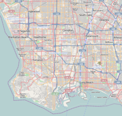
 Playa del Rey
Coordinates: 33°56′56″N 118°26′41″W / 33.94889°N 118.44472°W Country United States State California County Los Angeles City Los Angeles Playa del Rey (Spanish for "Beach of the King" or "King's beach") is a beachside community within the city of Los Angeles, California. It has a ZIP code of 90293 and area codes of 310 and 424. As of 2005, the district's population was estimated at 8,600.[1]
Contents
Geography
Playa del Rey lies beneath the Del Rey Hills, also known as the Westchester Bluffs on a flood plain (until 1824, the mouth of the Los Angeles River) which slopes gradually uphill north to the Santa Monica Mountains. The rolling hills are the result of ancient, wind-blown, compacted sand dunes which rise up to 125 feet above sea level, with one prominent, steep dune running parallel to the coast, from Playa del Rey, all the way south to Palos Verdes.
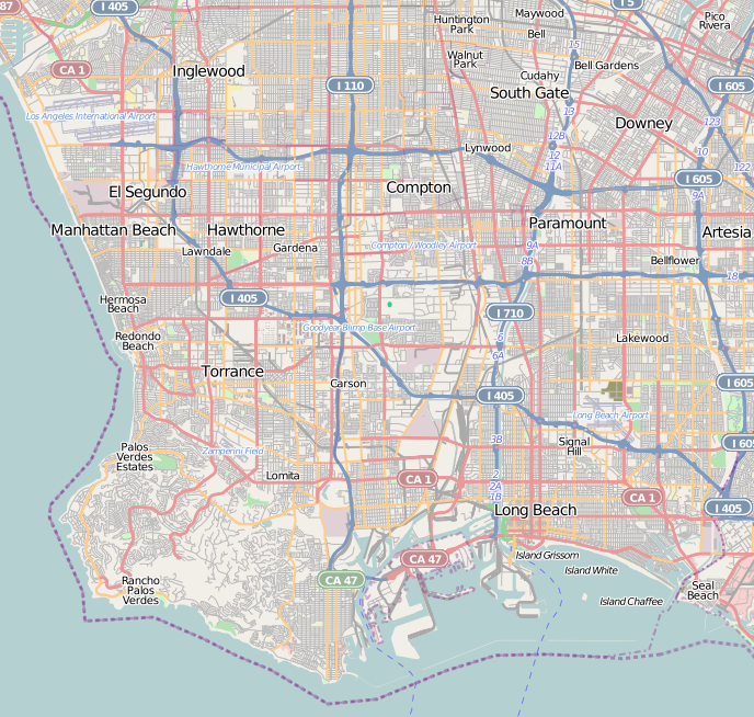
The community is bordered by the Pacific Ocean to the west, Marina del Rey and Ballona Creek to the north, Playa Vista to the northeast, Westchester to the east, and El Segundo to the south.
History
 Playa del Rey: Ballona Wetlands and Creek, 1902
 Beach and Lagoon, 1907
The northern part was originally wetlands, but the natural flooding was halted by the concrete channel which contains Ballona Creek. Before 1824, the harbor was the mouth of the Los Angeles River, before its course shifted to its current outlet at San Pedro. A bridge between Playa Del Rey and the jetty between Ballona Creek and the Marina is accessible to foot traffic and bicycle traffic, but not to automobiles. Bikers, skaters and joggers probably have the best chance of traversing the sidewalks of the beaches north to Santa Monica, and to the South Bay, here at this bridge. Both UCLA and LMU have crew teams that practice on the Ballona Creek channel.
In the 1870s, Playa Del Rey was the location of the first attempt at a dredged harbor in Santa Monica Bay. Under contract with the Atchison, Topeka & Santa Fe Railroad, Moye Wicks' syndicate spent $300,000 to dredge "Ballona Harbor", for shipping to the Orient. Within three years, winter waves brought flooding, but what remained of man's early efforts became the Playa Del Rey Lagoon, now a regional public park.
Development of Playa del Rey surged in 1928 with the building of the Del Rey Hills neighborhood in what is now the southern part of the community and move of then Loyola University to nearby Westchester. The area was the last stretch of coastal land in the city of Los Angeles to be developed.[2]
A large portion of Playa del Rey is now vacant, and homes were destroyed, after the expansion of Los Angeles International Airport (LAX) brought increased flight traffic. The noise from the flights made it less desirable to live on the dunes above the ocean under the LAX flight path. LAX bought the southern section of Playa del Rey under the power of eminent domain, eventually numbering 4,400 homes.[3] Today one can see only barbed-wire fences protecting vacant land and old streets where houses once sat. Recent LAX rejuvenation plans call for the city to finally remove the old streets that still line the empty neighborhood once known as Palisades del Rey. The condemned areas of the community are now a protected habitat of the endangered El Segundo blue butterfly.
Playa del Rey in the 1950s and early 1960s was known as a great Los Angeles area "surfing spot", but due to the many rock jetties that were built to prevent beach erosion, the good surf is mostly gone. The beach at the northernmost end of Playa del Rey is still known as "Toes Over Beach", "Toes Beach" or just "Toes" by the local surfing community, a name derived from the toes over or Hang Ten surfing maneuver. Most surfers now flock south of Dockweiler Beach, to "El Porto", the most northern part of beach in the city of Manhattan Beach. The lifeguard and park services are uniform across the entire twenty-mile stretch of beach.
One danger for beachgoers is the uncontrolled water runoff from the creek, and the occasional overflow from the giant Hyperion treatment plant to the south.
Locals refer to the small area of housing south of Culver Boulevard and closest to the beach as The Jungle, a nickname given to a group of closely built apartments built in 1956, within the bounding streets Trolley Place and Trolleyway Street on its east and west respectively, and including the streets Fowling, Rees, Sunridge and Surf. The small sidewalks between homes had/have deep green overgrowth, which added to the name.
Demographics
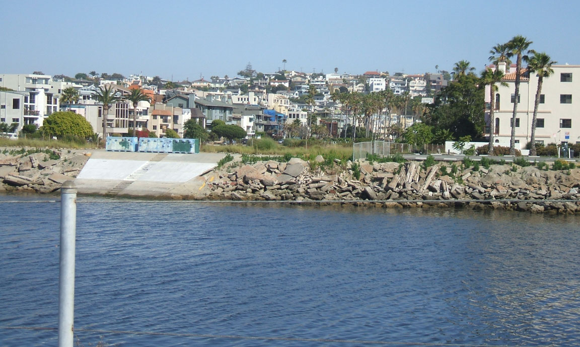
 Overlooking the entrance to the marina and Ballona Creek, with the tightly packed area known as The Jungle in the foreground.
 The community's proximity to LAX has made airport expansion a hot button issue to residents.
In 2009, the Los Angeles Times's "Mapping L.A." project supplied these Playa del Rey statistics: population: 9,755; median household income: $91,339.
According to data from the Los Angeles Times's "Mapping L.A." project, the demographics are White (72.6%), Asian (7.7%), African American (3.9%), Latino (10.0%) and Other (5.8%).[4]
Economy
The vast majority of land in Playa del Rey is zoned for residential purposes only. Only portions of Manchester Blvd, Pershing Drive and Culver Blvd have businesses—mainly restaurants and a pharmacy—and offices mixed in with residential buildings.
Government and infrastructure
Los Angeles Fire Department Station 5 (Westchester/LAX Area) is in the area.
Los Angeles Police Department operates the Pacific Community Police Station at 12312 Culver Boulevard, 90066, serving the neighborhood.[5]
The Los Angeles County Department of Health Services SPA 5 West Area Health Office serves Playa del Rey.[6]
Education
Playa del Rey is within the Los Angeles Unified School District. The area is within Board District 4.[7] As of 2009 Steve Zimmer represents the district.[8]
Area schools include
- Paseo del Rey Natural Science Magnet (K-5)
- Choice of Loyola Village Elementary School or Kentwood Elementary School and (1-5)
- Orville Wright Middle School (6-8)
- Westchester High School (9-12)
- St. Bernard High School is a private school in the area. Del Rey Christian Children's Center is a private preschool.
Notable residents/natives
- Mel Blanc, voice actor, comedian, and musician. In the 1940s he resided on Ellen Ave., now absorbed by LAX
- Jerry Buss, owner of the Los Angeles Lakers
- Dawn Robinson, original member of supergroup En Vogue.
- Phil Jackson, former coach of the Los Angeles Lakers.[9]
- Anissa Jones actress
- Tara Reid actress
- Carmen Twillie, actress/singer
- Donda West, late mother of hip-hop artist Kanye West.[10]
- Anthony Michael Hall actor
- Benny Mardones, singer songwriter
References
- ^ Groves, Martha (2005-01-20). "Line drawn in sand over Dunes project". CalCoast News. http://www.calcoast.org/news/coast0050120.html. Retrieved 2008-06-17.[dead link]
- ^ Del Rey Hills ( Now Playa del Rey ) 1928 - Los Angeles, California Scripophily.net
- ^ The Argonaut: Top Stories
- ^ "Playa del Rey" entry on the Los Angeles Times "Mapping L.A." website
- ^ http://www.lapdonline.org/pacific_community_police_station
- ^ "About Us." Los Angeles County Department of Health Services. Retrieved on March 18, 2010.
- ^ Board District 4 Map. Los Angeles Unified School District. Retrieved on November 24, 2008.
- ^ "Board Members." Los Angeles Unified School District. Retrieved on September 16, 2009.
- ^ Ding, Kevin. "News: Jackson accepts Lakers extension." The Orange County Register. Friday November 30, 2007. Retrieved on June 13, 2009.
- ^ "Donda West dies at 58; local resident and mother of hip-hop artist Kanye West." The Argonaut. November 15, 2007. Retrieved on June 13, 2009.
External links
- Playa del Rey Neighbors [1]
- Los Angeles' Ghost Town
- http://www.amazon.com/Beach-King-History-Westchester-California/dp/1449984177
- http://www.amazon.com/Playa-Del-Rey-California-Dukesherer/dp/145051524X/ref=pd_sim_b_2
- http://www.playa.ws
Coordinates: 33°56′56″N 118°26′41″W / 33.94889°N 118.44472°W

Venice, Los Angeles Marina del Rey, California Del Rey, Los Angeles 
Santa Monica Bay  Playa del Rey, Los Angeles
Westchester, Los Angeles 
El Segundo, California City of Los Angeles Topics History • Transportation • Culture • Landmarks • Historic sites • Skyscrapers • Demographics • Crime • Sports • Media • Music • Notable people • Lists
Government Flag • Mayors • City Council • Other elected officials • Airport • DWP • Fire Department • Police • Public schools • Libraries • Port • TransportationRegions Downtown • Eastside/Northeast • Harbor Area • Greater Hollywood • Westlake & Silver Lake/Los Feliz • San Fernando and Crescenta Valleys • South Los Angeles • Westside • WilshireWestside region, Los Angeles Districts and
neighborhoodsBel Air · Benedict Canyon · Beverly Crest · Beverly Glen · Beverly Hills Post Office · Beverlywood · Brentwood · Brentwood Circle · Brentwood Glen · Century City · Cheviot Hills · Crestview · Del Rey · East Gate Bel Air · Holmby Hills · Kenter Canyon · Mandeville Canyon · Marina Peninsula · Mar Vista · Palisades Highlands · Pacific Palisades · Palms · Playa del Rey · Playa Vista · Rancho Park · Rustic Canyon · Sawtelle · South Robertson · Venice · West Los Angeles · Westchester · Westdale · Westside Village · Westwood
Points of
interestSee also Downtown · Eastside/Northeast · Harbor Area · Greater Hollywood · Westlake & Silver Lake/Los Feliz · San Fernando and Crescenta Valleys · South Los Angeles · Westside · WilshireCategories:- Neighborhoods in Los Angeles, California


Wikimedia Foundation. 2010.