- Depienne Airfield
-
Depienne Airfield


Part of Twelfth Air Force Type Military airfield Coordinates 36°25′49.25″N 010°00′31.30″E / 36.4303472°N 10.008694°E Built 1941 Current
conditioninactive (still exists and use unknown) Controlled by United States Army Air Forces 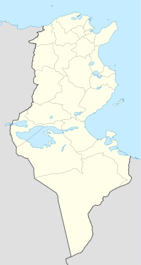
 Depienne AirfieldLocation of Depienne Airfield, Tunisia
Depienne Airfield is a World War II airfield in Tunisia, located approximately 12 km northeast of El Fahs, and 53 km southwest of Tunis. The airfield was first used by the German Luftwaffe in 1941 and 1942, and was captured by the British Army by a parachute attack on 3 December 1942. It was later used by the United States Army Air Force Twelfth Air Force as a B-17 Flying Fortress heavy bomber airfield during the North African Campaign.
- HQ 5th Bombardment Wing, August-December 1943
- 97th Bombardment Group, 15 August-20 December 1943, B-17 Flying Fortress
In aerial imagery, the airfield looks almost like it did in 1943 and is probably the most well-preserved wartime bomber field in Tunisia. The runway, although deteriorated, along with all of the taxiways and aircraft hardstands are very much in evidence. It is unclear what the current use of the facility is.
References
 This article incorporates public domain material from websites or documents of the Air Force Historical Research Agency.
- Maurer, Maurer. Air Force Combat Units of World War II. Maxwell AFB, Alabama: Office of Air Force History, 1983. ISBN 0-89201-092-4.
- Mauer, Mauer (1969), Combat Squadrons of the Air Force, World War II, Air Force Historical Studies Office, Maxwell AFB, Alabama. ISBN 0-89201-097-5
External links
 USAAF Twelfth Air Force in World War II
Stations French Morocco Berguent · Berrechid · Casablanca · Guercif · Louis Gentil · Marnia · Médiouna · Port Lyautey · Oujda · Rabat Sale · Ras el Ma
Algeria Ain M'lila · Berteaux · Biskra · Canrobert · Chateau-dun-du-Rhumel · Constantine · Es Sénia (Oran) · Maison Blanche (Algiers) · Matemore · Montesquieu · Nouvion · Orleansville · Philippeville · Relizane · Rerhaia · Saint-Donat · Saint-Leu · Sedrata · Sainte-Barbe du Tlélat · Tafaraoui (Oran) · Tébessa · Telergma · Thiersville · Youks-les-Bains
Tunisia Bizerte · Dar el Koudia · Depienne · Djedeida · Djilma · Ebba Ksour · El Djem · El Bathan · Enfidaville · Goubrine · Grombalia · Hergla · Kairouan · Korba · La Marsa · La Sebala · Le Sers · Massicault · Mateur · Menzel Temime · Monastir · Oudna · Pont du Fahs · Protville · Sainte Marie du Zit · Souk-el-Arba · Souk-el-Khemis · Soliman · Sousse · Thelepte
Italy Agrigento (Sicily) · Bagnoli · Barcelona LG (Sicily) · Bari · Boccadifalco (Sicily) · Borizzo (Sicily) · Capodichino (Naples) · Castel Volturno · Castelvetrano (Sicily) · Cassibile (Sicily) · Cattolica · Catania (Sicily) · Cercola · Ciampino (Rome) · Cesenatico · Decimomannu (Sardinia) · Elmas (Sardinia) · Falconara · Fano · Florence · Foggia · Follonica · Gerbini (Sicily) · Gioia · Grosseto · Grottaglie · Iesi · Le Banca · Lecce · Licata (Sicily) · Manduria · Marcianise · Malignano · Mazzara (Sicily) · Milazzo (Sicily) · Messina (Sicily) · Montalto Di Castro · Nettuno · Montecorvino · Ombrene · Orbetello · Paestum · Pisa · Pantelleria · Pignataro Maggiore · Piombino · Pomigliano · Ponte Galeria · Pontedera · Pompeii · Ponte Olivo (Sicily) · Reggio Calabria · Rocca Bernardo · Rosia · San Pancrazio · Santa Maria · Scordia (Sicily) · Sele · Serretella · Tarquinia · Termini (Sicily) · Tortorella · Torrente Comunelli · Tre Cancello · Voltone · Vesuvius
France Aghione (Corsica) · Amberieu (Y-5) · Amiens (B-48) · Clastres (A-71) · Dijon (Y-9) · Dôle-Tavaux (Y-7) · Ghisonaccia (Corsica) · Gisonochia (Corsica) · Istres (Y-17) · La Vallon (Y-18) · Le Luc · Luneville (Y-2) · Loyettes (Y-25) · Poretta (Corsica) · Saint-Dizier (A-64) · Salon de Provence (Y-16) · Serragia (Corsica) · Solonzara (Corsica) · Tantonville (Y-1) · Toul-Ochey (A-96)
Units CommandsXII Bomber · XII Tactical Air · XXII Tactical Air
Wings5th Bombardment · 42d Bombardment · 47th Bombardment (7th Fighter) · 51st Troop Carrier · 52d Troop Carrier · 57th Bombardment · 62d Fighter · 63d Fighter · 64th Fighter · 87th Fighter · 90th Photographic
GroupsBombardment2d Bombardment · 12th Bombardment · 17th Bombardment · 47th Bombardment · 97th Bombardment · 98th Bombardment · 99th Bombardment · 301st Bombardment · 310th Bombardment · 319th Bombardment · 320th Bombardment · 321st Bombardment · 340th Bombardment · 376th Bombardment
Fighter1st Fighter · 14th Fighter · 27th Fighter · 31st Fighter · 33d Fighter · 52d Fighter · 57th Fighter · 79th Fighter · 81st Fighter · 82d Fighter · 86th Fighter · 324th Fighter · 325th Fighter · 332d Fighter · 350th Fighter
Reconnaissance3d Reconnaissance · 5th Reconnaissance · 68th Reconnaissance
Troop carrier60th Troop Carrier · 61st Troop Carrier · 62d Troop Carrier · 64th Troop Carrier · 313th Troop Carrier · 314th Troop Carrier · 316th Troop Carrier
Squadrons15th Bombardment · 414th Night Fighter · 415th Night Fighter · 416th Night Fighter · 417th Night Fighter · 427th Night Fighter
Stations Bizerte · Depienne · Enfidaville · Massicault · Oudna · Pont du Fahs · Sainte Marie du Zit · SolimanAmendola · Bari · Castelltuccio · Cattolica · Celone · Cerignola · Fano · Foggia · Gioia del Colle · Grottaglie · Giulia · Lesina · Lucera · Madna · Manduria · Marcianise · Mondolfo · Pantanella · Piagiolino · Pisa · Rimini · Salsosa · San Giovanni · San Pancrazio · San Severo · Spinazzola · Sterparone · Tortorella · Torremaggiore · Torretto · Triolo · Venosa · Vincenzo
Units Wings5th Bombardment · 47th Bombardment · 49th Bombardment · 55th Bombardment · 304th Bombardment · 305th Fighter (P) · 306th FighterGroupsBombardment2nd Bombardment · 97th Bombardment · 98th Bombardment · 99th Bombardment · 301st Bombardment · 376th Bombardment · 449th Bombardment · 450th Bombardment · 451st Bombardment · 454th Bombardment · 455th Bombardment · 456th Bombardment · 459th Bombardment · 460th Bombardment · 461st Bombardment · 463rd Bombardment · 464th Bombardment · 465th Bombardment · 483rd Bombardment · 484th Bombardment · 485th BombardmentFighter 1st Fighter · 14th Fighter · 31st Fighter · 52nd Fighter · 82nd Fighter · 325th Fighter · 332nd FighterCategories:- Airfields of the United States Army Air Forces in Tunisia


Wikimedia Foundation. 2010.