- Roundway
-
Coordinates: 51°22′05″N 1°58′51″W / 51.36806°N 1.980812°W
Roundway 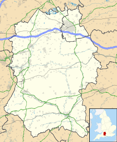
 Roundway
Roundway shown within WiltshirePopulation 2,267 (as of 2001) OS grid reference SU019651 Shire county Wiltshire Region South West Country England Sovereign state United Kingdom Post town Devizes Postcode district SN10 Dialling code 01380 Police Wiltshire Fire Wiltshire Ambulance Great Western EU Parliament South West England UK Parliament Devizes List of places: UK • England • Wiltshire Roundway is a Parish near to Devizes in English county of Wiltshire.
Roundway is still a parish independent from Devizes, but housing development has continued over northwards from Devizes over the parish boundary. In the census of 2001, the village had a population of 2,267. It is located in the north of Devizes, and lies off the A361, which passes from Devizes to Swindon. Roundway provides a bypass from the north of Devizes to the west through Conscience Lane.
The village is home to the Devizes White Horse, a chalk hill figure of a horse that was created in September 1999 to celebrate the millennium. It replaces the white horse of Devizes (Snob's Horse) that was lost after 1845.
The village used to have a hospital serving Devizes until it was closed in 1995, after the decision to close it was made in 1989, in favour of the locally famous Green Lane hospital in the south of Devizes.
Most of the land surrounding Roundway is used for agricultural purposes and to the north of Roundway is Roundway Hill, a popular place for walking, kite fyling and model aircraft flying.
Oliver Cromwell fought at the Battle of Roundway Down in 1643 which was fought on the Roundway downs, hence the alternative name for the Roundway Downs, 'Olivers Castle'.
See also
- Devizes
- Roundway Down and Covert, a nearby Site of Special Scientific Interest
- Henry Billington a tennis player is born there. He is the maternal grandfather of tennis player Tim Henman.
References
- "Wiltshire Council - Wiltshire Community History Get Community Information". Wiltshire Council. http://www.wiltshire.gov.uk/community/getcom.php?id=190. Retrieved 2010-05-14.
External Links
Suburbs Wick · Roundway · Hartmoor · Jump Farm · Nursteed · SouthbroomHistory History of Devizes · Devizes Branch Line · Devizes Railway Station · Devizes Prison · Battle of Roundway Down · Devizes Prosecution SocietyPlaces of Interest Politics Devizes Constituency · Claire Perry MP · Devizes Guardians · Wiltshire Council · Kennet District CouncilChurches St. Peter's · St. Johns · St. James'Other Devizes School · Devizes Town F.C. · Devizes to Westminster International Canoe Marathon · Wiltshire Police · Green Lane HospitalTwin Towns Categories:- Villages in Wiltshire
- Wiltshire geography stubs

Wikimedia Foundation. 2010.