- Teletsunami
-
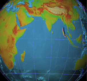
 The 2004 Indian Ocean tsunami is a teletsunami.
A teletsunami (also called an ocean-wide, distant, distant-source, far-field, or trans-ocean tsunami) is a tsunami that originates from a distant source, which is more than 1,000 km away from the area of interest (or more than three hours of travel time from its source).[1][2] A teletsunami can travel across an entire ocean. All teletsunamis have been generated by major earthquakes, such as the 1755 Lisbon earthquake, 1960 Valdivia earthquake, 1964 Alaska earthquake, and 2004 Indian Ocean earthquake.
Contents
Overview
Teletsunamis can be generated several different ways, the most common of which is through seismic activity.[3] A teletsunami can be generated by a large earthquake with a moment magnitude higher than 7.5.[4] More specifically, vertical displacement with a thrust-type earthquake is more likely to produce a teletsunami than an earthquake from a lateral strike-slip fault, such as San Andreas Fault.[5]
Because of this, subduction zones, which occur when a dense oceanic crust burrows underneath less-dense continental crust, are more likely to produce a teletsunami. The Pacific coast of North America is a prime example of a subduction zone. The Cascadia subduction zone, off the coasts of British Columbia, Washington, Oregon, and Northern California is an area of concern for possible tsunami generation. The Aleutian Islands and Gulf of Alaska coast of Alaska are also capable of producing very large offshore earthquakes that may produce large tsunamis. The 1964 tsunami, discussed later in detail, was generated by a large earthquake offshore Alaska.[6]
Natural precursors that may indicate the approach of a teletsunami include a drawback, or a large withdrawal of the ocean usually well below low tide.[7] While it may not always occur, the presence of a retreating surf is a sign of impending danger.
Characteristics
The general characteristics of teletsunamis are similar to local tsunamis. The interval between waves can range from 5 to 60 minutes, although it usually falls between 10 and 30 minutes.[8] The speed at which the teletsunami travels is dependent on the depth of the water. On average, tsunamis in the Pacific Ocean travel at about 480 miles/hour; however, due to the depth of the ocean, the height may only be a few feet.[9] This weak wave height, along with the extreme breadth of the distance from the wave's peak to its trough, which spans approximately between 50 and 150 miles, makes vessels in open water unaware of a tsunami passing. In shallow water, scuba divers caught in the 2004 Indian Ocean tsunami were reportedly tossed about under the water, yet those in the boat floating above them were unaffected, failing to notice the wave as it passed by.[9]
Teletsunamis generally consist of a series of waves, rather than a singular wave.[10] The number of waves can vary, but data have shown that there are usually between two and ten waves. Further, the first wave is typically not the largest one. For example, during the 2004 Indian Ocean tsunami, the second wave was regarded as the largest one, and in the 1964 Alaska tsunami, it was the fourth wave that proved most destructive in Crescent City, California.[9] This can sometime pose a serious problem, as the retreat of the first wave may falsely imply that the tsunami has "finished", which can lead people to return to the beach out of curiosity, only to be swept away by the next incoming wave. The period between waves can also vary, but generally falls between 5 and 60 minutes. This is always a major cause of concern for public safety officials responding to a tsunami.[citation needed]
Coastal water usually recedes before the first tsunami strikes,[11] and many witnesses have reported that the abnormal ocean activity, a wall of water, and approaching teletsunami waves create a loud roaring sound similar to that of a train or jet aircraft.[12]
Tsunami watches and warnings
Main article: tsunami warning systemAlthough teletsunamis are usually generated by a large earthquake, many of the areas affected are too far from the epicenter to feel it (thus the usage of the prefix tele-, or "distant"). Teletsunamis are also virtually undetectable to the human eye until they approach the shoreline. In this regard, several scientific instruments have been developed to establish a tsunami warning system, which is intended to provide sufficient forewarning of an approaching teletsunami for emergency preparations and evacuations to be initiated.
The Pacific Tsunami Warning Center (PTWC) in Hawaii provides warnings for Pacific–based teletsunamis to almost every country around the Pacific and to most of the Pacific island states. A few destructive teletsunamis are generated each century by great earthquakes around the Pacific Rim. Such tsunami can propagate across the entire Pacific in less than 24 hours, and cause widespread destruction along shorelines located thousands of miles from the source. With ever-increasing population and development along most coastlines, there is a corresponding increase in risk. The last destructive Pacific teletsunami was generated by the 2004 earthquake near the Sumatra coast.[13]
The West Coast and Alaska Tsunami Warning Center (WCATWC) in Palmer, Alaska watches for teletsunamis approaching the West Coast of the United States and Canada. The above mentioned PTWC will not issue watches or warnings for the west coast unless this warning system in Alaska fails. This is to prevent confusion, as two different warning centers issuing two separate messages can oftentimes contradict one another.[14]
There are several guidelines set by the WCATWC for issuing watches and warnings.[14]
- A watch is first issued if the arrival time for a potential teletsunami is more than 2 hours from the time of the warning. In this case, there would be enough time to verify the existence or nonexistence of a tsunami by way of NOAA buoys before a warning or cancellation message was issued.
- Either a watch or warning is immediately issued if a magnitude 7.5 or greater earthquake occurs anywhere in the Pacific Rim, depending on circumstances.
- A warning is issued if the potentially resulting tsunami would arrive onshore within 2 hours of the warning.
For example, if an 8.0 earthquake occurs in the Aleutian Islands, West Coast states such as Washington, Oregon, and California would receive a tsunami watch first; if there was verification of a tsunami, a warning would follow. If there is no wave observed, a cancellation message would follow before a warning was issued. However, if an 8.0 earthquake were to occur off of the West Coast of the United States, a warning without verification of a tsunami will be issued. This is due to the fact that there would not be enough time to first verify a wave and then order and conduct an evacuation of vulnerable areas.[14]
Historical documentations
Based on recorded history, destructive teletsunamis have occurred once or twice a century, making teletsunamis very rare and infrequent events. Whereas there are lots of data pertaining to hundreds of devastating natural disasters, there is only a handful of data for teletsunamis. Large tsunami events in 1868, 1946, 1960, 1964, 1995, and 2004 have provided adequate amounts of data for more accurate analysis.[14]
One of the oldest teletsunamis was reported in November 1755, when a major earthquake known as the 1755 Lisbon earthquake resulted in a teletsunami, which resulted in near-total destruction of Lisbon in the Kingdom of Portugal. The teletsunami crossed the Atlantic and was noticed throughout the eastern Caribbean from Barbados to Antigua and as far west as Cuba. This earthquake is commonly referred to as the Great Lisbon Earthquake. The amplitude of the tsunami in all islands was about 2–3 meters and waves continued to arrive for many hours. No damage or casualties were reported. European sources also reported that the Azores fracture zone generated a second teletsunami in March 1761, but no local confirmed observations were made in the Caribbean.[6]
The most recent destructive teletsunami occurred in 2004 and was caused by a powerful undersea megathrust earthquake off the northern coast of the Sumatra in Indonesia. It caused nearly 300,000 deaths in several countries along the Indian Ocean.
1946: Hawaii
Main article: 1946 Aleutian Islands earthquakeIn 1946, following a large earthquake in the Aleutian Islands, a teletsunami that originated in Alaska devastated Hilo, Hawaii. 30 foot waves were observed in Hilo, and at least 170 people were killed. There was no warning issued for this event, and as a result of raising concern, the Pacific Tsunami Warning Center (PTWC) was founded in Ewa Beach, HI. This 1946 teletsunami event was also observed in California, but no casualties were reported and damage was minimal (almost exclusively to personal vessels in the harbors).[15]
1960: Hawaii
Main article: 1960 Valdivia earthquakeIn 1960, a teletsunami generated near the coast of Chile again devastated Hilo. It was originated by the largest earthquake ever recorded, an earthquake with magnitude 9.6 that struck offshore Chile. This time, the warning was accurate in predicting arrival time, but unable to provide sufficient time for majority of Hilo residents to evacuate. 61 lives were lost as a result. With greater magnitude at origin, the teletsunami brought 35 foot waves to harbors in Hilo. This 1960 teletsunami also reached the West Coast of the United States.[16]
1964: Alaska
Main article: 1964 Alaska earthquakeIn 1964, a large tsunami that originated as a result of the 9.2 earthquake from the Gulf of Alaska was the first teletsunami to largely affect the U.S. West Coast in recent decades. California observed 20–25 foot waves and some region sustained heavy damages from flooding, resulting in total loss of 11 lives. Other regions such as Alaska, British Columbia, Washington, Oregon, and Hawaii were also impacted by the teletsunami to varying degrees. The California report indicates that it was the fourth wave which caused the most damage, emphasizing that the first wave of the teletsunami may not be the only wave, or even the largest.[17]
1995: Manzanillo, Mexico
This teletsunami was generated by the 8.0 earthquake which occurred offshore of Jalisco and Colima, the Pacific coast of Mexico. The earthquake itself was accountable for approximately 40 lost lives as a result of extensive inland damage. The tsunami generated quickly reached the west coast of the United States and affected 200 km of coastline. Some flat regions experienced floods as far inland as 200 meters. A large recession of the ocean followed by a large incoming wave was also observed. Several ports sustained heavy damage and extensive beach erosion was observed. This teletsunami event is notable as it occurred as a result of a large, yet smaller-than-usual earthquake for tsunami generation.[18]
2004: Indian Ocean
Main article: 2004 Indian Ocean earthquakeCausing approximately 300,000 fatalities in total, the 2004 Indian Ocean tsunami is by far the world’s most destructive teletsunami. The majority of the damage and fatalities were reported in Indonesia. The teletsunami generated by the 9.0 earthquake off the northern coast of the Sumatra also heavily impacted Thailand, Sri Lanka, and India.
The fact that this tsunami incident is recognized as the world’s first major tsunami event since 1964 (after a period of relatively high tsunami frequency from 1850–1975), brought an impression to the world that the hazard "skipped a generation." For the first time, there was a lot of video evidence of the teletsunami filmed at many locations. This visual evidence of the tsunami helped many scientists and emergency planners solve more mechanisms of inundation and run-up characteristics of teletsunamis.
Although this event is considered to be a horrendous and tragic event, the consequences of 2004 tsunami provoked a much-needed public awareness and preparedness against future tsunami incidents.
See also
- Historic tsunami
- Deep-ocean Assessment and Reporting of Tsunamis (DART)
- Megatsunami
- Meteotsunami
- Megathrust earthquake
- Submarine earthquake
- Cumbre Vieja (hypothetical future tsunami)
References
- ^ "ITIC :: About tsunamis :: IOC Tsunami Glossary". Ioc3.unesco.org. http://ioc3.unesco.org/itic/contents.php?id=19. Retrieved 2011-03-02.
- ^ "Tsunami Terms". Nthmp-history.pmel.noaa.gov. 1946-04-01. http://nthmp-history.pmel.noaa.gov/terms.html. Retrieved 2011-03-02.
- ^ http://www.pgfire.com/pdf/PGTsunamiResponsePlan.pdf
- ^ Watching for the Waves
- ^ http://pgfire.com/documents/PGTsunamiResponsePlan.doc
- ^ a b O'Loughlin, Karen Fay; James F. Lander. Caribbean Tsunamis: A 500-Year History from 1498–1998. Advances in Natural and Technological Hazards Research. http://books.google.com/books?id=eqR4VDrx96IC&pg=PA37&lpg=PA37&dq=teletsunami+subduction&source=bl&ots=_Key6t8IOL&sig=5Ma1sHenh03oZlOoWUWtn9dFDCc&hl=en&ei=ty_oSu2nDsjdlAeUt6SQCA&sa=X&oi=book_result&ct=result&resnum=3&ved=0CBIQ6AEwAg#v=onepage&q=teletsunami%20subduction&f=false.
- ^ "A Brief History of Tsunamis in the Caribbean Sea". http://74.125.93.132/search?q=cache:eOxyjO5q1OgJ:www.ngdc.noaa.gov/hazard/data/publications/Ref0537_lander.pdf+teletsunami+withdrawal&cd=3&hl=en&ct=clnk&gl=us&client=safari.
- ^ http://unpan1.un.org/intradoc/groups/public/documents/apcity/unpan022464.pdf
- ^ a b c http://pgfire.com/pdf/PGTsunamiResponsePlan.pdf
- ^ [1][dead link]
- ^ "Tsunami". Caymanprepared.ky. 2011-02-01. http://www.caymanprepared.ky/portal/page?_pageid=1143,1482366&_dad=portal&_schema=PORTAL. Retrieved 2011-03-02.
- ^ Yanagi, Brian. "Tsunami Warning System: Emergency Response and Tsunami Preparedness". Major Natural Disaster Fatalities in Hawaii During the 20th Century. International Tsunami Information Centre: Intergovernmental Oceanographic Commission.
- ^ http://prh.noaa.gov/ptwc/responsibilities.php
- ^ a b c d http://ci.marina.ca.us/DocumentView.aspx?DID=384
- ^ "The April 1, 1946 Earthquake and Tsunami in the Aleutian Islands - by Dr. George Pararas-Carayannis". Drgeorgepc.com. http://drgeorgepc.com/Tsunami1946.html. Retrieved 2011-03-02.
- ^ "The 1960 Tsunami, Hilo". Hvo.wr.usgs.gov. http://hvo.wr.usgs.gov/volcanowatch/1994/94_05_20.html. Retrieved 2011-03-02.
- ^ "1964 Alaskan Tsunami". Usc.edu. 1964-03-29. http://usc.edu/dept/tsunamis/alaska/1964/webpages/index.html. Retrieved 2011-03-02.
- ^ "The Manzanillo Earthquake". Usc.edu. 1995-10-09. http://www.usc.edu/dept/tsunamis/manzanillo/. Retrieved 2011-03-02.
External links
- IOC Tsunami Glossary by the Intergovernmental Oceanographic Commission (IOC) at the International Tsunami Information Centre (ITIC) of UNESCO
- Tsunami Terminology at NOAA
Categories:
Wikimedia Foundation. 2010.