- Smoky Group
-
Smoky Group
Stratigraphic range: Late Cretaceous
Kaskapau Shale exposed along the Pouce Coupe RiverType Geological formation Sub-units Puskwaskau Formation
Bad Heart Formation
Kaskapau FormationUnderlies Wapiti Group Overlies Dunvegan Formation Thickness up to 1,100 feet (340 m)[1] Lithology Primary Shale, sandstone, siltstone Location Named for Smoky River Named by George Mercer Dawson, 1881. Region  Alberta,
  British Columbia
Country  Canada
The Smoky Group is a stratigraphical unit of Late Cretaceous age in the Western Canadian Sedimentary Basin.
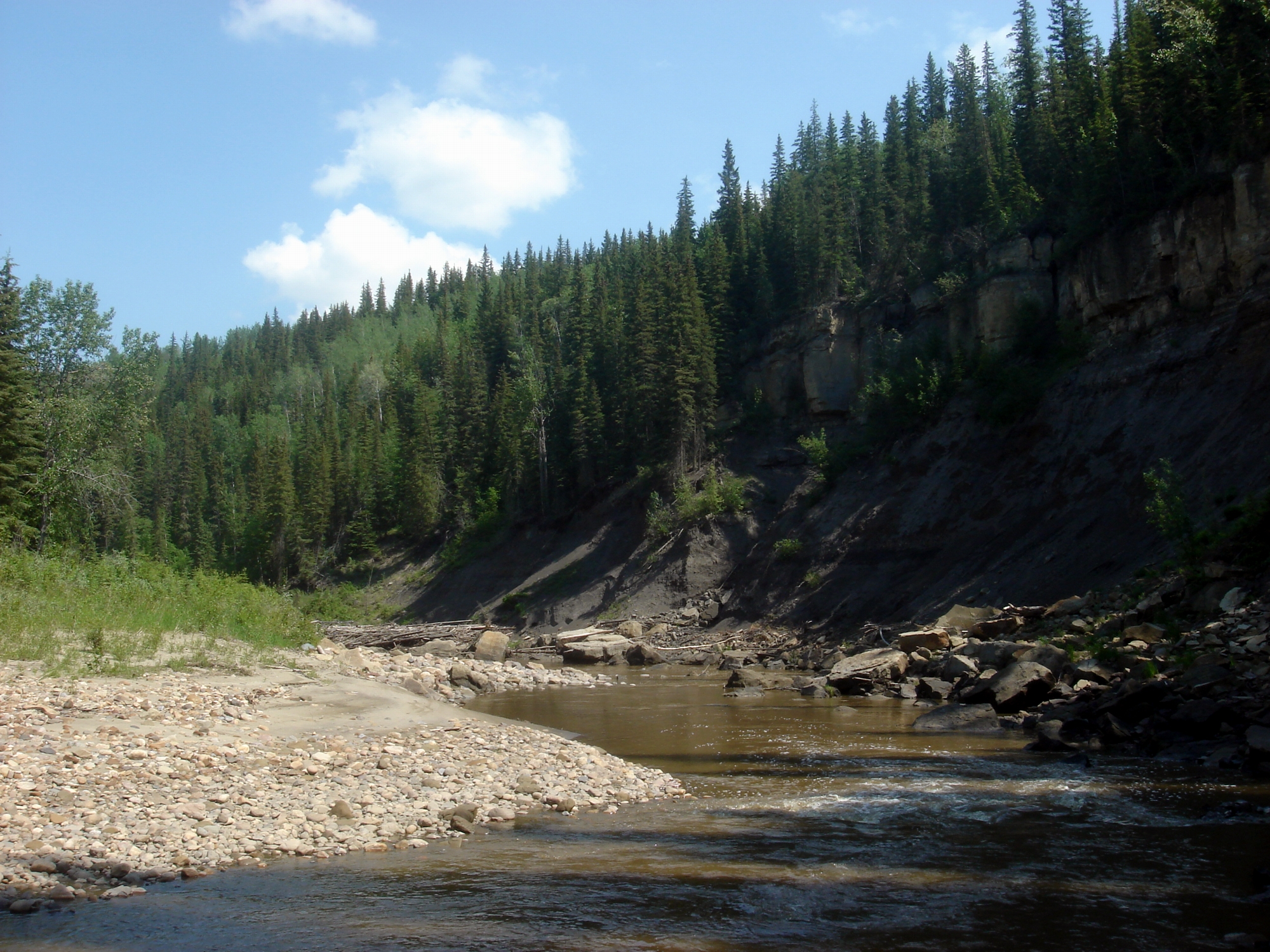
It takes the name from the Smoky River, and was first described in outcrops along the banks of the Smoky River, Spirit River and Pouce Coupe Rivers by George Mercer Dawson in 1881.[2].
Contents
Lithology
The Smoky Group is represented by marine silty shale with ironstone and bentonite streaks. Sandstone occurs at the base, and is transitional to the Dunvegan Formation.[1]
Hydrocarbon production
Gas is produced from the Cardium Formation in the southern reaches of the Group, in central Alberta and northern Alberta.
Distribution
The Kaskapau Shale reaches 477m in the Pouce Coupe River area and thins towards the east in the Smoky River area. The Bad Heart Formation sandstone is up to 8m thick, while the Puskwaskau Formation ranges from 200m in the Pouce Coupe Prairie to 123m in the Spirit River area. The entire group measures up to 677 m (2,220 ft) in the Pouce Coupe Prairie, and can reach 1,100 m (3,610 ft) in the Canadian Rockies foothills of northeast British Columbia.[1]
Relationship to other units
The Smoky Group is conformably and transgressively followed by the Wapiti Group and rests conformably on the Dunvegan Formation sandstone. The Cardium sandstone and Muskiki shale are replacing the upper parts of the Kaskapau Formation in the south-east of the distribution area. The entire group correlates with the Blackstone Formation, Cardium Formation and Wapiabi Formation of the Alberta Group in the southern foothills. The equivalent stratigraphic sequence in central Alberta consists of the Lea Park Formation and the upper Colorado Group, in north-eastern Alberta it correlates with Labiche Formation, and with the Kotaneelee Formation in the Liard River area.[1]
Subdivisions
The Smoky Group has the following sub-divisions from top to bottom:
Sub-unit Age Lithology Max.
ThicknessReference Puskwaskau Formation Santonian dark marine shale, siltstone beds 200 m (660 ft) [3] Bad Heart Formation Coniacian medium to coarse grained marine sandstone 8 m (30 ft) [4] Kaskapau Formation Turonian to Coniacian dark, fissile shale 900 m (2,950 ft) [5] Basal sandstone tongues Howard Creek Member late Cenomanian fine to medium grained glauconitic sandstone 4 m (10 ft) [6] Doe Creek Member Cenomanian fine grained sandstone 25 m (80 ft) [7] Pouce Coupe Member Cenomanian massive, fine grained sandstone 9 m (30 ft) [8] The Kaskapau Formation is equivalent to the sum of Blackstone Formation, Cardium Formation and Muskiki Formation.[5]
-
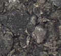
Paskwaskau Shale
-
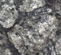
Bad Heart Sandstone
-
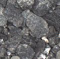
Kaskapau Shale
References
- ^ a b c d Lexicon of Canadian Geologic Units. "Smoky Group". http://cgkn1.cgkn.net/weblex/weblex_litho_detail_e.pl?00053:013975. Retrieved 2009-02-11.
- ^ Dawson, G.M., 1881. Report on the exploration from Port Simpson on the Pacific Coast to Edmonton on the North Saskatchewan River, Embracing a portion of the northern part of British Columbia and the Peace River Country, with Maps 150 and 152; Geological Survey of Canada, Report of Progress 1879-1880, Part B, p. 1-77.
- ^ Lexicon of Canadian Geologic Units. "Puskwaskau Formation". http://cgkn1.cgkn.net/weblex/weblex_litho_detail_e.pl?00053:012285. Retrieved 2009-02-11.
- ^ Lexicon of Canadian Geologic Units. "Bad Heart Formation". http://cgkn1.cgkn.net/weblex/weblex_litho_detail_e.pl?00053:000656. Retrieved 2009-02-11.
- ^ a b Lexicon of Canadian Geologic Units. "Kaskapau Formation". http://cgkn1.cgkn.net/weblex/weblex_litho_detail_e.pl?00053:007398. Retrieved 2009-02-11.
- ^ Lexicon of Canadian Geologic Units. "Howard Creek Member". http://cgkn1.cgkn.net/weblex/weblex_litho_detail_e.pl?00053:006740. Retrieved 2009-02-11.
- ^ Lexicon of Canadian Geologic Units. "Doe Creek Member". http://cgkn1.cgkn.net/weblex/weblex_litho_detail_e.pl?00053:004066. Retrieved 2009-02-11.
- ^ Lexicon of Canadian Geologic Units. "Pouce Coupe Member". http://cgkn1.cgkn.net/weblex/weblex_litho_detail_e.pl?00053:012150. Retrieved 2009-02-11.
Western Canadian Sedimentary Basin Hydrocarbon history Depositional Regions Southern Alberta · Central Alberta · Northwestern Alberta Plains · South-central Canadian Rockies foothills · North-east Plains · North-central foothills · Liard River · Fort Nelson · Northern Rocky Mountains · Fort St. John · Saskatchewan · Western ManitobaNorthwest Plains Paskapoo FM · Scollard FM · Wapiti GRP · Smoky GRP (Puskwaskau FM · Badheart FM · Muskiki FM · Cardium FM · Kaskapau FM · Pouce Coupe MBR · Doe Creek MBR) · Dunvegan FM · Fort St. John GRP (Shaftesbury FM · Peace River FM · Spirit River FM) · Bullhead GRP (Bluesky FM · Gething FM · Cadomin FM) · Nikanassin FM · Fernie GRP (Rock Creek MBR · Poker Chip Shale · Nordegg MBR) · Schooler Creek GRP (Baldonnel FM · Charlie Lake FM · Halfway FM) · Doig FM · Montney FM · Belloy FM · Stoddart GRP (Taylor Flat FM · Kiskatinaw FM · Golata FM) · Rundle GRP (Debolt FM · Shunda FM · Pekisko FM) · Banff FM · Exshaw FM · Wabamun FM · Trout River FM · Kakisa FM · Redknife FM (Jean Marie MBR) · Woodbend GRP (Irteton FM · Fort Simpson FM · Leduc FM) · Beaverhill Lake GRP (Waterways FM · Swan Hills FM · Fort Vermilion FM) · Elk Point GRP (Watt Mountain FM · Gillwood MBR · Presqu’ile FM · Sulphur Point FM · Pine Point FM · Muskeg FM · Zama MBR · Black Shale · Keg River FM · Rainbow MBR · Chinchaga FM · Cold Lake FM · Ernestina FM · Basal Red Beds · Granite Wash) · Canadian ShieldCategories:- Stratigraphy of Alberta
- Stratigraphy of British Columbia
- Geologic formation stubs
-

Wikimedia Foundation. 2010.