- Seversky Donets River
-
"Donetz" redirects here. For the Soviet cargo ship, see SS Donetz.
Seversky Donets 
Sviatohirsk Monastery in Donetsk Oblast, UkraineOrigin Russia Mouth Don River Basin countries Russia, Ukraine Length 1,053 km (654 mi) Source elevation 200 m (660 ft) Mouth elevation 5.5 m Avg. discharge 159 m3 (5,600 cu ft) (119 km (74 mi) from mouth)[1] Basin area 98,900 km2 (38,200 sq mi)  View of the Donets and Sviatohirsk Lavra.
 Seversky Donets and Don rivers.
Seversky Donets (Russian: Северский Донец; Ukrainian: Сіверський Донець; alternatively Donetz) is a river on the south of the East European Plain. It originates in the Central Russian Upland, north of Belgorod, flows south-east through Ukraine (Kharkiv, Donetsk and Luhansk Oblasts) and then again through Russia (Rostov Oblast) to join the Don River, about 100 km (62 mi) from the Sea of Azov. Seversky Donets is the fourth largest river in Ukraine and is an important source of fresh water in the east of the country.
Contents
Etymology
The Don River, which is fed by Donets, was known in the past as Tanais to Ptolemy,[2] and the Western Europeans recognized that the Don has a significant tributary which they called either small Tanais or Donetz.[3] The Slavic name of Seversky Donets originates from the fact that it flowed from the Seversky Principality ("Sever" is "North" in Russian). As the Italian chronicler Alexander Guagnini wrote: "There is also another, small Tanais, which originates in the Seversky Principality and flows into the big Tanais above Azov".[4]
Geography and hydrology
The Seversky Donets is the largest river of eastern Ukraine and the largest tributary of the Don. Its total length is 1,053 km (654 mi) and the basin area is 98,900 km2 (38,200 sq mi). The average annual flow is 25 m3 (880 cu ft) near the source and 200 m3 (7,100 cu ft) at the confluence to the Don.[5][6][7]
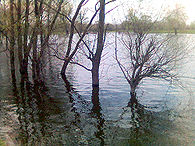
The Seversky Donets originates on the Central Russian Upland, near Podolhi village, Prokhorovka area, north of Belgorod,[8] at an elevation of 200 m (660 ft) above sea level. Its basin contains over 3000 rivers, of which 425 are longer than 10 km (6.2 mi) and 11 are longer than 100 km (62 mi); 1011 of those rivers directly flow into Seversky Donets.[9][10][11] These rivers are mostly fed by melting snow, and thus the water supply is uneven during the year. The spring flood takes about 2 months from February to April,[1] during this period the water level rises by 3–8 m (9.8–26 ft). Excessive flooding is rare due to abundant artificial water reservoirs constructed along the river.[11][12]
The river width mostly ranges between 30 and 70 m (98 and 230 ft),[7] sometimes reaching 100–200 m (330–660 ft) and even 4 km (2.5 mi) in the reservoir area. The river bottom is sandy and uneven, with the depth varying between 0.3 and 10 m (0 ft 10 in and 32 ft 10 in) and the average value of 2.5 m (8 ft 2 in).[7] The river freezes between around mid-December and late March[1] and is covered by 20–50 cm (7.9–20 in) thick ice. It flows into the Don at 218 km (135 mi) from its mouth, at an elevation of 5.5 m (18 ft) above sea level; thus the fall of the river is 195 m (640 ft) with the average gradient of 0.18 m/km.[11]
Current
 Near Shypylivka
 View of the Pechenga Reservoir from space
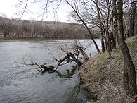
The flow is slow, between 0.15 m/s (0.49 ft/s) at Chuhuiv and 1.41 m/s (4.6 ft/s) near Lysychansk.[13] The river valley is wide: from 8–10 km (5.0–6.2 mi) in the upper part and up to 20–26 km (12–16 mi) downstream, and is asymmetrical. The right bank is usually high, sometimes with chalk cliffs, and is dissected by gullies. The left bank is more flat, contains numerous swamps, lakes and oxbow lakes,[1] the largest of which is lake Lyman. The river is curvy, especially above the tributary river Oskol.
In the upstream, above Belgorod, the river contains several dams and small reservoirs. In the downstream, after the confluence of the Wolf River (Volchiya River), there is Pechenga Reservoir (volume 86 km3)[1] which supplies water to the city of Kiev. Below Pechenga Reservoir, Donets is fed by Udy and by its largest tributary Oskol. There the valley widens and contains numerous oxbow lakes in its floodplain. In its middle, the river is partly fed by the Dnieper River waters which are brought though the Dnieper–Donbass–Seversky Donets channels which provide water to the coal industry of the Donets Basin. Near the Russian city of Donetsk (Rostov oblast), the river crosses the Donets ridge and flows in a narrow valley with steep and rocky slopes. In the lower part, the flow is interrupted by sluices and is slow. At the delta it splits into three distributaries.[1]
Major objects on the Seversky Donets (from source to mouth)[1] Country Oblast Dist. from the mouth, km Dist. from the source, km Name Type Note  Russia
Belgorod 1053 0 Source Near Podolhi village, Prokhorovka area RussiaBelgorod 990 63 Belgorod City RussiaBelgorod 990 63 Belgorod Reservoir  Ukraine
Kharkiv 940 113 Pechenga Reservoir UkraineKharkiv 874 179 Pechenga Urban-type settlement Annual consumption of 24.5 m3/s [14] UkraineKharkiv 837 216 Chuhuiv City Annual consumption of 20.5 m3/s [14] UkraineKharkiv 634 419 Bereka River and Dnepr – Donbas channel Right tributary Length 102 km; 2,680 km2 basin UkraineKharkiv 600 453 Izium City Annual consumption 52 m3/s [11] UkraineKharkiv 580 473 Oskol River Left tributary Length 436 km; 14,680 km2 basin UkraineDonetsk 518 535 Raigorodok Urban-type settlement Start of Donets-Donbass channel[1] UkraineDonetsk 516 537 Kazennyi Torets Tributary Length 129 km; 5410 km2 basin UkraineLuhansk 482 571 Rubizhne City UkraineLuhansk 432 621 Lysychansk City Annual consumption 106 m3/s [14] UkraineLuhansk 430 623 Severodonetsk City UkraineLuhansk 306 747 Luhansk City RussiaRostov 222 831 Donetsk, Russia City Start of the ship navigation zone RussiaRostov 197 856 Kamensk-Shakhtinsky City Annual consumption 159 m3/s RussiaRostov 0 1053 Mouth 218 km from the confluence of the Don River to Azov Sea. History
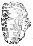 Drawing of a Stone Age tool found near the village of Krasny Yar, Luhansk Oblast.[15]
The river played a crucial role for its ancient settlers as a source of water and food, means of transportation and trade route. The first archaeological evidence of settlers relates to Cheulean and Acheulean periods of Lower Paleolithic through stone tools (axes) found on the river banks near Izium city of Kharkiv Oblast and in Luhansk Oblast.[16] Over the ages, the river banks were populated by tribals of various cultures, including Mousterian, Yamna, Catacomb, Scythian, Alan, Khazar and later Slavic cultures. Many of the related tribals had nomadic lifestyle characteristic of Kipchak people, Golden Horde and later of Cossacks. The Cossacks became later assimilated into the strengthening Russian Empire, which had rebuilt and reinforced the fortress of Belgorod and cities of Kiev, Izium, Luhansk, Chuhuiv and others in order keep defensive lines against the raids of nomads from the south-east. Later, the protective role of the river basin gave way to economic needs. In the 18th–19th centuries, the river was extensively used for watermills, which numbered by hundreds by the end of 18 century, and the mill dams interrupted navigation on the river.[17]
Industrialization in the 19th century shifted interests to mineral exploitation in Donbas, with water-hungry plants concentrated mostly in Kiev, Luhansk and Donetsk.[18] Already by the 1930s, Kharkiv, Donetsk and Luhansk were lacking water forcing the authorities to gradually create a network of canals and reservoirs. In 1936, the Kochetok Reservoir was created and coupled to the water system of Kharkiv.[11] By the 1950s, this measure proved insufficient, and in the 1960s, Pechenga Reservoir was constructed in place of the Kochetok Reservoir. It has with the capacity of 400 million m3 and provides about 75% of water consumed by Kharkiv. To supply water to southern Donbas and Donetsk, the 130-km long Donets-Donbass channel was built around 1958 starting near Raigorodok city,[1] and in compensation, the Dnieper-Donbass channel was created to supply water from Dnieper River to the upstream of Seversky Donets via Bereka River.[19] As a result of the industrial activity, the wild nature of Donets Basin transformed into an industrial settlement.[20][21] After the breakup of the USSR, most of the basin territory became part of Ukraine.

At present, the Seversky Donets is navigable up to the Russian city of Donetsk (Rostov Oblast), 222 km from the mouth.[1] Navigation on the last section is supported by six dams, built in 1911–1914.[22] Each consists of a 100–150-kilometer (62–93 mi) long concrete dam and a single-chamber sluice, 100 m (330 ft) long, 17 m (56 ft) wide and 2.5 m (8 ft 2 in) deep. Attempts to improve the dam network in the 19th and early 20th centuries, which were partly promoted by Dmitri Mendeleev,[23][24] were interrupted by World War I, Russian Civil War and lack of funds. The design of the dams and their old age slowed down the navigation of the river, which is currently rather limited.
Environment
Being one of the largest rivers in Ukraine, Donets is very intensively used in farming and industry. Ukraine alone uses more than 2 km3 (0.48 cu mi) of river waters per year, half of which is returned as polluted discharges; this consumption effectively reduces river runoff by 32 m3/s (1,100 cu ft/s).[13]
Donets suffered greatly even back in the 18th century, when old oaks were cut down along its banks.[25] The industrial development of the 19th century reduced the groundwater levels of the basin. This resulted in shallowing of the river and slowed down navigation. Until the mid-19 century, the river was rich in fish which population rapidly declined since then.[11] The water quality is graded as level IV (polluted) to V (dirty). The main pollutants are fertilizers, petroleum, phenols, zinc, chromium and copper.[26][27] In Kharkiv Oblast, water is contaminated by industrial and communal wastes of Belgorod, Izyum and Shebekino cities, but the water is partially purified through the Pechenga Reservoir. The density of plants and thus the contamination increase downstream in Donetsk and Luhansk areas, especially around Lysychansk and Severodonetsk, about 400 km from the mouth. Some tributaries of Seversky Donets, such as Kozenyi Butt, Bakhmut and Lugan are so polluted that consuming fish caught there is dangerous.[13] The purest segment of Donets is between the source and Belgorod, and between the Pecheneg Reservoir and Chuhuiv. Average water salinity is 650–750 mg/L, and it increases in winter to 1000 mg/L mostly due to industrial wastewater.[28]
 Carp
CarpFlora and fauna
Fish
Seversky Donets hosts 44 species of fish, predominantly small fishes such as European perch, rutilus and common rudd. Medium and large species include bream, perch, catfish and pike and are becoming increasingly rare.[11][29] Near Pechenga Reservoir a large hatchery of carp has successfully operated since 1967.[30]
Amphibians and reptiles
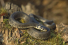 Grass Snake
On the banks of the river, in the floodplain wetlands, there are abundant water frogs, toads (especially green toad), Smooth and Great Crested Newts[31] and less common Grass Snake, Dice snake and European pond terrapin.[20]
Mammals
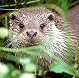
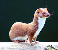
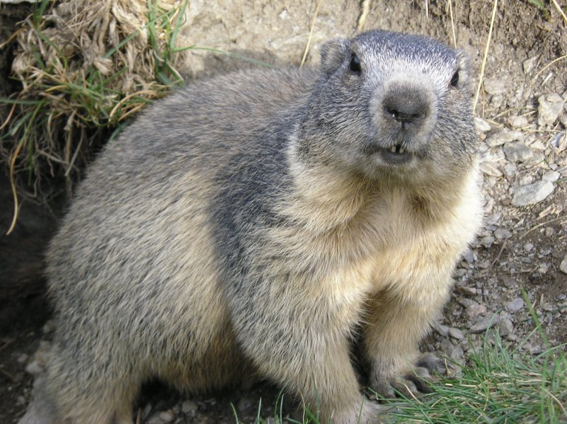
Human activities, mainly cultivation of the steppes, resulted in the disappearance of animals formerly common in the basin, such as tarpan, steppe antelope, Saiga Antelope, marmots and others.[20] Back in the 1960s–1970s, especially near Oskol River, it was not unusual to meet Bobak marmot, Eurasian deer, wild boar and Russian Desman.[30] Current mammals of the basin include European Beaver, dipodidae, suslik, mice, European Otter, European Mink, Weasel and bats.
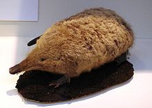
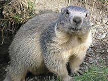
Russian Desman Marmot European Otter Least Weasel Birds
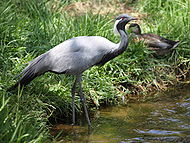
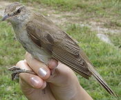
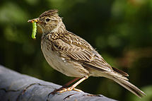
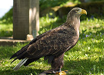
The number of bird species of the river basin reduced sharply over the past 100–150 years. The disappeared species include Steppe Eagle, tirkusha, Sociable Lapwing, bustard, black and winged lark. Less common are geese, swans, Golden Eagle, White-tailed Eagle, Peregrine Falcon, Honey Buzzard and Osprey. The reduction is mainly caused by the destruction of forests, especially old groves along the river banks.[30] The creation of artificial forest belts (windbreaks) in the basin in the 1960s brought insectivorous birds new to this area, such as Streptopelia, European Magpie and shrikes.[30] From the traditional bird types, still common are several species of ducks, crows, charadriiformes, podiceps, Great Reed Warbler and much less common are herons and storks. Only 12 individuals of Demoiselle Cranes remain in the area, near Svyatogorsk city. During the migratory season, the region is visited by greylag and black geese.[20]
Demoiselle Crane Great Reed Warbler Skylark White-tailed Eagle  Downy birch
Flora
Banks of the river used to contain groves of trees, which were cut during the 18th–19th centuries. Some of the trees were used for shipbuilding during the Russian-Turkish wars in the time of Peter I.[25] By the 20th century, most meadows along the river banks were converted into farmers' fields. Only a small part of the old groves remains, mainly in the Kharkiv Oblast. North of Izium, there are still broadleaf forests, and pine forests are found near Chuhuiv. Many species of wild plants survive near floodplain wetlands. These include willow, downy birch, alder and krushinnik. Along the river banks, there are cane, swamp horsetail, carex, kizlyak, swamp sabelnik and other types of grass.[20]
Tourism
 Downstream of Zmiyev.
Donets is regarded as one of the most scenic rivers of East European Plain and contains many hiking and biking routes along its banks. Canoe rafting is rather popular, especially between Zmiyev and Svyatogorsk. Rafting is of the first (lowest) degree of difficulty. The busiest tourism months are from May to September.[32] The most picturesque part is probably near the town of Izium, which hosts a National Park of Holy Mountains.[20] Down to Lysychansk, the water is clean for swimming, and there are many sandy beaches on the shores. Near Pechenga Reservoir, there are several health resorts.
Gallery
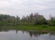
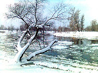
Spring flood Spring Summer Winter References
- ^ a b c d e f g h i j Seversky Donets entry in the Great Soviet Encyclopedia
- ^ Lloyd Arnold Brown (1979). The story of maps. Courier Dover Publications. p. 71. ISBN 0486238733. http://books.google.com/?id=Qh7nDfGm7BkC&pg=PA71.
- ^ James Rennell (1830). The geography system of Herodotus examined and explained, by a comparison with those of other ancient authors, and with modern geography. C.J.G. & F. Rivington. p. 76. http://books.google.com/?id=wKsBAAAAYAAJ&pg=PA76.
- ^ Alexander Guagnini. Description of Muscovy 1997 reprint (in Russian)
- ^ Bliznyakov E., Ovchinnikov KM, Bykov, VD Hydrography of the rivers of USSR, Gidrometeoizdat, Leningrad, 1945.
- ^ Kimstach, p. 376
- ^ a b c Nils Petter Gleditsch, North Atlantic Treaty Organization. Scientific Affairs Division (1997). Conflict and the environment. Springer. p. 438. ISBN 0792347684. http://books.google.com/?id=y5BLCAdgadMC&pg=PA438.
- ^ Antimonov NA Nature of the Belgorod Oblast, Belgorod Publishing House, 1959
- ^ Г.О.Шандиков, Г.Л.Гончаров (2008) (in Russian). Редкие виды рыб бассейна Северского Донца Северо-восточной Украины (Rare fish types of the Seversky Donets basin in the north-eastern Ukraine). Kharkiv University; hosted at gov.ua. http://www.nbuv.gov.ua/portal/natural/vkhnu/Biol/2008_828/pdf/65.pdf.
- ^ Рідний edge Харківський dominant педагогічний університет, Харків, 1999 ISBN 966-7542-20-3
- ^ a b c d e f g Demchenko MA Hydrography of Kharkiv Oblast Proceedings of the Geographical Society of Kharkiv. Volume VIII. Kharkiv Oblast. Nature and economy, Kharkiv State University, Kharkiv, 1971
- ^ Kimstach, p. 409
- ^ a b c Wisniewski В.І. Гідрологічні characteristics річок Ukraine, Ніка-Center, Kyiv, 2003 (in Ukrainian)
- ^ a b c State Water Cadastre. Annual data on mode and surface water resources. Parts 1 and 2, Volume II, Issue 3. RIHMI-WDC, Obninsk, 1989
- ^ Shramko BA History of Seversky Donets Kharkiv University, 1962
- ^ Boriskovsky PI Paleolithic Ukraine, Materials and Research on the Archaeology of the USSR (MIA), v. 40, Moscow, Leningrad, 1953
- ^ "Описания Харьковского наместничества конца XVIII века". Original publication year 1788. Кiev, Наукова думка, 1991, p. 39 (in Russian)
- ^ Zhuk G. P. Seversky Donets – Donbas, Acad. "Donbas", Donetsk, 1982
- ^ Kimstach, p. 381
- ^ a b c d e f Gorelova, LN, Dogadina T., Krivitsky IA Enchanted Valley. Travel Seversky Donets, "Prapor", Kharkiv, 1990
- ^ Dotsenko AP Why does Seversky Donets become shallow and loses fish, "Priroda" No. 4, 1958
- ^ Options for connecting the Volga and Don
- ^ Mendeleev D.I. Future force resting on the banks of the Donets. "Northern Herald", No. 8 – 12, 1888
- ^ Puzyrevskyi N.P. Prospecting on Sev. Donets River in 1903 and 1904 and the project of the waterway from Kharkiv and Belgorod to the confluence of river Donets, St. Petersburg, 1910
- ^ a b Morozov YI Гидрографичекій очеркъ Сѣвернаго Донца, University of Harkov, 1874
- ^ Kimstach, pp. 192, 214, 258, 388–394
- ^ Daniel P. Loucks (1998). Restoration of degraded rivers: challenges, issues, and experiences. Springer. p. 182. ISBN 0792349423. http://books.google.com/?id=p8Q17IQEaOoC&pg=PA182.
- ^ Agroclimaticale directory of Kharkiv area, Gidrometeoizdat, Leningrad, 1957
- ^ Klement Tockner, Urs Uehlinger, Christopher T. Robinson (2009). Rivers of Europe. Academic Press. p. 352. ISBN 0123694493. http://books.google.com/?id=wb9dTAgkg_UC&pg=PT532.
- ^ a b c d Lisiecki A. Fauna of the Kharkiv Oblast Proceedings of the Geographical Society of Kharkiv in Ukraine. Volume VIII. Kharkiv Oblast. Nature and economy, Kharkiv State University, Kharkiv, 1971
- ^ Kuzʹmin, S. L; Kenneth Dodd, C; Pikulik, Mikhail MikhaĭLovich (1995). Amphibian populations in the Commonwealth of Independent States: current status and declines. Pensoft Publishers. p. 33. ISBN 9546420077. http://books.google.com/?id=UQWu1WTnvYMC&pg=PA33.
- ^ Gorbunova NN Boat Tours in Ukraine, Physical Education and Sports, Moscow, 1969
Bibliography
- V. A. Kimstach, Michel Meybeck, Ellysar Baroudy (1998). A water quality assessment of the former Soviet Union. Taylor & Francis. ISBN 0419239200. http://books.google.com/?id=2dk_SC5TIl8C.
External links
- Site Seversk-Donets Basin Water Resources
- Северский Donets
- Donetsin the Dictionary of modern geographical names"
Satellite pictures from the source to the mouth
- Source area in Belgorod Oblast. Merger of Sazhnoi Donets into Seversky Donets (flowing left down)
- Впадение реки Липовый Донец (слева) в Донец (течёт справа вниз). Белгородская область
- Merger of river Vezelka into Donets (flowing down) near Belgorod.
- Area near the Belgorod Reservoir
- Belgorod Reservoir and village Maslova Pristan
- Pecheneg Reservoir and a dam
- Lugansk area
Categories:- Rivers of Belgorod Oblast
- Rivers of Rostov Oblast
- International rivers of Europe
- Rivers of Kharkiv Oblast
- Rivers of Luhansk Oblast
- Rivers of Donetsk Oblast
- Don basin


Wikimedia Foundation. 2010.