- Douglas Knob
-
Douglas Knob Elevation 8,507 ft (2,593 m) [1] Location Location Yellowstone National Park, Teton County, Wyoming Range Madison Plateau Coordinates 44°18′48″N 110°50′51″W / 44.31333°N 110.8475°WCoordinates: 44°18′48″N 110°50′51″W / 44.31333°N 110.8475°W[1] Topo map Shoshone Geyser Basin Douglas Knob el. 8,507 feet (2,593 m) is an isolated mountain peak in the southwest section of Yellowstone National Park. Located just east of the Littler Fork of the Bechler River at the southern extent of the Madison Plateau, Douglas Knob is named for Joseph O. Douglas. In 1962, then Assistant Chief Ranger, William S. Chapman named the summit for Douglas who was an early Park Ranger. In 1921, Douglas was the Assistant Chief Ranger as well as the park's chief Buffalo Keeper[2]. The summit is less than .25 miles (0.40 km) east of the Bechler River trail.
See also
Notes
- ^ a b "Douglas Knob". Geographic Names Information System, U.S. Geological Survey. http://geonames.usgs.gov/pls/gnispublic/f?p=gnispq:3:::NO::P3_FID:1587752.
- ^ Whittlesey, Lee (1996). Yellowstone Place Names. Gardiner, MT: Wonderland Publishing Company. p. 90. ISBN 1599717166.
Rivers, Waterfalls, Peaks and Lakes in the Cascade Corner (Southwest) section of the parkRivers Bechler River • Fall River • Lewis River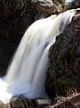
Waterfalls and Cascades Lakes and Peaks Douglas Knob • Shoshone Lake • Trischman KnobList of Yellowstone National Park related articles
 Media related to Waterfalls in Yellowstone at Wikimedia Commons
 State of Wyoming
Topics - Governors
- Delegations
- Geography
- Government
- History
- People
- Visitor Attractions
- State Symbols
- Radio Stations
Society - Crime
- Demographics
- Economy
- Education
- Politics
Regions Cities Counties Categories:- Mountains of Wyoming
- Mountains of Yellowstone

Wikimedia Foundation. 2010.