- Doukkala
-
 The "Green Mountain", the only visible hill, east of the region
 A "tazota", typical old architecture only found in the region
 Warar, a natural temporary lake, in 2008, flooding a house built in the 1970s
 Modern building at Sidi Bennour, now the biggest municipality of the area
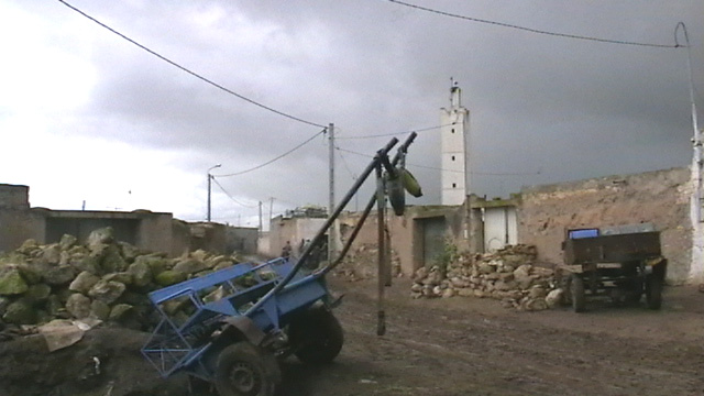
 "Sahel" sub-region, with "anticline climbing" road
Doukkala (Arabic دكالة) is a natural region of Morocco, included in the province of El Jadida and in the Abda-Doukkala administrative region.
It is a plain stretching from the Atlantic Ocean south of Oum Er-Rbia River up to some 50 km further southward and the same distance eastward.
The main urban centers are Sidi Smail, Sidi Bennour, Had Ouled Frej and Khemis Zemamra. Sidi Bennour is the fastest developing center of the four.
It is mainly an agricultural region, with few tourist attractions.
History
Historically, "Doukkala" referred to a Berber tribe which occupied the territory from Anfa (Casablanca) to Asfi. But they revolted against Almohad kings in the 12th century. About 1160, the Almohad ruler Abd al-Mu'min settled Arab bedouin tribes there.[1]
At the end of the French protectorate (ca 1950), there lived in Doukkala 372,269 Muslims, 2,680 Europeans and 3,933 Jews. [2]Geography
Doukkala is divided in three sub-regions, parallel to the seacoast.
- The "Oulja", along the beach, with garden-crops.
- The "Sahel", some 20 km inside, a stony region, only suiting to sheep breeding.
- The rich plain, with wheat, sugar beets, and intensive cattle breeding.
The only mountain to be seen is "Jbel Lakhdar", at the border with the plain of Rahamna.
The plain is subject to flooding. "Warar", a temporary natural lake between Sidi Bennour and Arbaa Od Aamran only fills in rainy years. Its largest surface was noted in 1916, 1966 and 2008.
References
- ^ Guide bleu Hachette du Maroc, 1978 ed., p. 302.
- ^ Guide bleu Hachette du Maroc, 7th ed., 1950, p. 178.
-

Sugar beets cultivation at Sidi Smail
-

Sugar factory at Sidi Bennour
-

Center of a typical Doukkala village (Mwarid, Oulad Bou Hmam)
Categories:- Morocco geography stubs
- Geography of Morocco
- Moroccan tribes


Wikimedia Foundation. 2010.