- Drove Cottage Henge
-
Drove Cottage Henge 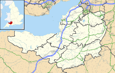
 Drove Cottage Henge shown within Somerset
Location: Somerset, England Coordinates: 51°14′44.37″N 2°37′59.47″W / 51.2456583°N 2.6331861°WCoordinates: 51°14′44.37″N 2°37′59.47″W / 51.2456583°N 2.6331861°W Area: Mendip Hills Built: During the Neolithic Period Architectural style(s): British pre-Roman Architecture Scheduled monument Official name: Henge 370m north east of Drove Cottage[1] Designated: April 8, 1997[1] Reference #: 29764[1] Drove Cottage Henge (sometimes called Hunter's Lodge Henge)[2] is a Scheduled Ancient Monument in the Priddy parish of Somerset, England. It is located 370 metres (1,210 ft) north of Drove Cottage.[1] The site is a ceremonial Neolithic location.[3] Since this henge is one of only around 80 henges throughout England, it is considered to be nationally important.[1]
Contents
Description
Drove Cottage Henge is situated in a valley. The bank circumscribing the henge is about 11.5 metres (38 ft) thick and .4 metres (1.3 ft) high, with a diameter of around 54 metres (177 ft) when measuring from the outsides of the banks. Just inside this bank is a ditch 6 metres (20 ft) wide and .3 metres (0.98 ft) deep, enclosing a circular central area about 19 metres (62 ft) in diameter. In the northern portion of this central area is a low-lying mound[1] in front of the exit, which appears as a break in the outside bank.[1][4]
Jodie Lewis noted in 2005 that "Examples of southerly and north-north-westerly orientations, apropos Stockwood and Hunter's Lodge, are documented at other Class I henge sites, but are not common".[5] Harding and Lee in 1987 said of it "HUNTERS LODGE, Priddy ST 559 498: Sub-oval enclosure, surviving as an earthwork, situated at the head of a shallow valley."[6]
This whole site has become hard to see because repeated ploughing has heavily damaged the archaeological site, including the turf cover.[3][4]
Nearby archaeological sites
Four barrows are relatively close to Drove Cottage Henge.[4] One is a disc barrow and a Scheduled Ancient Monument (designation #13840).[7] Another is a bowl barrow and a Scheduled Ancient Monument (designation #13871).[8] Another, also a bowl barrow, is a Scheduled Ancient Monument (designation #13872).[9] The final barrow is probably a bowl barrow, but it may be a spoil dump. It too is a Scheduled Ancient Monument (designation #13873).[10]
See also
References
- ^ a b c d e f g "Extract from English Heritage's Record of Scheduled Ancient Monuments" (PDF). Somerset Historic Environment Record. magic. http://www.magic.gov.uk/rsm/29764.pdf. Retrieved 1 January 2011.
- ^ "Drove Cottage Henge". Henge in England in Somerset. Megalithic Portal. http://www.megalithic.co.uk/article.php?sid=4958. Retrieved 1 January 2011.
- ^ a b "Mendip Hills". English Heritage. http://www.english-heritage.org.uk/professional/research/landscapes-and-areas/protected-landscapes/mendip-hills/. Retrieved 2 January 2011.
- ^ a b c "Henge 370m NE of Drove Cottage, Hillgrove Road, Priddy". Somerset Historic Environment Record. Somerset Government. http://webapp1.somerset.gov.uk/her/details.asp?prn=24154. Retrieved 2 January 2011.
- ^ Jodie Lewis, Monuments, ritual and regionality: the neolithic of Northern Somerset (Archaeopress, 2005)
- ^ A. F. Harding, G. E. Lee, Henge monuments and related sites of Great Britain: air photographic evidence and catalogue (1987)
- ^ "Disc barrow, 610m NE of Drove Cottage, Priddy". Somerset Historic Environment Record. Somerset Government. http://webapp1.somerset.gov.uk/her/details.asp?prn=24140. Retrieved 2 January 2011.
- ^ "Bowl Barrow, 550m SE of Southfield Farm, Priddy". Somerset Historic Environment Record. Somerset Government. http://webapp1.somerset.gov.uk/her/details.asp?prn=24157. Retrieved 2 January 2011.
- ^ "Bowl Barrow, 470m SE of Southfield Farm, Priddy". Somerset Historic Environment Record. Somerset Government. http://webapp1.somerset.gov.uk/her/details.asp?prn=24156. Retrieved 2 January 2011.
- ^ "Bowl Barrow, 570m SE of Southfield Farm, Priddy". Somerset Historic Environment Record. Somerset Government. http://webapp1.somerset.gov.uk/her/details.asp?prn=24158. Retrieved 2 January 2011.
External links
Categories:- Scheduled Ancient Monuments in Somerset
- Henges
- Mendip Hills

Wikimedia Foundation. 2010.