- Drumbegger
-
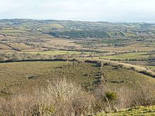 Part of the townland of Drumbegger with The Sillees River in the distance
Drumbegger (from Irish: Drom Beag Gearr meaning "small, short ridge") is a townland situated in the area of Boho, County Fermanagh, Northern Ireland. It contains the sub-townland known as Oubarraghan.[1] The area has been designated an Area of Special Scientific Interest (ASSI 322, 17 August 2009) as a consequence of species-rich wet grassland.[2]
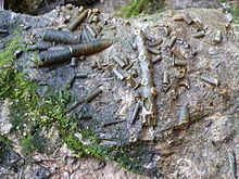 Fossil Crinoids in The Screenagh River
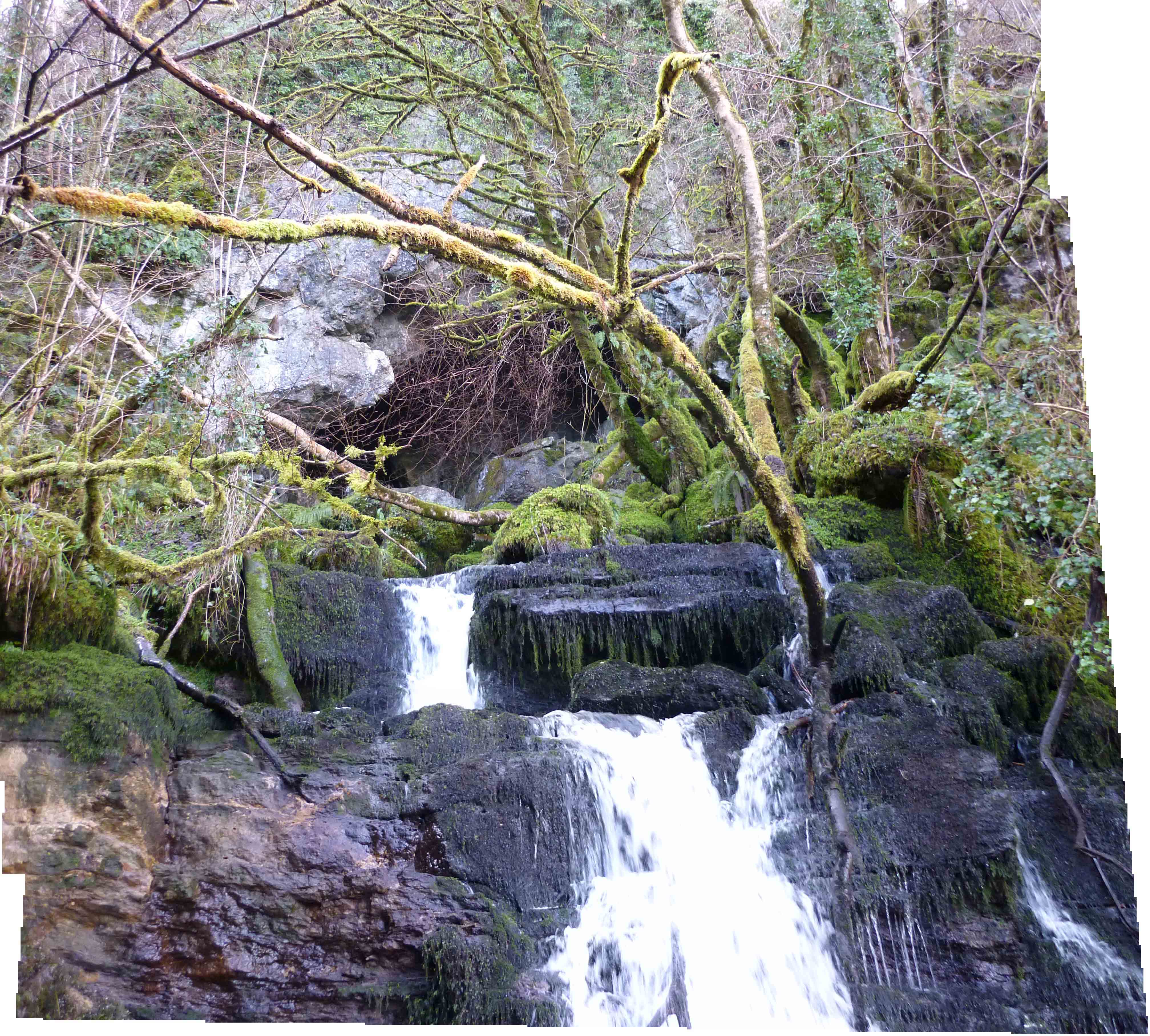
 Screenagh River Waterfall emerging from the Arch Cave in Oubarraghan
Oubarraghan contains the Arch Cave (Grid ref: H1037 4790) which is an outlet of a series of subterranean passages that originate from Noon's Hole.[3] The river that runs out of this cave is known as the Screenagh, which makes its way through Drumbegger and into the Sillees River.[3]
See also
- Caves of the Tullybrack and Belmore hills
References
- ^ Boho Heritage Organisation (2009). Edel Bannon, Louise Mclaughlin, Cecilia Flanagan. ed. Boho Heritage: A treasure trove of history and lore. Nicholson & Bass Ltd, Mallusk, Northern Ireland. pp. 246. ISBN 978-0-9560607-0-9.
- ^ "Area of Special Scientific Interest". Northern Ireland Environment Agency. http://www.ni-environment.gov.uk/assisitedetails?id=ASSI322.
- ^ a b "Earth Science Conservation Review". National Museums Northern Ireland. http://www.habitas.org.uk/escr/site.asp?item=1161.
Coordinates: 54°22′49″N 7°50′23″W / 54.38021°N 7.83986°W
Categories:- County Fermanagh geography stubs
- Townlands in County Fermanagh


Wikimedia Foundation. 2010.