- Drumgelloch (1989) railway station
-
Drumgelloch 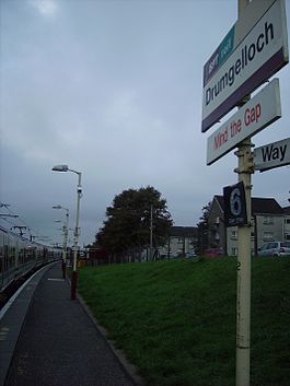
Drumgelloch station sign Location Place Airdrie Area North Lanarkshire Coordinates 55°51′58″N 3°57′14″W / 55.866°N 3.954°WCoordinates: 55°51′58″N 3°57′14″W / 55.866°N 3.954°W Grid reference NS776653 Operations Original company BR Scottish Region Pre-grouping First ScotRail Platforms 1 Annual rail passenger usage 2002/03 * 112,854 2004/05 * 130,903 2005/06 * 172,903 2006/07 * 165,163 2007/08 * 168,364 History May 1989 Opened[1] 9 May 2010 Station closed Disused railway stations in the United Kingdom * Annual passenger usage based on sales of tickets in stated financial year(s) which end or originate at Drumgelloch from Office of Rail Regulation statistics. Please note: methodology may vary year on year. Closed railway stations in Britain
A B C D–F G H–J K–L M–O P–R S T–V W–ZDrumgelloch railway station was a railway station serving Drumgelloch, an eastern suburb of Airdrie, North Lanarkshire, Scotland. The station was managed by First ScotRail and was the eastern terminus of the North Clyde Line, 20 km (12½ miles) east of Glasgow Queen Street from May 1989 to May 2010.
Contents
History
The station was opened in 1989 as the terminus of a short extension of the existing line from Airdrie, although the line to Bathgate that passed through here had been closed to all traffic seven years earlier (passenger services having ceased in 1956).
The North Clyde Line has been extended eastwards beyond Drumgelloch towards Bathgate, connecting with the Edinburgh to Bathgate Line. Plans for the project (termed the Airdrie-Bathgate Rail Link) were approved by the Scottish Parliament in March 2007 and received Royal Assent in May 2007.
Work commenced in 2008. As part of this project, the 1989 single platform Drumgelloch station was closed on 9 May 2010. A substitute bus service was provided until a new station at a new site 550 metres further east was opened on 12 December 2010.[2]
Services
There was a half-hourly service each day from Drumgelloch towards Glasgow Queen Street and Helensburgh Central.
Preceding station  National Rail
Following station Terminus First ScotRail
Airdrie From May 2010
Following closure of the station as part of the Airdrie to Bathgate project, a half-hourly bus service operated to and from Airdrie station to connect with onward services to Glasgow and Helensburgh.
From December 2010
Upon the opening of the 2010 station services operated from the new location, initially by bus due to delays in completion as a result of the inclement weather at the end of November 2010.
Gallery
-

Drumgelloch station, looking towards Airdrie station, with a Class 334 departing
-

The end of the North Clyde line
References
Notes
Sources
- Butt, R. V. J. (1995). The Directory of Railway Stations: details every public and private passenger station, halt, platform and stopping place, past and present (1st ed.). Sparkford: Patrick Stephens Ltd. ISBN 1-8526-0508-1. OCLC 60251199.
- Jowett, Alan (March 1989). Jowett's Railway Atlas of Great Britain and Ireland: From Pre-Grouping to the Present Day (1st ed.). Sparkford: Patrick Stephens Ltd. ISBN 1-8526-0086-1. OCLC 22311137.
- Yonge, John (May 1987). Gerald Jacobs. ed. British Rail Track Diagams - Book 1: ScotRail (1st edition ed.). Exeter: Quail Map Company. ISBN 0-9006-0948-6.
- Yonge, John (February 1993). Gerald Jacobs. ed. Railway Track Diagams - Book 1: Scotland and the Isle of Man (2nd edition ed.). Exeter: Quail Map Company. ISBN 0-9006-0995-8.
- Yonge, John (April 1996). Gerald Jacobs. ed. Railway Track Diagams - Book 1: Scotland and the Isle of Man (3rd edition ed.). Exeter: Quail Map Company. ISBN 1-8983-1919-7.
- Yonge, John (2007). Gerald Jacobs. ed. Railway Track Diagams - Book 1: Scotland & Isle of Man (Quail Track Plans) (fifth edition ed.). Bradford on Avon: "Trackmaps (formerly Quail Map Co)". http://www.trackmaps.co.uk.. ISBN 978-0-9549866-3-6. OCLC 79435248.
External links
Categories:- Disused railway stations in North Lanarkshire
- Railway stations opened by British Rail
- Railway stations opened in 1989
- Railway stations closed in 2010
- Scotland railway station stubs
-


Wikimedia Foundation. 2010.