- Dubrajpur (community development block)
-
Dubrajpur — Community development block — Location in West Bengal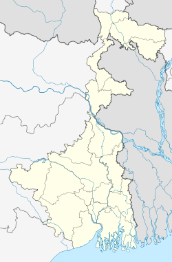
 Dubrajpur
Coordinates: 23°49′N 87°23′E / 23.817°N 87.383°E Country  India
IndiaState West Bengal District Birbhum Parliamentary constituency Birbhum Assembly constituency Dubrajpur, Suri Area - Total 132.3 sq mi (342.71 km2) Population (2001) - Total 158,968 - Density 1,201.8/sq mi (464/km2) Time zone IST (UTC+5.30) PIN Literacy Rate 56.75 per cent Website http://birbhum.nic.in/ Dubrajpur (community development block) (Bengali: দুবরাজপুর সমষ্টি উন্নয়ন ব্লক) is an administrative division in Suri Sadar subdivision of Birbhum district in the Indian state of West Bengal. Dubrajpur, Ilambazar and Sadaipur police stations serve this block. Headquarters of this block is at Dubrajpur.[1][2]
Contents
Geography
Dubrajpur is located at 23°49′N 87°23′E / 23.81°N 87.38°E.
Dubrajpur community development block has an area of 342.71 km2.[2]
Gram panchayats
Gram panchayats of Dubrajpur block/panchayat samiti are: Balijuri, Chinpai, Gohaliara, Hetampur, Jashpur, Lakshinarayanpur, Loba, Paduma, Parulia and Sahapur.[3]
Demographics
As per 2001 census, Dubrajpur block had a total population of 158,968, out of which 81,346 were males and 77,622 were females. Dubrajpur block registered a population growth of 17.07 per cent during the 1991-2001 decade. Decadal growth for Birbhum district was 17.88 per cent.[2]Decadal growth in West Bengal was 17.84 per cent.[4]
Scheduled castes at 57,931 formed around one-third the population. Scheduled tribes numbered 8,358.[5]
Literacy
As per 2001 census, Dubrajpur block had a total literacy of 56.75 per cent for the 6+ age group. While male literacy was 68.07 per cent female literacy was 44.81 per cent. Birbhum district had a total literacy of 61.48 per cent, male literacy being 70.89 per cent and female literacy being 51.55 per cent.[6]
Economy
Bakreshwar Thermal Power Station is located partly in Dubrajpur block.[7]
References
- ^ "Contact details of Block Development Officers". Birbhum district. West Bengal Government. http://wbprd.gov.in/html/asp/bdo_contact.asp?cd=DG. Retrieved 2011-10-10.
- ^ a b c "Provisional population totals, West Bengal, Table 4, Birbhum District (8)". Census of India 2001. Census Commission of India. http://web.cmc.net.in/wbcensus/DataTables/02/Table4_8.htm. Retrieved 2011-10-10.
- ^ "Annexure A to the G.O. No.16 (Sanction)-RD/CCA/BRGF/1C-9/2008 dated 12.4.11". Government of West Bengal - Department of Panchayats & Rural Development. http://wbprd.nic.in/html/asp/writereaddata/Notifications/01000005.doc. Retrieved 2011-10-10.
- ^ "Provisional Population Totals, West Bengal. Table 4". Census of India 2001. Census Commission of India. http://web.cmc.net.in/wbcensus/DataTables/02/FrameTable4_1.htm. Retrieved 2011-10-10.
- ^ "TRU for all Districts (SC & ST and Total)". Census 2001. Census Commission of India. http://web.cmc.net.in/wbcensus/HouseListingF/SCST/All_distSCST%28TRU1%298.htm. Retrieved 2011-10-10.
- ^ "Provisional population totals, West Bengal, Table 5, Birbhum District". Census of India 2001. Census Commission of India. http://web.cmc.net.in/wbcensus/DataTables/02/Table5_8.htm. Retrieved 2011-10-10.
- ^ Sarajit Pramanick, Birbhumer Ahankar:Bakreshwar Tapbidyut Kendra, Paschim Banga, Birbhum special issue, pp. 189–192, (in Bengali), February 2006, Information and Culture Department, Government of West Bengal
Municipalities & CD blocks of West Bengal Municipal
CorporationsMunicipalities Alipurduar · Arambagh · Ashoknagar Kalyangarh · Baduria · Baidyabati · Bally · Balurghat · Bangaon · Bankura · Bansberia · Baranagar · Barasat · Bardhaman · Barrackpore · Baruipur · Basirhat · Beldanga · Berhampore · Bhadreswar · Bhatpara · Bidhannagar · Birnagar · Bishnupur · Bolpur · Budge Budge · Chakdaha · Champdani · Chandrakona · Contai · Cooch Behar · Dainhat · Dalkhola · Darjeeling · Dhulian · Dhupguri · Diamond Harbour · Dinhata · Dubrajpur · Dum Dum · Egra · English Bazar · Gangarampur · Garulia · Gayespur · Ghatal · Gobardanga · Guskara · Habra · Haldia · Haldibari · Halisahar · Hugli-Chuchura · Islampur · Jalpaiguri · Jamuria · Jangipur · Jhalda · Jhargram · Jiaganj Azimganj · Jaynagar Mazilpur · Kaliaganj · Kalimpong · Kalna · Kalyani · Kamarhati · Kanchrapara · Kandi · Katwa · Kharagpur · Kharar · Khardaha · Kshirpai · Konnagar · Krishnanagar · Kulti · Kurseong · Madhyamgram · Maheshtala · Mal · Mathabhanga · Mekhliganj · Memari · Midnapore · Murshidabad · Nabadwip · Naihati · Nalhati · New Barrackpur · North Barrackpur · North Dumdum · Old Maldah · Panihati · Panskura · Pujali · Purulia · Raghunathpur · Raiganj · Rajarhat · Rajpur Sonarpur · Ramjibanpur · Rampurhat · Ranaghat · Raniganj · Rishra · Sainthia · Shantipur · Serampore · Sonamukhi · South Dumdum · Suri · Taki · Tamluk · Tarakeswar · Titagarh · Tufanganj · Uluberia · Uttarpara Kotrung
Community
development
blocks*A Alipuduar I · Alipurduar II · Amdanga · Amta I · Amta II · Andal · Arambagh · Arsha · Ausgram I · Ausgram II B Baduria · Bagdah · Baghmundi · Bagnan I · Bagnan II · Balagarh · Balarampur · Balurghat · Bally Jagachha · Bamangola · Bandwan · Bangaon · Bankura I · Bankura II · Barjora · Bansihari · Barabani · Barabazar · Barrackpore I · Barrackpore II · Barasat I · Barasat II · Baruipur · Basanti · Basirhat I · Basirhat II · Beldanga I · Beldanga II · Berhampore · Bhagawangola I · Bhagawangola II · Bhagabanpur I · Bhagabanpur II · Bhangore I · Bhangore II · Bharatpur I · Bharatpur II · Bhatar · Binpur I · Binpur II · Bishnupur, Bankura · Bishnupur I, South 24 Parganas · Bishnupur II, South 24 Parganas · Bolpur Sriniketan · Budge Budge I · Budge Budge II · Burdwan I · Burdwan II · Burwan C Canning I · Canning II · Chakdaha · Chanchal I · Chanchal II · Chandipur · Chanditala I · Chanditala II · Chapra · Chandrakona I · Chandrakona II · Chhatna · Chinsurah-Mogra · Chopra · Contai I · Contai II · Contai III · Cooch Behar I · Cooch Behar II D Darjeeling Pulbazar · Dantan I · Dantan II · Daspur I · Daspur II · Debra · Deganga · Diamond Harbour I · Diamond Harbour II · Deshapran · Dhaniakhali · Dhupguri · Dinhata I · Dinhata II · Domjur · Domkal · Dubrajpur E Egra I · Egra II · English Bazar F Falakata · Falta · Farakka · Faridpur-Durgapur G Gaighata · Galsi I · Galsi II · Gangajalghati · Gangarampur · Garhbeta I · Garhbeta II · Garhbeta III · Gazole · Ghatal · Goalpokhar I · Goalpokhar II · Goghat I · Goghat II · Gopiballavpur I · Gopiballavpur II · Gorubathan · Gosaba H Habibpur · Habra I · Habra II · Haldia · Haldibari · Hanskhali · Hariharpara · Haringhata · Haripal · Harirampur · Harishchandrapur I · Harishchandrapur II · Haroa · Hasnabad · Hemtabad · Hili · Hingalganj · Hirbandh · Hura I Ilambazar · Indas · Indpur · Islampur · Itahar J Jagatballavpur · Jalangi · Jalpaiguri · Jamalpur · Jamboni · Jamuria · Jangipara · Jaynagar I · Jaynagar II · Jhalda I · Jhalda II · Jhargram · Jorebunglow Sukhiapokhri · Joypur, Bankura · Joypur, Purulia · K Kakdwip · Kalchini · Kaliachak I · Kaliachak II · Kaliachak III · Kaliaganj · Kaliganj · Kalimpong I · Kalimpong II · Kalna I · Kalna II · Kandi · Kanksa · Karandighi · Karimpur I · Karimpur II · Kashipur · Katwa I · Katwa II · Keshiari · Keshpur · Ketugram I · Ketugram II · Khanakul I · Khanakul II · Khandaghosh · Kharagpur I · Kharagpur II · Khargram · Kharibari · Khatra · Khejuri I · Khejuri II · Khoyrasole · Kotulpur · Krishnaganj · Krishnanagar I · Krishnanagar II · Kulpi · Kultali · Kumarganj · Kumargram · Kurseong · Kushmandi L Labpur · Lalgola M Madarihat-Birpara · Magrahat I · Magrahat II · Mahisadal · Mal · Manbazar I · Manbazar II · Mandirbazar · Manikchak · Manteswar · Mathabhanga I · Mathabhanga II · Mathurapur I · Mathurapur II · Matiali · Matigara · Maynaguri · Mayureswar I · Mayureswar II · Mejia · Mekhliganj · Memari I · Memari II · Midnapore Sadar · Minakhan · Mirik · Mohammad Bazar · Mohanpur · Mongalkote · Moyna · Murarai I · Murarai II · Murshidabad-Jiaganj N Nabadwip · Nabagram · Nagrakata · Nakashipara · Nalhati I · Nalhati II · Namkhana · Nandakumar · Nandigram I · Nandigram II · Nanoor · Naoda · Narayangarh · Naxalbari · Nayagram · Neturia O Old Malda · Onda · P Panchla · Pandabeswar · Pandua · Panskura I · Panskura II · Para · Patashpur I · Patashpur II · Patharpratima · Patrasayer · Phansidewa · Pingla · Polba-Dadpur · Puncha · Purbasthali I · Purbasthali II · Pursurah · Purulia I · Purulia II R Raghunathganj I · Raghunathganj II · Raghunathpur I · Raghunathpur II · Raiganj · Raina I · Raina II · Raipur · Rajarhat · Rajganj · Rajnagar · Ramnagar I · Ramnagar II · Rampurhat I · Rampurhat II · Ranaghat I · Ranaghat II · Rangli Rangliot · Ranibandh · Raniganj · Raninagar I · Raninagar II · Ratua I · Ratua II S Sabang · Sagar · Sagardighi · Sahid Matangini · Sainthia · Salanpur · Salboni · Saltora · Samserganj · Sandeshkhali I · Sandeshkhali II · Sankrail, Howrah · Sankrail, Paschim Medinipur · Santipur · Santuri · Sarenga · Shyampur I · Shyampur II · Simlapal · Singur · Sitai · Sitalkuchi · Sonamukhi · Sonarpur · Sreerampur-Uttarpara · Suri I · Suri II · Sutahata · Suti I · Suti II · Swarupnagar T Taldangra · Tamluk · Tapan · Tarakeswar · Tehatta I · Tehatta II · Thakurpukur Mahestala · Tufanganj I · Tufanganj II U Udaynarayanpur · Uluberia I · Uluberia II
- Similar to Tehsils in many states of India
Birbhum district topics General Alkap • Amar Kutir • Bakreshwar Thermal Power Station • Ballabhpur Wildlife Sanctuary • Banalakshmi • Baul • Culture of Birbhum • Dharmathakur • Gajan • Fairs in Birbhum • Mama Bhagne • Muluk murder case • Nanoor massacre • Poush Mela • Santhal rebellion • Visva-Bharati UniversityPeople Subdivisions Bolpur • Rampurhat • Suri SadarTerritories Locations
other than cities and townsBakreshwar • Bhimgarh • Ekachakra · Jaydev Kenduli • Kankalitala • Khustigiri • Mollarpur • Patharchapuri • Raipur • Surul · TarapithMunicipalities Community development blocks Suri Sadar subdivision Suri I • Suri II • Sainthia • Dubrajpur • Khoyrasole • Rajnagar • Mohammad Bazar Bolpur subdivision Bolpur Sriniketan • Ilambazar • Labpur • Nanoor Rampurhat subdivision Mayureswar I • Mayureswar II • Rampurhat I • Rampurhat II • Murarai I • Murarai II • Nalhati I • Nalhati IIRivers Transport Panagarh–Morgram Highway • Eastern Railway (India) • Sahibganj Loop • Ahmedpur Katwa RailwayLok Sabha constituencies Vidhan Sabha constituencies Dubrajpur • Suri • Bolpur • Nanoor • Labpur • Sainthia • Mayureswar • Rampurhat • Hansan • Nalhati • MuraraiFormer Vidhan Sabha constituencies Mahammad Bazar • RajnagarSee also Cities and towns in Birbhum district • People from Birbhum district • People associated with Santiniketan • Visva-Bharati alumni • Villages in Birbhum districtOther districts in West Bengal Bankura • Bardhaman • Cooch Behar • Dakshin Dinajpur • Darjeeling • Hooghly · Howrah • Jalpaiguri • Kolkata • Malda • Murshidabad • Nadia • North 24 Parganas • Paschim Medinipur • Purulia • Purba Medinipur • South 24 Parganas • Uttar DinajpurSurrounding areas outside West Bengal Jharkhand Cities and towns in Santhal Parganas • Santhal Pargana division topicsCategories:- Community development blocks in Birbhum district

Wikimedia Foundation. 2010.