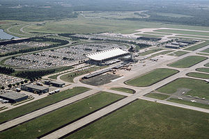
- Dulles International Airport (WMATA station)
-
Dulles International Airport Station statistics Lines Silver Line (planned)Structure Underground Platforms 1 island platform Tracks 2 Other information Opened Expected to open in 2016[1] Code N12 Services Preceding station Washington Metro Following station Route 606toward Route 772Silver Line (planned) Herndon – Dulles Easttoward Stadium–ArmoryDulles International Airport is a planned Washington Metro station at Dulles International Airport in Loudoun County, Virginia on the Silver Line. It is scheduled to begin operation in 2016,[1] linking Dulles by rail to Washington, D.C. and Ronald Reagan Washington National Airport via Rosslyn. The station was originally planned to be underground, and station features include a tunnel link with the Dulles baggage claim area.[2]. Current plans call for an above-ground station next to daily parking garage 1.[3]
A Washington Metro station had been considered for Dulles since at least 1969, but formal plans were not made until 2002, with the first phase of the project commencing in 2004. According to a 1969–1970 engineering study, a full-scale Metro station was planned (but never built) 28 feet (8.6 m) below a parking lot.[4] The originally planned single-side platform station would not meet current Metro specifications for a center platform, which is necessary since current plans would extend service beyond the airport to western suburbs. In order to address escalations in the projected cost of Phase II, the MWAA Board is considering alternatives to the original plan for an underground station adjacent to the Dulles Airport terminal. Alternatives being considered are an underground station near the airport's north garage about 550 feet from the terminal, and above ground stations located either at the present arrival road ramp or at the parking garage. These plans have drawn concerns from the Virginia Historic Preservation Office regarding the visual impact on the Eero Saarinen-designed terminal. Consultants estimate that an above-ground station would save $640 million in construction costs.[5] On April 6, 2011, the WMATA Board voted 9 to 4 to build an underground station 550 feet away from the terminal rather than an above-ground station 1,150 feet away from the terminal at an additional cost of $330 million. Construction of the underground station would extend its expected opening to mid-2017.[6] On July 20, 2011, the MWAA board reversed its previous vote and approved an above-ground station due to pressure from state and local officials to reduce overall project costs.[7]
References
- ^ a b Dulles Metro Front Page
- ^ Dulles Metro: Dulles Station
- ^ Washington Times: Airports board approves above-ground Dulles Metro station
- ^ Metrorail Track and Structures at BelowTheCapital.org
- ^ Kravitz, Derek (November 9, 2010). "Metro stop's location could mar view of Dulles". Washington Post: p. B5.
- ^ Hosh, Kafia (April 7, 2011). "Dulles to get underground Metro station". Washington Post: p. B1.
- ^ NBC Washington: Decision Made to Build Dulles Rail Station Above Ground
Categories:- Silver Line (Washington Metro)
- Proposed Washington Metro stations
- Transportation in Loudoun County, Virginia
- Proposed railway stations scheduled to open in 2016
- Airport railway stations in the United States
- Washington Metro stubs
Wikimedia Foundation. 2010.

