- Dunstable Downs
-
Dunstable Downs Elevation 243 m (797 ft) Prominence c. 105 m Parent peak Haddington Hill Listing County Top Location Location Chiltern Hills, England Coordinates 51°51′51″N 0°32′11″W / 51.864243°N 0.536344°WCoordinates: 51°51′51″N 0°32′11″W / 51.864243°N 0.536344°W Topo map OS Landranger 166 OS grid TL008194 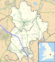
 Dunstable Downs shown within Bedfordshire
Dunstable Downs are part of the Chiltern Hills, in southern Bedfordshire in England. They are a chalk escarpment forming the north-eastern reaches of the Chilterns. At 243 m (797 ft), Dunstable Downs are the highest point of the county of Bedfordshire.[1]
Because of its elevation, Dunstable Downs hosted a station in the shutter telegraph chain which connected the Admiralty in London to its naval ships in the port of Great Yarmouth during the years 1808 to 1814.[2]
Whipsnade Zoo has cut an enormous lion shape into the chalk into the side of one of the hills. The lion can be seen from the B489 (Aylesbury to Dunstable road).
The downs are used by gliders, kite fliers, hang gliders and paragliders in the area because of their height. The London Gliding Club is based at the foot of the downs.
Much of the downs are managed by the National Trust as part of the Dunstable Downs, Countryside Centre & Whipsnade Estate property.
Contents
Ascents
Central Bedfordshire Council and the National Trust commissioned Architype architects to build a visitor centre known as The Chilterns Gateway Centre, on the very top of Dunstable Downs. The summit is right next to the B4541 road that crosses the hill, and so an ascent of the hill requires nothing more than getting out of a car at the highest point and walking across to the trig point.
For those who wish to climb the hill from the base, it is possible to do a circular walk from the village of Whipsnade by following the Icknield Way Path and Chiltern Way, both of which are marked on Ordnance Survey maps. This circuit can be extended to take in the northern top of Five Knolls. The hill can also be ascended from Dunstable to the north. The Icknield Way Trail[3], a horse rider and off-road cycle route, has been established following a similar route to the Icknield Way Path which passes over the Dunstable Downs.
 Dunstable Downs panorama
Natural history
Dunstable and Whipsnade Downs Site of Special Scientific Interest Area of Search Bedfordshire Grid reference TL005205 Interest Biological Area 73.36 hectare (181.27 acre) Notification 1987 Location map Natural England The downs are home to a wide variety of wildlife including many rare wild flowers, such as the Bee Orchid, and different butterfly species, like the Marbled White and the Chalkhill Blue.
Areas of the west-facing slope were notified in 1987 under the Wildlife and Countryside Act 1981 as a Site of Special Scientific Interest (SSSI) called Dunstable and Whipsnade Downs. This includes parts of Whipsnade Zoo.[4]
Blow's Downs
Blow's Downs (51°52′55″N 0°30′04″W / 51.8819°N 0.5012°W) are a continuation of the Dunstable Downs escarpment on the eastern side of Dunstable. This is also known as Blow's Down, and the apostrophe is sometimes omitted.[5]
The area is designated an SSSI,[6] most of which is managed as a nature reserve by the Wildlife Trust for Bedfordshire, Cambridgeshire, Northamptonshire and Peterborough.[7]
See also
Notes and references
- ^ "Geographical Facts, Figures and Statistics about Bedfordshire". Bedfordshire Libraries. http://www.galaxy.bedfordshire.gov.uk/webingres/bedfordshire/vlib/0.yoyo/yyc_facts_geography.htm. Retrieved 2008-02-23.[dead link]
- ^ "Shutter telegraph signalled new era". Great Yarmouth Mercury. http://www.greatyarmouthmercury.co.uk/content/yarmouthmercury/content/porthole/story.aspx?brand=GYMOnline&category=Porthole&tBrand=GYMonline&tCategory=porthole&itemid=NOED03%20Jan%202008%2015%3A17%3A31%3A957. Retrieved 2008-02-23.
- ^ Icknield Way Trail.
- ^ "Dunstable and Whipsnade Downs". English Nature. http://www.english-nature.org.uk/citation/citation_photo/1004427.pdf. Retrieved 2008-02-23.
- ^ The plural form was used by the Ordnance Survey in the 19th century (Bedfordshire 32NE, published in 1891). It is used by local authors such as W. G. Smith (Dunstable: Its History and Surroundings) and V. Evans (The Book of Dunstable and Houghton Regis), in the publications of the Bedfordshire Natural History Society, in the Dunstable Gazette, and by the Wildlife Trust as the name of its reserve. The singular form is used by Dunstable Town Council in the name of its Blows Down Management Committee, and by Natural England as the name of the SSSI.
- ^ Natural England, Blow's Down.
- ^ Wildlife Trust, Blow's Downs.
External links
- Dunstable Downs, Countryside Centre & Whipsnade Estate at the National Trust
- The lion is very clear on 5
- London Gliding Club
Categories:- Dunstable
- Hills of Bedfordshire
- National Trust properties in Bedfordshire
- Visitor attractions in Bedfordshire
- Chiltern Hills


Wikimedia Foundation. 2010.