- Coal River (West Virginia)
-
For other uses, see Coal River (disambiguation).
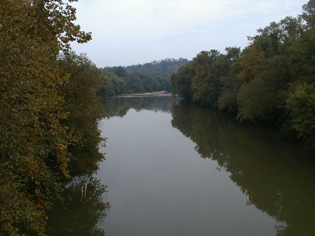
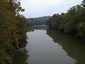 The Coal River at Upper Falls
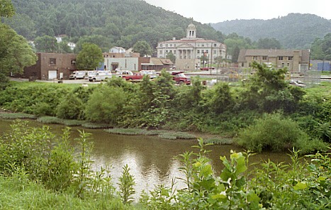
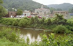 The Little Coal River at Madison
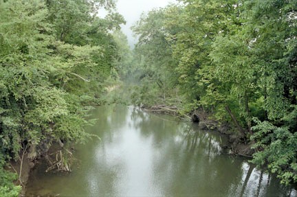
 The Little Coal River near Julian
The Coal River is a tributary of the Kanawha River in southern West Virginia. It is formed near the community of Alum Creek by the confluence of the Big and Little Coal Rivers, and flows generally northward through western Kanawha County, past the community of Upper Falls and into the Kanawha River at St. Albans.
Contents
History
Originally named Walhondecepe by the Delaware Indians,The three rivers that make up the Coal River Watershed, Big, Little and Coal River were renamed in the 18th century by explorer John Peter Salley (or Salling) for the coal deposits found along its banks.
Since humans first arrived in the region the three rivers that make up the Coal River Watershed have served as a vital transportation link to the Kanawaha River. The Indians used the rivers as favorite hunting and fishing sites. Early settlers in the region discovered that outcrops of (Cannel) Coal along the Big Coal River could be utilized as an excellent source of heat and light. The abundant timber reserves found in the region also could be transported to the Kanawah Valley during floods and sold to the growing Kanawha Valley.
The availability of large seams of Cannel Coal, which could be used to produce a very desirable coal oil, brought investors to the region in the mid-19th century. The coal could be utilized to produce a coal oil which was in high demand in the urban areas of the US. The oil was used to replace whale oil for lighting. Cannel Coal oil burned bright and produced very little smoke. The utilization of the rivers for navigation was enhanced in the mid 1851 by the construction of a 34 mile lock and dam system designed by William Rosecrans. The Coal River Navigation Company was formed and invested approximately $208,000 to complete the system.[1]
The lock and dam system was repeatedly washed out by floods but continued to be rebuilt by investors. The system operated successfully from 1855 through 1861. In 1860 over 850,000 bushels of coal were shipped. The outbreak of the Civil War stopped operations of the system but in 1867 a new company was formed and the lock and dams returned to service until 1881. Altogether the lock and dams operated for 16 years. The system is now listed on the National Register of Historic Places as is a series of Log booms built after the locks on the dams were washed away as the Coal River Locks, Dams, and Log Booms Archeological District.[2] The log booms helped to channel cut timber into Sawmill locations along the Coal River near St. Albans, WV.
The Coal River from St. Albans to Upper Falls remains a federal government of the United States-designated navigable waterway.
Beginning around 1800, flax mills and gristmills were built and operated along the river, yielding fiber for the production of textiles in addition to staples such as flour and cornmeal.
After failed attempts by others, the Coal River and Western Railway Company established scheduled rail service along the river at the dawn of the 20th century. This finally provided a reliable source of transportation for the coal and timber industries, sparking an economic boom in the region.
Environmental concerns
The period since World War II is characterized by controversy over the practices of timber and coal operators. Of particular concern is the damaging effects of coal mining. While this activity adds billions of dollars in value to the West Virginia economy, it also wreaks environmental devastation on the Coal River.
Numerous environmental hazards are posed by underground and surface mining operations in the Coal River watershed. Especially troubling to many residents and the United Mine Workers is the coal slurry impoundments that are a byproduct of coal mining and preparation. Some are hundreds of feet tall and contain billions of gallons of toxic waste. This sludge includes dozens of carcinogenic chemicals used for processing, in addition to heavy metals such as arsenic, cadmium, lead and mercury. A persistent fear is that a repeat of the nearby Buffalo Creek disaster is possible, especially since today's impoundments dwarf the one there. Blackwater spills and surface water contamination on tributaries of the Coal River are common. Activism in opposition to the practices of mine operators is a constant and normal feature of life in the region.
The Coal Rivers are undergoing a transformation that is bringing life back to the rivers. Local Community volunteer watershed groups are working to help restore the rivers and improve fish habitat and recreational opportunities. Despite the ravages of the past the rivers are in much better condition than they are often portrayed. The WV DEP has implemented a massive program to restore the Little Coal River. A series of river structures are being built that are designed to move accumulated silt in order to improve fish habitat. Marshall University has been hired to conduct one of the most comprehensive river water quality studies ever performed on the Little Coal and to conduct e-coli testing on the three Coal Rivers. Studies are showing an amazing diversity of aquatic life.(Dr. Tom Jones MU).
The single biggest problem found from recent(2008) studies indicate a very high level of e-coli in the tributaries. Several new sewage treatment facilities are under construction and efforts are under way to address the man made problems. Communities along the rivers are beginning to work together to remove accumulations of trash and metal to improve the aesthetic experience for people paddling and enjoying the rivers. An 88 mile water trail has been established on the rivers to encourage recreational activities.
The rivers have served the local residents as a center of recreation for centuries. The former black coal silt that had polluted the river's many beaches has been covered by new clean sand and people are again using the rivers as a major center for recreational paddle boating and fishing is reported to be excellent throughout the watershed.
Big Coal River
The Big Coal River rises in Raleigh County as two streams, the Clear Fork and the Marsh Fork, which join near Whitesville. The river then flows generally northwest through Boone County, past the towns of Sylvester, Seth and Racine.
Little Coal River
The Little Coal River also rises as two streams, the Spruce Fork in Logan County and the Pond Fork in Boone County. They meet at Madison in Boone County and the river then flows generally northward, past the towns of Danville and Julian.
Tour de Coal
The Tour de Coal, a "paddling event" for canoes and kayaks normally held in June, is an 11-mile trip from Upper Falls to St. Albans. Paddlers negotiate the Lower Falls, a one-mile rapid along the route. About 200 people participated in 2009.
See also
- Julia Bonds
- List of West Virginia rivers
- Coal River Group
- Coal,Steamboats,Timber and Trains book Author Bill Dean
References
- ^ Dean, Bill (2008). Coal Steamboats, timber and Trains. ChessieShop.com.
- ^ "National Register Information System". National Register of Historic Places. National Park Service. 2010-07-09. http://nrhp.focus.nps.gov/natreg/docs/All_Data.html.
External links
- United States Geological Survey
- U.S Geological Survey Real-Time Water Data for Coal River
- U.S. Geological Survey Real-Time Water Data for Big Coal River
- U.S. Geological Survey Geographic Names Information System: Coal River
- U.S. Geological Survey Geographic Names Information System: Big Coal River
- U.S. Geological Survey Geographic Names Information System: Little Coal River
- United States Environmental Protection Agency
Wind power Wind power Environmental effects · History · Vehicles · Offshore wind power · Wind turbine · Windmill · Kitegen
Wind power by country Wind turbines Aerodynamics · Airborne · Darrieus · Design · Floating · Savonius · Quietrevolution · Small · Unconventional · Vertical axis · Devices in useWind power industry Wind farms Concepts Betz' law · Capacity factor · EROEI · Grid energy storage · HVDC · Intermittency · Net energy gain · Storage · Subsidies · Wind power forecasting · Wind profile power law · Wind resource assessmentCategories:- Rivers of West Virginia
- Geography of Kanawha County, West Virginia
- Kanawha River
Wikimedia Foundation. 2010.