- Jerusalem Technology Park
-
Jerusalem Technology Park (Hebrew: גט"י - הגן הטכנולוגי), also Malha Technology Park (Hebrew: הגן הטכנולוגי מלחה, Hagan HaTechnology Malha) is a high-tech industrial park located in Malha neighborhood in southhwest Jerusalem, Israel.
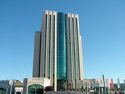 The central office tower in the park
The Jerusalem Technology Park covers an area of about 15 acres (61,000 m2) and was built gradually and populated since 1996, along with the development of the entire area, which includes: the Jerusalem Mall, Teddy Stadium, Jerusalem Malha Railway Station, Jerusalem Tennis center, the Biblical Zoo, a residential neighborhood and a park.[1]
The Park was designed and built as part of urban development plan that puts an emphasis on integrating the urban fabric with the surrounding landscape, while creating a quality working environment . Within the park, in-between its buildings, there is also a Sculpture garden.[1]
Contents
Tenants
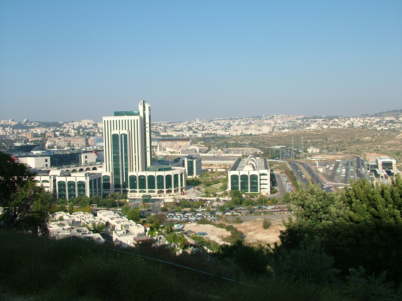
 A view of the park from a nearby hill
with the Jerusalem Mall (far left)
and Malha Railway Station (far right)The park is owned and managed by Isras Group, which offers office space in the park to rent only, while providing management and maintenance services. 70% of the tenants are Hi-tech sector companies and 30% are from the business services and media sectors.[2] Notable tenants include:
- IBM R&D Labs in Israel[3]
- BBC Middle East Bureau [4]
- Thomson Reuters Israel [5]
- Deltathree
- Answers.com
- Ex Libris Group Development Center
- Visionix
- Nanonics Imaging
See also
References
External links
Neighborhoods of Jerusalem Old City 
East Jerusalem American Colony • Al Bustan • Al-Issawiya • At-Tur • Bab a-Zahara • Beit Hanina • Jabel Mukaber • Ma'ale ha-Zeitim • Nachalat Shimon • Nof Zion • Ras al-Amud • Sheikh Jarrah • Shimon HaTzadik • Shuafat • Silwan • Sur Baher • Umm Tuba • Wadi al-JozHaredi neighborhoods Batei Munkatch • Batei Ungarin • Beit Yisrael • Ezrat Torah • Geula • Givat Shaul • Har Nof • Kerem Avraham • Kiryat Belz • Kiryat Mattersdorf • Kiryat Sanz • Kiryat Shomrei Emunim • Machanayim • Mea Shearim • Mekor Baruch • Nachalat Ya'akov • Ramat Shlomo • Ramot Polin • Sanhedria • Sanhedria Murhevet • Sha'arei Hesed • Shmuel HaNavi • Tel Arza • Unsdorf • Zikhron MosheCentral Neighborhoods Batei Nissan Bak • Beit David • Beit Ya'akov • Bukharan neighborhood • Even Yisrael • Ezrat Yisrael • Givat Ram • Katamon • Kiryat Shmuel • Kiryat Wolfson • Mahane Israel • Mahane Yehuda • Merhavia • Mishkenot Sha'ananim • Musrara • Nachalat Achim • Nachlaot • Nayot • Neve Sha'anan • Ohel Shlomo • Rehavia • Yemin MosheNorthern Neighborhoods French Hill • Givat HaMivtar • Ma'alot Dafna • Neve Yaakov • Pisgat Ze'ev • Ramat Eshkol • Ramot • Ramot PolinSouthern Neighborhoods Abu Tor • Baka • Beit Safafa • East Talpiot • The German Colony • Gilo • Givat HaMatos • Greek colony • Har Homa • Mekor Chaim • Ramat Rachel • TalpiotWestern Neighborhoods Bayit VeGan • Beit HaKerem • Givat Massuah • Givat Mordechai • Givat Oranim • Har Hotzvim • Ir Ganim • Katamonim • Kiryat HaYovel • Kiryat Menachem • Kiryat Moshe • Malha • Motza • Pat • Ramat Beit HaKerem • Ramat Denya • Ramat Sharett • Romema • Yefeh NofHistoric Neighborhoods See also: Ring Neighborhoods Coordinates: 31°48′9.1″N 35°12′34.69″E / 31.802528°N 35.2096361°E
Categories:- Neighbourhoods of Jerusalem
- Industrial parks in Israel
- Economy of Jerusalem


Wikimedia Foundation. 2010.