- Mailu Island
-
Mailu Island
Central Province
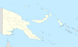
Papua New GuineaDistrict: Abau District LLG: Amazon Bay Rural LLG Coordinates: 10°22′56″N 149°21′30″E / -10.382251°S 149.358313°ECoordinates: 10°22′56″N 149°21′30″E / -10.382251°S 149.358313°E Population: 770 (2000) Main languages: Mailu language Location: 250 km (155 mi) ESE of Port Moresby Mailu Island is a small, 1.8 km long, island in Central Province, Papua New Guinea. It lies 250 km ESE from Port Moresby.
Contents
Characteristics
Mailu is an island that has been inhabited since ancient times.[1] It is located 8 km south of the New Guinean coast. Bananas, taro, yams, betel, sugarcane, as well as coconut, areca nut and sago palms grow on the island. The village is located on the NE shores. There is a smaller island right off Mailu's southern point. Pottery[2] was made by the women on Mailu Island and traded with goods from the coast, mainly the South Cape and the Aroma people to the NW.
This island was visited by polish anthropologist Bronisław Malinowski in 1914. Mailu Island was also visited by Austrian anthropologist and photographer Hugo Bernatzik in 1932. Bernatzik, who published an ethnography a few years later, described Mailu as a very pleasant place and had a good impression of the Mailuans, as reliable people of a good character and skilled seafarers. He admired the buildings and the boats and took photographs of Mailu houses from the inside and outside. Bernatzik also took pictures of the islanders and their artifacts, reflecting a culture that he deemed was dying in contact with the modern world.[3] Frank Hurley also visited Mailu during his journeys.[4]
Between 1972 and 1974 New Zealand archaeologist Geoffrey Irwin[5] carried out a survey of Mailu Island and the neighbouring coast where linguistically related groups, speakers of Mailuan languages, live.
See also
References
- ^ J T Clark & J Terrell , Archaeology in Oceania, Annual Review of Anthropology
- ^ Patricia May & Margaret Tuckson, The Traditional Pottery of Papua New Guinea, University of Hawai`i Press ISBN 978-0-8248-2344-3
- ^ Hugo Bernatzik, Südsee; ein Reisebuch. first edition Leipzig 1934
- ^ Photograph album of Papua and the Torres Strait
- ^ Geoffrey Irwin, The Emergence of Mailu as a Central Place in Papuan Prehistory. 1985
External links
Categories:- Papua New Guinea geography stubs
- Islands of Papua New Guinea
- Central Province (Papua New Guinea)
Wikimedia Foundation. 2010.

