- Malwa
-
For other uses, see Malwa (disambiguation).
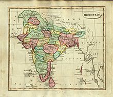
Malwa — Region, former administrative division — Mhow cantonment area in Malwa Malwa (highlighted) as per 1823 depiction of India by Fielding Lucas Jr..
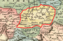
Country India Area - Total 81,767 km2 (31,570.4 sq mi) ElevationAverage elevation of the Malawa Plateau 500 m (1,640 ft) Population (2001) - Total 18,889,000 - Density 231/km2 (598.3/sq mi) Time zone IST (UTC+05:30) Largest city Indore Malwa (Devnagari: मालवा, Marathi: माळवा) is a region in west-central northern India occupying a plateau of volcanic origin.
Geologically, the Malwa Plateau generally refers to the volcanic upland south of the Vindhya Range. Politically and administratively, the historical Malwa region includes districts of western Madhya Pradesh and parts of south-eastern Rajasthan. The definition of Malwa is sometimes extended to include the Nimar region north of the Vindhyas.
The Malwa region had been a separate political unit from the time of the ancient Malava Kingdom. It has been ruled by several kingdoms and dynasties, including the Avanti Kingdom, the Mauryans, the Guptas, the Parmaras, the Malwa sultans, the Mughals and the Marathas. Malwa continued to be an administrative division until 1947, when the Malwa Agency of British India was merged into Madhya Bharat (also known as Malwa Union) state of independent India.
Although its political borders have fluctuated throughout history, the region has developed its own distinct culture, influenced by the Gujarati, Rajasthani and Marathi cultures. Several prominent people in the history of India have hailed from Malwa, including the poet and dramatist Kalidasa, the author Bhartrihari, the mathematicians and astronomers Varahamihira and Brahmagupta, and the polymath king Bhoja. Ujjain had been the political, economic, and cultural capital of the region in ancient times, and Indore is presently the largest city and commercial centre.
Overall, agriculture is the main occupation of the people of Malwa. The region has been one of the important producers of opium in the world. Cotton and soybeans are other important cash crops, and textiles are a major industry.
Contents
History
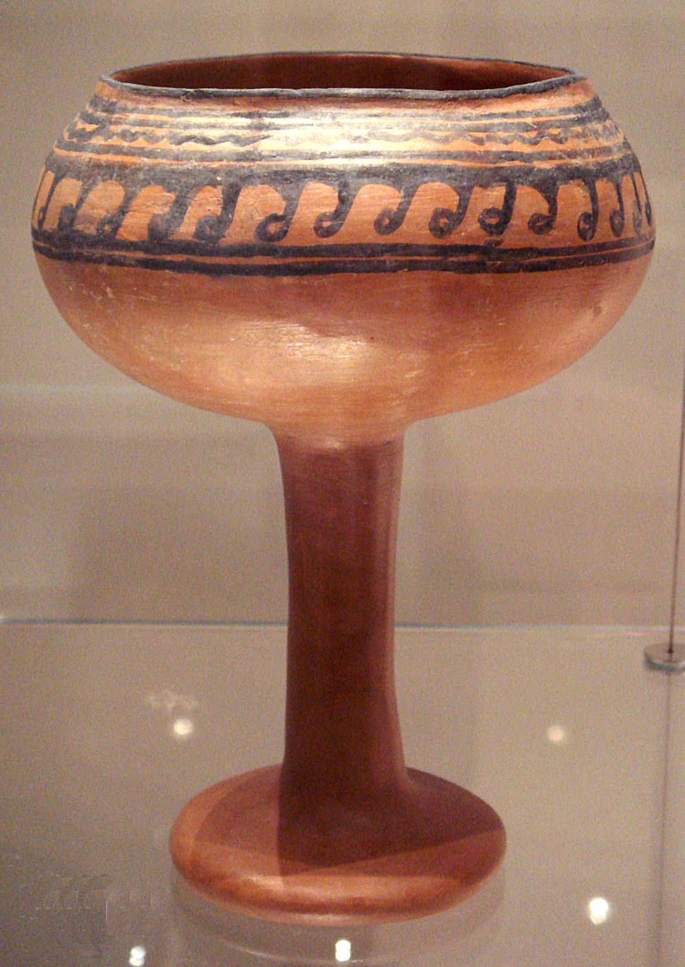
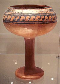 Ceramic goblet from Navdatoli, Malwa, 1300 BCE.
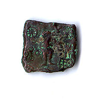 Coin showing Karttikeya and Lakshmi (Ujjain, circa 150–75 BC)
Several early stone age or Lower Paleolithic habitations have been excavated in eastern Malwa.[1] The name Malwa is derived from the name of the ancient Aryan tribe of Malavas, about whom very little is known apart from the fact that they created the Vikrama Samvat, a calendar dating from 57 BC that is widely used in India and is popularly associated with king Chandragupta Vikramaditya.
Ancient historians have mention about a great tribe in Indo-Scythians called Abhira migrated from Eastern Iran[2][3] to Malwa in A.D 151.[4][5][6] The name Malava is derived from the Sanskrit term Malav, and means “part of the abode of Lakshmi”.[7] The location of the Malwa or Moholo, mentioned by the 7th century Chinese traveller Xuanzang, is plausibly identified with present-day Gujarat.[8] The region is cited as Malibah in Arabic records, such as Kamilu-t Tawarikh by Ibn Asir.[9]
Ujjain, also known historically as Ujjaiyini and Avanti, emerged as the first major centre in the Malwa region during India's second wave of urbanisation in the 7th century BC (the first wave was the Indus Valley Civilization). Around 600 BC an earthen rampart was built around Ujjain, enclosing a city of considerable size. Avanti was one of the prominent mahajanapadas of the Indo-Aryans. In the post-Mahabharata period—around 500 BC—Avanti was an important kingdom in western India; it was ruled by the Haihayas, a people who were possibly of mixed Indo-Aryan and aboriginal descent, who were responsible for the destruction of Naga power in western India.[10]
The region was conquered by the Maurya empire in the mid-4th century BC. Ashoka, who was later a Mauryan emperor, was governor of Ujjain in his youth. After the death of Ashoka in 232 BC, the Maurya Empire began to collapse. Although evidence is sparse, Malwa was probably ruled by the Kushanas and the Shakas during the 2nd and 1st centuries BC. Ownership of the region was the subject of dispute between the Western Kshatrapas and the Satavahanas during the first three centuries AD. Ujjain emerged a major trading centre during the 1st century AD.
 Rani Rupmati Pavilion at Mandu, built by Miyan Bayezid Baz Bahadur (1555–62)
Malwa became part of the Gupta Empire during the reign of Chandragupta II (375–413), also known as Vikramaditya, who conquered the region, driving out the Western Kshatrapas. The Gupta period is widely regarded as a golden age in the history of Malwa, when Ujjain served as the empire's western capital. Kalidasa, Aryabhata and Varahamihira were all based in Ujjain, which emerged as a major centre of learning, especially in astronomy and mathematics. Around 500, Malwa re-emerged from the dissolving Gupta Empire as a separate kingdom; in 528, Yasodharman of Malwa defeated the Hunas, who had invaded India from the north-west. During the seventh century, the region became part of Harsha's empire, who disputed the region with the Chalukya king Pulakesin II of Badami in the Deccan.
In 756 AD Gurjars advanced into Malwa.[11] In 786 the region was captured by the Rashtrakuta kings of the Deccan, and was disputed between the Rashtrakutas and the Gurjara Pratihara kings of Kannauj until the early part of the tenth century. From the mid-tenth century, Malwa was ruled by the Paramaras, who established a capital at Dhar. King Bhoj, who ruled from about 1010 to 1060, was known as the great polymath philosopher-king of medieval India; his extensive writings cover philosophy, poetry, medicine, veterinary science, phonetics, yoga, and archery. Under his rule Malwa became an intellectual centre of India. Bhoj also founded the city of Bhopal to secure the eastern part of his kingdom. His successors ruled until about 1200, when Malwa was conquered by the Delhi Sultanate.
 Position of Malwa with respect to other states in c. 1200. prior to conquest by Delhi Sultanate
Dilawar Khan, previously Malwa's governor under the rule of the Delhi sultanate, declared himself sultan of Malwa in 1401 after the Mongol conqueror Timur attacked Delhi, causing the break-up of the sultanate into smaller states. Khan started the Malwa Sultanate and established a capital at Mandu, high in the Vindhya Range overlooking the Narmada River valley. His son and successor, Hoshang Shah (1405–35), embellished[clarification needed] Mandu. Hoshang Shah's son, Ghazni Khan, ruled for only a year and was succeeded by Sultan Mahmud Khalji (1436–69), the first of the Khalji sultans of Malwa, who expanded the state to include parts of Gujarat, Rajasthan, and the Deccan. The Muslim sultans invited the Rajputs to settle in the country. In the early 16th century, the sultan sought the aid of the sultans of Gujarat to counter the growing power of the Rajputs, while the Rajputs sought the support of the Sesodia Rajput kings of Mewar. Gujarat stormed Mandu in 1518 and 1531, and shortly after that, the Malwa sultanate collapsed. The Mughal emperor Akbar captured Malwa in 1562 and made it a subah (province) of his empire. The Malwa Subah existed from 1568 to 1743. Mandu was abandoned by the 17th century.
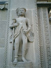 Sculpture of a Holkar courtier from Fort Ahilya
As the Mughal state weakened after 1700, the Marathas held sway over Malwa under dispatchment of bajirao 1 under leadership of Chimnaji Appa, Nemaji Shinde and Chimnaji Damodar were the first Maratha Generals to cross the boundary of Maharashtra and to invade in Malwa in 1698. Subsequently, Malharrao Holkar (1694–1766) became leader of Maratha armies in Malwa in 1724, and in 1733 the Maratha Peshwa granted him control of most of the region, which was formally ceded by the Mughals in 1738. Ranoji Scindia noted Maratha Commander established his head quarters at Ujjain in 1721. This capital was later moved to Gwalior by Daulatrao Scindia.Another Maratha general, Anand Rao Pawar, established himself as the Raja of Dhar in 1742, and the two Pawar brothers became Rajas of Dewas. At the end of the 18th century, Malwa became the venue of fighting between the rival Maratha powers and the headquarters of the Pindaris, who were irregular plunderers. The Pindaris were rooted out in a campaign by the British general Lord Hastings, and further order was established under Sir John Malcolm.[8] The Holkar dynasty ruled Malwa from Indore and Maheshwar on the Narmada until 1818, when the Marathas were defeated by the British in the Third Anglo-Maratha War, and the Holkars of Indore became a princely state of the British Raj. After 1818 the British organised the numerous princely states of central India into the Central India Agency; the Malwa Agency was a division of Central India, with an area of 23,100 km2 (8,900 sq mi) and a population of 1,054,753 in 1901. It comprised the states of Dewas (senior and junior branch), Jaora, Ratlam, Sitamau and Sailana, together with a large part of Gwalior, parts of Indore and Tonk, and about 35 small estates and holdings. Political power was exercised from Neemuch.[8] Upon Indian independence in 1947, the Holkars and other princely rulers acceded to India, and most of Malwa became part of the new state of Madhya Bharat, which was merged into Madhya Pradesh in 1956.
Geography
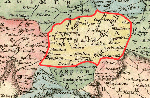
 Malwa (central India, in yellow), as depicted in the Ostell's New General Atlas, 1814
The Malwa region occupies a plateau in western Madhya Pradesh and south-eastern Rajasthan (between 21°10′N 73°45′E / 21.167°N 73.75°E and 25°10′N 79°14′E / 25.167°N 79.233°E),[10] with Gujarat in the west. The region includes the Madhya Pradesh districts of Dewas, Dhar, Indore, Jhabua, Mandsaur, Neemuch, Rajgarh, Ratlam, Shajapur, Ujjain, and parts of Guna and Sehore, and the Rajasthan districts of Jhalawar and parts of Banswara and Chittorgarh. Malwa is bounded in the north-east by the Hadoti region, in the north-west by the Mewar region, in the west by the Vagad region and Gujarat. To the south and east is the Vindhya Range and to the north is the Bundelkhand upland.
The plateau is an extension of the Deccan Traps, formed between 60 and 68 million years ago[12][13] at the end of the Cretaceous period. In this region the main classes of soil are black, brown and bhatori (stony) soil. The volcanic, clay-like soil of the region owes its black colour to the high iron content of the basalt from which it formed. The soil requires less irrigation because of its high capacity for moisture retention. The other two soil types are lighter and have a higher proportion of sand.
The average elevation of the plateau is 500 m. Some of the peaks over 800 m high are at Sigar (881 m), Janapav (854 m) and Ghajari (810 m). The plateau generally slopes towards the north. The western part of the region is drained by the Mahi River, while the Chambal River drains the central part, and the Betwa River and the headwaters of the Dhasan and Ken rivers drain the east. The Shipra River is of historical importance because of the Simhasth mela, held every 12 years. Other notable rivers are Parbati, Gambhir and Choti Kali Sindh. Malwa's elevation gives it a mild, pleasant climate; a cool morning wind, the karaman, and an evening breeze, the Shab-e-Malwa, make the summers less harsh.
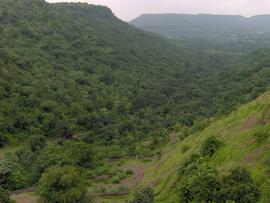
 The Vindhya Range marks the southern boundary of the plateau, and is the source of many rivers of the region.
The year is popularly divided into three seasons: summer, the rains, and winter. Summer extends over the months of Chaitra to Jyestha (mid-March to mid-May). The average daily temperature during the summer months is 35 °C, which typically rises to around 40 °C on a few days. The rainy season starts with the first showers of Aashaadha (mid-June) and extends to the middle of Ashvin (September). Most of the rain falls during the southwest monsoon spell, and ranges from about 100 cm in the west to about 165 cm in the east. Indore and the immediately surrounding areas receive an average of 140 cm of rainfall a year. The growing period lasts from 90 to 150 days, during which the average daily temperature is below 30 °C, but seldom falls below 20 °C. Winter is the longest of the three seasons, extending for about five months (mid-Ashvin to Phalgun, i.e., October to mid-March). The average daily temperature ranges from 15 °C to 20 °C, though on some nights it can fall as low as 7 °C. Some cultivators believe that an occasional winter shower during the months of Pausha and Maagha—known as Mawta—is helpful to the early summer wheat and germ crops.[10]
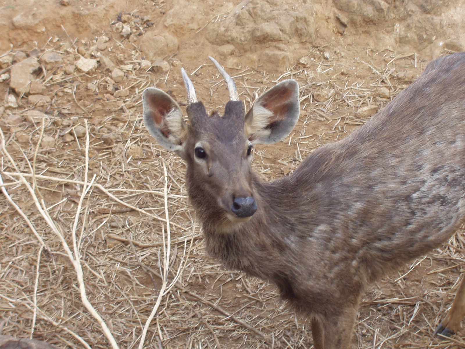
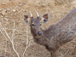 The Sambhar is one of the most common wild animals found in the region.
The region is part of the Kathiawar-Gir dry deciduous forests ecoregion.
Vegetation: The natural vegetation is tropical dry forest, with scattered teak (Tectona grandis) forests. The main trees are Butea, Bombax, Anogeissus, Acacia, Buchanania and Boswellia. The shrubs or small trees include species of Grewia, Ziziphus mauritiana, Casearia, Prosopis, Capparis, Woodfordia, Phyllanthus, and Carissa.
Wildlife: Sambhar (Cervus unicolor), Blackbuck (Antilope cervicapra), and Chinkara (Gazella bennettii) are some common ungulates.[14] During the last century, deforestation has happened at a fast rate, leading to environmental problems such as acute water scarcity and the danger that the region is being desertified.
Demographics
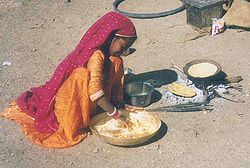 A girl from the Gadia Lohars nomadic tribe of Marwar, cooking on the outskirts of a village in Ratlam district
The population of the Malwa region was about 18.9 million in 2001, with a population density of a moderate 231/km². The annual birth rate in the region was 31.6 per 1000, and the death rate 10.3. The infant mortality rate was 93.8, slightly higher than the overall rate for the Madhya Pradesh state.
There are numerous tribes in the region, such as the Bhils—and their allied groups, the Bhilalas, Barelas and Patelias—and the Meenas, who all differ to a remarkable degree from the regional population in their dialects and social life. They encompass a variety of languages and cultures. Some tribes of the region, notably the Kanjars, were notified in the 19th century for their criminal activities, but have since been denotified. A nomadic tribe from the Marwar region of Rajasthan, the Gadia Lohars—who work as lohars (blacksmiths)—visit the region at the start of the agricultural season to repair and sell agricultural tools and implements, stopping temporarily on the outskirts of villages and towns and residing in their ornate metal carts. The Kalbelia is another nomadic tribe from Rajasthan that regularly visits the region.[15]
Malwa has a significant number of Dawoodi Bohras, a subsect of Shia Muslims from Gujarat, who are mostly businessmen by profession. Besides speaking the local languages, the Bohras have their own language, Lisan al-Dawat. The Patidars, who probably originated from the Kurmis of Punjab, are mostly rural farmers who settled in Gujarat around 1400. Periods of Maratha rule led to the growth of sizeable Marathi communities. the region of Indore, dhar, dewas and ujjain has a considerable marathi speaking populace.even on the native language malwi, marathi influence is visible.A significant number of Jats and Rajputs also live in the region. The Sindhis, who settled in the region after the partition of India, are an important part of the business community. Like neighbouring Gujarat and southern Rajasthan, the region has a significant number of Jains, who are mostly traders and business people. The region is home to smaller numbers of Goan Catholics, Anglo-Indians, Punjabis and Parsis or Zoroastrians. The Parsis are closely connected to the growth and evolution of Mhow, which has a Parsi fire temple and a Tower of Silence.
Economy
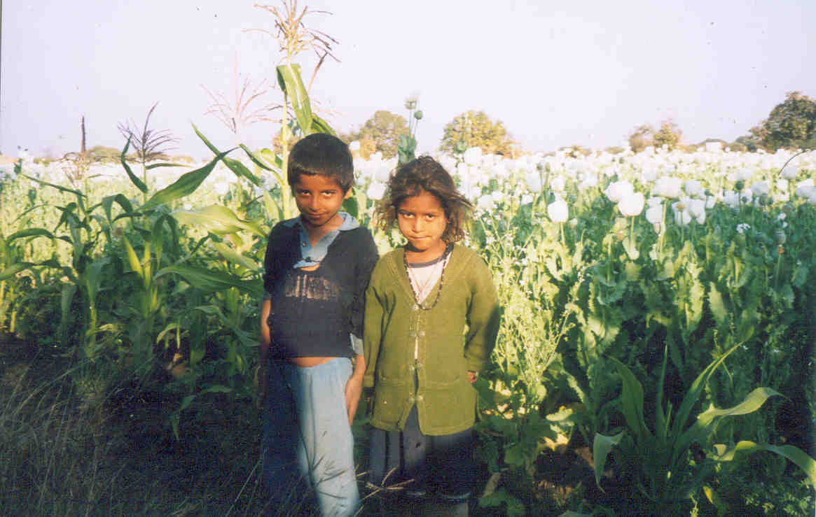
 Children in an opium field in Malwa
Malwa is one of the world's major opium producers. This crop resulted in development of close connections between the economies of Malwa, the western Indian ports and China, bringing international capital to the region in the 18th and 19th centuries. Malwa opium was a challenge to the monopoly of the British East India Company, which was supplying Bengal opium to China. This led the British company to impose many restrictions on the production and trade of the drug; eventually, opium trading was pushed underground. When smuggling became rife, the British eased the restrictions. Today, the region is one of the largest producers of legal opium in the world. There is a central, government-owned opium and alkaloid factory in the city of Neemuch. Nevertheless, there is a still a significant amount of illicit opium production, which is channelled into the black market. The headquarters of India's Central Bureau of Narcotics is in Gwalior. The Rajputana-Malwa Railway was opened in 1876.
The region is predominantly agricultural. The brown soil in parts of the region is particularly suitable for the cultivation of such unalu (early summer) crops as wheat, gram (Cicer arietinum) and til (Sesamum indicum). Relatively poor soil is used for the cultivation of syalu such (early winter) crops as millet (Andropogon sorghum), maize (Zea mays), mung bean (Vigna radiata), urad (Vigna mungo), batla (Pisum sativum) and peanuts (Arachis hypogaea). Overall, the main crops are jowar, rice, wheat, coarse millet, peanuts and pulses, soya bean, cotton, linseed, sesame and sugarcane. Sugar mills are located in numerous small towns.
The black, volcanic soil is ideal for the cultivation of cotton, and textile manufacture is an important industry. Large centres of textile production include Indore, Ujjain and Nagda. Maheshwar is known for its fine Maheshwari saris, and Mandsaur for its coarse woollen blankets. Handicrafts are an important source of income for the tribal population. Coloured lacquerware from Ratlam, rag dolls from Indore, and papier-mâché articles from Indore, Ujjain and several other centres are well known.
Mandsaur district is the sole producer in India of white- and red-coloured slate, used in the district's 110 slate pencil factories. There is a cement factory in . Apart from this, the region lacks mineral resources. The region's industries mainly produce consumer goods—but there are now many centres of large- and medium-scale industries, including Indore, Nagda and Ujjain. Indore has a large-scale factory that produces diesel engines. Pithampur, an industrial town 25 km from Indore, is known as the Detroit of India for its heavy concentration of automotive industry. Indore is recognised as the commercial capital of Madhya Pradesh, and is the main centre for trade in textiles and agro-based products. It has one of the six Indian Institutes of Management
Culture
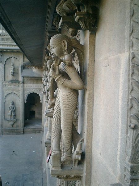
 A Maratha-styled sculpture from Maheshwar
The culture of Malwa has been significantly influenced by Gujarati and Rajasthani culture, because of their geographic proximity. Marathi influence is also visible, because of recent rule by the Marathas.
The main language of Malwa is Malvi, although Hindi is widely spoken in the cities. This Indo-European language is subclassified as Indo-Aryan. The language is sometimes referred to as Malavi or Ujjaini. Malvi is part of the Rajasthani branch of languages; Nimadi is spoken in the Nimar region of Madhya Pradesh and in Rajasthan. The dialects of Malvi are, in alphabetical order, Bachadi, Bhoyari, Dholewari, Hoshangabadi, Jamral, Katiyai, Malvi Proper, Patvi, Rangari, Rangri and Sondwari. A survey in 2001 found only four dialects: Ujjaini (in the districts of Ujjain, Indore, Dewas and Sehore), Rajawari (Ratlam, Mandsaur and Neemuch), Umadwari (Rajgarh) and Sondhwari (Jhalawar, in Rajasthan). About 55% of the population of Malwa can converse in and about 40% of the population is literate in Hindi, the official language of the Madhya Pradesh state.[16]
Traditional Malwa food has elements of Gujarati, Rajasthani and Maharashtrian cuisine. Traditionally, jowar was the staple cereal, but after the Green Revolution in India, wheat has replaced jowar as the most important food crop; many are vegetarians. Since the climate is mostly dry throughout the year, most people rely on stored foods such as pulses, and green vegetables are rare. A typical snack of Malwa is the bhutta ri kees (made with grated corn roasted in ghee and later cooked in milk with spices). Chakki ri shaak is made of wheat dough, which is washed under running water, steamed and then used in a gravy of curd. The traditional bread of Malwa is called baati/bafla, which is essentially a small, round ball of wheat flour, roasted over dung cakes, in the traditional way. Baati is typically eaten with dal (pulses), while baflas are dripping with ghee and soaked with dal. The amli ri kadhi is kadhi made with tamarind instead of yogurt. Sweet cakes, made of a variety of wheat called tapu, are prepared during religious festivities. Sweet cereal called thulli is also typically eaten with milk or yoghurt. Traditional desserts include mawa-bati (milk-based sweet similar to Gulab jamun), khoprapak (coconut-based sweet), shreekhand (yogurt based) and malpua.
Lavani is a widely practised form of folk music in southern Malwa, which was brought to the region by the Marathas. The Nirguni Lavani (philosophical) and the Shringari Lavani (erotic) are the two of the main genres. The Bhils have their own folk songs, which are always accompanied by dance. The folk musical modes of Malwa are of four or five notes, and in rare cases six. The devotional music of the Nirguni cult is popular throughout Malwa. Legends of Raja Bhoj and Bijori, the Kanjar girl, and the tale of Balabau are popular themes for folk songs. Insertions known as stobha are commonly used in Malwa music; this can occur in four ways: the matra stobha (syllable insertion), varna stobha (letter insertion), shabda stobha (word insertion) and vakya stobha (sentence insertion).
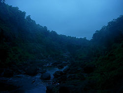
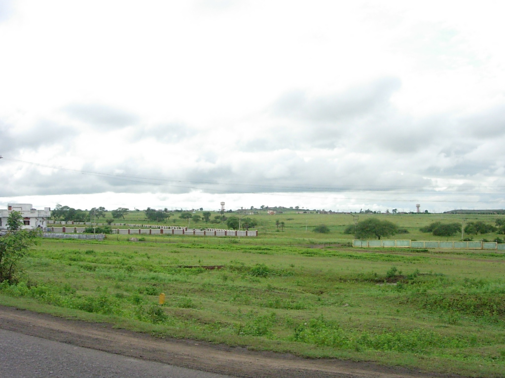
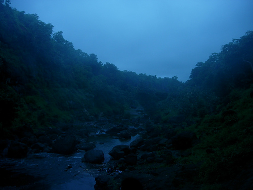
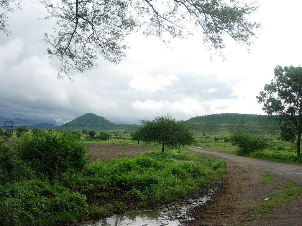
 Typical countryside near Mhow during the monsoon season
Malwa was the centre of sanskrit literature during and after the Gupta period. The region's most famous playwright, Kalidasa, is considered to be the greatest Indian writer ever. His first surviving play is Malavikagnimitra (Malavika and Agnimitra). Kalidasa's second play, his masterpiece, is the Abhijñānaśākuntalam, which tells the story of king Dushyanta, who falls in love with a girl of lowly birth, the lovely Shakuntala. The last of Kalidasa's surviving plays is Vikramuurvashiiya ("Urvashi conquered by valour"). Kalidasa also wrote the epic poems Raghuvamsha ("Dynasty of Raghu"), Ritusamhāra and Kumarasambhava ("Birth of the war god"), as well as the lyric Meghaduuta ("The cloud messenger").
Swang is a popular dance form in Malwa; its roots go back to the origins of the Indian theatre tradition in the first millennium BC. Since women did not participate in the dance-drama form, men enacted their roles. Swang incorporates suitable theatrics and mimicry, accompanied alternately by song and dialogue. The genre is dialogue-oriented rather than movement-oriented.[17]
Mandana (literally painting) wall and floor paintings are the best-known painting traditions of Malwa. White drawings stand out in contrast to the base material consisting of a mixture of red clay and cow dung. Peacocks, cats, lions, goojari, bawari, the swastika and chowk are some motifs of this style. Sanjhya is a ritual wall painting done by young girls during the annual period when Hindus remember and offer ritual oblation to their ancestors. Malwa miniature paintings are well known for their intricate brushwork.[18] In the 17th century, an offshoot of the Rajasthani school of miniature painting, known as Malwa painting, was centred largely in Malwa and Bundelkhand. The school preserved the style of the earliest examples, such as the Rasikapriya series dated 1636 (after a poem analysing the love sentiment) and the Amaru Sataka (a 17th-century Sanskrit poem). The paintings from this school are flat compositions on black and chocolate-brown backgrounds, with figures shown against a solid colour patch, and architecture painted in vibrant colours.[19]
The biggest festival of Malwa is the Simhastha mela, held every 12 years, in which more than 40 million pilgrims take a holy dip in river Shipra. The festival of Gana-gour is celebrated in honour of Shiva and Parvati. The history of the festival goes back to Rano Bai, whose parental home was in Malwa, but who was married in Rajasthan. Rano Bai was strongly attached to Malwa, and did not want to stay in Rajasthan. After marriage, she was allowed to visit Malwa only once a year; Gana-gour symbolises these annual return visits. The festival is observed by women in the region once in the month of Chaitra (mid-March) and Bhadra (mid-August). The Ghadlya (earthen pot) festival is celebrated by the girls of the region, who gather to visit every house in their village in the evenings, carrying earthen pots with holes for the light from oil lamps inside to escape. In front of every house, the girls recite songs connected with the Ghadlya and receive food or money in return. The Gordhan festival is celebrated on the 16th day in the month of Kartika. The Bhils of the region sing Heeda, anecdotal songs to the cattle, while the women sing the Chandrawali song, associated with Krishna's romance.
The most popular fairs are held in the months of Phalguna, Chaitra, Bhadra, Ashvin and Kartik. The Chaitra fair, held at Biaora, and the Gal yatras, held at more than two dozen villages in Malwa are remarkable. Many fairs are held in the tenth day of the month of Bhadra to mark the birth of Tejaji. The Triveni mela is held at Ratlam, and other fairs take place in Kartika at Ujjain, Mandhata (Nimad), Nayagaon, among others.
Tourism
The main tourist destinations in Malwa are places of historical or religious significance. The river Shipra and the city of Ujjain have been regarded as sacred for thousands of years. The Mahakal Temple of Ujjain is one of the 12 jyotirlingas. Ujjain has over 100 other ancient temples, including Harsidhhi, Chintaman Ganesh, Gadh Kalika, Kaal Bhairava and Mangalnath. The Kalideh Palace, on the outskirts of the city, is a fine example of ancient Indian architecture. The Bhartrihari caves are associated with interesting legends. Since the fourth century BC, Ujjain has enjoyed the reputation of being India's Greenwich,[20] as the Prime Meridian of the Hindu geographers. The observatory built by Jai Singh II is one of the four such observatories in India and features ancient astronomical devices. The Simhastha mela, celebrated every 12 years, starts on the full moon day in Chaitra (April) and continues into Vaishakha (May) until the next full moon day.
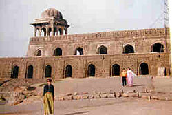
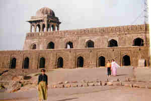
 Mandu Valley
Mandu was originally the fort capital of the Parmar rulers. Towards the end of the 13th century, it came under the sway of the Sultans of Malwa, the first of whom named it Shadiabad (city of joy). It remained as the capital, and in it the sultans built exquisite palaces like the Jahaz Mahal and Hindola Mahal, ornamental canals, baths and pavilions. The massive Jami Masjid and Hoshang Shah's tomb provided inspiration to the designers of the Taj Mahal centuries later. Baz Bahadur built a huge palace in Mandu in the 16th century. Other notable historical monuments are Rewa Kund, Rupmati's Pavilion, Nilkanth Mahal, Hathi Mahal, Darya Khan's Tomb, Dai ka Mahal, Malik Mughit is Mosque and Jali Mahal.
 Fort Ahilya in Maheshwar
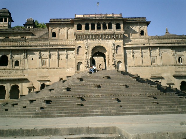
Close to Mandu is Maheshwar, a town on the northern bank of Narmada River that served as the capital of the Indore state under Rajmata Ahilya Devi Holkar. The Maratha rajwada (fort) is the main attraction. A life-size statue of Rani Ahilya sits on a throne within the fort complex. Dhar was the capital of Malwa before Mandu became the capital in 1405. There, the fort is in ruins but offers a panoramic view. The Bhojashala Mosque (built in 1400) is still used as a place of worship on Fridays. The abandoned Lat Masjid (1405) and the tomb of Kamal Maula (early 15th century), a Muslim saint, are other places of interest.
Modern Indore was planned and built by Rajmata Ahilya Devi Holkar. The grand Lal Baag Palace is one of its grandest monuments. The Bada Ganpati temple houses what is possibly the largest Ganesh idol in the world, measuring 7.6 m from crown to foot. The Kanch Mandir is a Jain temple entirely inlaid with glass. The Town Hall was made in 1904 in indo-gothic style; originally named King Edward Hall, it was renamed Mahatma Gandhi Hall in 1948. The chhatris are the tombs or cenotaphs erected in memory of dead Holkar rulers and their family members.
The shrine of Hussain Tekri, built by the Nawab of Jaora, Mohammad Iftikhar Ali Khan Bahadur, in the 19th century, is on the outskirts of Jaora in the Ratlam district. Mohammad Iftikhar Ali Khan Bahadur was buried in the same graveyard where Hussain Tekri was buried. During the month of Moharram, thousands of people from all over the world visit the shrine of Hazrat Imam Hussain there, which is a replica of the Iraqi original. The place is famous for the rituals called Hajri to cure mental illness.
In Fiction
In the Belisarius series, by David Drake and Eric Flint, the people of Malwa are chosen by malicious beings from the future to change the course of history. The Byzantine general Belisarius is set against them by a creature sent by a benevolent group of future beings.
See also
- Madhya Pradesh
- Rajasthan
- List of people from Malwa
- Rajasthani cuisine
Historical regions of North India Ajmer · Awadh · Bagelkhand · Braj · Bundelkhand · Delhi · Doab · Doaba · Dhundhar · Garhwal · Gird · Godwar · Hadoti · Jaisalmer · Jangladesh · Kumaun · Magadha · Mahakoshal · Majha · Malwa · Malwa (Punjab) · Marwar · Mewar · Mewat · Mithila · Nimar · Purvanchal · Rohilkhand · Shekhawati · Vagad
Mountains and Plateaus Himalayas · Western Ghats · Eastern Ghats · Aravalli Range · The Nilgiris · Vindhya Range · Satpura Range · Garo Hills · Shivalik Hills · Mahabharat Range · Khasi Hills · Annamalai Hills · Cardamom Hills · Sulaiman Mountains · Toba Kakar Range · Karakoram · Hindu Kush · Chittagong Hill Tracts · Deccan Plateau · Thar Desert · Makran · Chota Nagpur · Naga Hills · Mysore Plateau · Ladakh Plateau · Gandhamardan HillsLowlands and Islands Indo-Gangetic plain · Indus River Delta · Ganges Basin · Ganges Delta · Terai · Atolls of Maldives · Coromandel Coast · Konkan · Lakshadweep · Andaman and Nicobar Islands · Sundarbans · Greater Rann of Kutch · Little Rann of Kutch · Protected areas in Tamil NaduCountries Notes
- ^ Jacobson, J. (August 1975). Early Stone Age Habitation Sites in Eastern Malwa. Proceedings of the American Philosophical Society, Vol. 119, No. 4.
- ^ Uttankita Vidya Aranya Trust (1985). Uttankita Sanskrit Vidya-Aranya epigraphs. Bharatiya Vidya Bhavan. http://books.google.com/books?id=C-gaAAAAMAAJ. Retrieved 9 February 2011.
- ^ B.S. Nijjar (2007). Origins and History of Jats and Other Allied Nomadic Tribes of India. Atlantic Publishers & Distributors. pp. 169–. ISBN 9788126909087. http://books.google.com/books?id=xQM9voN21ekC&pg=PA169. Retrieved 9 February 2011.
- ^ Tej Ram Sharma (1 January 1989). A political history of the imperial Guptas: from Gupta to Skandagupta. Concept Publishing Company. pp. 28–. ISBN 9788170222514. http://books.google.com/books?id=fWVZWjNAcAgC&pg=PA28. Retrieved 9 February 2011.
- ^ Romesh Chunder Dutt; Vincent Arthur Smith; Stanley Lane-Poole; Sir Henry Miers Elliot, Sir William Wilson Hunter, Sir Alfred Comyn Lyall (1906). History of India. The Grolier Society. pp. 255–. http://books.google.com/books?id=yE4eAQAAIAAJ&pg=PA255. Retrieved 9 February 2011.
- ^ Royal Asiatic Society of Great Britain and Ireland (1897). Journal of the Royal Asiatic Society of Great Britain & Ireland. Cambridge University Press for the Royal Asiatic Society. pp. 885–. http://books.google.com/books?id=VXwuAAAAYAAJ&pg=PA885. Retrieved 9 February 2011.
- ^ Malwa Plateau on Britannica
- ^ a b c Malwa in Encyclopedia Britannica 1911 Edition
- ^ Panhwar, M.H., Sindh: The Archaeological Museum of the world.
- ^ a b c Ahmad, S. H., Anthropometric measurements and ethnic affinities of the Bhil and their allied groups of Malwa area., Anthropological Survey of India,1991, ISBN 81-85579-07-5
- ^ Asiatic Society of Bombay, Journal of the Asiatic Society of Bombay, The Society, 1951 , p. 56
- ^ "Geochronological Study of the Deccan Volcanism by the 40Ar-39Ar Method". Archived from the original on 2006-02-25. http://web.archive.org/web/20060225205236/http://ksgeo.kj.yamagata-u.ac.jp/~iwata/personal/Deccan-e.htm.
- ^ The Deccan beyond the plume hypothesis
- ^ Dewas district
- ^ Kalbeliya nomads
- ^ Ethnologue
- ^ 'Swang' – The Folk Dance of Malwa
- ^ Paintings of Mewar and Malwa
- ^ Malwa painting on Encyclopedia Britannica
- ^ Ujjain district official portal
References
- Malcolm, Sir John, A Memoir of Central India including Malwa and Adjoining Provinces. Calcutta, Spink, 1880, 2 Volumes, 1129 p., ISBN 81-7305-199-2.
- Chakrabarti, Manika, Malwa in Post-Maurya period: a critical study with special emphasis on numismatic evidences. Calcutta. Punthi Pustak, 1981.
- Day, Upendra Nath, Medieval Malwa: a political and cultural history 1401–1562., New Delhi, Munshiram Manoharlal, 1965.
- Jain, Kailash Chand, Malwa through the ages from the earliest times to 1305 A.D., Delhi, Motilal Banarsidass, 1972.
- Khare, M.D. Splendour of Malwa paintings., New Delhi, Cosmo Publications, 1983., ASIN B0006EHSUU
- Joshi, Ramchandra Vinayak, Stone age cultures of Central India., Poona, Deccan College, 1978.
- Seth, K.N., The growth of the Paramara power in Malwa., Bhopal, Progress Publishers, 1978.
- Sharma, R.K., ed., Art of the Paramaras of Malwa., Delhi, Agam Kala Prakashan, 1979.
- Sircar, D.C. Ancient Malwa and the Vikramaditya tradition., New Delhi, Munshiram Manoharlal, 1969., ISBN 81-215-0348-5
- Singh, Raghubir, Malwa in transition, Laurier Books, 1993, ISBN 81-206-0750-3
- Srivastava, K, The revolt of 1857 in Central India-Malwa, Allied Publishers, ASIN B0007IURKI
- Ahmad, S. H., Anthropometric measurements and ethnic affinities of the Bhil and their allied groups of Malwa area., Anthropological Survey of India,1991, ISBN 81-85579-07-5
- Farooqui, Amar, Smuggling as subversion: colonialism, Indian merchants, and the politics of opium, 1790–1843, Lexington Books, 2005, ISBN 0-7391-0886-7
- Mathur, Kripa Shanker, Caste and ritual in a Malwa village, Asia Pub. House, 1964.
External links
Categories:- Regions of India
- Historical Indian regions
- Madhya Pradesh
- Malwa
- Plateaus of India
- Plateaus of Madhya Pradesh


Wikimedia Foundation. 2010.