- North–South Expressway Central Link
-
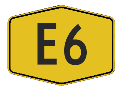
E6 Expressway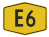
Route information Maintained by PLUS Expressway Berhad and Expressway Lingkaran Tengah Sdn Bhd (ELITE) Length: 60 km (40 mi) Existed: 1994 – present History: Completed in 1996 Major junctions North end: Shah Alam, Selangor  Guthrie Corridor Expressway
 AH2 New Klang Valley Expressway
 Shah Alam Expressway
 Damansara-Puchong Expressway
 Putrajaya Link
 KLIA Expressway
 AH2 North-South Expressway Southern Route
South end: Nilai North, Negeri Sembilan Location Primary
destinations:Batu Tiga, UEP Subang Jaya, Putra Heights, Hicom, Puchong, Bandar Saujana Putra, Putrajaya, Cyberjaya, Nilai Highway system Asian Highway Network AH2 North South Expressway Central Link, NSECL
AH2, (Malay: Lebuhraya Utara-Selatan Hubungan Tengah) also known as ELITE or ELITE Highway, is the main expressway in Malaysia. The 60 km (37 mi) of the expressway starts from Shah Alam Interchange Nilai North Interchange North South Expressway network.Contents
Route background
The Kilometre Zero starts at Shah Alam Interchange in Shah Alam, Selangor and its interchange with the New Klang Valley Expressway
and the Guthrie Corridor Expressway .History
The purpose to build the North-South Expressway bypass from Kuala Lumpur had begun in 1992. The construction started in 1994 and was completed in 1996. In 1997, all of the sections in the North–South Expressway Central Link and KLIA Expressway was opened to traffic. While the Kuala Lumpur International Airport (KLIA) was opened on 27 June 1998 it became a busing traffic flowing from north to south especially Kuala Lumpur. The Putrajaya Link which was connected to Putrajaya was opened in 2000. On 1 September 2003, The company Expressway Lingkaran Tengah Sdn Bhd, (ELITE) was now a member of PLUS Expressway Berhad.
The Expressway is divided into three sections as follows :
- Section 1 of the Expressway, which extends from the Shah Alam Interchange (NKVE) to the USJ (Hicom East) Interchange, inclusive of the ramps in (Ebor North) and out (Ebor South) connecting the Expressway to the Jalan Subang-Batu Tiga
 .
.
- Section 2 which extends from just South of the USJ Interchange to the Nilai (North) Interchange and includes that part of the KLIA Expressway up to the bridge crossing Sg. Langat.
- Section 3 includes Putrajaya Interchange, Bandar Baru Nilai Interchange, Salak Tinggi Interchange and the -2.74 km continuation of the KLIA Expressway (KLIA Expressway Extension) , just south of Sg. Langat up to the boundary of the Kuala Lumpur International Airport (KLIA).
Features
Main features
- Closed toll system (refer to PLUS)
- Batu Tiga flyover longest in NSE network.
- Act as bypass from bustling Kuala Lumpur travelling from north to south and vice versa.
- Smooth access to KLIA
- PLUS Speedway (formerly ELITE Speedway) in USJ Rest and Service Area is the first highway go-kart circuit in Malaysia
- Extension to KLIA.
- Safety CS Team (PROPEL) roadworks.
Batu Tiga flyover
Jejambat Batu TigaOfficial name Batu Tiga flyover Carries Motor vehicles Crosses Section 13, Shah Alam,
Batu Tiga,
Federal Highway
Damansara RiverLocale North-South Expressway Central Link Maintained by PLUS Expressway Berhad
Expressway Lingkaran Tengah Sdn Bhd (ELITE)Designer Malaysian Highway Authority (LLM)
United Engineers Malaysia Berhad (UEM)Design box girder bridge Total length 2 km Width -- Longest span -- Constructed by United Engineers Malaysia Berhad (UEM) Opened 1996 Batu Tiga flyover
The Batu Tiga flyover is the longest flyover in the North-South Expressway network. The 2 km flyover connects Shah Alam Interchange in the north until Ebor Interchange in the south.
List of Interchanges, and Rest and Service Areas.
Km Exit Interchange To Remarks
0
AH2
--SHAH ALAM INTERCHANGE
SHA
TnG TAG i
Customer Service CentreShah Alam
Bukit Jelutong
 GUTHRIE CORRIDOR EXPRESSWAY
 Sungai Buloh
Kuala Selangor
AH2 NEW KLANG VALLEY EXPRESSWAY
Port_Klang_ _
_ Port Klang
 Klang
Klang
AH2 Ipoh
_ Subang 
AH2 Kuala LumpurClosed tolled trumpet expressway interchange
Expressway dual trumpet interchange with toll plaza AH2 NEW KLANG VALLEY EXPRESSWAY AH2 NORTH-SOUTH EXPRESSWAY CENTRAL LINKBatu Tiga flyover
2 kilometresStart/End of flyover Batu Tiga flyover Batu Tiga flyover
Railway crossing bridgeBatu Tiga flyover
Sungai Damansara bridgeBatu Tiga flyover
2 kilometresStart/End of flyover
44.3 EBOR INTERCHANGE (NORTH)
EBNEBOR NORTH TOLL PLAZA
EBN
TAG TnG EBOR INTERCHANGE (SOUTH)
EBSEBOR SOUTH TOLL PLAZA
EBS
RM (Cash) TnG TAG
Batu Tiga
FEDERAL HIGHWAY
Shah Alam
I-City
Kuala LumpurFrom south bound only
Off-ramp with toll plaza
Pay a distance toll only
5
AH2
--5.3 SEAFIELD INTERCHANGE
SEA
TnG TAG i
Customer Service Centre
PLUS PLUS Expressway Berhad (PEB) section maintainences office
PROPEL PROPEL Berhad section maintainences office SHAH ALAM EXPRESSWAY
WEST
Pulau Indah
Klang
Kota Kemuning
EAST
Subang Jaya
Sri Petaling
Cheras[disambiguation needed ]
]
KuantanExpressway trumpet interchange with toll plaza
6
AH2
--R&R USJ Rest and Service Area and Overhead Bridge Restaurant 
 Caltex
 ATM
ATM
Mofaz Food Stop
PLUS Speedway
MUFORS GalleryBoth directions USJ INTERCHANGE
USJ
TnG TAG i
Customer Service Centre USJ
USJ
Hicom
DAMANSARA PUCHONG EXPRESSWAY
PuchongTrumpet interchange with toll plaza
13
AH2
--13.2 PUTRA HEIGHTS INTERCHANGE
PHT
TnG TAG i
Customer Service CentrePutra Heights Trumpet interchange with toll plaza Sungai Klang bridge
Petaling-Kuala Langat district border
14
AH2
--SAUJANA PUTRA INTERCHANGE
SPTBandar Saujana Putra
 SOUTH KLANG VALLEY EXPRESSWAY
WEST
Pulau Indah
Banting
Teluk Panglima Garang
(Under construction)
EAST
Kajang
Putrajaya
CyberjayaTrumpet interchange with toll plaza
18
AH2
--PUTRAJAYA INTERCHANGE
PTJEAST
PUTRAJAYA LINK
Putrajaya
Cyberjaya
 MAJU EXPRESSWAY
Kuala Lumpur
(Jalan Tun Razak)Expressway trumpet interchange with toll plaza 22.9 R&R Dengkil Rest and Service Area Esso Caltex ATM
Caltex petrol station
Petronas Petrol stationNorth bound
23
AH2
--23.6 R&R Dengkil Rest and Service Area Esso Shell ATM
Esso Petrol station
Shell petrol stationSouth bound
24
AH2
--
25
AH2
--Kuala Langat-Sepang district border
30
AH2
--
31
AH2
--31.6 KLIA INTERCHANGE
KLA
TnG TAG i
Customer Service CentreSOUTH
KLIA EXPRESSWAY
_ Kuala Lumpur International Airport (KLIA)
 Sepang
Bandar Enstek
Sepang F1 CircuitExpressway trumpet interchange with toll plaza
32
AH2
--Sungai Langat bridge SALAK TINGGI INTERCHANGE
SLT PUTRAJAYA-CYBERJAYA EXPRESSWAY
Salak Tinggi
Sepang
Bandar EnstekTrumpet interchange with toll plaza
Under planningRailway crossing bridge DENGKIL INTERCHANGE
DKLB48 Dengkil
B48 Salak Tinggi
B48 Bandar EnstekTrumpet interchange with toll plaza
Future interchangeSungai Dengkil bridge Selangor Darul Ehsan
Sepang district borderSelangor-Negeri Sembilan border Negeri Sembilan Darul Khusus
Seremban district borderBANDAR BARU NILAI INTERCHANGE
BBNBandar Baru Nilai
NilaiTrumpet interchange with toll plaza
Future interchange
43
AH2
-- AH2 NORTH-SOUTH EXPRESSWAY CENTRAL LINK AH2 NORTH-SOUTH EXPRESSWAY SOUTHERN ROUTE
46
AH2
--NILAI NORTH INTERCHANGE AH2 NORTH-SOUTH EXPRESSWAY SOUTHERN ROUTE
Kuala Lumpur
Kajang
Bangi
P Nilai Layby
Johor Bahru
Seremban
NilaiClosed tolled expressway directional T interchange External links
Malaysian Expressway System History 
Interstate North–South Expressway Northern Route (including New Klang Valley Expressway) · North–South Expressway Southern Route · North–South Expressway Central Link (including Putrajaya Link) (NSECL/ELITE) ·  Kuala Lumpur-Karak Expressway and East Coast Expressway (LPT/ECE) ·
  Butterworth–Kulim Expressway (BKE) ·
  Kajang–Seremban Highway (LEKAS/KASEH) ·
  ^ West Coast Expressway (LPB/WCE) ·
  ^ Paroi-Senawang-KLIA Expressway (PSKE) · ^ Central Spine Expressway (CSE/LRUT)
Greater Kuala Lumpur/Klang Valley
and Selangor New Klang Valley Expressway (part of the North–South Expressway Northern Route) · Shah Alam Expressway (SAE/KESAS) ·  Cheras–Kajang Expressway (CKE/Grand Saga) ·
  Sungai Besi Expressway (SBE/BESRAYA) (including # Shamelin Expressway or Besraya Extension Expressway) ·
  New Pantai Expressway (NPE) · Damansara-Puchong Expressway (LDP) ·
  Ampang – Kuala Lumpur Elevated Highway (AKLEH) ·
  Kemuning – Shah Alam Highway (LKSA) ·
  Kajang Dispersal Link Expressway (SILK) · Maju Expressway (MEX) (Kuala Lumpur – Putrajaya Expressway (KLPE) and KL-KLIA Dedicated Expressway) ·
  Sprint Expressway (Kerinchi Link, Damansara Link and Penchala Link) ·
  Kuala Lumpur – Kuala Selangor Expressway (KLS) (Assam Jawa-Templer Park Highway (LATAR)) · South Klang Valley Expressway (SKVE) · New North Klang Straits Bypass (NNKSB) ·
  Duta – Ulu Klang Expressway (DUKE) · Guthrie Corridor Expressway (GCE) ·
  East–West Link Expressway and Kuala Lumpur – Seremban Expressway ·
  Stormwater Management and Road Tunnel (SMART Tunnel) · ^ Kuala Lumpur Outer Ring Road (KLORR) · ^ Guthrie-Damansara Expressway (GDE) · ^ Kuala Lumpur Arah Serendah Expressway (KLAS) · ^ Serdang-Kinrara-Putrajaya Expressway (SKIP)
Iskandar Malaysia and Johor  Second Link Expressway (Malaysia–Singapore Second Link) (MSSC/LINKEDUA) ·
  # JB Eastern Dispersal Link ·
  Senai–Desaru Expressway (SDE)
Penang  Butterworth Outer Ring Road (BORR) · # Penang Outer Ring Road (PORR) · # Penang Second Bridge ·
  Penang Bridge · ^ Sungai Juru Expressway
Kedah and Perak  Ipoh–Lumut Expressway · ^ Jelas Expressway (Jelas) · ^ South Kedah Expressway (Lekas)
Others #: under construction, ^: under planning and development.Categories:- Expressways in Malaysia
- Expressways and highways in the Klang Valley
- Box girder bridges
- North–South Expressway Networks, Malaysia
- Section 1 of the Expressway, which extends from the Shah Alam Interchange (NKVE) to the USJ (Hicom East) Interchange, inclusive of the ramps in (Ebor North) and out (Ebor South) connecting the Expressway to the Jalan Subang-Batu Tiga

Wikimedia Foundation. 2010.