- Mampang Prapatan, South Jakarta
-
Mampang Prapatan is a subdistrict of South Jakarta, one of the five administrative cities which forms the special capital region of Jakarta, Indonesia. The expatriate residential area of Bangka and Kemang, known for its annual Kemang Festival, is located in Mampang Prapatan Subdistrict. The boundaries of Mampang Prapatan are Krukut River to the west, Cideng River and Mampang River to the east, Jend. Gatot Subroto Tollway to the north, and Kemang Selatan-Kemang Timur Road to the south.
Mampang Prapatan Main Road passed through Mampang Prapatan Subdistrict.
Contents
Kemang
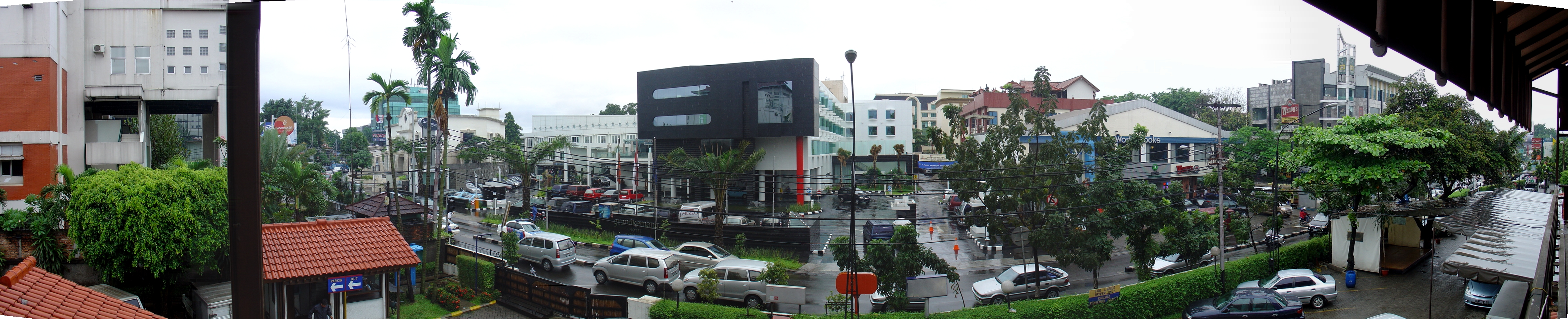
 Kemang Raya Street, a shopping street in Kemang, Mampang Prapatan Subdistrict.
Kemang is an expatriate neighborhood located mostly in Bangka Kelurahan (in Mampang Prapatan Subdistrict), and also in Pejaten Barat Kelurahan (in Pasar Minggu Subdistrict). The name Kemang came from the fruit kemang, a species of mango (Mangifera kemanga). The main area of Kemang is marked by the roads of Jalan Kemang Raya, Jalan Prapanca, and Jalan Bangka.
Kemang is a kampung which has been gentrified into an expatriate residentials. The adjacent Bangka kampung, which was also gentrified, is sometimes referred as "Kemang" as well, although this was originally a different village. The gentrification of Kemang started after the end of 1970s. Kemang was a quiet Betawi kampong dotted with mosques in traditional Javanese style.[1] During the 1970s, the land in Kemang were sold for residential use. The lush green character of Kemang attracted people into this area, including expatriates. Since then, Kemang has grown into a bustling area known for its international-oriented facilities such as traditional craft retails and night clubs. Some of the original kampong still exists behind the high-class residentials. This unique contrast between the original Muslim community and the international expatriate community has created a unique laid-back typology that feels more like an old town than a new city.[2]
In 1998, the Governor of Jakarta Sutiyoso transform the area of Kemang from a residential - as stated in the 1985-2005 city master plan - into a commercial area. In the following year, he strengthened the decision with the issuance of a decree declaring Kemang as a "modern kampong". This brings more commercials into the area, as houses are converted into retails.[2] Despite of this, lack of urban planning has resulted in congestion in its relatively narrow road.[3] Located between the two streams of Krukut River and Mampang River, without any flood control, Kemang is prone to flooding every rainy season.
Kemang hosts the Kemang Festival, held once or twice every year since 2001. During the festival, roads in Kemang are pedestrianized and vendors fill the street offering traditional souvenirs, clothings, and food.
Kelurahan (Administrative Villages)
The Subdistrict of Mampang Prapatan is divided into five kelurahan or administrative villages:
- Kuningan Barat - area code 12710
- Pela Mampang - area code 12720
- Bangka - area code 12730
- Tegal Parang - area code 12790
- Mampang Prapatan - area code 12790
List of important places
- Al Barkah Mosque, build in 1818, one of the few mosque built in traditional Javanese architecture[4]
- Kemang neighborhood
- Indonesian Institute of Sciences
- Museum TNI-AD "Satria Mandala", or Satria Mandala Museum
References
- ^ Shahab, Alwi (2001) (in id). Robinhood Betawi: kisah Betawi tempo doeloe. Republika. pp. 119–122. ISBN 9793210001, 9789793210001. http://books.google.com/books?id=BsPa3Qp2g6wC&pg=PA119&dq=kemang+bangka&hl=en&ei=B5M9Tdm5NcitrAfU7_zECA&sa=X&oi=book_result&ct=result&resnum=10&ved=0CFIQ6AEwCQ#v=onepage&q=kemang%20bangka&f=false. Retrieved January 24, 2011.
- ^ a b T. Sima Gunawan (September 6, 2006). "Kemang - Modern Kampong: Jakarta, Indonesia". Indonesia in Focus. Planet Mole. http://www.planetmole.org/daily/kemang-modern-kampong-jakarta-indonesia.html. Retrieved January 23, 2011.
- ^ "Eksekusi Lahan di Kemang Raya Akibatkan Kemacetan" (in id). May 21, 2010. http://www.berita8.com/news.php?tgl=2010-05-21&cat=2&id=22409. Retrieved January 23, 2011.
- ^ Zein, Abdul Baqir (1999) (in id). Masjid-masjid bersejarah di Indonesia. Gema Insani. p. 151. ISBN 979561567X, 9789795615675. http://books.google.com/books?id=-NnF9Ryal0IC&pg=PA151&dq=kemang+bangka&hl=en&ei=B5M9Tdm5NcitrAfU7_zECA&sa=X&oi=book_result&ct=result&resnum=4&ved=0CDQQ6AEwAw#v=onepage&q=kemang%20bangka&f=false. Retrieved January 24, 2011.
Administrative areas of the Special Capital Territory of Jakarta Cities and Regency of Jakarta Central Jakarta Cempaka Putih • Gambir • Johar Baru • Kemayoran • Menteng • Sawah Besar • Senen • Tanah Abang
West Jakarta Cengkareng • Grogol • Kalideres • Kebon Jeruk • Kembangan • Palmerah • Taman Sari • Tambora
South Jakarta Cilandak • Jagakarsa • Kebayoran Baru • Kebayoran Lama • Mampang Prapatan • Pancoran • Pasar Minggu • Pesanggrahan • Setiabudi • Tebet
East Jakarta Cakung • Cipayung • Ciracas • Duren Sawit • Jatinegara • Kramat Jati • Makasar • Matraman • Pasar Rebo • Pulo Gadung
North Jakarta Cilincing • Kelapa Gading • Koja • Pademangan • Penjaringan • Tanjung Priok
Thousand Islands See also: List of regencies and cities of Indonesia Categories:- Subdistricts of Jakarta
Wikimedia Foundation. 2010.