- Leh–Manali Highway
-
Leh-Manali Highway लेह-मनाली राजमार्ग
Lēha-manālī rājamārga
Route information Length: 479 km (298 mi) Major junctions North end: Leh, Ladakh, Jammu and Kashmir South end: Manali, Himachal Pradesh Location States: Himachal Pradesh, Jammu and Kashmir Primary
destinations:Leh · Shey · Karu · Upshi · Gya · Sarchu (state border) · Zingzingbar · Patseo · Darcha · Jispa · Keylong · Tandi · Gonda · Sissu · Khoksar · Manali Highway system Indian Road Network
National • Expressways • State
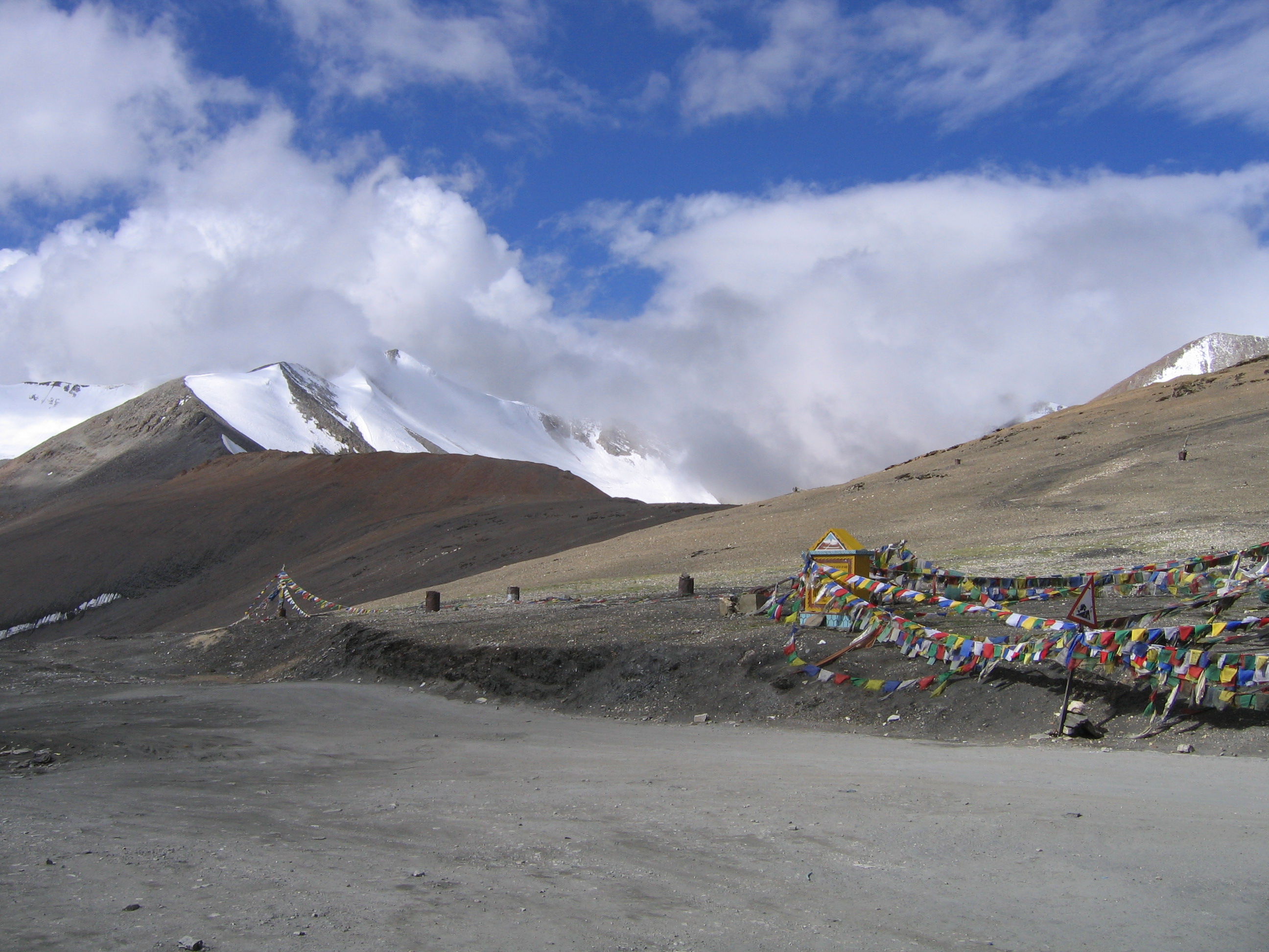
State Highways in ¬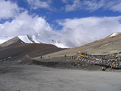 Tanglang La on the Leh-Manali Highway.
 Traffic jam on the way to Rohtang Pass.
 Many accidents occur on this highway.
The Leh-Manali Highway (Hindi: लेह-मनाली राजमार्ग Lēha-manālī rājamārga) is a highway in India connecting Leh and Manali. It is open only between June and mid-September when snow is cleared from the road by the Border Roads Organisation. It connects the Manali valley to Kullu valley, Lahaul and Spiti and Ladakh. It is made part of NH 21, with completion date of 2012.[1]
The highway crosses some of the highest mountain passes in the world, including Rohtang La 3,978 m (13,051 ft), Baralacha La 4,892 m (16,050 ft), Lachulung La 5,059 m (16,598 ft) and Taglang La 5,325 m (17,470 ft). The latter two passes are less problematic over former due to less snowfall in Ladakh.[2]. Between Lachlung La and Taglang La this road crosses the More plains. A tunnel is being constructed to bypass Rohtang pass to make the highway an all-weather road.[3]
As the journey along the road normally takes two days (or more depending on road conditions), many tourists and travellers make overnight stops at Jispa and tented camps such as Sarchu. Alternately, overnight stops can be made at Keylong. Distance between Manali and Sarchu is 222 km (138 mi) in Himachal Pradesh state,[4] and distance from Sarchu to Leh is 257 km (160 mi), with total highway length of 479 km (298 mi).[5] Owing to the high altitudes and the low-oxygen air, many travelers experience mountain sickness or in some cases even acute mountain sickness.
Leh-Manali Highway was designed, built, constructed and maintained in its entirety by the Indian Army and is capable of supporting the heaviest of their vehicles.
See also
References
External links
- High Road To.. updates on the Manali-Leh Road
- Beefy's Tibet and Nepal Page
- Manali-Leh Highway on Bikemap (with GPS-track)
- Photos of a bike tour along the Highway from 1996.
- Ladakh detailed map
Leh-Manali Highway Passes Valleys Towns Rivers Indian Highways Network National Expressways NE 1 • NE 2


State Expressways Mumbai-Pune • Delhi-Gurgaon • DND Flyway • Bengaluru-Mysore • Chennai HSCTC • Hyderabad Elevated ExpresswaysNational Highways 1 • 1A • 1B • 1C • 1D • 2 • 2A • 3 • 4 • 4A • 4B • 5 • 5A • 6 • 7 • 7A • 8 • 8A • 8B • 8C • 8D • 8E • 9 • 10 • 11 • 11A • 11B • 12 • 12A • 13 • 14 • 15 • 16 • 17 • 17A • 17B • 18 • 19 • 20 • 21 • 21A • 22 • 23 • 24 • 24A • 24B • 25 • 25A • 26 • 26A • 27 • 28 • 28A • 28B • 28C • 29 • 30 • 30A • 31 • 31A • 31B • 31C • 31D • 32 • 33 • 34 • 35 • 36 • 37 • 37A • 38 • 39 • 40 • 41 • 42 • 43 • 44 • 44A • 45 • 45A • 45B • 45C • 46 • 47 • 47A • 47B • 47C • 48 • 49 • 50 • 51 • 52 • 52A • 52B • 53 • 54 • 54A • 55 • 56 • 57 • 57A • 58 • 59 • 59A • 60 • 60A • 61 • 62 • 63 • 64 • 65 • 66 • 67 • 68 • 69 • 70 • 71 • 71A • 71B • 72 • 72A • 73 • 73A • 74 • 75 • 76 • 77 • 78 • 79 • 79A • 80 • 81 • 82 • 83 • 84 • 85 • 86 • 86A • 87 • 88 • 89 • 90 • 91 • 91A • 92 • 93 • 94 • 95 • 96 • 97 • 98 • 99 • 100 • 101 • 102 • 103 • 104 • 105 • 106 • 107 • 108 • 109 • 110 • 111 • 112 • 113 • 114 • 116 • 117 • 119 • 121 • 123 • 125 • 126 • 127 • 128 • 129 • 150 • 151 • 152 • 153 • 154 • 155 • 200 • 201 • 202 • 203 • 203A • 204 • 205 • 206 • 207 • 208 • 209 • 210 • 211 • 212 • 213 • 214 • 214A • 215 • 216 • 217 • 218 • 219 • 220 • 221 • 222 • 223 • 224 • 226 • 227 • 228 • 229 • 234 • 235State Highways Andhra Pradesh • Arunachal Pradesh • Assam • Bihar • Chhattisgarh • Goa • Gujarat • Haryana • Himachal Pradesh • Jammu and Kashmir • Jharkhand • Karnataka • Kerala • Madhya Pradesh • Maharashtra • Manipur • Meghalaya • Mizoram • Nagaland • Orissa • Punjab • Rajasthan • Sikkim • Tamil Nadu • Tripura • Uttarakhand • Uttar Pradesh • West BengalNotable


Wikimedia Foundation. 2010.