- Mapungubwe National Park
-
Mapungubwe National Park IUCN Category II (National Park)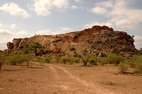
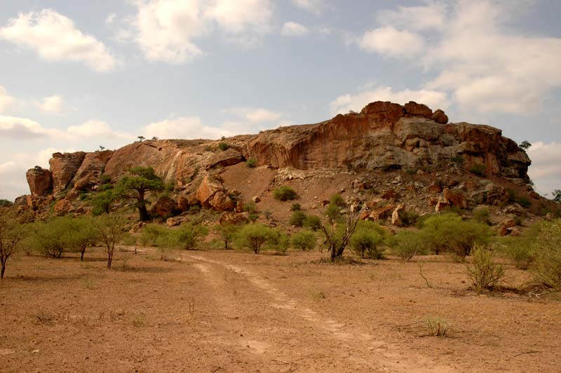
Mapungubwe HillLocation of the park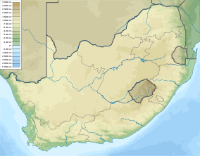

Location Limpopo, South Africa Nearest city Musina Coordinates 22°11′33″S 29°14′20″E / 22.1925°S 29.23889°ECoordinates: 22°11′33″S 29°14′20″E / 22.1925°S 29.23889°E Area 280 square kilometres (110 sq mi) Established 1995 Governing body South African National Parks World Heritage Site 2003 Official website Mapungubwe National Park is a national park in Limpopo Province, South Africa, located near the confluence of the Limpopo and Shashe rivers. It abuts on the border with Botswana and Zimbabwe, and forms part of the proposed Limpopo-Shashe Transfrontier Conservation Area. It was established in 1995[1] and covers an area of over 28 000 hectares. The park protects the historical site of Mapungubwe Hill, which was the capital of the Kingdom of Mapungubwe, as well as the wildlife and riverine forests along the Limpopo River. An interesting thing about this area is that it is one of the few places in Africa that has both Meerkats and Nile crocodiles.
The status of the park as part of the Transfrontier Conservation Area is severely threatened by the planned exploitation of coal reserves in the immediate vicinity of the reserve. An open-cast coal mine and power plant are planned in the buffer zone of the National Park, which threaten its Natural and Cultural values.[2] In addition, the large amount of water required for the mining activities will impact the ecology of a large part of the region.[3][4]
See also
References
- ^ "Mapungubwe National Park and World Heritage Site: History of the Park". SANParks. http://www.sanparks.org/parks/mapungubwe/tourism/progress.php. Retrieved 7 July 2009.
- ^ http://www.fin24.com/articles/default/display_article.aspx?Channel=News_Home&ArticleId=1518-1786_2570357&IsColumnistStory=False
- ^ http://www.fin24.com/articles/default/display_article.aspx?Channel=News_Home&ArticleId=1518-1786_2570357&IsColumnistStory=False
- ^ http://allafrica.com/stories/200904200415.html
External links
National parks of South Africa Addo Elephant National Park · Agulhas National Park · ǀAi-ǀAis/Richtersveld Transfrontier Park · Augrabies Falls National Park · Bontebok National Park · Camdeboo National Park · Garden Route National Park · Golden Gate Highlands National Park · Karoo National Park · Kgalagadi Transfrontier Park · Knysna National Lake Area · Kruger National Park · Mapungubwe National Park · Marakele National Park · Mokala National Park · Mountain Zebra National Park · Namaqua National Park · Table Mountain National Park · Tankwa Karoo National Park · Tsitsikamma National Park · West Coast National Park · Wilderness National ParkCategories:- IUCN Category II
- Protected areas established in 1995
- National parks of South Africa

Wikimedia Foundation. 2010.