- Margaritifer Sinus quadrangle
-
The margaritifer Sinus quadrangle is one of a series of 30 quadrangle maps of Mars used by the United States Geological Survey (USGS) Astrogeology Research Program. The Margaritifer Sinus quadrangle is also referred to as MC-19 (Mars Chart-19).[1]
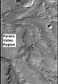
The Margaritifer Sinus quadrangle covers the area from 0° to 45° west longitude and 0° to 30° south latitude on Mars. Margaritifer Sinus contains some of the longest lake-chain systems on Mars, perhaps because of a wetter climate, more groundwater, or some of each factor. The Samara/Himera lake-chain system is about 1800 km long; the Parara/Loire valley network and lake-chain system is about 1100 km long.[2] A low area between Parana Valles and Loire Vallis is believed to have once held a lake.[3][4]
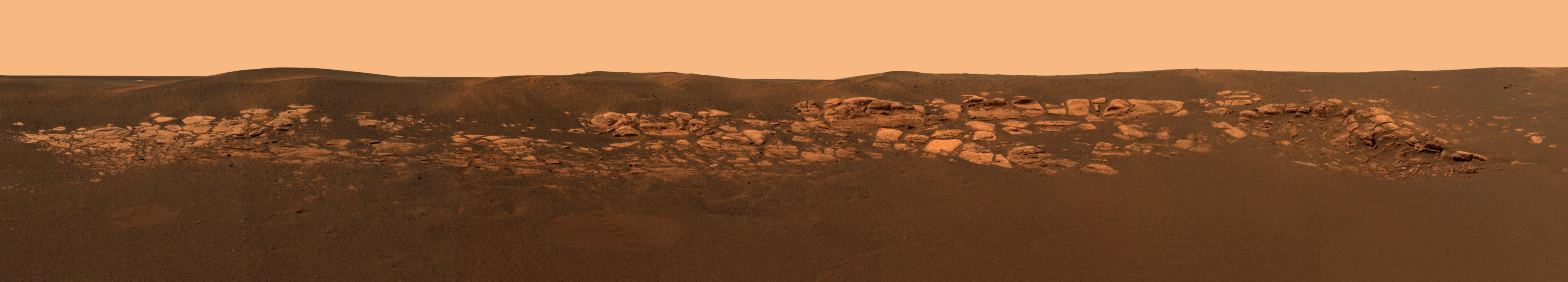
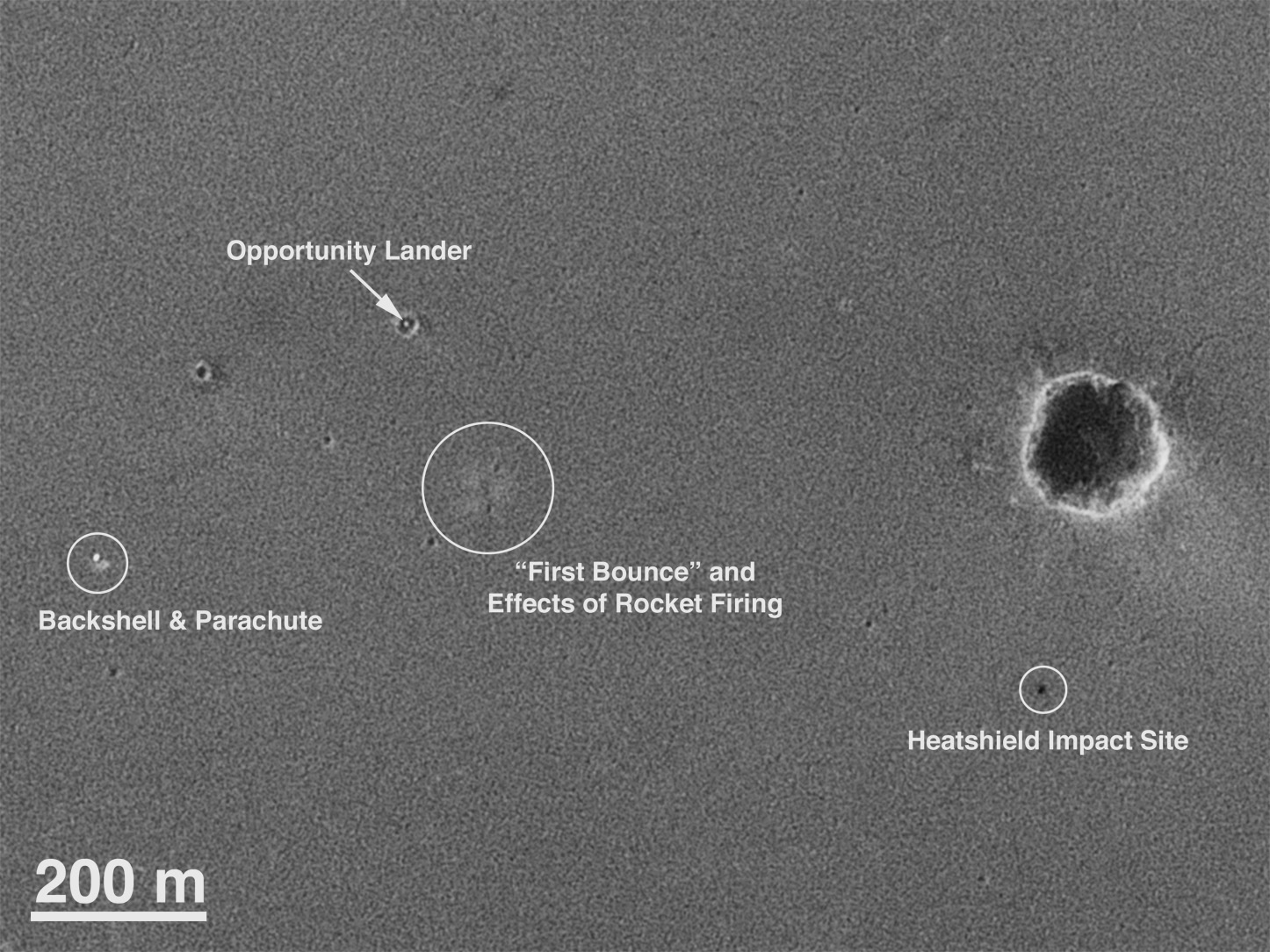
This region of Mars is famous because the Opportunity Rover landed there on January 25, 2004 at 1.94°S and 354.47°E (5.53° W).
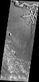
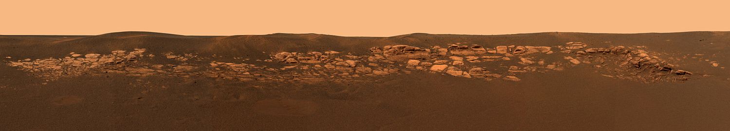 This panorama of Eagle crater shows outcroppings which are thought to have water origins.
-
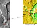
Opportunity Rover as seen by HiRISE on January 29, 2009. Opportunity is on its way to Endeavour Crater, 17 km away at this point (2.1° S and 354.5° E).
-
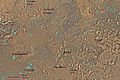
Location of Opportunity Rover on surface of Mars.
-

Mars Global Surveyor orbiter's photograph of landing site showing "hole in one."
Contents
Vallis
Vallis (plural valles) is the Latin word for valley. It is used in planetary geology for the naming of valley landform features on other planets.
Vallis was used for old river valleys that were discovered on Mars, when probes were first sent to Mars. The Viking Orbiters caused a revolution in our ideas about water on Mars; huge river valleys were found in many areas. Space craft cameras showed that floods of water broke through dams, carved deep valleys, eroded grooves into bedrock, and traveled thousands of kilometers.[5][6][7]
-
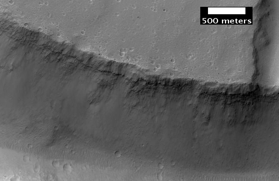
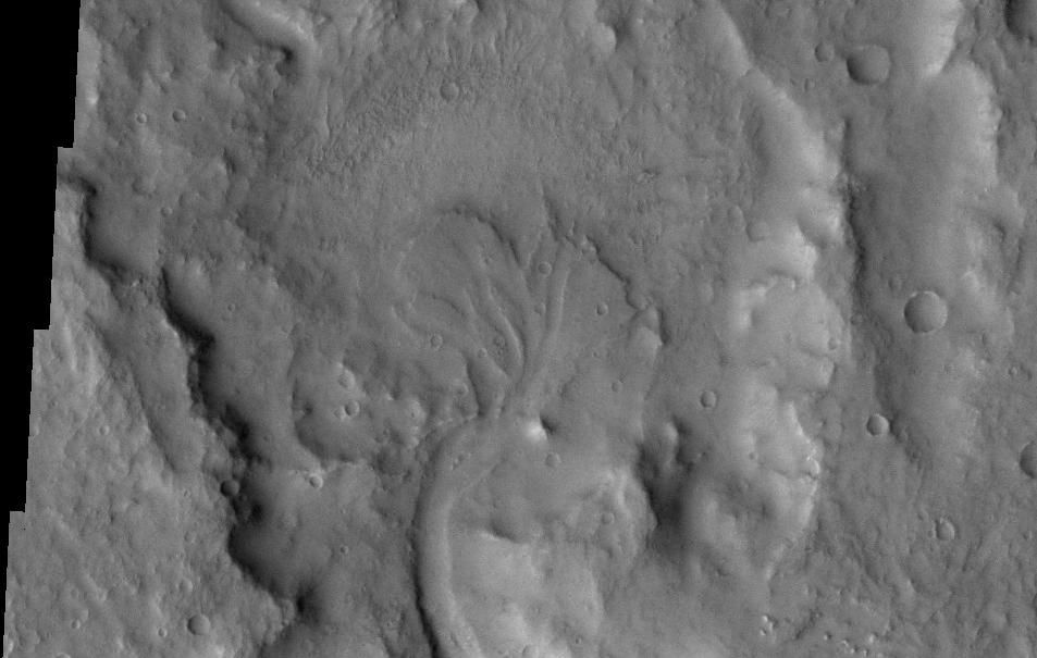
Parana Valles, as seen by HiRISE. Scale bar is 1000 meters long.
-
Ladon Valles, as seen by HiRISE. Click on image to see dark and light-toned layers.
-
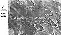
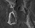
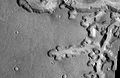
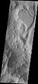
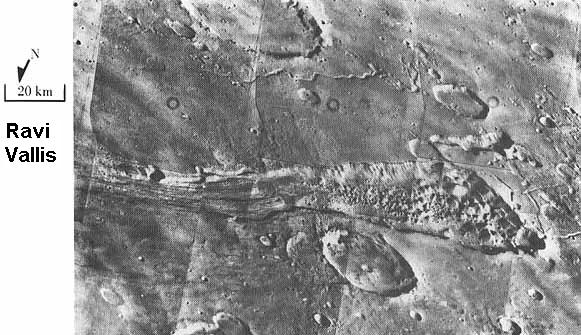
Ravi Vallis, as seen by Viking Orbiter. Ravi Vallis was probably formed when catastrophic floods came out of the ground to the right (chaotic terrain). Image located in Margaritifer Sinus quadrangle.
-
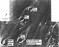
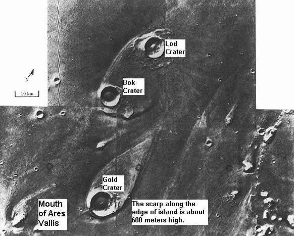
Tear-drop shaped islands caused by flood waters from Maja Vallis, as seen by Viking Orbiter. Image is located in Oxia Palus quadrangle.
-
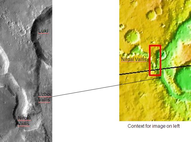
The long channel Nirgal Vallis is showed where it connects to Uzboi Vallis. The crater Luki is 21 km in diameter. Picture taken by THEMIS.
-
Nirgal Vallis, as seen by THEMIS.
-
Nirgal Vallis Close-up, as seen by THEMIS
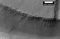
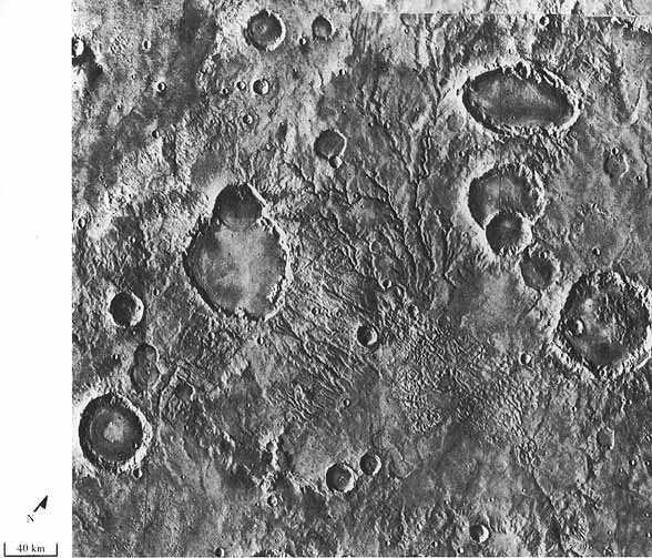
Branched streams seen by Viking
The Viking Orbiters discovered much about water on Mars. Branched streams, studied by the Orbiters in the southern hemisphere, suggested that rain once fell.[5][6][7]
-
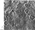
The branched channels seen by Viking from orbit strongly suggested that it rained on Mars in the past. Image is located in Margaritifer Sinus quadrangle
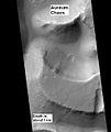
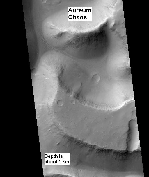
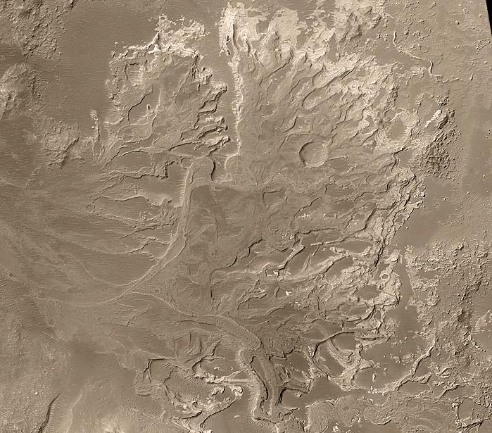
Aureum Chaos
Aureum Chaos is a major canyon system and collapsed area. It is probably a major source of water for large outflow channels.
Large outflow channels on Mars are believed to be caused by catastrophic discharges of ground water. Many of the channels begin in chaotic terrain, where the ground has apparently collapsed. In the collapsed section, blocks of undisturbed material be seen. The OMEGA experiment on Mars Express discovered clay minerals (phyllosilicates) in a variety of places in Aureum Chaos. Clay minerals need water to form, so the area may once have contained large amounts of water.[8] Scientists are interested in determining what parts of Mars contained water because evidence of past or present life may be found there.
-
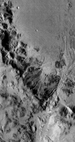
Huge canyons in Aureum Chaos. Gullies are rare at this latitude. Picture taken by THEMIS.
-
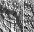
Aureum Chaos, as seen from THEMIS.
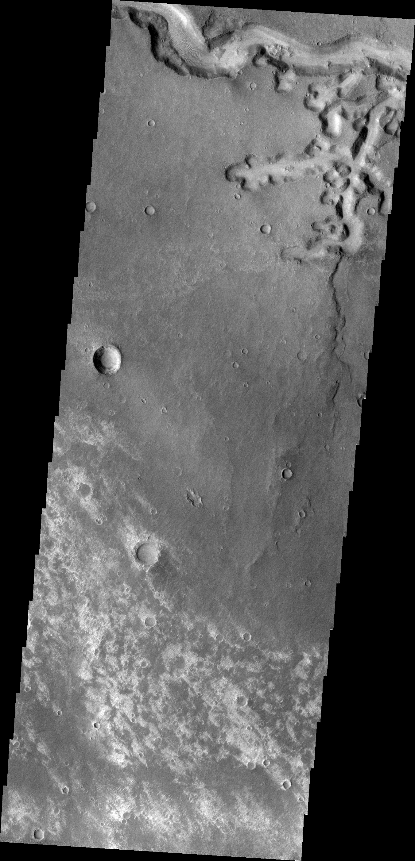
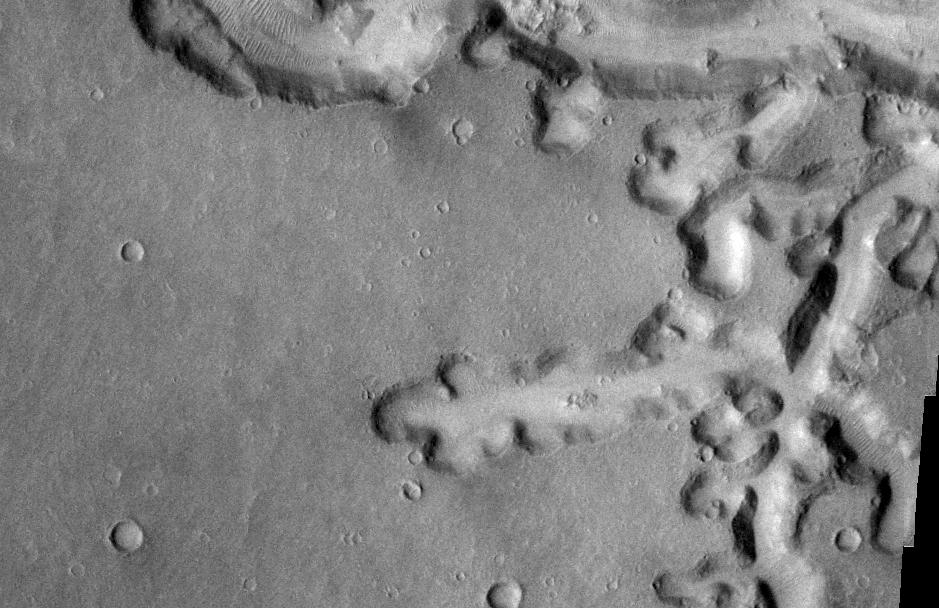
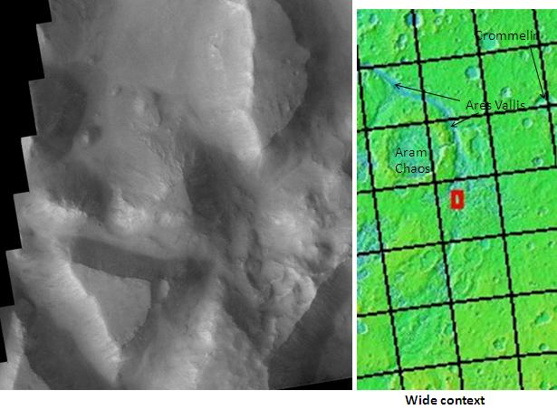
On April 1, 2010, NASA released the first images under the HiWish program, with the public suggesting places for HiRISE to photograph. One of the eight locations was Aureum Chaos.[9] The first image below gives a wide view of the area. The next two images are from the HiRISE image.[10]
-
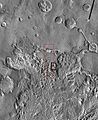
THEMIS image of wide view of following HiRISE images. Black box shows approximate location of HiRISE images. This image is just a part of the vast area known as Aureum Chaos. Click on image to see more details.
-
Aureum Chaos, as seen by HiRISE, under the HiWish program.
-
Close up view of previous image, as seen by HiRISE under HiWish program. Small round dots are boulders.
Mars Science Laboratory
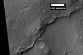
Several sites in the Margaritifer Sinus quadrangle have been proposed as areas to send NASA's next major Mars rover, the Mars Science Laboratory. Both Holden Crater and Eberswalde Crater made the cut to be among the top four.[11] Miyamoto Crater was in the top 7 sites chosen. Holden Crater is believed to have once been a lake.
-
West Rim of Holden Crater, as seen by THEMIS. Click on image to see more details.
-

Close-up of Channels on Rim of Holden Crater, as seen by THEMIS. Click on image to see more details.
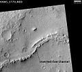
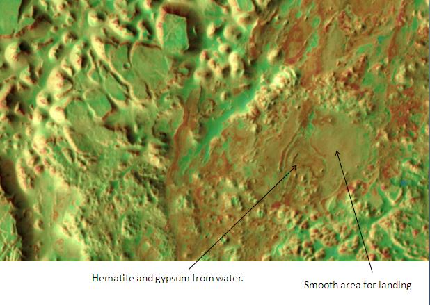
Eberswalde Crater contains a delta.[12] There is a great deal of evidence that Miyamoto Crater once contained rivers and lakes. Many minerals, such as clays, chlorides, sulfates, and iron oxides, have been discovered there.[13] These minerals are often formed in water. A picture below shows an inverted channel in Miyamoto Crater. Inverted channels formed from accumulated sediments that were cemented by minerals. These channels eroded into the surface, then the whole area was covered over with sediments. When the sediments were later eroded away, the place where the river channel existed remained because the hardened material that was deposited in the channel was resistant to erosion.[14] Iani Chaos, pictured below, was among the top 33 landing sites. Deposits of hematite and gypsum have been found there.[15] Those minerals are usually formed in connection with water.
-

Iani Chaos, as seen by THEMIS. Sand from eroding mesas is covering brighter floor material. Click on image to see relationship of Iani Chaos to other local features.
-
Landing zone in Iani Chaos, as seen by THEMIS.
The aim of the Mars Science Laboratory is to search for signs of ancient life. It is hoped that a later mission could then return samples from sites that the Mars Science Laboratory identified as probably containing remains of life. To safely bring the craft down, a 12 mile wide, smooth, flat circle is needed. Geologists hope to examine places where water once ponded.[15] They would like to examine sediment layers.
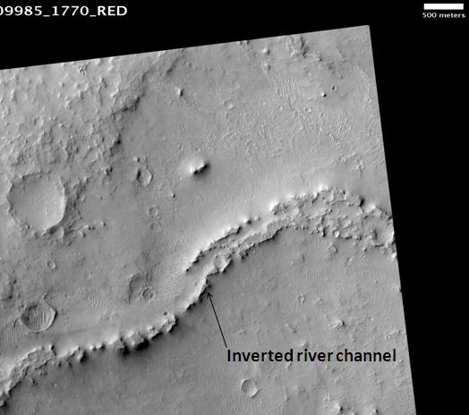
Inverted relief
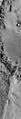
Some places on Mars show inverted relief. In these locations, a stream bed may be a raised feature, instead of a valley. The inverted former stream channels may be caused by the depositon of large rocks or due to cementation. In either case erosion would erode the surrounding land and leave the old channel as a raised ridge because the ridege will be more resistant to erosion. An image below, taken with HiRISE of Miyamoto Crater shows a ridge that is an old channel that has become inverted.[16]
-
Inverted Channel in Miyamoto Crater, as seen by HiRISE. The scale bar is 500 meters long.
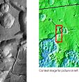
-
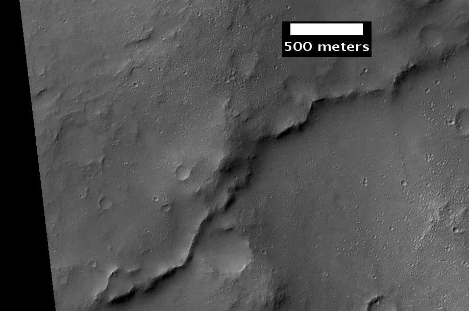
CTX context image for next image that was taken with HiRISE. Note long ridge going across image is probably an old stream. Box indicates area for HiRISE image.
-
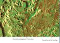
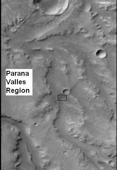
Example of inverted terrain in Parana Valles region, as seen by HiRISE under the HiWish program.
Deltas
Researchers have found a number of examples of deltas that formed in Martian lakes. Finding deltas is a major sign that Mars once had a lot of water. Deltas often require deep water over a long period of time to form. Also, the water level needs to be stable to keep sediment from washing away. Deltas have been found over a wide geographical range. Below, are pictures of a few.[17]
-

Delta in Margaritifer Sinus quadrangle as seen by THEMIS.
-
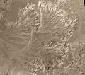
Probable delta in a crater to the NE of Holden Crater, as seen by Mars Global Surveyor. Image in Margaritifer Sinus quadrangle.
Craters
Impact craters generally have a rim with ejecta around them, in contrast volcanic craters usually do not have a rim or ejecta deposits. As craters get larger (greater than 10 km in diameter) they usually have a central peak.[18] The peak is caused by a rebound of the crater floor following the impact.[5] Sometimes craters will display layers. Craters can show us what lies deep under the surface.
-
Beer Crater eroded west wall, as seen by CTX.
-
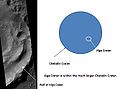
Alga Crater, as seen by HiRISE. Click on image to see the relationship between Alga Crater and the larger Chekalin Crater.
-
Timbuktu Crater, located on the edge of Capri Chasma. Image taken with THEMIS.
Gallery
-
Map of Margaritifer Sinus quadrangle with major features labeled. Capri Chasma and Eos Chasma are at the east end of the Mariner Valley.
See also
External links
References
- ^ Davies, M.E.; Batson, R.M.; Wu, S.S.C. “Geodesy and Cartography” in Kieffer, H.H.; Jakosky, B.M.; Snyder, C.W.; Matthews, M.S., Eds. Mars. University of Arizona Press: Tucson, 1992.
- ^ Fassett, C. and J. Head III. 2008. Valley network-fed, open-basin lakes on Mars: Distribution and implications for Noachian surface and subsurface hydrology. Icarus: 198. 39-56. doi: 10.1016/j.icarus.2008.06.016
- ^ Goldspiel, J. and S. Squyres. 2000. Groundwater sapping and valley formation on Mars. Icarus. 89: 176-192. doi: 10.1006/icar.2000.6465
- ^ Michael H. Carr (2006). The surface of Mars. Cambridge University Press. ISBN 9780521872010. http://books.google.com/books?id=uLHlJ6sjohwC. Retrieved 21 March 2011.
- ^ a b c Hugh H. Kieffer (1992). Mars. University of Arizona Press. ISBN 9780816512577. http://books.google.com/books?id=NoDvAAAAMAAJ. Retrieved 7 March 2011.
- ^ a b Raeburn, P. 1998. Uncovering the Secrets of the Red Planet Mars. National Geographic Society. Washington, D.C.
- ^ a b Moore, P. et al. 1990. The Atlas of the Solar System. Mitchell Beazley Publishers, New York.
- ^ (HiRISE image; Observation ID: PSP_0040261765)
- ^ Captioned Images Inspired by HiWish Suggestions (HiRISE)
- ^ Mesas in Aureum Chaos (HiRISE image; Observation ID: ESP_016869_1775)
- ^ Next Mars Rover's Landing Site Narrowed to 4 Choices. JR Minkel, 15 June 2010 (SPACE.com)
- ^ NASA Narrows List of Next Mars Landing Sites. Irene Klotz, 21 November 2008. (Discovery News)
- ^ Murchie, S. et al. 2009. A synthesis of Martian aqueous mineralogy after 1 Mars year of observations from the Mars Reconnaissance Orbiter. Journal of Geophysical Research: 114. doi:10.1029/2009JE003342
- ^ HiRISE - High Resolution Imaging Science Experiment
- ^ a b The Floods of Iani Chaos (Mars Odyssey THEMIS)
- ^ Sinuous Ridges Near Aeolis Mensae (HiRISE image; Observation ID: PSP_002279_1735)
- ^ Irwin III, R. et al. 2005. An intense terminal epoch of widespread fluvial activity on early Mars: 2. Increased runoff and paleolake development. Journal of Geophysical Research: 10. E12S15
- ^ Stones, Wind, and Ice: A Guide to Martian Impact Craters. Compiled by Nadine G. Barlow, Virgil L. Sharpton
Quadrangles on Mars MC-01 Mare Boreum
(features)MC-05 Ismenius Lacus
(features)MC-06 Casius
(features)MC-07 Cebrenia
(features)MC-02 Diacria
(features)MC-03 Arcadia
(features)MC-04 Acidalium
(features)MC-12 Arabia
(features)MC-13 Syrtis Major
(features)MC-14 Amenthes
(features)MC-15 Elysium
(features)MC-08 Amazonis
(features)MC-09 Tharsis
(features)MC-10 Lunae Palus
(features)MC-11 Oxia Palus
(features)MC-20 Sinus Sabaeus
(features)MC-21 Iapygia
(features)MC-22 Mare Tyrrhenum
(features)MC-23 Aeolis
(features)MC-16 Memnonia
(features)MC-17 Phoenicis Lacus
(features)MC-18 Coprates
(features)MC-19 Margaritifer Sinus
(features)MC-27 Noachis
(features)MC-28 Hellas
(features)MC-29 Eridania
(features)MC-24 Phaethontis
(features)MC-25 Thaumasia
(features)MC-26 Argyre
(features)MC-30 Mare Australe
(features)Categories: -


Wikimedia Foundation. 2010.