- Magor, Monmouthshire
-
Coordinates: 51°34′47″N 2°49′52″W / 51.57981°N 2.83121°W
Magor Welsh: Magwyr 
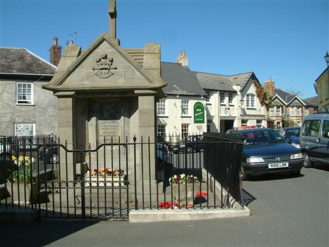
War memorial in the centre of Magor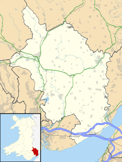
 Magor
Magor
Magor shown within MonmouthshirePopulation 5,876 OS grid reference ST425871 Principal area Monmouthshire Ceremonial county Gwent Country Wales Sovereign state United Kingdom Post town CALDICOT Postcode district NP26 Dialling code 01633 Police Gwent Fire South Wales Ambulance Welsh EU Parliament Wales UK Parliament Newport East List of places: UK • Wales • Monmouthshire Magor (Welsh: Magwyr) - meaning 'a wall' - is a large village in Monmouthshire, south east Wales, between Chepstow and the city of Newport, and adjoining the Caldicot Levels beside the Severn estuary. Magor lies close to the M4 motorway[1], which has a nearby motorway service area sharing its name. It is within the commuter belts of Newport, Bristol and Cardiff.
Contents
History
The original Welsh language name Magwyr, from which the English name is derived, is thought to originate from the Latin maceria, meaning masonry walls or ruins. It may relate either to a now-lost Roman villa in the area, or alternatively to sea defences or a causeway built by the Romans. Magor and the surrounding area contain many Roman ruins and artefacts, and the village centre was originally located at the inner edge of salt marshes which the Romans began to reclaim as farmland. The local name "Whitewall" may relate to the same causeway, which would have connected the village to a small now-vanished harbour on the Severn estuary known as Abergwaitha or Aberweytha.[2]
In 1994 the remains of a 13th century boat, used for trading along and across the Severn estuary, and perhaps with Ireland, were found buried in the mud of the estuary close to Magor Pill. The boat was found to have been carrying iron ore from Glamorgan.[3][4]
The church
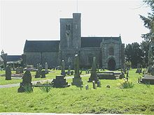 St. Mary's Church, Magor
According to tradition, the Church in Wales parish church was founded in the 7th century, and was originally dedicated to St. Leonard[disambiguation needed
 ].[5] The existing building has been described as "one of the most ambitious churches in Monmouthshire".[6] The earliest parts of the building date from the 13th century, at about the same time as it was handed by Gilbert Marshal, Earl of Pembroke to the abbey of Anagni in Italy. It was later administered by Tintern Abbey.
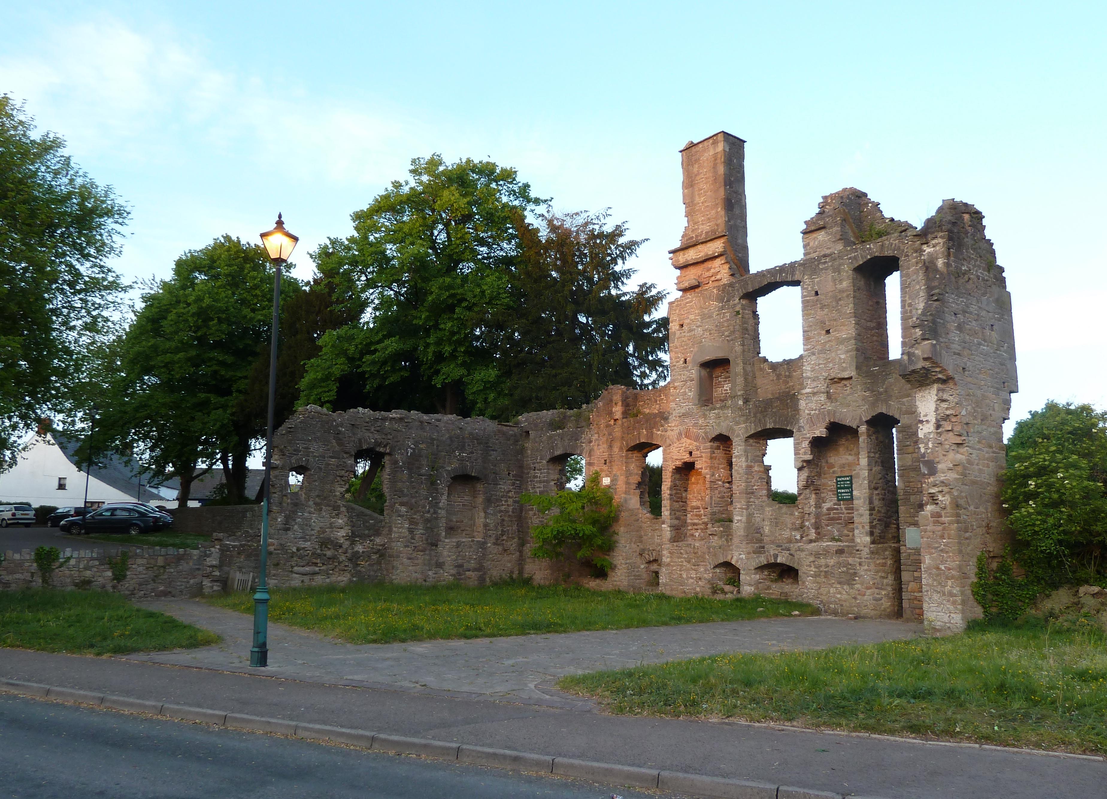
 The Procurator's House
Remains of the Procurator's House, some parts of which may date from the 14th century and others from the 16th century, are still standing just off the village square. The Procurator was responsible for collecting the tithes of the village on behalf of the abbey.[6] The church was greatly extended in the 15th century, and was restored and re-dedicated to St. Mary in the mid-19th century.[5]
Amenities
Although it could be described as a dormitory town it has a thriving village centre containing shops, pubs, restaurants and a Post Office. Magor and the neighbouring village of Undy support a thriving athletic club whose clubhouse and pitches are found at the eastern end of the villages.
Undy actually consists of all land lying to the north of Magor reen, taking in Dancing Hill where the reen intersects Cowleaze (Magor) to the south and Millfield Park and Mill Reen (Undy) to the north. Vinegar Hill, often regarded as a boundary point between Magor and Undy, actually lies wholly within Undy.
In 2007 a relief road was proposed for Newport which would have been built to the west of the village utilising the existing motorway junction.[7] The plans were dropped in 2009.[8]
As well as the large parish church the village also has an historic Baptist church.[9]
Magor Marsh is a 90 acres (36 ha) wetland reserve managed by the Gwent Wildlife Trust. It has a rich variety of habitats, including damp hay meadows, sedge fen, reedbed, scrub, wet woodland, a large pond and numerous reens. It includes breeding grounds for Common Snipe, Common Redshank, Reed Warbler, Grasshopper Warbler and Cetti's Warbler. It is the richest site in Wales for wetland beetles and soldier-flies,[10] and its pattern of drainage ditches and other features has remained unchanged since the 14th century.[11][12]
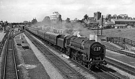 Magor Railway Station on the Great Western Railway in 1961
Notable people
- See Category:People from Magor
References
- ^ Photo of M4 at Magor
- ^ Name "Magor" at Gwent County History Association
- ^ Magor boat at S4C
- ^ Nayling, Nigel (1998). The Magor Pill medieval wreck. Council for British Archaeology. pp. 105–111. ISBN 1-872414-86-9.
- ^ a b Sir Joseph Bradney, A History of Monmouthshire, vol.4 part 2, 1932
- ^ a b John Newman, The Buildings of Wales: Gwent/Monmouthshire, 2000, ISBN 0-14-071053-1
- ^ http://www.statistics.gov.uk/geography/downloads/gbttwa.pdf
- ^ BBC News: "M4 and airport road plans dropped", 15 July 2009
- ^ Ebenezer Baptist Church
- ^ A guide to the nature reserves of the Gwent Wildlife Trust, leaflet, 2009
- ^ Severnside Forum: Magor Marshes - a summary of ecological information
- ^ BBC: Magor Marsh
External links
Categories:- Villages in Monmouthshire
- M4 corridor


Wikimedia Foundation. 2010.