- Marshall Mount, New South Wales
-
Marshall Mount
New South Wales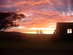
Sunset at Marshall MountEstablished: 1829 Postcode: 2530 Coordinates: 34°32′42″S 150°44′12″E / 34.545°S 150.73667°ECoordinates: 34°32′42″S 150°44′12″E / 34.545°S 150.73667°E Location: - 4 km (2 mi) SW of Dapto
- 2 km (1 mi) NNW of Albion Park
LGA: City of Wollongong Region: Illawarra State District: Shellharbour Federal Division: Throsby Suburbs around Marshall Mount: Avon Avondale Penrose Avon Marshall Mount Yallah Calderwood Calderwood Calderwood Marshall Mount is a suburb of Wollongong in New South Wales, Australia. It is located between the larger centres of Dapto and Albion Park.
History
In 1829 Henry Osborne, a wealthy Irish immigrant, was granted 2,560 acres (10.4 km2) in the Dapto district known as Marshall Mount, where he settled with his wife Sarah Osborne (nee Marshall) in 1833. By the 1840s Henry had added to his estate by securing Charles Throsby Smith’s "Calderwood" 1,280 acres (5.2 km2), Elyard’s "Avondale", William Browne’s "Athanlin" (Yallah), Brook’s "Exmouth" and numerous smaller grants. Marshall Mount was expanded to reach from Mullet Creek in the north to the Macquarie Rivulet in the south.
In 1841, Marshall Mount House was completed as the Osborne's new residence and in 1843, Osborne held a cattle show at his property which led to the founding of the Illawarra Agricultural Association.
By the 1850s the Osbornes had become one of the most powerful families in the region, and in 1851 Henry Osborne was elected to the Legislative Council as member for East Camden, representing his constituency in the first Legislative Assembly. (McDonald, 1976; Dowd, B.T. , 1960; Hagan, 1997.)
A school opened at Marshall Mount in 1859, and after the death of Henry Osborne in the same year, Marshall Mount road became a public thoroughfare. Marshall Mount remained primarily the property of Osborne's descendants until 1890, when Hamilton Osborne sold twenty-two lots of property to new owners.[1]
In 2009, Marshall Mount is an agricultural/rural district, and is considered a part of the state suburb Avondale, which at the 2006 census had a population of 513.[2] Under the West Dapto Local Environmental Plan, Marshall Mount is currently being considered for residential development by the NSW State Government.[3]
Notable Attractions
Marshall Mount is the site of the Marshall Mount Old Time Dance, a fortnightly gathering run by the Marshall Mount Progress Association.[4]
The Marshall Mount Public School and Schoolmaster's Residence, opened in 1859, are still standing on Marshall Mount Road and offer an example of typical architectural style of the period.[5]
Marshall Mount House, a colonial-style built on the original site of the Osborne residence, has been a heritage listed building since 1978, due to the significance of its original owner.[6]
References
- ^ Wollongong City Library. "Timeline". http://www.wollongong.nsw.gov.au/library/onlineresources/suburbprofiles/pages/marshallmount.aspx. Retrieved 2011-02-01.
- ^ Australian Bureau of Statistics (25 October 2007). "Avondale (State Suburb)". 2006 Census QuickStats. http://www.censusdata.abs.gov.au/ABSNavigation/prenav/LocationSearch?collection=Census&period=2006&areacode=SSC16111&producttype=QuickStats&breadcrumb=PL&action=401. Retrieved 2010-01-16.
- ^ Question and Answers Paper No. 63. "2044 - Marshall Mount to Calderwood Valley". http://www.parliament.nsw.gov.au/prod/lc/qalc.nsf/962613d55d0cee2aca257146008027f7/afa6d6b7772e8f16ca25747400218857?OpenDocument. Retrieved 2011-03-30.
- ^ Illawarra Folk Club Inc. "Illawarra Folk Club Store". http://www.illawarrafolkclub.org.au/store/cart.php?target=product&product_id=336&category_id=41. Retrieved 2009-02-11.
- ^ Wollongong City Library. "Historic buildings". http://www.wollongong.nsw.gov.au/library/5367.asp. Retrieved 2009-02-11.[dead link]
- ^ "Entry AHD1532". Australian Heritage Database. Department of Sustainability, Environment, Water, Population and Communities. http://www.environment.gov.au/cgi-bin/ahdb/search.pl?mode=place_detail;place_id=1532. Retrieved 2009-02-11.
Suburbs and Localities of Wollongong, New South Wales Albion Park · Albion Park Rail · Austinmer · Avon · Avondale · Balarang · Balgownie · Barrack Heights · Barrack Point · Bellambi · Berkeley · Blackbutt · Bombo · Broughton Village · Brownsville · Bulli · Burning Palms · Calderwood · Carrington Falls · Cleveland · Clifton · Coalcliff · Coledale · Coniston · Cordeaux · Cordeaux Heights · Corrimal · Cringila · Croom · Curramore · Dapto · Darkes Forest · Dombarton · Dunmore · East Corrimal · Fairy Meadow · Farmborough Heights · Fernhill · Figtree · Flinders · Foxground · Gerringong · Gerroa · Gwynneville · Haywards Bay · Helensburgh · Horsley · Huntley · Jamberoo · Jerrara · Kanahooka · Keiraville · Kembla Grange · Kembla Heights · Kemblawarra · Kiama · Kiama Downs · Kiama Heights · Knights Hill · Koonawarra · Lake Heights · Lake Illawarra · Lilyvale · Macquarie Pass · Maddens Plains · Mangerton · Marshall Mount · Minnamurra · Mount Keira · Mount Kembla · Mount Ousley · Mount Pleasant · Mount Saint Thomas · Mount Warrigal · North Macquarie · North Wollongong · Oak Flats · Otford · Penrose · Port Kembla · Primbee · Rose Valley · Russell Vale · Saddleback Mountain · Scarborough · Shell Cove · Shellharbour · Shellharbour City Centre · Spring Hill · Stanwell Park · Stanwell Tops · Tarrawanna · Thirroul · Tongarra · Toolijooa · Towradgi · Tullimbar · Unanderra · Upper Kangaroo Valley · Warilla · Warrawong · Werri Beach · West Wollongong · Willow Vale · Windang · Wollongong · Wombarra · Wongawilli · Woonona · Yallah · Yellow Rock
Categories:- Populated places established in 1829
- Suburbs of Wollongong, New South Wales

Wikimedia Foundation. 2010.