- Marsham, Norfolk
-
Coordinates: 52°46′09″N 1°15′17″E / 52.76909°N 1.25481°E
Marsham 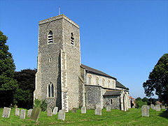
All Saints, Marsham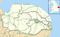
 Marsham
Marsham shown within NorfolkArea 7.40 km2 (2.86 sq mi) Population 674 - Density 91 /km2 (240 /sq mi) OS grid reference TG196240 Parish Marsham District Broadland Shire county Norfolk Region East Country England Sovereign state United Kingdom Post town NORWICH Postcode district NR10 Police Norfolk Fire Norfolk Ambulance East of England EU Parliament East of England List of places: UK • England • Norfolk 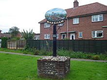 The village sign depicts the peewit bird
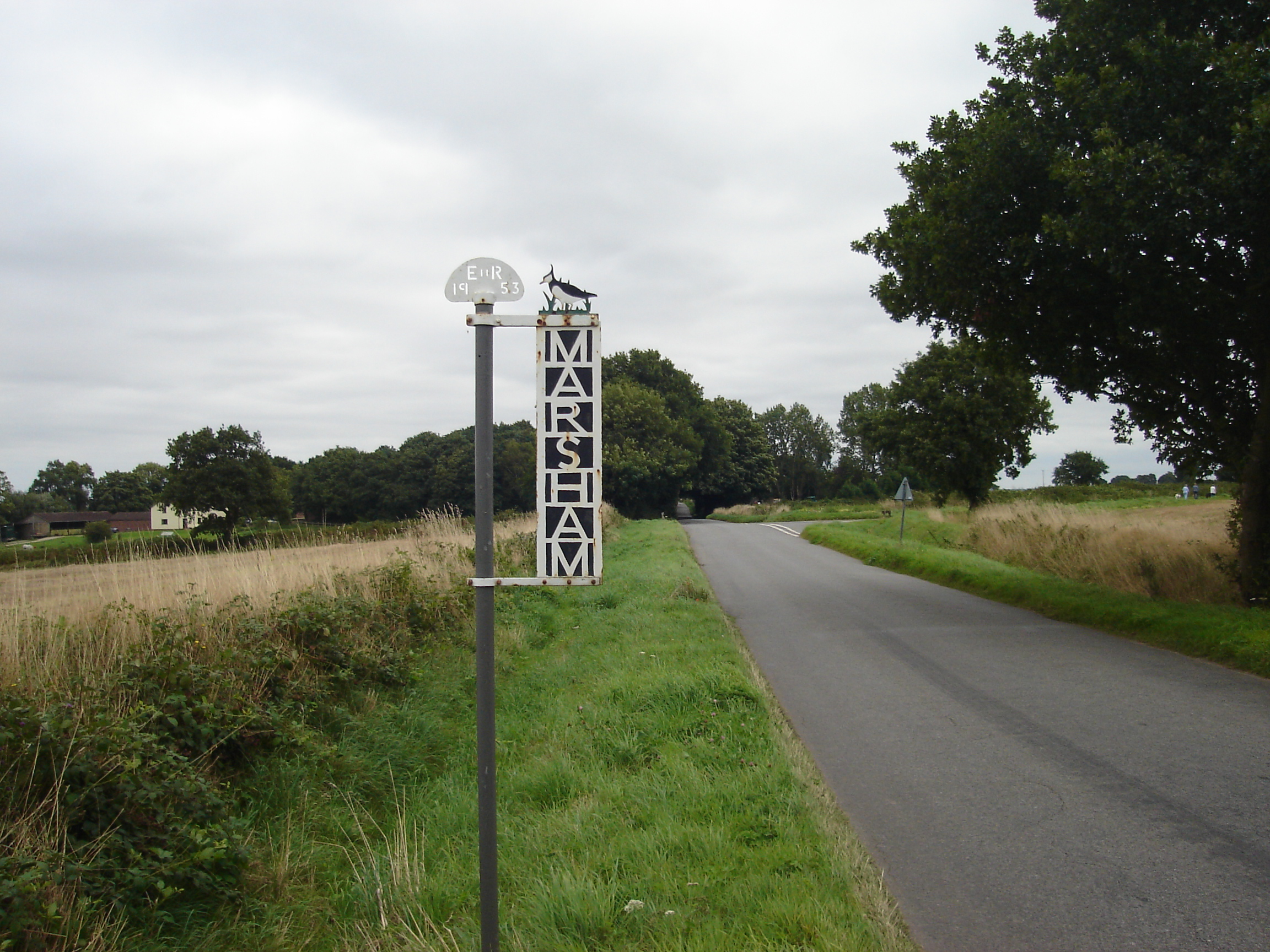
Marsham is a civil parish in the English county of Norfolk, about 10 miles (16 km) north of Norwich. It covers an area of 7.40 km2 (2.86 sq mi) and had a population of 674 in 282 households as of the 2001 census.[1] For the purposes of local government, it falls within the district of Broadland.
Contents
History
The Imperial Gazetteer of England and Wales (1870–1872) described Marsham thus:
“ MARSHAM, a village and a parish in Aylsham district, Norfolk. The village stands near the river Bure, 2 miles S of Aylsham, and 11 N of Norwich r. station; and gives the title of Viscount to Earl Romney. The parish comprises 1,819 acres. Real property, £2,314. Pop., 622. Houses, 148. The property is subdivided. Bolwick Hall is the seat of J. H. Warnes, Esq. The ancestors of Earl Romney resided in the parish in the 12th century. The living is a rectory in the diocese of Norwich. Value, £281. Patrons, Miss C. Blake and the Rev. E. T. Yates. The church consists of nave and chancel, with a tower; and contains an ancient screen, a carved font, and monuments of the Norrises and others. There are a Primitive Methodist chapel, and charities £18.[2] ” Gallery
-

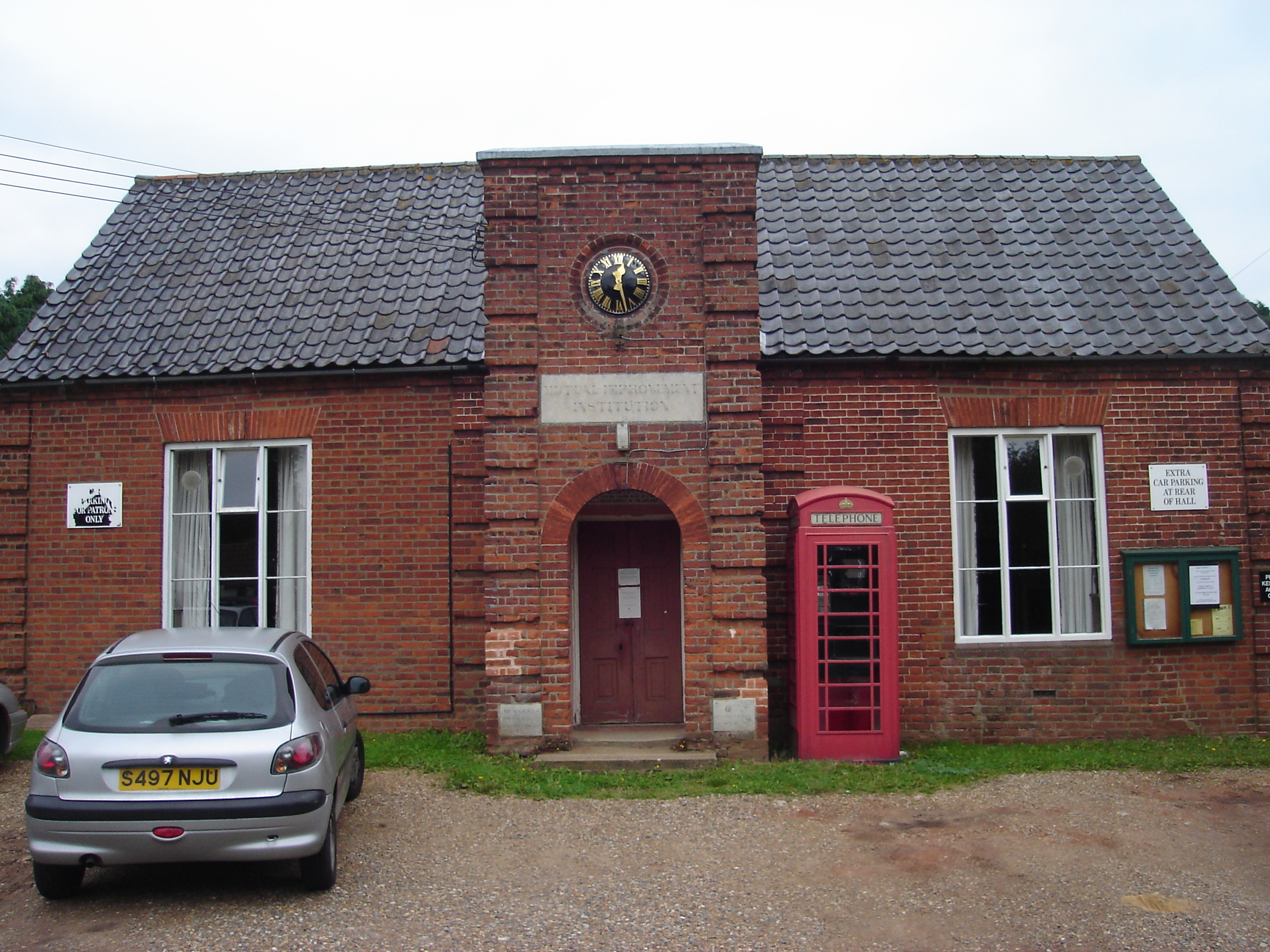
The Mutual Improvement Institution is a Grade II listed building dating back back to 1857.
-

The village sign was erected in 1953 to commemorate the coronation of Queen Elizabeth II.
-

The Plough Inn Marsham
References
- ^ Census population and household counts for unparished urban areas and all parishes. Office for National Statistics & Norfolk County Council (2001). Retrieved 20 June 2009.
- ^ Wilson, John Marius, Imperial Gazetteer of England and Wales (1870-1872), extract for Marsham online at visionofbritain.org.uk, accessed 24 January 2009
External links
Categories:- Broadland
- Villages in Norfolk
- Civil parishes in Norfolk
- Norfolk geography stubs
-


Wikimedia Foundation. 2010.