- Maryland Route 218
-
Maryland Route 218
Suitland Road 
Route information Maintained by MDSHA Length: 1.64 mi[1] (2.64 km) Major junctions West end: Southern Avenue at the Washington, D.C. border East end:  MD 458 in Suitland
Highway system Maryland highway system
Interstate • US • State • Minor • Former • Turnpikes←  MD 216
MD 219  →
→Maryland Route 218 (MD 218) is a state highway in the U.S. state of Maryland. Known as Suitland Road, the route runs 1.64 mi (2.64 km) from Southern Avenue at the Washington, D.C. border east to Maryland Route 458 in Suitland. MD 218 provides access to the Suitland Federal Center, which is home to the United States Census Bureau.
Contents
Route description
Maryland Route 218 begins at Southern Avenue on the District of Columbia boundary. Suitland Road continues west into D.C. until it meets Alabama Avenue. After providing access to a couple of apartment complexes immediately to the east of Southern Avenue, the route crosses Oxon Creek and heads east as a two-lane road with a speed limit of 30 mph (48 km/h) through the grounds of three cemeteries, Cedar Hill Cemetery to the north and Lincoln Memorial and Washington Memorial cemeteries to the south. After passing the cemeteries, MD 218 expands to a three-lane road with a center turn lane and passes a mix of apartment complexes and commercial establishments on the north and the Suitland Federal Center on the south. The road meets its eastern terminus at Maryland Route 458 (Silver Hill Road) in Suitland. Suitland Road continues east as a county-maintained road toward the Capital Beltway and Andrews Air Force Base. MD 458 south leads to the Suitland Parkway and the Suitland station of the Washington Metro.
History
Maryland Route 218 was paved from the D.C. line to Oxon Creek by 1927 and out to Suitland by 1930.[2][3] The 1939 Maryland state highway map shows MD 218 assigned to its present course.[4]
Junction list
The entire route is in Prince George's County.
Location Mile[1] Destinations Notes Suitland 0.00 Southern Avenue Suitland Road
Western terminus 1.23 Shadyside Avenue 1.86 MD 458 (Silver Hill Road) – Hillcrest Heights, District Heights
Suitland Road
Eastern terminus References
- ^ a b Maryland State Highway Administration (2008). "Highway Location Reference: Prince George's County" (PDF). http://apps.roads.maryland.gov/KeepingCurrent/performTrafficStudies/dataAndStats/hwyLocationRef/2008_hlr_all/co16.pdf. Retrieved 2010-01-06.
- ^ Maryland State Highway Administration (1927). "Map of Maryland" (JPG). http://www.mdhighwaycentennial.com/images/template/gallery/maps/1927SIDE1.jpg. Retrieved 2010-01-06.
- ^ Maryland State Highway Administration (1930). "Map of Maryland" (JPG). http://commons.wikimedia.org/wiki/File:Maryland_State_Highway_Map_-_1930.jpg. Retrieved 2010-01-06.
- ^ Maryland State Highway Administration (1939). "Map of Maryland" (PDF). http://commons.wikimedia.org/wiki/File:Maryland_State_Highway_Map_-_1939.pdf. Retrieved 2010-01-06.
External links
Roads in Prince George's County, Maryland Maryland State Highways 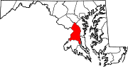
U.S. Routes Interstate Highways Roads by name Categories:- State highways in Maryland
- Roads in Prince George's County, Maryland


Wikimedia Foundation. 2010.