- Maryland Route 496
-
Maryland Route 496
Bachmans Valley Road 
Route information Maintained by MDSHA Length: 7.23 mi[1] (11.64 km) Major junctions West end:  MD 97 in Pleasant Valley
East end:  MD 30 near Melrose
Location Counties: Carroll Highway system Maryland highway system
Interstate • US • State • Minor • Former • Turnpikes←  MD 495
MD 497  →
→Maryland Route 496 (MD 496) is a state highway in the U.S. state of Maryland. Known as Bachmans Valley Road, the state highway runs 7.23 miles (11.64 km) from MD 97 near Pleasant Valley east to MD 30 in Melrose. MD 496 was constructed from Pleasant Valley to Bachman Mills in the mid-1930s. The state highway was completed to Melrose in the late 1940s.
Contents
Route description
MD 496 begins at an intersection with MD 97 (Littlestown Pike) near the hamlet of Pleasant Valley north of Westminster. The state highway heads northeast as a two-lane road through farmland. MD 496 crosses Bear Branch, on which lies the Bear Branch Nature Center, and passes Saw Mill Road, which leads to the Whittaker Chambers Farm. The state highway intersects Old Bachmans Valley Road just south of the hamlet of Bachman Mills, where the highway crosses Big Pipe Creek. Old Bachmans Valley Road leads southwest to the historic Christian Royer House and John Orendorff Farm. MD 496 continues northeast to the community of Melrose north of Manchester, where the state highway reaches its eastern terminus at MD 30 (Hanover Pike). The roadway continues northeast as county-maintained Wentz Road.[1][2]
History
The first sections of MD 496 from what was then U.S. Route 140 (now MD 97) to Bachman Mills were completed as a concrete road by 1933.[3][4] The next segment of the state highway was constructed from Bachman Mills to near Hoover Mill Road between 1934 and 1936.[4][5] Traffic from Bachman Mills to Melrose followed county-maintained Ebbvale Road until MD 496 was completed as a macadam road on a new alignment to MD 30 in 1947.[6][7]
Junction list
The entire route is in Carroll County.
Location Mile[1] Destinations Notes Pleasant Valley 0.00 MD 97 (Littlestown Pike) – Westminster, Union MillsWestern terminus Melrose 7.23 MD 30 (Hanover Pike) / Wentz Road east – Manchester, HanoverEastern terminus 1.000 mi = 1.609 km; 1.000 km = 0.621 mi References
- ^ a b c "Highway Location Reference: Carroll County" (PDF). Maryland State Highway Administration. 2009. http://www.marylandroads.com/Location/2009_CARROLL.pdf. Retrieved 2011-04-29.
- ^ Google, Inc. Google Maps – Maryland Route 496 (Map). Cartography by Google, Inc. http://maps.google.com/maps?f=d&source=s_d&saddr=MD-97+N%2FBaltimore+Blvd%2FLittlestown+Pike&daddr=MD-496+E%2FBachmans+Valley+Rd&hl=en&geocode=Fa6iXAIdHhlp-w%3BFfC-XQId3IZq-w&mra=ls&sll=39.698503,-76.904769&sspn=0.014892,0.038581&ie=UTF8&t=h&z=12. Retrieved 2011-04-29.
- ^ Maryland Geological Survey. Map of Maryland Showing State Road System: State Aid Roads and Improved County Road Connections (Map) (1933 ed.).
- ^ a b Report of the State Roads Commission of Maryland. 1931-1934. Baltimore: Maryland State Roads Commission. 1934-12-28. pp. 326–327. http://www.archive.org/details/reportofstateroa1931mary. Retrieved 2011-04-30.
- ^ Maryland State Roads Commission. Map of Maryland Showing State Road System (Map) (1936 ed.).
- ^ Report of the State Roads Commission of Maryland. 1947-1948. Baltimore: Maryland State Roads Commission. 1949-02-15. p. 114. http://www.archive.org/details/reportofstateroa1947mary. Retrieved 2011-04-30.
- ^ Maryland State Roads Commission. Maryland: Official Highway Map (Map) (1948 ed.).
External links
Roads in Carroll County, Maryland State highways 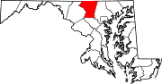
U.S. Highways Interstate Highways Categories:- State highways in Maryland
- Roads in Carroll County, Maryland


Wikimedia Foundation. 2010.