- Maryland Route 725
-
Maryland Route 725
Route information Maintained by MDSHA Length: 1.19 mi[1] (1.92 km) Major junctions West end: Brown Station Road in Upper Marlboro  MD 202 in Upper Marlboro
East end:  US 301 in Upper Marlboro
Highway system Maryland highway system
Interstate • US • State • Minor • Former • Turnpikes←  MD 717
MD 726  →
→Maryland Route 725 (MD 725) is a state highway in the U.S. state of Maryland. The state highway runs 1.86 mi (2.99 km) from Brown Station Road east to U.S. Route 301 (US 301) within Upper Marlboro. In conjunction with county highways at either end, MD 725 is the old alignment of MD 4 through the county seat of Prince George's County.
Contents
Route description
 MD 725 westbound past MD 717 in Upper Marlboro
MD 725 begins at an intersection with Brown Station Road on the west side of Upper Marlboro. Old Marlboro Pike continues west as a county highway.[2] After passing John Rogers Boulevard, MD 725 crosses Fed Spring Branch and enters the town limits of Upper Marlboro.[1] The state highway curves south, then turns east at the intersection with Old Crain Highway, where the highway's name changes to Main Street. MD 725 heads into the downtown area, where the highway meets the northern end of MD 717 (Water Street) and passes many county buildings, including the county courthouse. The state highway passes Governor Oden Bowie Drive, where the highway's name changes to Marlboro Pike, and heads northeast out of the downtown area. MD 725 leaves the town limits by crossing the Western Branch of the Patuxent River and immediately meets the eastern end of MD 202 (Largo Road).[1][2] The state highway passes several industrial buildings that cluster around the road's at-grade crossing of CSX's Popes Creek Subdivision. MD 725 reaches its eastern terminus at a cluster of restaurants surrounding the intersection with US 301 (Robert Crain Highway). Marlboro Pike continues east as a county highway.[2]
History
MD 725, Old Marlboro Pike to the west, and Marlboro Pike to the east form the old alignment of MD 4, which bypassed the county seat around 1960. East of Old Crain Highway, the state highway is also the old alignment of US 301, which bypassed Upper Marlboro in the early 1950s.
Junction list
The entire route is in Upper Marlboro in Prince George's County.
Mile
[1]Destinations Notes 0.00 Old Marlboro Pike west / Brown Station Road north Western terminus 0.65 Old Crain Highway south Old alignment of US 301 0.78  MD 717 south (Water Street) to MD 4
MD 717 is unsigned 1.25 MD 202 west (Largo Road) – Largo, Landover1.86 US 301 (Robert Crain Highway) – Baltimore, RichmondEastern terminus Marlboro Pike east References
- ^ a b c d "Highway Location Reference: Prince George's County" (PDF). Maryland State Highway Administration. 2008. http://apps.roads.maryland.gov/KeepingCurrent/performTrafficStudies/dataAndStats/hwyLocationRef/2008_hlr_all/co16.pdf. Retrieved 2010-06-11.
- ^ a b c Google, Inc. Google Maps – Maryland Route 725 (Map). Cartography by Google, Inc. http://maps.google.com/maps?f=d&source=s_d&saddr=Old+Marlboro+Pike&daddr=Marlboro+Pike&hl=en&geocode=FYBVUAId6q1s-w%3BFRhoUAId8Bpt-w&mra=ls&sll=38.824137,-76.732668&sspn=0.00382,0.009645&ie=UTF8&t=h&z=15. Retrieved 2010-06-11.
External links
Roads in Prince George's County, Maryland Maryland State Highways 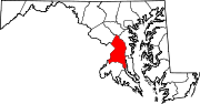
U.S. Routes Interstate Highways Roads by name Categories:- State highways in Maryland
- Roads in Prince George's County, Maryland


Wikimedia Foundation. 2010.