- Maryland Route 826
-
Maryland Route 826
Route information Maintained by MDSHA Location Counties: Garrett Highway system Maryland highway system
Interstate • US • State • Minor • Former • Turnpikes←  MD 825
MD 827  →
→Maryland Route 826 (MD 826) is a collection of unsigned state highways in the U.S. state of Maryland. These 13 highways are service roads constructed or old alignments maintained to provide access to private property or county highways whose access was compromised by the reconstruction of U.S. Route 219 (US 219) in Garrett County in the 1950s. Several instances of MD 826 connect with auxiliary routes of US 219. MD 826A through MD 826D are found near Oakland. MD 826E, MD 826G, MD 826H, and MD 826J through MD 826N are located between Accident and Keyser's Ridge. MD 826P was established between Hoyes and Accident.
- MD 826A is the designation for SHA Drive and Weber Road, which together comprise 0.56 mi (0.90 km) of the old alignment of US 219 between CSX's Mountain Subdivision and an old alignment of MD 135, MD 825B (Oakland Drive). The state highway intersects both MD 135 (Maryland Highway) and US 219A (Weber Road), which connects MD 826A with US 219. MD 826A provides access to the Oakland Shop of the Maryland State Highway Administration at its southern end.[1][2]
- MD 826B is the designation for Lumber City Road, a 0.15-mile (0.24 km) service road that provides access to industrial facilities west of US 219 just north of the CSX rail line in Oakland. MD 826B connects to US 219 at the same intersection as US 219A (Weber Road).[1][3]
- MD 826C is the designation for an unnamed service road that comprises 0.16 mi (0.26 km) of the old alignment of US 219 between Gortner and Oakland, paralleling the southbound side of US 219 between two dead ends north of Monte Vista Road.[1]
- MD 826D is the designation for an unnamed an unnamed service road that comprises 0.05 mi (0.080 km) of the old alignment of US 219 between Gortner and Oakland, paralleling the southbound side of US 219 between two dead ends south of Monte Vista Road.[1]
- MD 826E is the designation for Accident Garage Road, which comprises 0.35 mi (0.56 km) of the old alignment of US 219 between Accident and Keyser's Ridge, paralleling the northbound side of the federal highway heading west from US 219. MD 826E is located just south of Northern Garrett High School and serves the namesake business.[1][4]
- MD 826G is the designation for an unnamed service road that comprises 0.08 mi (0.13 km) of the old alignment of US 219 between Accident and Bear Creek, paralleling the southbound side of US 219 between two dead ends. MD 826G is connected to US 219 by US 219C.[1]
- MD 826H is the designation for an unnamed 0.19-mile (0.31 km) service road that runs from US 40 (National Pike) southeast to a dead end at Exit 14 of Interstate 68 in Keyser's Ridge. MD 826H provides access to the Keyser's Ridge Shop of the Maryland State Highway Administration.[1]
- MD 826J is the designation for Stockyard Road, which comprises 0.60 mi (0.97 km) of the old alignment of US 219 at Keyser's Ridge paralleling the southbound side of the federal highway. The state highway runs between two dead ends; access to US 219 is provided at the south end and north end by US 219D and US 219E, respectively.[1][5]
- MD 826K is the designation for an unnamed service road that comprises 0.05 mi (0.080 km) of the old alignment of US 219 south of Keyser's Ridge, paralleling the northbound side of the federal highway between two dead ends. MD 826K is connected to US 219 by US 219F.[1]
- MD 826L is the designation for Ryland Court, which comprises 0.19 mi (0.31 km) of the old alignment of US 219 south of Keyser's Ridge, paralleling the southbound side of the federal highway between two dead ends. MD 826L is connected to US 219 by US 219G.[1][6]
- MD 826M is the designation for Rabbit Hollow Road, which comprises 0.51 mi (0.82 km) of the old alignment of US 219 south of Keyser's Ridge, paralleling the northbound side of the federal highway heading east from US 219 to the county-maintained portion of Rabbit Hollow Road.[1][7]
- MD 826N is the designation for an unnamed service road that comprises 0.25 mi (0.40 km) of the old alignment of US 219 south of Keyser's Ridge, paralleling the northbound side of the federal highway between two dead ends. MD 826N is connected to US 219 by county-maintained Collier Road just north of Northern Garrett High School.[1]
- MD 826P is the designation for an unnamed service road that comprises 0.17 mi (0.27 km) of the old alignment of US 219 south of Accident, looping between two intersections with the federal highway on the northbound side.[1][8]
References
- ^ a b c d e f g h i j k l m "Highway Location Reference: Garrett County" (PDF). Maryland State Highway Administration. 2009. http://www.marylandroads.com/Location/2009_GARRETT.pdf. Retrieved 2010-11-11.
- ^ Google, Inc. Google Maps – Maryland Route 826A (Map). Google, Inc. http://maps.google.com/maps?f=d&source=s_d&saddr=Sha+Dr&daddr=Unknown+road&geocode=FZIhWQIdPH9E-w%3BFYA9WQIdjpFE-w&hl=en&mra=ls&sll=39.399525,-79.396906&sspn=0.015155,0.038581&ie=UTF8&t=h&z=16. Retrieved 2010-05-15.
- ^ Google, Inc. Google Maps – Maryland Route 826B (Map). Google, Inc. http://maps.google.com/maps?f=d&source=s_d&saddr=Weber+Rd&daddr=Lumber+City+Rd&geocode=FewrWQIdwH1E-w%3BFYUwWQIdlnVE-w&hl=en&mra=ls&sll=39.398829,-79.397743&sspn=0.003789,0.009645&ie=UTF8&t=h&z=18. Retrieved 2010-05-15.
- ^ Google, Inc. Google Maps – Maryland Route 826E (Map). Google, Inc. http://maps.google.com/maps?f=d&source=s_d&saddr=Unknown+road&daddr=Unknown+road&geocode=FY82XQId4wxG-w%3BFUwxXQIdcgZG-w&hl=en&mra=ls&sll=39.661503,-79.296661&sspn=0.001887,0.004823&ie=UTF8&ll=39.662576,-79.296087&spn=0.001887,0.004823&t=h&z=18. Retrieved 2010-05-15.
- ^ Google, Inc. Google Maps – Maryland Route 826J (Map). Google, Inc. http://maps.google.com/maps?f=d&source=s_d&saddr=Stockyard+Rd&daddr=Stockyard+Rd&geocode=FdhxXQIdUnlG-w%3BFap-XQIdE55G-w&hl=en&mra=ls&sll=39.681566,-79.258139&sspn=0.001887,0.004823&ie=UTF8&t=h&z=17. Retrieved 2010-05-15.
- ^ Google, Inc. Google Maps – Maryland Route 826L (Map). Google, Inc. http://maps.google.com/maps?f=d&source=s_d&saddr=Ryland+Ct&daddr=Beartooth+Pass&geocode=FXx-XQIdeFpG-w%3BFVB6XQIddmBG-w&hl=en&mra=ls&sll=39.681124,-79.274635&sspn=0.001887,0.004823&ie=UTF8&t=h&z=18. Retrieved 2010-05-15.
- ^ Google, Inc. Google Maps – Maryland Route 826M (Map). Google, Inc. http://maps.google.com/maps?f=d&source=s_d&saddr=Garrett+Hwy%2FUS-219+N&daddr=Rabbit+Hollow+Rd&geocode=FVp4XQIdsjRG-w%3BFbJ4XQIdXFVG-w&hl=en&mra=ls&sll=39.680232,-79.277218&sspn=0.000943,0.002411&ie=UTF8&t=h&z=17. Retrieved 2010-05-15.
- ^ Google, Inc. Google Maps – Maryland Route 826P (Map). Google, Inc. http://maps.google.com/maps?f=d&source=s_d&saddr=Unknown+road&daddr=Unknown+road&geocode=FRBNXAIddG5F-w%3BFVtUXAId43NF-w&hl=en&mra=ls&sll=39.599174,-79.337447&sspn=0.007556,0.01929&ie=UTF8&t=h&z=18. Retrieved 2010-05-15.
External links
Roads in Garrett County, Maryland State highways 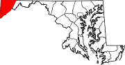
U.S. Highways Interstate Highways Categories:- State highways in Maryland
- Roads in Garrett County, Maryland


Wikimedia Foundation. 2010.