- Maryland Route 850
-
Maryland Route 850
Route information Maintained by MDSHA Location Counties: Carroll, Frederick Highway system Maryland highway system
Interstate • US • State • Minor • Former • Turnpikes←  MD 849
MD 851  →
→Maryland Route 850 (MD 850) is a collection of state highways in the U.S. state of Maryland. These six highways are sections of old alignment of MD 26, most of which are named Old Liberty Road, in the communities of Taylorsville, Winfield, and Eldersburg in southern Carroll County. There are also three former sections of MD 850: two are in Eldersburg and one is in Frederick.
Contents
Frederick
MD 850K was the designation for the 0.31-mile (0.50 km) section of Market Street between MD 355, which headed south as Market Street and north as Routzahn Way, and a partial intersection with MD 26 on the north side of Frederick. MD 850K was transferred from the state highway system to municipal maintenance in 2009 concurrent with MD 355 being truncated south of Frederick.[1][2]
Taylorsville–Winfield
- MD 850D is the designation for a pair of disjoint sections of Old Liberty Road on the eastbound side of MD 26 at the Frederick–Carroll county line near Taylorsville. The western segment runs 0.11 miles (0.18 km) from a dead end east to Buffalo Road, which follows the county boundary.[1][3] The eastern segment runs 0.10 miles (0.16 km) from Roop Road east to a dead end.[4][5] The 0.19-mile (0.31 km) section of Old Liberty Road between the disjoint segments of MD 850D was transferred from state to private maintenance in 2001.[6] Prior to the transfer, MD 850D was one segment with a length of 0.40 miles (0.64 km); now the total length is 0.21 miles (0.34 km).[1][4][6]
- MD 850C is the designation for a 0.77-mile (1.24 km) section of Old Liberty Road between two dead ends on the eastbound side of MD 26 between MD 850D and MD 27 in Taylorsville. The state highway is connected to MD 26 by county-maintained Franklinville Road.[4][7]
- MD 850E is the designation for a 0.78-mile (1.26 km) section of Old Liberty Road that follows the eastbound side of MD 26 from a dead end in Taylorsville east to an intersection with MD 26 in Winfield.[4][8]
- MD 850I is the designation for a 0.02-mile (0.032 km) section of Old Liberty Road on the westbound side of MD 26 east of Winfield. MD 850I is connected to MD 26 by MD 26A.[4]
Winfield
Maryland Route 850J
Location: Winfield Length: 1.24 mi[4] (2.00 km) MD 850J runs 1.24 miles (2.00 km) between two dead ends on the westbound side of MD 26 in Winfield.
Route description
MD 850J begins at a dead end just east of the eastern terminus of MD 850E. The state highway heads east and intersects county-maintained Salem Bottom Road and passes through a small commercial area. MD 850J starts to closely parallel MD 26; the two highways are connected by spurs on either side of South Carroll High School, east of which the state highway reaches its eastern terminus at a dead end.[4][9]
Junction list
MD 850J is entirely in Winfield in Carroll County.
Mile[4] Destinations Notes 0.00 Dead end Western terminus 0.17 Salem Bottom Road 0.83  To MD 26
1.14 To MD 261.24 Dead end Eastern terminus 1.000 mi = 1.609 km; 1.000 km = 0.621 mi Winfield–Eldersburg
Dorsey Crossroads/Eldersburg MD 850H: Old Liberty Road West (1.77) [4] [10]
Maryland Route 850HLocation: Winfield–Eldersburg Length: 1.77 mi[4] (2.85 km) MD 850H runs 1.77 miles (2.85 km) on the eastbound side of MD 26 between dead ends east of Winfield and west of Eldersburg.
Route description
MD 850H begins at a dead end east of Winfield. The state highway heads east and intersects county-maintained Freter Road on a course that veers away from MD 26. In the hamlet of Dorsey Crossroads, MD 850H meets MD 97 (Old Washington Road) at a roundabout a short distance south of MD 97's interchange with MD 26. MD 850H continues east and gradually approaches the parallel MD 26. The state highway is connected to MD 26 by a spur at MD 26's intersection with Klee Mill Road before reaching its eastern terminus at a dead end west of Eldersburg.[4][10]
Junction list
MD 850J is entirely in Carroll County.
Location Mile[4] Destinations Notes Winfield 0.00 Dead end Western terminus 0.09 Freter Road Eldersburg 1.08  MD 97 (Old Washington Road) – Westminster, Olney
Roundabout 1.72 To MD 261.77 Dead end Eastern terminus 1.000 mi = 1.609 km; 1.000 km = 0.621 mi Eldersburg
There are a pair of former sections of MD 850 in Eldersburg. The two highways were removed from the state highway system in 2002.[11]
- MD 850G was the designation for a 0.96-mile (1.54 km) section of Old Liberty Road between two dead ends on the westbound side of MD 26. The state highway was connected to MD 26 by county-maintained Linton Road. The eastern end of former MD 850G has been obliterated by new suburban development.[6][12]
- MD 850F was the designation for a 0.63-mile (1.01 km) stretch of old alignment of MD 26 on the eastbound side of the state highway between MD 26 and a dead end adjacent to the main highway's intersection with Martz Road. The state highway started as Emerald Lane, then turned east parallel to MD 26 and became Old Liberty Road.[6][13]
References
- ^ a b c "Highway Location Reference: Frederick County" (PDF). Maryland State Highway Administration. 2009. http://www.marylandroads.com/Location/2009_FREDERICK.pdf. Retrieved 2011-04-20.
- ^ Google, Inc. Google Maps – Maryland Route 850K (Map). Cartography by Google, Inc. http://maps.google.com/maps?f=d&source=s_d&saddr=N+Market+St&daddr=Unknown+road&hl=en&geocode=FSndWQIdVAxj-w%3BFdbmWQIdmhtj-w&mra=ls&sll=39.440568,-77.390914&sspn=0.014947,0.038581&ie=UTF8&t=h&z=17. Retrieved 2011-04-20.
- ^ Google, Inc. Google Maps – Maryland Route 850D West (Map). Cartography by Google, Inc. http://maps.google.com/maps?f=d&source=s_d&saddr=Unknown+road&daddr=Unknown+road&hl=en&geocode=FQYoWgId3Dpn-w%3BFaQnWgIdFENn-w&mra=ls&sll=39.462431,-77.119067&sspn=0.003736,0.009645&ie=UTF8&ll=39.46287,-77.119743&spn=0.003736,0.009645&t=h&z=17. Retrieved 2011-04-20.
- ^ a b c d e f g h i j k l "Highway Location Reference: Carroll County" (PDF). Maryland State Highway Administration. 2009. http://www.marylandroads.com/Location/2009_CARROLL.pdf. Retrieved 2011-04-20.
- ^ Google, Inc. Google Maps – Maryland Route 850D East (Map). Cartography by Google, Inc. http://maps.google.com/maps?f=d&source=s_d&saddr=Old+Liberty+Rd&daddr=Old+Liberty+Rd&hl=en&geocode=Fd0mWgId5FBn-w%3BFbQmWgIdXlhn-w&mra=ls&sll=39.461726,-77.116578&sspn=0.003736,0.009645&ie=UTF8&ll=39.462604,-77.114207&spn=0.003736,0.009645&t=h&z=17. Retrieved 2011-04-20.
- ^ a b c d "Highway Location Reference: Carroll County" (PDF). Maryland State Highway Administration. 2001. http://www.marylandroads.com/Location/2001_CARROLL.pdf. Retrieved 2011-04-20.
- ^ Google, Inc. Google Maps – Maryland Route 850C (Map). Cartography by Google, Inc. http://maps.google.com/maps?f=d&source=s_d&saddr=Old+Liberty+Rd&daddr=Old+Liberty+Rd&hl=en&geocode=FeUdWgIdj4Fn-w%3BFRoWWgIdmrdn-w&mra=ls&sll=39.458484,-77.089493&sspn=0.000934,0.002411&ie=UTF8&t=h&z=16. Retrieved 2011-04-20.
- ^ Google, Inc. Google Maps – Maryland Route 850E (Map). Cartography by Google, Inc. http://maps.google.com/maps?f=d&source=s_d&saddr=Old+Liberty+Rd+W&daddr=Old+Liberty+Rd+W&hl=en&geocode=FTQBWgIdjPJn-w%3BFR_xWQIdDCRo-w&mra=ls&sll=39.450311,-77.06494&sspn=0.003736,0.009645&ie=UTF8&t=h&z=16. Retrieved 2011-04-20.
- ^ Google, Inc. Google Maps – Maryland Route 850J (Map). Cartography by Google, Inc. http://maps.google.com/maps?f=d&source=s_d&saddr=W+Old+Liberty+Rd&daddr=W+Old+Liberty+Rd&hl=en&geocode=FTzvWQIdgilo-w%3BFd7RWQIdwX5o-w&mra=ls&sll=39.44462,-77.0488&sspn=0.014947,0.038581&ie=UTF8&t=h&z=15. Retrieved 2011-04-20.
- ^ a b Google, Inc. Google Maps – Maryland Route 850H (Map). Cartography by Google, Inc. http://maps.google.com/maps?f=d&source=s_d&saddr=Unknown+road&daddr=W+Old+Liberty+Rd+to:W+Old+Liberty+Rd&hl=en&geocode=FYTBWQIdGrJo-w%3BFRCiWQIdU_ho-w%3BFbaOWQIdNBxp-w&mra=ps&sll=39.429431,-77.004247&sspn=0.007475,0.01929&ie=UTF8&t=h&z=15. Retrieved 2011-04-20.
- ^ "Highway Location Reference: Carroll County" (PDF). Maryland State Highway Administration. 2002. http://www.marylandroads.com/Location/2002_CARROLL.pdf. Retrieved 2011-04-20.
- ^ Google, Inc. Google Maps – Maryland Route 850G (Map). Cartography by Google, Inc. http://maps.google.com/maps?f=d&source=s_d&saddr=Old+Liberty+Rd&daddr=Old+Liberty+Rd&hl=en&geocode=FVyEWQIdCC9p-w%3BFYFsWQIdr1lp-w&mra=ls&sll=39.414774,-76.981558&sspn=0.000935,0.002411&ie=UTF8&t=h&z=16. Retrieved 2011-04-20.
- ^ Google, Inc. Google Maps – Maryland Route 850F (Map). Cartography by Google, Inc. http://maps.google.com/maps?f=d&source=s_d&saddr=Emerald+Ln&daddr=Liberty+Rd&hl=en&geocode=FZ5fWQIdUnFp-w%3BFbRPWQIdy5dp-w&mra=ls&sll=39.407745,-76.966704&sspn=0.000935,0.002411&ie=UTF8&t=h&z=16. Retrieved 2011-04-20.
External links
Roads in Carroll County, Maryland State highways 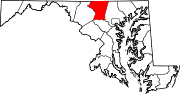
U.S. Highways Interstate Highways Roads in Frederick County, Maryland State highways 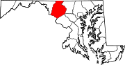
U.S. Highways Interstate Highways Categories:- State highways in Maryland
- Roads in Carroll, Maryland
- Roads in Frederick, Maryland


Wikimedia Foundation. 2010.