- Maryland Route 924
-
Maryland Route 924
Route information Maintained by MDSHA Length: 7.34 mi[1] (11.81 km) Major junctions South end:  MD 24 near Edgewood
 US 1 Bus. in Bel Air
North end:  US 1 / MD 24 in Bel Air
Location Counties: Harford Highway system Maryland highway system
Interstate • US • State • Minor • Former • Turnpikes←  MD 922
MD 925  →
→Maryland Route 924 (MD 924) is a state highway in the U.S. state of Maryland. The state highway runs 7.34 miles (11.81 km) from MD 24 near Edgewood to U.S. Route 1 (US 1) and MD 24 in Bel Air. MD 924 is the old alignment of MD 24 through the Bel Air area in central Harford County. The state highway was originally constructed in the late 1920s and early 1930s. MD 924 was assigned when MD 24 was moved to a new divided highway to the west in 1987.
Contents
Route description
MD 924 begins at an intersection with MD 24 (Vietnam Veterans Memorial Highway) near Edgewood. Tollgate Road forms the west leg of the intersection, which is being transformed into a diamond interchange. MD 924 heads northeast and then north as two-lane Emmorton Road. The state highway gains a center turn lane as it passes between several residential subdivisions and a few shopping centers around its intersection with Singer Road and Abingdon Road at Norris Corner. After passing St. Mary's Church, Old Emmorton Road splits to the east and MD 924 passes through the hamlet of Emmorton. The state highway gains a center turn lane at Wheel Road and continues north as a three-lane highway through suburban areas past its intersection with MacPhail Road, where the highway enters the town of Bel Air and its name changes to Main Street.[1][2]
MD 924 remains a three-lane street until the highway splits into a one-way pair at Linwood Avenue at the southern edge of downtown Bel Air. Northbound MD 924 continues on Main Street while the southbound direction follows Bond Street one block to the west. Within the Bel Air Courthouse Historic District, which contains the county courthouse and county offices at the center of the county seat, the one-way pair intersects another one-way pair, Fulford Avenue eastbound and Churchville Road westbound. Those streets head east from Main Street as MD 22 and west as US 1 Business, which joins MD 924 in a concurrency. Within the downtown area, MD 924 passes the Harford National Bank building, the Odd Fellows Lodge, the Graham-Crocker House, the Bel Air Armory, and the Hays House, now a museum and home of the Harford County Historical Society.[1][2]
The two directions of the one-way pair come together at Gordon Street on the north side of downtown. Gordon Street leads west to the historic home Liriodendron and east to the historic Proctor House. One block to the north, US 1 Business turns northeast onto Broadway. MD 924's name changes to Rock Spring Avenue at Maulsby Avenue. The state highway heads through the northern part of the town as a three-lane road with center turn lane to its northern terminus at a partial cloverleaf interchange with the Bel Air Bypass, which carries US 1. Southbound MD 24 follows the Bel Air Bypass around the northwest side of the town and then south to the other end of MD 924. The roadway continues as MD 24 north toward Forest Hill.[1][2]
History
Construction on what is now MD 924 got underway with the construction of a 1-mile (1.6 km) section of macadam road from Ring Factory Road south to Plumtree Road near Emmorton between 1925 and 1927.[3][4] Another macadam segment was completed from Emmorton south to Singer Road at Norris Corner in 1928.[5] A concrete highway from Norris Corner toward US 40 in Edgewood, as well as a macadam road along Rock Spring Avenue from Bel Air to the community of Frogtown, which is the location of the Bel Air Bypass, were started in 1929.[6] The first section of the road toward Edgewood, which includes the southernmost part of MD 924, was completed to approximately the location of I-95 in 1930. The road to Frogtown was also completed in 1930.[7] Two county highway gaps in the state highway from Edgewood to Bel Air—from Ring Factory Road to Bel Air and from Emmorton to Plumtree Road—were resurfaced with macadam and brought into the state system in 1933.[8][9] All of modern MD 924 was designated as a southern extension of MD 24 in 1938; MD 24 originally had its southern terminus in Forest Hill.[10]
When the Vietnam Veterans Memorial Highway was under construction in 1986, the old alignment of MD 24 was provisionally marked as a northern segment of MD 755, which is the designation for old MD 24 in Edgewood.[11] MD 924 was assigned to the old alignment of MD 24 between Edgewood and the Bel Air Bypass when MD 24 was moved to the Vietnam Veterans Memorial Highway in 1987.[12] In autumn 2008, the Maryland Transportation Authority began a project to build a diamond interchange at MD 24's junction with MD 924 and Tollgate Road just north of I-95. The interchange is expected to open in autumn 2011.[13]
Junction list
The entire route is in Harford County.
Location Mile
[1]Destinations Notes Edgewood 0.00  MD 24 (Vietnam Veterans Memorial Highway) to I-95 / Tollgate Road north – Bel Air, Aberdeen Proving Ground, Baltimore
Southern terminus; interchange under construction Bel Air 5.20 Bond Street South end of MD 924 one-way pair 5.45  MD 22 east (Fulford Avenue) – Churchville, Aberdeen
South end of concurrency with US 1 Business 5.51 US 1 Bus. south (Churchville Road) – BaltimoreWestern terminus of westbound direction of MD 22; Churchville Road heads west as unsigned MD 922E 5.95  MD 924 / US 1 Bus. south (Bond Street)
North end of MD 924 one-way pair 6.02 US 1 Bus. north (Broadway) / Broadway west – HickoryNorth end of concurrency with US 1 Business 7.34 US 1 (Bel Air Bypass) / MD 24 (Rock Spring Avenue) – Baltimore, Hickory, Forest HillNorthern terminus; partial cloverleaf interchange 1.000 mi = 1.609 km; 1.000 km = 0.621 mi References
- ^ a b c d e "Highway Location Reference: Harford County" (PDF). Maryland State Highway Administration. 2009. http://www.marylandroads.com/Location/2009_HARFORD.pdf. Retrieved 2011-02-27.
- ^ a b c Google, Inc. Google Maps – Maryland Route 924 (Map). Cartography by Google, Inc. http://maps.google.com/maps?f=d&source=s_d&saddr=Emmorton+Rd&daddr=Rock+Spring+Rd&hl=en&geocode=FdIuWgIdpYtz-w%3BFUqQWwIdErpy-w&mra=ls&sll=39.52033,-76.34099&sspn=0.030258,0.077162&ie=UTF8&t=h&z=12. Retrieved 2010-05-31.
- ^ Maryland Geological Survey. Map of Maryland: Showing State Road System and State Aid Roads (Map) (1927 ed.).
- ^ Report of the State Roads Commission of Maryland. 1924-1926. Baltimore: Maryland State Roads Commission. January 1927. pp. 44–45, 84. http://www.archive.org/details/annualreportsofs1924mary. Retrieved 2011-02-27.
- ^ Maryland Geological Survey. Map of Maryland: Showing State Road System and State Aid Roads (Map) (1928 ed.).
- ^ Report of the State Roads Commission of Maryland. 1927-1930. Baltimore: Maryland State Roads Commission. 1930-10-01. p. 214. http://www.archive.org/details/reportofstateroa1927mary. Retrieved 2011-02-27.
- ^ Maryland Geological Survey. Map of Maryland Showing State Road System: State Aid Roads and Improved County Road Connections (Map) (1930 ed.).
- ^ Maryland Geological Survey. Map of Maryland Showing State Road System: State Aid Roads and Improved County Road Connections (Map) (1933 ed.).
- ^ Report of the State Roads Commission of Maryland. 1931-1934. Baltimore: Maryland State Roads Commission. 1934-12-28. pp. 39, 338. http://www.archive.org/details/reportofstateroa1931mary. Retrieved 2011-02-27.
- ^ Maryland State Roads Commission. Map of Maryland Showing State Road System (Map) (1938 ed.).
- ^ "Traffic Volume Map" (PDF). Maryland State Highway Administration. 1986. http://www.marylandroads.com/Traffic_Volume_Maps/86_Traffic_Volume_Maps.pdf. Retrieved 2010-05-31.
- ^ "Traffic Volume Map" (PDF). Maryland State Highway Administration. 1987. http://www.marylandroads.com/Traffic_Volume_Maps/87_Traffic_Volume_Maps.pdf. Retrieved 2010-05-31.
- ^ "I-95/MD 24 Interchange Improvement Project". Maryland State Highway Administration. http://apps.roads.maryland.gov/WebProjectLifeCycle/ProjectInformation.asp?projectno=HA8882112. Retrieved 2011-02-26.
External links
Roads in Harford County, Maryland State highways 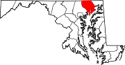
U.S. Highways Interstate Highways Categories:- State highways in Maryland
- Roads in Harford County, Maryland


Wikimedia Foundation. 2010.