- Whitchurch–Stouffville
-
Town of Whitchurch–Stouffville — Town — Main Street, Whitchurch–Stouffville

Flag
Coat of arms
LogoMotto: Country close to the city. Whichurch–Stouffville's location within York Region, Ontario.

 Town of Whitchurch–Stouffville
Coordinates: 43°58′00″N 79°15′00″W / 43.9666667°N 79.25°W Country Canada Province Ontario Regional municipality York Region Incorporated Township of Whitchurch 1792 Incorporated Village of Stouffville 1877 Amalgamation January 1, 1971 Government – Type Municipality – Mayor Wayne Emmerson – Councillors Ken Ferdinands
Phil Bannon
Clyde Smith
Susanne Hilton
Richard Bartley
Rob Hargrave– MPP Helena Jaczek – MP Paul Calandra Area[1] – Total 206.74 km2 (79.8 sq mi) Elevation 239 m (784 ft) Population (2006)[1] – Total 24,390 – Density 118/km2 (305.6/sq mi) – Ethnicity
(2006 census estimates)[citation needed]Ethnic groupsFrom Statistics Canada Time zone EST (UTC−5) – Summer (DST) EDT (UTC−4) Forward sortation area L0H (Gormley)
L4A (Stouffville, Vandorf)
L0G (Cedar Valley)Area code(s) 905 and 289 Highways Highway 48
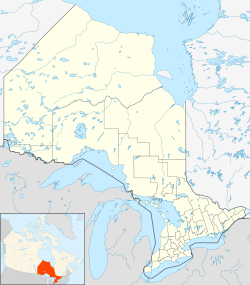
Highway 404Website www.townofws.com For other uses of "Whitchurch", see Whitchurch (disambiguation).Whitchurch–Stouffville (2006 population 24,390; June 2011 estimate 38,650[2]) is a municipality in the Greater Toronto Area of Ontario, Canada, approximately 14 kilometres north of the City of Toronto. It is 206.74 square kilometers in size, and located in the mid-eastern area of the Regional Municipality of York on the ecologically sensitive Oak Ridges Moraine. Its motto is "country close to the city".
The town of Whitchurch–Stouffville consists of several distinct communities and the intermediary countryside. The largest urban area is Stouffville proper, while other communities in the larger town include Ballantrae, Bethesda, Bloomington, Cedar Valley, Gormley, Lemonville, Lincolnville, Musselman Lake, Pine Orchard, Pleasantville, Preston Lake, Ringwood, Vandorf, Vivian, and Wesley Corners.[3] The town is bounded by Davis Drive (York Regional Road 31) in the north, York-Durham Line (York Regional Road 30) in the east, and Highway 404 in the west. The southern boundary conforms with a position approximately 200 metres north of 19th Avenue (York Regional Road 29), and is irregular due to the annexation of lands formerly part of Markham Township in 1971.[4]
Whitchurch–Stouffville is one of the fastest growing communities in Ontario. In June 2011, the official population estimate was 38,650,[5] which represents a 58% increase since 2006. The town projects a total population of 42,343 in 2013; 55,800 in 2021[6], and 62,321 in 2026.[7]
Future growth is governed provincially by the Oak Ridges Moraine Conservation Act (2001), the Greenbelt Act (2005) and the Places to Grow Act (2005).[8] The intent of these statutes is to prevent urban sprawl on environmentally sensitive land and to accommodate future growth in approved settlement areas only. Consequently Whitchurch–Stouffville's future growth is planned as "sustainable development," largely within the boundaries of urban Stouffville alone, which reflects the vision of “small town tradition between the country and the city.”[9]
Contents
History
The oldest human artifacts found in Whitchurch Township date back to 1500 BC and were found in the hamlet of Ringwood (now part of urban Stouffville).[10] Prior to the arrival of Europeans, two Native trails crossed through what is today Whitchurch–Stouffville. The Vandorf Trail ran from the source waters of the Rouge River to Newmarket, across the heights of the hamlet of Vandorf, and the Rouge Trail ran along the Rouge River and northwest from Musselman Lake; both were part of the aboriginal and Coureur des bois trail system leading through dense forests from Lake Ontario to Lake Simcoe.[11] The territory was the site of several Native villages, including Iroquois settlements around Preston Lake,[12] Vandorf,[13] and Musselman Lake.[14] In 2003, a large 16th century Huron village was discovered in Stouffville during land development; approximately 2000 people once inhabited the site (Mantle Site), which included a palisade and more than 70 longhouses, yielding tens of thousands of artifacts.[15] Other significant late precontact Huron village sites have been located to the south-east (the Draper Site on the Pickering Airport lands) and to the north-west of urban Stouffville (the Ratcliff or Baker Hill Site on Ontario Highway 48, and the Old Fort or Aurora Site on Kennedy Road).[16]
The western end of Whitchurch and Markham Townships was purchased by the British crown from the Mississaugas of the New Credit First Nation in 1787 as part of the Toronto Purchase. Whitchurch Township was created in 1792 as one of ten townships in York County. It was named in honour of the village of Whitchurch, Herefordshire in England, where Elizabeth Simcoe (wife of Upper Canada Lieutenant Governor Sir John Graves Simcoe), was born. The first European settlements in Whitchurch Township were established in the 1790s, though Whitchurch and large areas of southern Ontario were only ceded by the south-Central Ontario Mississaugas in 1923.[17] Between 1800 and 1802, John Stegman completed a survey of the township which created a system of land concessions. This allowed for the organized distribution of land to settlers, with each concession containing five, 200-acre (0.81 km2) lots. This layout remains visible today, as the road network in the area reflects the locations of the boundaries between concession blocks.[18]
Early settlers of this period included Quakers[19] and Mennonites--two pacifist groups from the nearby American states of Pennsylvania, Vermont and New York. Both groups were seeking religious freedom, and were identified by the Upper Canadian government as people with necessary skills and abilities for establishing viable communities that could, in turn, attract others to settle in the region.[20] Mercenary German Hessian soldiers, like Stegman, were also granted land in Upper Canada by Britain in exchange for their service in the American Revolution against the 13 Colonies.[20]
 Map, Village of Stouffville, 1880
Many of the first settlements in Whitchurch Township were developed at the intersections of main roads throughout the township and /or near streams where mills could built to process the timber cleared from the land.[21] Stoufferville was one such hamlet that grew around the saw and grist mills of Abraham Stouffer, a Mennonite who with his wife Elizabeth Reesor Stouffer came from Chambersburg, Pennsylvania in 1804, and acquired 600 acres (2.4 km2) of land.[22] Elizabeth's brother Peter Reesor established what is today Markham, first called Reesorville. Fifty-five more families from Pennsylvania, mostly Mennonite, arrived in Stoufferville in the next few years.[23] Stouffer's sawmill was in operation by 1817 on Duffin's Creek on the Whitchurch side of Main St., and by 1825 he had a gristmill across the street on the Markham Township side of Main St. as well.[24]
In the early 1830s, the old Stouffville Road was carved through largely virgin forest to connect York (Toronto) with Brock Township;[25] a post office was opened in 1832 and the name Stouffville was standardized.[26] In 1839, a new resident from England noted that Stouffville still had "no church (other than the Mennonite Meeting House in neighbouring Altona), baker, or butcher," though "saddlebag [Methodist circuit] preachers sometimes arrived and held meetings at the schoolhouse."[27] Nonetheless, Stouffville was considered a centre "of Radical opinion," one of the "hotbeds of revolution," and it was here that William Lyon Mackenzie set forth his plan for the Upper Canada Rebellion of 1837-38.[28]
The hamlet of Stouffville grew rapidly in the 1840s, and by 1849, it had "one physician and surgeon, two stores, two taverns, one blacksmith, one waggon maker, one oatmeal mill, one tailor, one shoemaker."[29] The population reached 350 in 1851, 600 in 1866, and 866 in 1881, with a diversity of Mennonite, Methodist, Presbyterian, Episcopal, Baptist and Congregational places of worship.[30] In 1869 Ballantrae had a populuation of 75, Bloomington 50, Gormley 80, Lemonville 75, and Ringwood 100.[31] In 1876, there was a regular stage coach connection from the hamlet of Stouffville to Ringwood, Ballantrae, Lemonville, Glasgow, Altona and Claremont.[32]
In 1877, Stouffville became an incorporated village.[33] Stouffville's growth was aided by the establishment of the Toronto and Nipissing Railway, built in 1871, which connected Stouffville and Uxbridge with Toronto. In 1877, a second track was built north to Jackson's Point on Lake Simcoe. These connections were created in large part to provide a reliable and efficient means of transporting timber harvested and milled in these regions.[34] Soon Stouffville Junction serviced thirty trains per day.[35] During this time of prosperity, Stouffville businessman R.J. Daley built a large music hall, roller-skating rink, and curling rink.[36] In 1911 Stouffville had a public library, two banks, two newspapers, as well as telephone and telegraph connections.[37]
Intensive forestry in Whitchurch Township led to large-scale deforestation, eroding the thinner soils of northern Whitchurch into sand deserts; by 1850 Whitchurch Township was only 35 percent wooded, and that was reduced to 7 percent by 1910.[38] The Lake Simcoe Junction Railway Line was consequently abandoned in 1927.[39] Reforestation efforts were begun locally, and with the passage of the Reforestation Act (1911), the process of reclaiming these areas began. Vivian Forest, a large conservation area in northern Whitchurch–Stouffville, was established in 1924 for this purpose. This development has helped to restore the water-holding capacity of the soil and to reduce the cycles of flash spring floods and summer drought. In 2008, the town had more than 62²km of protected forest;[40] the forest is considered one of the most successful restorations of a degraded landscape in North America.[41] Yet similar environmental consequences due to increased urbanization were projected in 2007 by the Toronto and Region Conservation Authority as probable for southern Whitchurch–Stouffville (headwaters of the Rouge River watershed) if targeted plantings in this area did not begin quickly.[42] Already in 1993, the Whitchurch Historical Committee warned a new generation of "Whitchurch-Stouffville residents" to be ever "vigilant to treat trees and forests with respect ... . In the 1990s care must be taken so that urbanization and concrete road-building do not repeat the destruction to our forest heritage."[43] And in 2009, a similar warning was made by the Lake Simcoe Conservation Authority about water quality: after a major assessment of the Musselman's Lake subwatershed, it recognized that the water quality was not only "impaired" and "degraded," but had declined since a previous assessment in 1989.[44]
 Historic Clock Tower and The Lebovic Centre for Arts & Entertainment: Nineteen on the Park
Though growth in the hamlets of Whitchurch–Stouffville was stagnant after the demise of the forest industry, the population began to grow again in the 1970s, with development in Metropolitan Toronto and the consequent arrival of new commuters. These developments led to a reexamination at the provincial level of municipal governance. On January 1, 1971, Whitchurch Township and the Village of Stouffville were merged to create the Town of Whitchurch–Stouffville; the combined population was 11,487 (see demographics below). In addition to the merger, the southern boundary of the town was moved four farm lots south of the original southern boundary of Main Street. This land was formerly a part of Markham Township, and now residents along the south side of Main Street were legally part of the same town as those on the north (the population of urban Stouffville was 5,036).[45]
Whitchurch–Stouffville adopted its coat of arms in 1973 (see information box right). The dove of peace, the original seal of Whitchurch Township, is at the crest, recalling the pacifist Quaker and Mennonite settlers who founded many of the town's communities, including Stouffville. The British Union banner of 1707 pays tribute to the United Empire Loyalists. The white church symbolizes Whitchurch, and the star and chalice come from the Stouffer family (Swiss) coat of arms.[46]
The growth of Toronto brought serious ecological problems to Whitchurch–Stouffville. Between 1962 and 1969, hundreds of thousands of litres per month of sulphuric acid, calcium hydroxide, and oil waste were poured into unlined Whitchurch–Stouffville dumps never designed as landfill sites and situated directly above the town's main aquifer. This was followed by years of solid waste from Toronto (1,100 tons per day in 1982). In the early 1980s, a group initially named "Concerned Mothers" found that the miscarriage rate in Whitchurch–Stouffville was 26% compared to the provincial average of 15%, and that the town had a high rate of cancer and birth defects.[47] Though the Ministry of Environment was satisfied that the wells tested in 1974 and 1981 had negligible levels of cancer causing agents (mutagens), the town opposed the expansion of the "York Sanitation Site #4". Only after much grass-roots advocacy at the provincial level was the site ordered to close on June 30, 1983.[48] In 1984 it was reported in the Legislative Assembly of Ontario that PCBs were found in well-water, and that 27,000 gallons of contaminated leachate per day were leaking from the site, threatening ground water quality.[49]
With new commuter rail service on the Stouffville Line in the 1990s, the drilling of two deep aquifer wells to secure safer water for a large, new development in the hamlet of Ballantrae[50] in 1996, and the controversial expansion of the York-Durham Sewage System Big Pipe with additional water capacity from Lake Ontario, Whitchurch–Stouffville began a major self-transformation.[51] Not unlike the late 19th century, responsible land and water stewardship, as well as the positive integration of many new residents annually into the community, define the challenges and opportunities for Whitchurch–Stouffville in the years to come.
The most significant challenge facing Whitchurch–Stouffville in the coming years, however, is the federal government's proposed development of an international airport immediately south-east of Whitchurch-Stouffville (the Pickering Airport lands). Under the current plan, approaches for two of the three landing strips would be directly above Whitchurch–Stouffville communities: the first over Ballantrae, Musselman's Lake and the north-east corner of urban Stouffville, with planes descending (or ascending) from 535 to 365 metres (with an allowable building height in Stouffville of 43 metres); the second over Gormley and the Dickson Hill area (near the Walmart and Smart Centre). The 2004 plan anticipates 11.9 million passengers per year (or 32,600 per day) by 2032.[52] Stouffville is the closest urban centre to the proposed airport and would be most directly impacted by noise levels and quality of life;[53] yet because planned roads to the airport are from the south only (Highway 407 and Highway 7), a direct economic benefit, however, would be minimal. The current runway configuration would also block the continuous flow of vehicular traffic south out of Stouffville on the York-Durham Line. In 1998, Whitchurch–Stouffville Council endorsed a resolution by the Town of Pickering requesting the Minister of Transportation not to declare the federal lands in Pickering as an airport site.[54] When public consultations were held in 2003, Whitchurch–Stouffville was one of the few directly affected municipalities that did not submit written representation to Transport Canada.[55] A "Needs Assessment Study" was completed by the Greater Toronto Airports Authority for the federal government in May 2010. After a "due diligence review," Transport Canada released the report in July 2011.[56]
Government
Municipal
Whitchurch–Stouffville is governed by a mayor and a city council of six councilors, with one councilor representing each of the six municipal wards. The Mayor of Whitchurch–Stouffville also sits on the York Regional Council. On October 25, 2010, Wayne Emmerson was re-elected mayor of Whitchurch–Stouffville.[57]
Two York Region District School Board trustees are elected to represent Whitchurch–Stouffville and East Gwillimbury (one English language and one French), as well as two trustees for the York Catholic District School Board (one English language and one French).[58] School board trustees are elected at the same time, and on the same ballot, as the mayor and city councilors.
In 2008, 94.4% of Whitchurch–Stouffville residents were either satisfied or very satisfied with the overall quality of life in the Town of Whitchurch–Stouffville. In a major community survey, close to 30% of the respondents described the town as fine, good, nice, great, or pleasant; more than half of the respondents like the community or small town feel, while 46.3% enjoyed the friendly neighbourhoods.[59] The most important municipal issues indicated by residents in 2008 were the need to improve the road system; traffic issues; increasing urbanization and overcrowding; land use development and sprawl; and the cost of living (including taxes and user fees) in the town.[60] Environmental protection, including environmental assessments for new development and natural preservation measures, was identified as matter of high importance by residents, but low on a scale of satisfaction. In the hamlet of Musselman's Lake, 72% of residents in 2009 were concerned about the environmental health of the lake and the surrounding community.[61] All municipalities in York Region except Whitchurch–Stouffville have an active Environmental Advisory Committee; the town of Whitchurch–Stouffville dismantled its committee after the municipal elections in 2006.[62]
Town Hall is a rented facility on 37 Sandiford Drive in Stouffville. A new building was purchased in 2010 at 111 Sandiford Dr., and the anticipated move-in date is August 3, 2011.[63]
Provincial
At the provincial level Whitchurch–Stouffville is in the Oak Ridges—Markham riding. Since 2007 this riding has been represented at the Legislative Assembly of Ontario by Helena Jaczek, a member of the governing Ontario Liberal Party.
Federal
At the federal level Whitchurch–Stouffville is in the Oak Ridges—Markham riding. Between 2001 and 2006, the number of voters in this riding increased by 52.8%--more than any other riding in Canada, and only slightly behind Brampton West for the worst representation by riding population in the country.[64] Since 2008, the Oak Ridges-Markham riding has been represented in the House of Commons of Canada by Paul Calandra, a member of the governing Conservative Party of Canada. In 2009, Calandra introduced Bill C-431, "An Act to change the name of the electoral district of Oak Ridges—Markham"; the proposed new name is Markham—Stouffville—Oak Ridges—King.[65]
Geography
Physical geography
The greatest portion of Whitchurch–Stouffville is lies on the Oak Ridges Moraine.[66] The moraine consists of knobby hills between 290 to 373 meters above sea level of irregularly bedded layers of unconsolidated sand and gravel (built-up glacial debris) deposited by the meltwater of the Wisconsin glacier some twenty-five thousand to ten thousand years ago.[67] In a few cases the retreating glacier left behind and buried huge blocks of ice which, when melted, created deep, water-filled depressions known as kettle lakes. Preston Lake, Van Nostrand Lake and Musselman Lake are three such examples.
The boundaries of Whitchurch–Stouffville contain a watershed divide. Streams and rivers at the top of the Oak Ridges Moraine flow northward into the Lake Simcoe basin, part of the Lake Huron watershed. The southern sections (south of Bloomington Road) make up the headwaters of the Rouge River, and flow into the Lake Ontario basin. These headwaters include many smaller streams and creeks throughout southern Whitchurch–Stouffville. Their identification and protection, plus reforestation in these area, has been identified as urgent for rebuilding water-capacity in the Rouge River watershed which can off-set the worst environmental impacts (e.g., flash flooding, erosion and ground water contamination) of rapid urbanization.[68] The heavily wooded Vivian Infiltration Area is an environmentally significant hydrological infiltration area that contributes groundwater to the Oak Ridges aquifer complex.
The northwestern corner of Whitchurch–Stouffville is outside the moraine and is part of the Schomberg Lake plain, an ancient lake-bed overlain by silts and fine sands. The soil formed over the former lake-bed is well-drained, arable farmland. The southern-most portion of Whitchurch–Stouffville west of Highway 48 lies below the moraine and is a clay-loam till plain.
Tree species native to Whitchurch–Stouffville include: American Mountain Ash, Balsam Fir, Bitternut Hickory, Black Cherry, Black Spruce, Bur Oak, Eastern Hemlock, Eastern White Cedar, Peachleaf Willow, Pin Cherry, Red Oak, Red Maple, Red Pine, Shagbark Hickory, Silver Maple, Sugar Maple, Tamarack, Trembling Aspen, White Birch, White Oak, White Pine and White Spruce.[69]
Climate
Whitchurch–Stouffville has a continental climate moderated by the Great Lakes and influenced by warm, moist air masses from the south, and cold, dry air from the north. The Oak Ridges Moraine affects levels of precipitation: as air masses arrive from Lake Ontario and reach the elevated ground surface of the moraine, they rise causing precipitation.[70]
Climate data for Stouffville Month Jan Feb Mar Apr May Jun Jul Aug Sep Oct Nov Dec Year Record high °C (°F) 11.0
(51.8)13.5
(56.3)23
(73)30.5
(86.9)32
(90)34
(93)35.5
(95.9)36.5
(97.7)32.8
(91.0)25.5
(77.9)22.8
(73.0)18
(64)36.5
(97.7)Average high °C (°F) −3.2
(26.2)−2.4
(27.7)3.1
(37.6)11.1
(52.0)18.5
(65.3)23.1
(73.6)26.2
(79.2)24.7
(76.5)19.9
(67.8)12.8
(55.0)6
(43)−0.6
(30.9)11.6 Average low °C (°F) −11.6
(11.1)−10.9
(12.4)−5.7
(21.7)1.2
(34.2)7.4
(45.3)11.8
(53.2)14.8
(58.6)14
(57)9.6
(49.3)3.5
(38.3)−1
(30.2)−7.7
(18.1)2.1 Record low °C (°F) −35.5
(−31.9)−28.3
(−18.9)−28
(−18)−17
(1)−3.3
(26.1)0
(32)7
(45)2.5
(36.5)−2
(28)−7.2
(19.0)−15
(5)−31.5
(−24.7)−35.5
(−31.9)Precipitation mm (inches) 52.8
(2.079)53.5
(2.106)62.8
(2.472)65.5
(2.579)81.2
(3.197)73.3
(2.886)75.8
(2.984)99.3
(3.909)79.2
(3.118)81.2
(3.197)78.5
(3.091)65.6
(2.583)868.6
(34.197)Source: Environment Canada[71] Because of increasing greenhouse gas emissions, the Ontario Ministry of Natural Resources estimates a 1-2 degree increase both in summer and winter average temperatures in the region between 2011 and 2040, and a 0% to 10% decrease in precipitation (compared to averages between 1970 and 2000).[72]
Air quality
Smog producing ground-level ozone is a problem affecting the entire Greater Toronto Area. A major pathway for airborne pollutants flows from the upper Midwest United States and the Ohio River Valley and across southern Ontario and Toronto; key sources are coal-burning power-plants and vehicle engines. On episode days (O3 > 82 ppb), Whitchurch–Stouffville reaches its peak about one to two hours later than Toronto.[73] Smog Advisory Alerts are issued by the Ministry of the Environment when smog conditions are expected to reach the poor category in Ontario. The Greater Toronto Area had 13 smog days in 2008, 29 in 2007, 11 in 2006, 48 in 2005.[74]
Demographics
Religion [75] Population 2001 Percent Total 21,835 Protestant 11,180 51.2% Roman Catholic 4,975 22.8% Christian (not specified) 725 3.3% Christian Orthodox 540 2.4% Jewish 165 0.75% Muslim 160 0.73% Other Religions (Hindu, Buddhist, Sikh, Eastern) 90 0.41% No religious affiliation 3,965 18.15% Visible Minority Population [76] Population 2006 Percent Total 1,775 7.2% Chinese 730 3.0% South Asians 395 1.6% Black 260 1.0% Filipino 85 0.35% Historical populations Year Pop. ±% 1851 350 — 1866 600 +71.4% 1881 866 +44.3% 1901 1,223 +41.2% 1911 1,034 −15.5% 1971 11,487 +1010.9% 1976 13,129 +14.3% 1981 13,882 +5.7% 1986 15,725 +13.3% 1991 19,036 +21.1% 1996 20,485 +7.6% 2001 22,859 +11.6% 2006 26,149 +14.4% 2009* 33,200 +27.0% Figures for 1851 to 1911 are for the Village of Stouffville alone. Beginning in 1971, figures are for the consolidated Town of Whitchurch-Stouffville. Sources: 1804-1866 (cf. "History" above); 1901;[77] 1911;[78] 1971-2006;[79] 2009 est.[80] Between 2006-2008 Stouffville's population grew 23%, second in the province only to Milton at 24.9%, and far exceeding the provincial average was 2.3%.[81]
In 2006 with a population of 24,390, 18% of residents were immigrants, 80% of whom came to Canada before 1991; the number of visible minorities grew from 4.53% in 2001 to 7.2% in 2006 (and is expected to triple again by 2031).[82] Already by 2010, 34% of the Grade Three children in one of the community's newest school were effectively bi-lingual (i.e., the first language learned at home was other than English).[83] In 2010 the proportion of Whitchurch–Stouffville residents that socialized with people from other cultures on a regular basis was far above the national average.[84]
 New construction in urban Stouffville, 2010 (Mantle Ave. and York-Durham Line, looking west to Greenbury Ct)
Of the population 15 years and over in 2006, 58.7% were legally married (and not separated); 26.5% were never married, 6% were divorced, 5.6% were widowed, and 3% were separated (but still legally married). 6% of the population over 15 lived in a common-law relationship. These figures are close to the provincial averages.[85]
As of 2006, Whitchurch–Stouffville's population has been aging faster compared to the larger population of the region or the province. The town anticipates that this trend will change slowly over the next twenty-five years due to an increase of new residents from a broad range of age groups. In 2006, 19.6% of the population (or 5,032 individuals) was children and youth aged five to eighteen; this is expected to decline to 16.4% (or 8,321 individuals) by 2031. Over this same period, the proportion of adults will increase by 115% (19,225 to 41,406 individuals), and the 0-4 age group will increase by 136%.[86]
Infrastructure
Transportation
Motor traffic is served primarily by Ontario provincial Highway 48, Highway 407, and Highway 404, which are in turn complemented by a network of regional roads that form a grid pattern across the town. In 1994, a plan to connect urban Stouffville directly to Highway 401 via the proposed East Metro Freeway was canceled in large part due to the concerns of residents and the work of the Rouge River activist groups.
Whitchurch–Stouffville is traversed by two railway lines: One is Canadian National Railway's primary freight corridor connecting Greater Toronto to Northern Ontario and Western Canada, which is being considered for future GO Transit train service with stations in the communities of Vandorf and Gormley (West).[87] The other railway line, formerly the Toronto and Nipissing Railway, is now owned by GO Transit and hosts Stouffville line passenger service to and from Toronto. This line includes two stations in Whitchurch–Stouffville: the Stouffville GO Station in urban Stouffville, and the line's terminus, Lincolnville GO Station, located to Stouffville's northeast. The York-Durham Heritage Railway also runs historical trains between the station and Uxbridge on summer weekends.[88]
York Region Transit (YRT) operates two routes within urban Stouffville, with connection to the Markham-Stouffville Hospital and other Markham routes.[89] GO Transit operates bus services in Stouffville, with buses traveling south into Markham and to Union Station, Toronto, as well as services north to the Town of Uxbridge.[90]
Despite excellent access to the GO Transit and York Region Transit systems, the two systems are not integrated. In 2006, only 4.0% of working Whitchurch–Stouffville residents used public transit to get to work (compare 12.9% for Ontario)--up slightly from 3.4% in 2001, and only 3.6% walked or bicycled to work (compare 6.8% for Ontario)--no percentage change from 2001.[91] Excellent public transportation options will become an increasingly urgent issue for Whitchurch–Stouffville as the town continues to grow with residents who commute daily to Toronto (see Economy below).
Health care
The Markham Stouffville Hospital is a multi-site hospital that serves the communities of Markham, Uxbridge, and Whitchurch–Stouffville. The hospital employs 275 physicians and 1,700 staff.[92] The main hospital site is in Markham, 10 minutes south of urban Stouffville on Ninth Line, and linked by public transportation from Stouffville. The hospital opened in 1990 and, though designed for municipal population of 110,000, was providing care for a population of 300,000 in 2010; plans are underway to double the size of the facility.[93] Residents in northern Whitchurch–Stouffville live in close proximity to the Southlake Regional Health Centre in neighbouring Newmarket.
The York-Durham Aphasia Centre is located in Stouffville's Parkview Village, and is a program of March of Dimes Canada.[94]
Policing
The Town of Whitchurch–Stouffville is policed by York Regional Police and is located within Number Five District. The Stouffville Community Policing Centre was opened in October 2000 and is located at the Stouffville Train Station.[95] In August 2010 York Regional Police reported to Whitchurch–Stouffville Town Council that the crime rate in the region was down 7% making it "one of Canada's safest communities."[96]
Amenities
Historic downtown Stouffville offers casual eateries, cafes, pubs, fine dining restaurants, and a variety of boutique stores.[97] Urban Stouffville also has a large-scale format, unenclosed shopping centre anchored by Walmart and Canadian Tire. Stouffville has no regular cinema, however Canadian and international films are shown on the second Wednesday of every month at The Lebovic Centre for Arts & Entertainment – Nineteen on the Park.
Outside of urban Stouffville, the town operates community centres in the hamlets of Ballantrae, Lemonville, and Vandorf.
Accommodations in Whitchurch–Stouffville include one hotel (Stouffville Inn), spa and retreat centres (Mysthaven Country Retreat & Spa; Shadow Lake Centre), and a number of bed & breakfasts (Linden-on-the-Lake; Musselman Lake B & B; Freckles Bed and Breakfast). Overnight tenting, recreational vehicle camping, and seasonal stay trailer camping are available at Cedar Beach Park on the shores of Musselman's Lake.
Education
The first schoolhouse in Stouffville was on Church St., just north of Main St., where the United Church building stands. In 1865, the schoolhouse was purchased by the Methodist congregation and moved across the street; the building still exists as a two-family dwelling.[98] Today Whitchurch–Stouffville is home to several public, Catholic, and private educational institutions.
The York Region District School Board has one public secondary institution in Whitchurch–Stouffville--Stouffville District Secondary School--and six public elementary institutions: Ballantrae Public School, Glad Park Public School, Summitview Public School, Whitchurch Highlands Public School, Harry Bowes Public School, and Oscar Peterson Public School. Another elementary school is planned for 2012.[99]
The York Catholic District School Board has two Catholic elementary institutions in Whitchurch–Stouffville: Saint Mark's Elementary (1965) and Saint Brigid Elementary. A third elementary school is planned for a location south of Main Street.[100] Catholic school students graduating from Grade Eight are either bused to Brother André Catholic High School in Markham, or transfer to the public system and attend Stouffville District Secondary School.
Stouffville also has four private schools: The Progressive Montessori Academy,[101] Stouffville Christian School,[102] Mindtech Montessori School,[103] and Willowgrove Primary School.[104] In 2009, there were 38 licensed child care centres registered in York, but none were located in Whitchurch–Stouffville; eight child care facilities in Whitchurch–Stouffville have subsidized spaces, and four do not.[105]
As the town continues to expand, new facilities are being constructed to accommodate the increasing number of school-aged children in the community.[106] In 2006, construction was begun on a new facility to replace the aging Stouffville District Secondary School. Located near the intersection of Weldon and Hoover Park Drive (part of a major suburban expansion project), the new high school accommodates approximately 1,500 students.
Not all programs have kept pace with the rapid change. The Education Quality and Accountability school reports for 2009 show 28% of the Grade Three students in one of Stouffville's newest schools first spoke a language other than English at home,[107] but for 2010-11 the school board planned to offer none of its 81 international language programs for elementary pupils in Whitchurch–Stouffville.
Both the proportion of youth participating in higher education, as well as the proportion of adults in Whitchurch–Stouffville who have completed a university program is growing annually and far exceeds the national average.[84] However there are no post-secondary education campuses located in Whitchurch–Stouffville. In 1877, the village of Stouffville established a Mechanics' Institute, which later became the Whitchurch-Stouffville Public Library. Emmanuel Bible College in Kitchener, Ontario had its beginnings in Stouffville in 1940.[108] In 1991 the town came close to securing an agreement with Seneca College to open a new campus in Stouffville.[109] In 2010, the Markham Stouffville Hospital (located in Markham) became a teaching site for residents practicing family medicine at the University of Toronto Faculty of Medicine.[110]
Media
The town is currently served by two local community newspapers: the Stouffville Free Press and the Stouffville Sun-Tribune. SNAP Stouffville/Uxbridge is a print publication which specializes in a photographic view of life in the community. Stouffville Connects is an online publication focussed on community contributed journalism.[111] A community radio station, WhiStle Radio (CIWS-FM) 102.7 FM, was launched in 2008.[112]
Economy
Stouffville's economy prior to 1900 flourished because of its position on juncture of the Markham-Uxbridge Road and the Town Line, and the coming of the railway in 1871.[113] In recent years the town of Whitchurch–Stouffville has increasingly become a bedroom community for commuters working in Toronto and its environs: in 2006, only 30% of the total employed labour force living in Whitchurch–Stouffville (4,025 of 13,100 people) worked locally or at home, compared to the Ontario average of 56.6%.[114]
Industries of employment, from the 2006 Census Industry People employed Agriculture and other resource-based industries 410 Construction 1,400 Manufacturing 1,385 Wholesale trade 890 Retail trade 1,165 Finance and real estate 1,215 Health and Social Services 895 Educational Services 965 Business services 2,950 Other services 2,295 The greatest proportion of employment in Whitchurch–Stouffville is concentrated in service-producing industries (72.7%), which includes personal services (27%) and retail trade. Golf-related employment accounts for the 34.9% of jobs within the personal services sector. 27.0% of local employment is in the goods-producing sector.[115]
The top private sector employers in Whitchurch–Stouffville are:[116]
- Teva Canada, pharmaceutical manufacturing: 300 employees[117]
- Southwire, cable manufacturing: 225 employees
- K-Line Group, electrical power generation: 120 employees
- Strategic Information Technology, software development: 115 employees
- Hanson, concrete pipe manufacturing: 105 employees
- Wal-Mart Supercentre
- Stock Transport
- Tam-Kal
- Parkview Home
- Ontario OSPA, 120 employees
Whitchurch–Stouffville is York Region's largest "mineral aggregate resource area;" these gravel sites and designated resource areas are located north and south of Bloomington Road, and all lie within the boundaries of the Oak Ridges Moraine.[118] Under the Oak Ridges Moraine Conservation Act (2001), future aggregate resource operations must meet stringent review and approval standards.[119]
In 2001, 20,406 acres (8,258 hectares) of land in Whitchurch–Stouffville was dedicated to farming; 45% of the farms were between 10 and 69 acres (280,000 m2) in size; 25% focused on "other animal production," (792 horses and ponies on 50 farms) and 24% in greenhouse, nursery and floriculture production. Gross farm receipts for 2000 were $27,182,691; gross forestry receipts (once the backbone of Whitchurch Township's wealth) were $59,098.[120]
Based on the 2006 Census data, the median household income of Whitchurch–Stouffville residents was $95,007, which is 37% higher than the Ontario median household income of $69,156. The unemployment rate in 2006 was 4.8%, well below the Ontario average of 6.8%[121]
New housing starts in Whitchurch–Stouffville jumped from 242 in 2005 to 1,159 in 2007.[122] In the first six months of 2009, Whitchurch–Stouffville's population grew by 4.6% (1,500 people), far out-pacing the York Region average of 1.3% change.[123] In 2010, the Town of Whitchurch–Stouffville planned for a more manageable and sustainable pace of 650 new housing starts,[124] though 967 building permits for new residential development were issued by the end of the year.[125] The Town is planning for 450 new housing starts in 2011.[126] In 2009, there were 3,527 residential units within the built boundaries of urban Stouffville; the city is planning to increase this number by 43% (or 1,500 units, including second suites) by 2031 to meet provincial intensification guidelines, with a total population of 67,289.[127]
The relative prosperity of the town has made it difficult for those with low income; a high proportion of recent immigrants experience housing affordability problems in certain census tracts in Whitchurch–Stouffville.[128] The ratio of owned dwellings to rented dwellings in Whitchurch–Stouffville is almost 6 to 1, whereas for Ontario as a whole it is 2.5 to 1. Between 1994 and 2009, 84% of the new residential units in Whitchurch–Stouffville were low-density dwellings.[129] In 2006, the median monthly payments for rented dwellings in Whitchurch–Stouffville was $924.00, or 15% higher than the Ontario median; the average value of homes in Whitchurch-Stoufville was 66% higher than the provincial average in 2006, and 52.6% higher than in 2001.[130] Soaring housing costs in the region have resulted in a 28% rise in Food Bank use between January 2008 and January 2010.[131] The Community and Health Services Department of York Region has no resources in Stouffville for the homeless; there are two group homes in Whitchurch–Stouffville, as well as 51 units of public social housing and 124 not-for-profit units for the elderly (including a long-term care facility).[132] In 2006, 4% of residents were in a low-income bracket, compared to the provincial average of 11%. Social services in Whitchurch–Stouffville include the Whitchurch–Stouffville Food Bank, located at the Churchill Community Church (Baptist) between the communities of Musselman Lake and Ballantrae[133] and the Care and Share Thrift Store (Mennonite Central Committee) located on Main Street in urban Stouffville on the original settlement site of Abraham Stouffer. The YMCA also operates an employment resource centre in Stouffville.
Whitchurch–Stouffville is also home to internationally respected, church-based non-governmental service organizations: Emmanuel International Canada, EMAS Canada and Christian Blind Mission - Canada (CBM), all located on Stouffville Road near Kennedy Avenue.[134]
Sports
History and facilities
The first organized sport in Stouffville was curling in 1890 on the Mill Pond (today site of the Latcham Art Gallery and the Mennonite Care and Share Thrift Store). Lacrosse was also played at this time, and in 1897, Stouffville won the Ontario championships. The first hockey team was organized about 1900, and at the turn of the century the Stouffville rink below Burkholder Street was considered "the largest and best arranged rink in Canada."[135] Lawnbowling has also been played in Stouffville since the early 1900s as well as organized men's and women's baseball.[136]
The most important recreational facilities in Whitchurch–Stouffville are the Stouffville Clippers Sports Complex, with two NHL size ice pads (completed 2010); the Stouffville Arena, with two ice pads; the Lebovic Leisure Centre, with a 25 meter pool, hot tub, gym and fitness centre, and Bethesda Park, with two ball diamonds, a senior soccer pitch and four mini sports fields (completed 2010).[137] In 2008, 47% of residents noted that had they used the town's Department of Leisure Services in the past twelve month period with a high rate of satisfaction.[138] A 2010 survey of residents identified the need for accommodations for desired activities like curling, indoor soccer, racquetball, squash, and indoor tennis.[139]
Whitchurch–Stouffville's residents are increasingly concerned about the connection between health and the recreational options available in the town. A 2008 survey on Parks, Recreation and Culture services indicated a large gap between the level of importance of walking/bike trails and children/youth recreation programs to residents on the one side, and their level of satisfaction with these services on the other.[140] Whitchurch–Stouffville's children have become increasingly inactive: for senior Kindergarten children in those areas of Whitchurch–Stouffville experiencing the most growth, the average score in "physical health and wellbeing" decreased 8.1% between 2003 and 2006 (in comparison, York Region's average was a drop of 3.5%).[141]
Hockey and skating
Whitchurch–Stouffville is home to the Stouffville Spirit Junior "A" ice hockey team.[142] The Stouffville Amateur Hockey League (men's and women's leagues), the Stouffville-Markham Girls Hockey Association, Whitchurch–Stouffville Minor Hockey Association, the Whitchurch–Stouffville Skating Club, and the Stouffville Adult Skating Club offer programs in the town's arenas.[143]
Recreational trails
 "Blue Angel" sculpture, Stouffville Creek Trail, Stouffville, Ontario
1,142 hectares of the twenty York Regional Forest tracts (or slightly more than half of the total) are found within the borders of Whitchurch–Stouffville.[144]
The Whitchurch Conservation Area covers ten hectares, and is accessed on Aurora Sideroad, three kilometers east of Woodbine Ave.[145] It is connected to a larger York Region Forest Tract and to trails of the Oak Ridges Trail Association.
The Pangman Springs Conservation Area[146] is accessed from Kennedy Road between Davis Drive and Aurora Road or from the Porritt tract of the York Region Forest using an Oak Ridges Trail Association side trail.
Bruce's Mill Conservation Area in Whitchurch–Stouffville is the northern gateway to Rouge Park. The Master Plan for the conservation area includes not only a trail system within the park, but also future trail connections to inter-regional trails.[147]
An extensive trail system within urban Stouffville is being developed that connects to the larger forested areas of the Whitchurch–Stouffville. The most significant trail begins in town along the Stouffville Creek and leads through a mature forest around the Stouffville Reservoir.[148]
In 2011, Whitchurch-Stouffville had 0.8 kilometers of trails per 1000 residents, an increase from 0.3 kilometers in 2006.[149]
Golf
Whitchurch–Stouffville is home to many golf courses, including Emerald Hills, Rolling Hills, Spring Lakes, Maples of Ballantrae, Ballantrae Golf & Country Club, St. Andrews East Golf & Country Club, Timber Creek Mini Golf & Family Fun Centre, Sleepy Hollow, Meadowbrook and Station Creek.
Soccer
The Whitchurch–Stouffville Soccer Club was established in 1977 and had 1,250 members in 2010.[150] The club uses fields at Bethesda Park, the Stouffville Arena, Bruce's Mill Conservation Area, and fields owned by Teva Canada.
Baseball
The Whitchurch–Stouffville Softball Association is a volunteer run house-league organization. The association uses eleven ball diamonds in town plus five in the neighbouring villages of Goodwood and Claremont.[151]
Outdoor water recreation
Whitchurch–Stouffville is home to a number of kettle lakes, which are ideal for outdoor water recreation.
Musselman's Lake provides public access for swimming, boating and fishing through Cedar Beach Trailer Park.[152] Public access to Preston Lake was lost in the 1990s, when Landford Development purchased the west-shore beach and trailer park and built a subdivision of estate properties with a shared private beach. The town failed to secure a public access point. Though this glacier-formed kettle lake is crown property and regulated by all levels of government, it is encompassed by private property and access is restricted to circa seven hundred residents with private/deeded access rights.[153] In 2008 the town's development plans included a trail system with access to the lake, but this was met with opposition from Preston Lake residents who desired to protect their exclusive access. Interest and support for the purchase or expropriation of land for public access to the town's natural lakes has grown with the town's development.[154]
The Town of Whitchurch–Stouffville operated an outdoor public swimming pool until 2010.
Arts and culture
In 2006, the town of Whitchurch–Stouffville developed and adopted Municipal Cultural Policy as a framework for planning and delivering cultural services.[155] Whitchurch–Stouffville's investment in the arts has been slow, and consequently residents have not only fallen below the national average on exposure to the performing arts, museums and galleries, but the average exposure has decreased from 2006 to 2010.[84]
Arts and entertainment centre
Whitchurch–Stouffville's deficit in the performing arts has been addressed in part by the recent rehabilitation of the former Stouffville Town Hall (constructed in 1896), creating a multifaceted arts, culture and entertainment centre in downtown Stouffville; The Lebovic Centre for Arts & Entertainment – Nineteen on the Park opened its doors to the public in May 2009.[156]
Art gallery
The Latcham Gallery is a community art gallery established in 1979, by a group of local artists and visionaries who saw the need for an arts facility in Whitchurch–Stouffville. The gallery was named after Arthur Latcham, a local philanthropist who donated money for the gallery building on 6240 Main Street. Its exhibitions feature traditional and contemporary work by local and provincial artists. The gallery is a member of the Ontario Association of Art Galleries and its operations are supported by the Town of Whitchurch–Stouffville.[157]
Since 2000, artists in Whitchurch–Stouffville have organized a Fall Stouffville Studio Tour, featuring more than two dozen artists in eighteen venues across Whitchurch–Stouffville. In 2008, the Tour was nominated for “The Premier’s award for excellence in art.”[158]
There is also an annual exhibition held in the winter by the grade 12 art class of Stouffville District Secondary School
Library
 Whitchurch-Stouffville Public Library, Lebovic Leisure Centre, 2010
The Whitchurch-Stouffville Public Library is located in the Lebovic Leisure Centre (constructed in 2001), a facility occupied jointly by the department of Leisure Services and the library. Circulation of materials increased 14.4% from 2007 to 2008; 54% of the town's residents had a library membership in 2008.[159] While the total membership and circulation has increased with the population growth, the town's library expenditures have not kept pace. Expenditures for books and periodicals dropped 25% between 2003 and 2005; the total budget dropped from 5.1% of town operating expenses in 2004 to 3.0% in 2007, and to 2% in the 2011 budget. In 2010, Stouffville was ranked last of eleven Ontario towns in its population category for per capita library spending.[160] In the same year, the Maclean's "Third Annual Smart Cities Rankings" showed that for residents in Whitchurch–Stouffville, "exposure to reading" had declined annually from 2006 to 2010, and fell significantly below the national average.[161] In June 2011 local book clubs and individuals began a grass-roots campaign to petition for greater municipal funding for the public library.[162]
Festivals and fairs
The Stouffville Strawberry Festival is a traditional community fair on the Canada Day weekend, which celebrates Stouffville's agricultural heritage.[163]
 Stouffville Strawberry Festival, 2011
The Markham Fair is hosted by the Markham and East York Agricultural Society, and supported by both the City of Markham and the Town of Whitchurch–Stouffville (Stouffville south of Main Street was part of Markham Township prior to 1971). The Markham Fair dates back to 1844 and is one of Canada's oldest and largest fairs, hosting upwards of 80,000 visitors. The fair is held on the weekend before Thanksgiving. It is held at the Markham fairgrounds, directly south of the Stouffville town border.[164]
Bruce's Mill Conservation Area hosts an annual Sugarbush Maple Syrup Festival over four weeks in March and April.[165]
Over the Family Day weekend in February, the Musselman Lake community hosts an annual Winter Carnival at Cedar Beach.
York Region's Spring Forest Festival is held annually during Earth Week (April) in the York Regional Forest, Eldred King Tract, Highway 48 (just south of Vivian Road).
The annual Wine and Food Festival (June) is organized by the Ballantrae Golf and Country Club.
Museum
The Whitchurch–Stouffville Museum was established in 1971 and is located in the historic hamlet of Vandorf. The museum site covers about 2 acres (8,100 m2) and includes five historic structures from the former Township of Whitchurch: the Bogarttown Schoolhouse (1857), a pioneer log cabin (c. 1850),the Brown House (1857), a barn (c. 1830) and Vandorf Public School (1870).[166] The museum also hosts an Annual Antique & Classic Car Show in August. Museum attendance has dropped in recent years from a high of 6,278 visitors in 2004 to 5,383 in 2008.[167] A new Visitor and Community Centre at the museum was completed in 2011.
The Christian K. Hoover House, a Pennsylvania Mennonite family home built in 1824 at the corner of McCowan and Stouffville Roads (then part of Markham Township), is a featured building at the Markham Museum in Markham.
Film and TV
Movies partially shot on location in the community of Stouffville include: The Russell Girl (2008), Stir of Echoes: The Homecoming (2007), Who Killed Atlanta's Children? (2000), On Hostile Ground (2000), Strike! (1998), The Sweet Hereafter (1997), Bad Day on the Block (1997), Martin's Day (1984), and The Dead Zone (1983). Television shows shot in Stouffville include episodes from Warehouse 13 (2010), The West Wing,[168] Degrassi: The Next Generation and Nikita.[169]
Films and television shows shot at Shadow Lake Centre in Whitchurch–Stouffville (Musselman Lake) include 1-8oo-Missing, Tarzan & Jane, The Crossing, Run the Wild Fields, Ice Men, Top Cops, The Loretta Claiborne Story, True Romance, Ready or Not, and The White Dog Sacrifice.[170]
Attractions
- Applewood Farm Winery[1]
- Bruce's Mill Conservation Area,[2] the northern gateway to Rouge Park with trails, and Community Safety Village.[3]
- Burd's Family Fishing[4]
- Downtown Stouffville Farmers' Market[5] (Thursdays, June–October)
- Latcham Gallery[6]
- Lionel's Farm[7] (Petting zoo, pony farm, horse centre and wagon collection)
- Magic Hill Farms[8]
- Oak Ridges Trail and York Demonstration Forest
- RHLS Narrow Gauge Railway[9]
- Ringwood Fish Culture Station[10]
- Stouffville Country Market[11] (flea market; Saturdays)
- Timber Creek Mini Golf & Family Fun Centre[12]
- Whitchurch–Stouffville Museum[13]
- Willow Springs Winery[14]
- York-Durham Heritage Railway[15]
Notable residents
- Acton, Keith - National Hockey League player and Stanley Cup winner, current owner of the local Boston Pizza franchise
- Bessey, James - Canadian watercolour artist[171]
- Bowser, John W. - Construction Superintendent of the Empire State Building and Royal Ontario Museum.
- Brock, Nathan - Assistant Conductor of the Montreal Symphony Orchestra[172]
- Brown, Roy - Royal Air Force officer and World War I flying ace, credited with downing the Red Baron (Manfred von Richthofen)
- Cockburn, Karen - Canadian Olympic medalist (trampoline gymnast)
- Cook, Earl D. - Major League Baseball Player (Detroit Tigers)
- Del Zotto, Michael - National Hockey League player
- Harris, Mike - Canadian Olympic medalist (curler)
- Hassard, Bob - National Hockey League player and Stanley Cup winner
- MacMillan, Harvey Reginald (H.R.) - forester, forestry industrialist, wartime administrator, and philanthropist
- May, Brad - National Hockey League player
- Parsons, Jason - Member of Canadian band Ubiquitous Synergy Seeker
- Pearce, John - Canadian Olympic equestrian show jumper[173]
- Pierson, Sean - Canadian professional mixed martial arts fighter
- Powe, B. W - Canadian author
- Underhill, Frank - Founder of the Co-operative Commonwealth Federation (CCF) Party; co-writer of the Regina Manifesto (1933) and Officer of the Order of Canada.
- Veltman, Jim - National Lacrosse League Hall of Fame player
Sister city
See also
- List of Whitchurch-Stouffville Churches
- List of Mayors of Whitchurch-Stouffville, Ontario
References
- ^ a b "Community highlights for Whitchurch-Stouffville". Statistics Canada. 2007-03-13. http://www12.statcan.ca/english/census06/data/profiles/community/Details/Page.cfm?Lang=E&Geo1=CSD&Code1=3519044&Geo2=PR&Code2=35&Data=Count&SearchText=stouffville&SearchType=Begins&SearchPR=01&B1=All&Custom=. Retrieved 2007-03-13.
- ^ Town of Whitchurch-Stouffville, Council in Committee Report: Growth Management Status, Feb. 15, 2011.
- ^ Cf. Boundary Map, Town of Whitchurch-Stouffville, official website. For a detailed history of these unique communities, see Jean Barkey et al., Whitchurch Township (Erin, ON: Boston Mills, 1993).
- ^ A Brief History of Whitchurch-Stouffville (Part 5), Town of Whitchurch-Stouffville (official website).
- ^ Town of Whitchurch-Stouffville, Council in Committee Report: Growth Management Status, Feb. 15, 2011; cf. also the town's Annual Report 2009, 2.
- ^ Town of Whitchurch-Stouffville, "Council in Committee Report: Growth Management Status: Community of Stouffville 2010 Year End Assessment," 3.3 (February 15, 2011).
- ^ Town of Whitchurch-Stouffville, Progress and Results: Population Growth; Community of Whitchurch-Stouffville Secondary Plan. Phase 2 Development Lands - Background and Options Report, Draft (Sept 2009). In 2006, the Whitchurch-Stouffville hamlet of Ballantrae was identified by Statistics Canada as the fastest growing area in all of Canada.("Population and Dwelling Counts of Urban Areas 2006, listed according to the amount of growth". Statistics Canada. March 2007. http://www12.statcan.ca/english/census06/data/popdwell/Table.cfm?T=801&PR=0&SR=1&S=5&O=D. Retrieved 2008-02-17.).
- ^ Ontario Ministry of Municipal Affairs and Housing, Oa Ridges Morain Conservation Plan; Greenbelt Protection; Ontario Ministry of Energy and Infrastructure, Places to Grow Act, 2005.
- ^ Town of Whitchurch-Stouffville, Residential Intensification Strategy: Background Analysis Report (October 2009); Community of Stouffville Residential Intensification Study; Draft: Sustainable Development Guidelines (November 2009); also York Region Official Plan, Map: Environmentally Significant Areas and Life Science Areas of Natural and Scientific Interest (December 2009).
- ^ Barkey et al., Whitchurch Township, 118f.; for a very descriptive account of ancient native burial grounds in Whitchurch Township written in 188, cf. C. Mulvany et al., History of Toronto and County of York, Ontario (Toronto: C. Blackett Robinson, 1885), 148-151.
- ^ Barkey et al., Whitchurch Township, ch. 1, pp. 9ff., 18. Cf. also C.P. Mulvany, et al., Whitchurch, History of Toronto and County of York, Ontario (Toronto: C.B. Robinson, 1885), 148ff.; cf. 1718 map by [Guillaume de L'Isle], Carte de la Louisiane et du cours du Mississipi, with trail from Lake Ontario to Lake Simcoe clearly indicated.
- ^ Cf. A Brief History of Preston LakePride and Preston Lake website).
- ^ Barkey et al., Whitchurch Township, 124f.
- ^ The Community of Musselman's Lake: A Little History, Musselman's Lake Residents Association (MLRA) official website.
- ^ Archeological Services, Inc., Mantle Site; Toronto Museum Project, Dunsmere Pipe; also Minutes, Town of Whitchurch-Stouffville Council, Huron Ancestral Village Resolution (C10-C0 & R00), June 17, 2007.
- ^ Cf. also Totten Sims Hubicki Associates, Stage 1 Archaeological Assessment (AA) of: Four Proposed Operations Centres, Part of Lots 64 and 65, Concessions 7 and 8, Town of Whitchurch-Stouffville, Regional Municipality of York, Ontario, Sept. 2007.
- ^ Indian and Northern Affairs Canada, The Williams Treaties, 1923.
- ^ Cf. Barkey et al., Whitchurch Township, 14.
- ^ Wm. H. Smith, Whitchurch, Canadian Gazatteer (Toronto: Roswell, 1849), 212.
- ^ a b Barkey et al., Whitchurch Township, 14.
- ^ See Barkey, et al., Whitchurch Township, 19f.
- ^ History of Toronto and County of York, Ontario, vol. 2 (1885), 462.
- ^ For a detailed account, see Jean Barkey, Stouffville, 1877-1977: A Pictorial History of a Prosperous Ontario Community (Stouffville, ON: Stouffville Historical Committee, 1977), 2ff.
- ^ (Whitchurch Township, 34; also Isabel Champion, ed., Markham: 1793-1900 (Markham, ON: Markham Historical Society, 1979), 289-296. For a detailed description of pioneer life, cf. L. Henry and G.C. Paterson, Pioneer Days in Ontario (Toronto: Ryerson, 1938).
- ^ Barkey et al., Whitchurch Township, 18.
- ^ A Brief History of Whitchurch-Stouffville (Part 2), Town of Whitchurch-Stouffville (official website); see also History Geography Whitchurch-Stouffville, Virtual Walk Stouffville.
- ^ Barkey et al., Whitchurch Township, 96.
- ^ [C. Fothergill, ed., Mackenzie's Own Narrative of the Late Rebellion (Ottawa: Golden Dog, 1980), 5; J.C. Dent, The Story of the Upper Canada Rebellion, vol. 2 (Toronto: 1885), 218; D.B. Read, The Canadian rebellion of 1837 (Toronto, 1896), 293.
- ^ Stouffville, Canadian Gazatteer (Toronto: Roswell, 1849), 177.
- ^ Cf. Barkey et al., Appendix A: Churches, Whitchurch-Township, 126ff. Also C.P. Mulvany, et al., Stouffville, History of Toronto and County of York, Ontario (Toronto: C.B. Robinson, 1885), 202. Mulvany (p. 152) notes that Whitchurch Township, without the Village of Stouffville, had a population of 4,529 in 1881. Cf. also The Ecclesiastical Gazette, (London, 1869), 318;The Congregational Quarterly, Vol. 11 (1869):140; A Historical and Statistical Report of the Presbyterian Church of Canada (Montreal, 1866), 36; Altona Mennonite Meetinghouse (Stouffville), Global Anabaptist Mennonite Encyclopedia Online; see esp. Barkey, Stouffville, 1877-1977, 138–151, 7.
- ^ McEvoy, The Province of Ontario Gazetteer and Directory, 1869.
- ^ J. A. Crawford, Gazetteer and Directory of the County of Ontario, for the year 1876 (Uxbridge, ON: 1876), 14.
- ^ Cf. the detailed 1878 maps, Township of Markham; Township of Whitchurch, Illustrated historical atlas of the county of York and the township of West Gwillimbury & town of Bradford in the county of Simcoe, Ont. (Toronto : Miles & Co., 1878); also Stouffville Map (1880).
- ^ A Brief History of Whitchurch-Stouffville (Part 3), Town of Whitchurch-Stouffville (official website).
- ^ Barkey, Stouffville, 1877-1977, 19.
- ^ History of Toronto and County of York, Ontario, vol. 2 (1885), 453.
- ^ <Province of Ontario Gazetteer and Directory: Stouffville (Ingersoll, ON, 1911), 995.
- ^ Cf. Barkey et al., Whitchurch Township, 18-19, 21; 28f.
- ^ Barkey et al., Whitchurch Township, 92.
- ^ Town of Whitchurch-Stouffville, Annual Report 2008, 6.
- ^ York Regional Forest, York Region official website.
- ^ Toronto and Area Conservation Authority, Rouge River Watershed Plan (2007), 64, 78.
- ^ Barkey et al., Whitchurch Township, 33; see also 30f.
- ^ Cf. Lake Simcoe Conservation Authority and the Town of Whitchurch-Stouffville, Musselman's Lake Subwatershed Assessment and Stewardship Opportunities Report (March 31, 2009), 115-117.
- ^ Barkey et al., Whitchurch Township, 99; also A Brief History of Whitchurch-Stouffville (Part 5), Town of Whitchurch–Stouffville (official website).
- ^ Cf. Barkey et al., Whitchurch Township, 99.
- ^ New Scientist, Birth Defects Mystery (July 18, 1981), 137; The Sorry Saga of Stouffville's Polluted Water (Mar 18, 1982), 700; Legislative Assembly of Ontario, Proceedings, April 6, 1982; H. Rosenberg, The Kitchen and the Multinational Corporation: An analysis of the links between the household and global corporations, Journal of Business Ethics 6 (1987), 179f.; Globe and Mail (May 12, 1982).
- ^ Cf. Legislative Assembly of Ontario, Proceedings, (April 6, 1982); Proceedings (January 18, 1983). The garbage disposal company made a substantial donation to the governing Progressive Conservative party in 1974 as it was seeking disposal permits (cf. John Swaigan, How to Fight for What's Right (James Lorimer & Company, 1981), 8f.).
- ^ Cf. Ministry of the Environment, Whitchurch-Stouffville Mutagenicity Study: Final Report (1982), 46-47; also the Legislative Assembly of Ontario, Proceedings: Stouffville Dump (June 18, 1984).
- ^ Warren Smith, Ballantrae Golf and Country Club - Not always thus .... Between 2001 and 2006, Ballantrae's population mushroomed from a population 295 to 1,278 people (Statistics Canada, Population and dwelling counts, for urban areas, 2006 and 2001).
- ^ York Region, Water and Wastewater Masterplan (November 2009); Amendment 6 to the Official Plan for the Regional Municipality of York (1998).
- ^ Cf. Transport Canada, Plan Showing Pickering Airport Site; also Greater Toronto Airports Authority, Pickering Airport Draft Plan Report, 6.3. By comparison, Toronto Pearson International Airport had 32.3 million passengers in 2008, with an average of 1,179 "aircraft movements" per day (GTTA, Toronto Pearson Fast Facts.
- ^ New (Phase 2) residential developments in south-east Stouffville will be as close to the planned runways as to town hall; see GTTA, Pickering Airport Draft Plan Report, Fig. 5-1.
- ^ Town of Whitchurch-Stouffville, Special Council Minutes, December 22, 1998.
- ^ Transport Canada, Pickering Airport Site Zoning Regulations: Regulatory Impact Analysis Statement - Consultation, September 30, 2004.
- ^ Transport Canada, News Release: "Transport Canada releases findings of the 2010 Pickering Lands Needs Assessment Study," July 11, 2011; see also S. Bolan, "Stouffville politicians mixed over airport plan," Stouffville Sun-Tribune, July 13, 2011.
- ^ S. Bolan, Emmerson Proud of Hardest Win Ever, Stouffville Sun-Tribune, Oct. 25, 2010.
- ^ Government & School Representatives, Town of Whitchurch-Stouffville official website.
- ^ DPRA Canada, Town of Whitchurch-Stouffville Community Satisfaction Survey (May 27, 2008), 7f.
- ^ DPRA Canada, Town of Whitchurch-Stouffville Community Satisfaction Survey (May 27, 2008), 8.
- ^ Lake Simcoe Region Conservation Authority/ Town of Whitchurch-Stouffville, Musselman's Lake Subwatershed: Assessment and Stewardship Opportunities Report (2009), 115-117.
- ^ Derek Sawyer, Letter to the Editor, Environment committee could have been council's tree-cutting watch dog, Stouffville Sun-Tribune (August 29, 2007); cf. the complete list of 2010 committees, Town of Whitchurch-Stouffville, Committees and Appointees, official website.
- ^ S. Bolan, "Customer King at New Stouffville Town Hall," Stouffville Sun-Tribune, June 16, 2011.
- ^ Census Canada, Population and dwelling counts, for Canada and federal electoral districts, 2006.
- ^ 40th Parliament, 2nd Session, Friday, June 19, 2009.
- ^ Ontario Ministry of Municipal Affairs and Housing, Land Use Planning: The Oak Ridges Moraine (Map).
- ^ For the following, see Barkey, et al., Whitchurch Township, ch. 6.
- ^ Cf. Toronto and Region Conservation Authority, Rouge River Watershed Plan Report (2007).
- ^ For more detail, see Ontario Ministry of Natural Resources, Ontario Tree Atlas: Ecodistrict 6E-7.
- ^ Cf. Toronto and Region Conservation Authority, Rouge River Watershed Plan Report (2007), 15.
- ^ Environment Canada—Canadian Climate Normals 1971–2000, accessed 26 May 2010
- ^ Ontario Ministry of Natural Resources, Climate Change in Ontario: Interactive Map.
- ^ Secretariat of the Commission for Environmental Cooperation, Long-Range Transport of Ground-Level Ozone and Its Precursors (Montreal, 1997), 20; eight-hour exposure to ozone concentrations of 85 to 104 ppb are described as "unhealthy" for sensitive groups.
- ^ Jasmeet Sidhu, GTA gets year's first smog advisory, Toronto Star, May 21, 2009.
- ^ Statistics Canada, 2001 Census Community Profile for Stouffville; the 2006 Census does not provide data on religion for Whitchurch-Stouffville. Cf. also List of Whitchurch-Stouffville Churches.
- ^ Statistics Canada, 2006 Census Community Profile for Stouffville.
- ^ Census 1901: Stouffville, schedule 1;
- ^ Library and Archives Canada, Census 1911: Stouffville, 21
- ^ York Region Population Growth 1971 to 2006: Whitchurch-Stouffville
- ^ Town of Whitchurch-Stouffville Overview.
- ^ Cf. BMA Management Consulting, Municipal Study 2008, 9; the most detailed demographic study of Whitchurch-Stouffville is provided by Watson & Associates Economists Ltd.'s Demographic and Economic Profile and Growth Analysis, in Town of Whitchurch-Stouffville, Community of Stouffville Phase Two Development Lands, (September 2009), Appendix D.
- ^ Statistics Canada, Highlights for Whitchurch-Stouffville, 1991 & 1996; 2001 Community Highlights for Whitchurch-Stouffville; Community Profiles: Stouffville; also S. Bolan, Stouffville residents sound off on leisure, Stouffville Sun-Tribune (online), May 26, 2010.
- ^ Education Quality and Accountability Office, Oscar Peterson Public School, September 2010.
- ^ a b c Canadian Council on Learning, Composite Learning Index 2010 Profile: Whitchurch-Stouffville, Macleans May 31, 2010.
- ^ Statistics Canada, Community Profiles: Stouffville
- ^ Town of Whitchurch-Stouffville, Community of Stouffville Phase Two Development Lands (September 2009), 12.
- ^ Cf. GO Transit Richmond Hill Line Notification Letters, 2009.
- ^ York-Durham Heritage Railroad, official website.
- ^ Cf. the YRT's Stouffville local route and the 9th Line (Stouffville-Markham) route; for the history and ridership of these routes, see the Canadian Public Transit Discussion Board, Route 9 and Route 15; also York Region Transit-Viva Annual Service Plan (2008); see York Region's Moving on Sustainability Transportation Master Plan Update, Main Report (Nov. 2009).
- ^ Cf. GO Transit's Stouffville Schedule.
- ^ Cf. the 2006 Statistics Canada Community Profile for Stouffville; also Statistics Canada, 2001 Community Profile: Whitchurch-Stouffville.
- ^ Markham-Stouffville Hospital, news release.
- ^ Markham-Stouffville Hospital, Expansion: We're Growing, Official Website.
- ^ Aphasia Centre, official website.
- ^ Stouffville Community Policing Centre, official website.
- ^ Town of Whitchurch-Stouffville, Stouffville Sun-Tribune, Aug. 19, 2010, p. 4 (print version only). See also "Canada's Most Dangerous Cities," Macleans, October 14, 2010, which ranks York Region 95 out 100 (i.e., fifth safest place in Canada).
- ^ Cf. Stouffville Country Village, Stouffville Business Improvement Area, official website.
- ^ Barkey, Stouffville, 1877-1977, 116 (with picture), 140; also Barkey et al., Whitchurch Township, 96.
- ^ Town of Whitchurch-Stouffville, Community of Stouffville Phase Two Development Lands (September 2009), 13.
- ^ Community of Stouffville Phase Two Development Lands (September 2009), 13.
- ^ The Progressive Montessori Academy, official website.
- ^ Stouffville Christian School, official website.
- ^ Mindtech (Montessori) School, official website
- ^ Willowgrove Primary School official website
- ^ York University, Infrastructure in York Region: Human Resources Analysis, (June 30, 2009), 46; Town of Whitchurch-Stouffville, Community of Stouffville Phase Two Development Lands (September 2009), 14.
- ^ The Town of Whitchurch-Stouffville is planning with the assumption that most of the new residents coming to Stouffville will be younger families; cf. Town of Whitchurch-Stouffville, Progress and Results: Population Growth.
- ^ Cf. York Region District School Board, Oscar Peterson Public School.
- ^ E.R. Storms, Emmanuel Bible College (1956), Global Anabaptist Mennonite Encycledia Online.
- ^ Phil Johnson, Whitchurch-Stouffville vies for new campus, Toronto Star, Nov. 28, 1991.
- ^ Cf. Looking for a Family Physician? Partnership with UofT will Produce Benefits for our Community, Messenger: Markham-Stouffville Hospital Foundation, (Winter 2009).
- ^ Cf. Stouffville Free Press, official website; Stouffville Sun-Tribune, official website (1888-2007 archived issues available at OurOntario.ca Community Newspapers Collection); SNAP Stouffville/Uxbridge, official website; and Stouffville Connects, official website.
- ^ WhiStle Radio, official website.
- ^ For a detailed history of Stouffville's early economy activity, see Champion, ed., Markham: 1793-1900, 289-296.
- ^ The 2006 Statistics Canada Community Profile for Stouffville.
- ^ Town of Whitchurch-Stouffville, Employment by Sector, accessed May 28, 2010.
- ^ Cf. Town of Whitchurch-Stouffville, Annual Report 2009, 2; also S. Bolan, "100 Jobs Created Last Year in Stouffville, Stouffville Sun Tribune (Jun 17, 2011).
- ^ Cf. "Jobs, expansion coming to Stouffville drug plant," Stouffville Sun-Tribune, July 14, 2011.
- ^ York Region Official Plan, Map: Mineral Aggregate Resource Areas (December 2009).
- ^ Ontario Ministry of Municipal Affairs and Housing,Oak Ridges Moraine Conservation Plan: Land Use Planning.
- ^ Statistics Canada, Table 5 - Land Use, and Table 4, Table 2, Table 22 - Other Livestock, Table 33 - Gross Farm Receipts 2001.
- ^ Statistics Canada, Whitchurch-Stouffville Community Profile, 2006.
- ^ Population and Demographic Statistics, Town of Whitchurch-Stouffville, official website.
- ^ York Region, Economic and Development Review Midyear 2009.
- ^ 2010 Budget and Business Plan, Town of Whitchurch-Stouffville (Dec. 1, 2009), 137.
- ^ Town of Whitchurch-Stouffville, 2010 Annual Report, p. 4.
- ^ Town of Whitchurch-Stouffville, 2011 Operating, Capital Budget and Ten Year Forecast, (Feb 22, 2011), 172.
- ^ Town of Whitchurch-Stouffville, Community of Stouffville Residential Intensification Study (October 2009), 25; Community of Stouffville Phase Two Development Lands: Background and Options Report (Sept. 2009), 11.
- ^ York University, [Infrastructure in York Region: Human Resources Analysis], (June 30, 2009), 88.
- ^ Town of Whitchurch-Stouffville, Community of Stouffville Phase Two Development Lands: Background and Options Report (Sept. 2009), 11.
- ^ Statistics Canada, 2006 Community Profile for Stouffville; cf. also 2001 Community Profile for Whitchurch-Stouffville.
- ^ Editorial, Soaring housing market not good for everyone, Stouffville Sun-Tribune, March 25, 2010; also York Region Food Network, 2009 Report on Hunger, 2.
- ^ Town of Whitchurch-Stouffville, Community of Stouffville Phase Two Development Lands: Background and Options Report (Sept. 2009), 14; cf. also York Support Services Network, Housing Options Program.
- ^ Whitchurch-Stouffville Food Bank, York Region Food Network.
- ^ Emmanuel International Canada, official website; and CBM (Christian Blind Mission Canada, official website.
- ^ Barkey, Stouffville, 1877-1977: A Pictorial History, 172, 175.
- ^ Barkey, Stouffville, 1877-1977: A Pictorial History, 180, 184, 188.
- ^ Cf. "Leisure," Town of Whitchurch-Stouffville, official website.
- ^ DPRA Canada, Town of Whitchurch-Stouffville Community Satisfaction Survey (May 27, 2008), 26f.
- ^ S. Bolan, Stouffville residents sound off on leisure, Stouffville Sun-Tribune (online), May 26, 2010.
- ^ DPRA Canada, Town of Whitchurch-Stouffville Community Satisfaction Survey (May 27, 2008), 12-18.
- ^ York Region, Ballantrae-Stouffvile Neighbourhood EDI (Early Development Instrument) Results (Stouffville west of the train tracks), 2006; compare results for Stouffville (east of the train tracks).
- ^ Stouffville Spirit official website.
- ^ Town of Whitchurch-Stouffville, Stouffville Arena, official website.
- ^ York Regional Forest Management Plan 1998-2018, March 2010.
- ^ Whitchurch Conservation Area, Lake Simcoe Region Conservation Authority, official website.
- ^ Pangman Springs Conservation Area, official website.
- ^ Bruce's Mill Conservation Area, Toronto and Region Conservation Authority, official website.
- ^ See the Town of Whitchurch-Stouffville's map of Existing and Future Trails--Stouffville and a description of the Stouffville Town trail; see also York Region's Take a Hike Trail Guide, Recreational Trails Guide and the York Region 2011 Cycling Map.
- ^ Town of Whitchurch-Stouffville, "2010 Municipal Performance Measurement Program;"2007 Municipal Performance Measurement Program."
- ^ Whitchurch-Stouffville Soccer Club, official website.
- ^ Whitchurch-Stouffville Softball Association, official website.
- ^ Cf. the Musselman's Lake Residents Association website.
- ^ Cf. the Pride and Preston Lake local community website. For photographs of Preston Lake, including an areal view, cf. A photographic journey through the four seasons of Preston Lake, by Jeffrey Elliott; cf. also the stunning areal view, Ontario Fall Colours--Preston Lake, 2009.
- ^ The Vandorf-Preston Lake Secondary plan which proposed a trail system that would give public access to the lake met with opposition; cf. H. Volpe, Sun-Tribune, Little growth but some concerns for Vandorf area, Feb. 22, 2008; Town of Whitchurch-Stouffville, Council Public Hearing Minutes, Feb. 19, 2008. Fishermen are also unhappy: cf. Ontario Fishing Forum, Preston Lake Access; see also letters to local papers in 2010 (e.g., Last Chance for Lakeside Park, Mar 5, 2010).
- ^ Town of Whitchurch-Stouffville, Municipal Cultural Policy (June 2006).
- ^ The Lebovic Centre for Arts & Entertainment – Nineteen on the Park, official website.
- ^ Latcham Gallery, official website; see also Gallery, Stouffville.com, and Latcham Gallery Association Online Exhibit, StouffvilleConnects.com.
- ^ Stouffville Studio Tour, official website.
- ^ Town of Whitchurch-Stouffville, Annual Report 2008, 9.
- ^ Town of Whitchurch-Stouffville, Annual Financial Statements; Annual Report 2004, 7; Annual Report 2008, 9; see also Whitchurch-Stouffville Public Library, 2010-2012 Strategic Plan; Town of W-S, Town Council Approves 2011 Budget, Feb. 23, 2011; BMA Municipal Study 2010, 124.
- ^ Canadian Council on Learning, Composite Learning Index 2010 Profile: Whitchurch-Stouffville; How Smart is Your City? Macleans May 31, 2010.
- ^ Whitchurch-Stouffville Library Petition, June 2011.
- ^ Stouffville Strawberry Festival, official website.
- ^ Markham Fair, official website.
- ^ Toronto and Region Conservation Authority, Sugarbush Maple Syrop Festival: Bruce's Mill, official website.
- ^ Whitchurch-Stouffville Museum, Official website.
- ^ Town of Whitchurch-Stouffville, Annual Report 2004, 7; Annual Report 2008, 9.
- ^ West Wing Episode Guide, Opposition Research.
- ^ Stouffville Sun-Tribune, Stouffville subs in for South Dakota town in TV shoot (March 31, 2010).
- ^ Shadow Lake Centre, Film Shoots, official website (accessed June 9, 2010).
- ^ S. Bolan, Stouffville Sun-Tribune, Renowned Stouffville artist dies, Sept. 14, 2010.
- ^ S. Bolan, Stouffville Sun-Tribune, Art York grad handed baton in Montreal, July 6, 2009.
- ^ Canadian Show Jumpers Earn Olympic Berth, CBC Sports, October 7, 2010 (website).
- ^ Stouffville-Igoma Partnership (SIP), official website.
External links
- Town of Whitchurch-Stouffville official website
- Ontario Plaques - Founding of Stouffville
- Ontario Plaques - Whitchurch Quaker Settlement
- Ontario Places of Worship Inventory: Stouffville
- Whitchurch-Stouffville Chamber of Commerce
- York Info, Community Information and Volunteer Database: Whitchurch-Stouffville
- Town of Whitchurch–Stouffville, 2010 Final Business Plan, Capital & Operating Budgets and Five Year Capital Forecast, January 26, 2010.

East Gwillimbury Newmarket
Aurora
Oak Ridges
Uxbridge  Whitchurch-Stouffville

Richmond Hill Markham Pickering Communities of Whitchurch-Stouffville, Ontario Ballantrae · Bethesda · Bloomington · Gormley · Lemonville · Lincolnville · Musselman Lake · Pine Orchard · Pleasantville · Preston Lake · Ringwood · Stouffville · Vandorf · Wesley CornersCommunities in other York Region municipalities: King • Markham • Richmond Hill • Vaughan • Whitchurch–StouffvilleTown of Markham • Town of Newmarket • Town of Richmond Hill • City of Vaughan • Town of Whitchurch-StouffvilleGreater Toronto Area Largest city: TorontoRegions 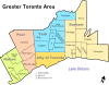
Cities Towns Ajax • Aurora • Caledon • East Gwillimbury • Georgina • Halton Hills • Markham • Milton • Newmarket • Oakville • Richmond Hill • WhitbyTownships and municipalities Categories:


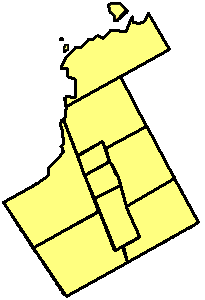


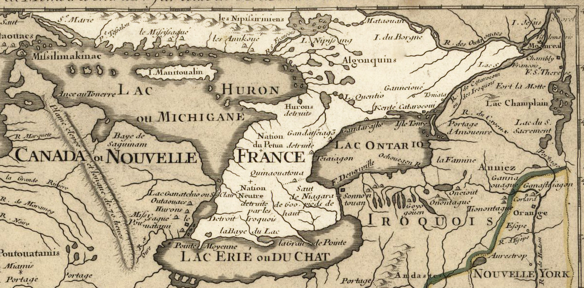
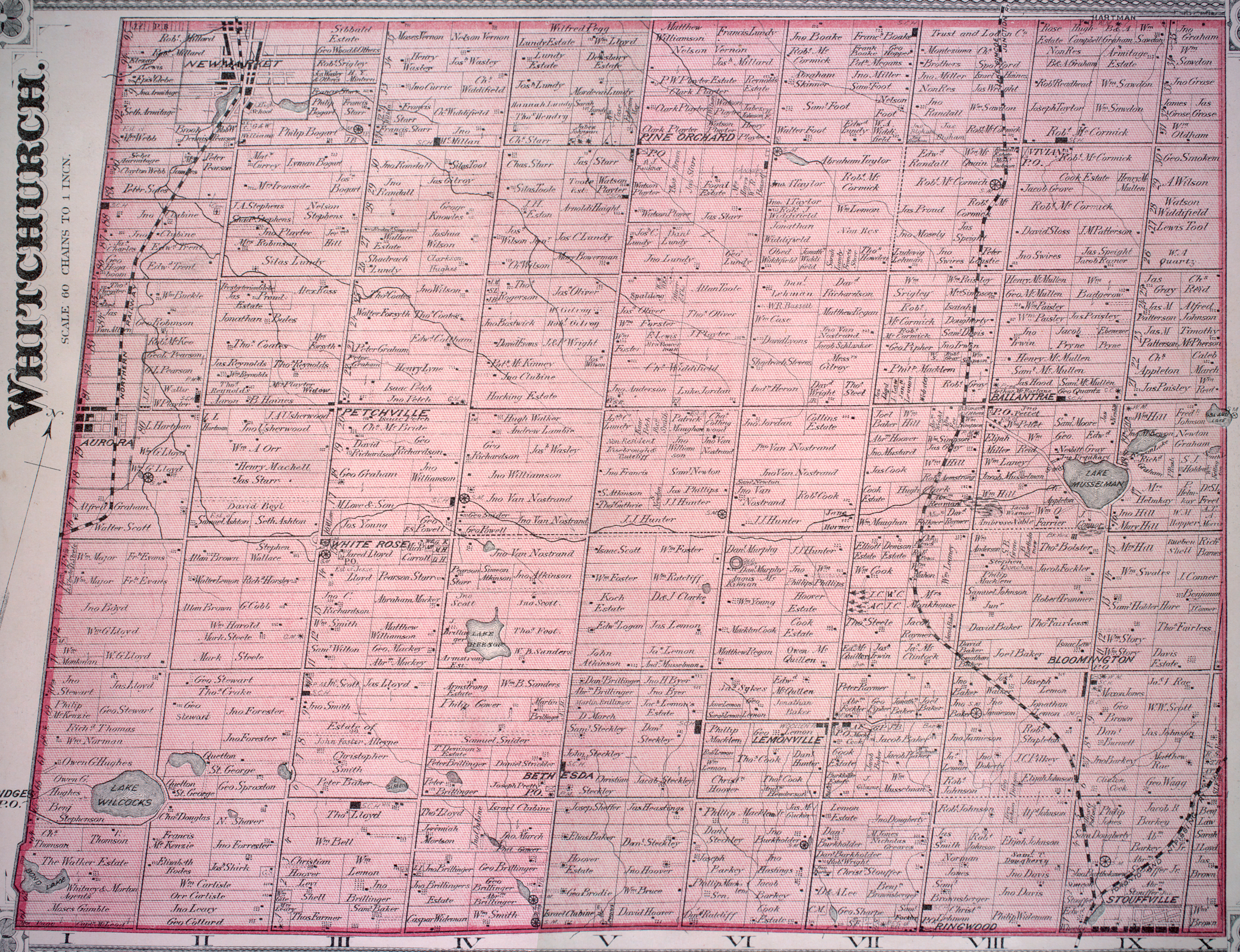
Wikimedia Foundation. 2010.