- Maud Williamson State Recreation Site
-
Maud Williamson State Recreation Site 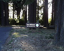
Oregon State Parks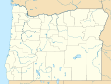

Type Public, state Location Yamhill County, Oregon Nearest city McMinnville Coordinates 45°05′47″N 123°04′01″W / 45.0965072°N 123.0670441°WCoordinates: 45°05′47″N 123°04′01″W / 45.0965072°N 123.0670441°W[1] Area 24 acres (9.7 ha) Operated by Oregon Parks and Recreation Department Maud Williamson State Recreation Site is a state park in Yamhill County, Oregon, United States, administered by the Oregon Parks and Recreation Department. The park is located at the intersection of Oregon Route 221 and Oregon Route 153 near Wheatland. The park entrance is across from Wheatland Road, which leads to the Wheatland Ferry.[2]
The site includes of a stand of second-growth Douglas-fir and a historic farmhouse.[3] In the early spring trilliums are abundant.[3]
The 24-acre (9.7 ha) park formerly offered overnight camping, but now is day-use only.[2] Amenities include picnic tables, restrooms, a covered picnic shelter, volleyball courts and horseshoe pits. Admission is free, but there is a fee to reserve the picnic shelter.[2][3]
History
Maud Williamson was a teacher at the school in Wheatland for many years.[4] In about 1930, a new Wheatland School was built across the Dayton-Salem highway from the park, which then was a farm owned by Williamson.
Maud Williamson died in about 1933, and willed her timberland and house to the State of Oregon in memory of her mother, Ruby T. Williamson.[2][4] Part of the park is situated on the original Donation Land Claim of Adam Matheny, one of the sons of Daniel Matheny, who established the ferry in Wheatland.[5]
The adjoining Charles S. Williamson House is a Queen Anne-style house built in 1890 by Maud Williamson's father, who was postmaster of Wheatland for 12 years.[6][7] Maud Williamson once lived there with her brother.[2] The house is not open to the public.
A bronze plaque commemorating the donation of the site was placed in the park in 1934.[8]
See also
References
- ^ "Maud Williamson State Park". Geographic Names Information System, U.S. Geological Survey. http://geonames.usgs.gov/pls/gnispublic/f?p=gnispq:3:::NO::P3_FID:1123846. Retrieved July 4, 2011.
- ^ a b c d e Bannan, Jan Gumprecht (2002). Oregon State Parks: A Complete Recreation Guide. The Mountaineers. p. 129. ISBN 0898867940. http://books.google.com/books?id=Bpf7evm8Vs4C&pg=PA129&dq=%22Maud+Williamson%22+House.
- ^ a b c "Maud Williamson State Recreation Site". Oregon Parks and Recreation Department. http://www.oregonstateparks.org/park_137.php. Retrieved March 18, 2009.
- ^ a b Pearse, N. O. (December 30, 1976). "History of Wheatland Settlement". Dayton Tribune. http://news.google.com/newspapers?id=4DgMAAAAIBAJ&sjid=mGIDAAAAIBAJ&pg=2895,1082582&dq=maud-williamson. Retrieved March 18, 2009.[dead link]
- ^ Capi, Lynn (January 5, 2005). "Couples married, then headed west". Statesman Journal. http://statesmanjournal.com/apps/pbcs.dll/article?AID=/20050105/NEWS/501050326&SearchID=73195849503671. Retrieved July 4, 2011.
- ^ "Charles S. Williamson House". Oregon Parks and Recreation Department Oregon Historic Sites Database. http://heritagedata.prd.state.or.us/historic/index.cfm?do=v.dsp_siteSummary&resultDisplay=19894. Retrieved March 18, 2009.
- ^ Gaston, Joseph; George H. Himes (1912). The Centennial History of Oregon, 1811-1912. II. Chicago: S. J. Clarke Pub. p. 822. http://books.google.com/books?id=c78UAAAAYAAJ&printsec=frontcover&dq=editions:0X9SXf-ct21q79Z24uB#PPA822,M1.
- ^ "Maud Williamson Landmark". Oregon Parks and Recreation Department Oregon Historic Sites Database. http://heritagedata.prd.state.or.us/historic/index.cfm?do=v.dsp_siteSummary&resultDisplay=19895. Retrieved March 18, 2009.
Protected Areas of Oregon Federal State Arcadia Beach • Bob Straub • Bradley • Cape Kiwanda • Cape Lookout • Cape Meares • Clay Myers at Whalen Island • Del Rey Beach • Ecola • Elmer Feldenheimer • Fishing Rock • Fort Stevens • Gearhart Ocean • Haystack Hill • Hug Point • John Yeon • Manhattan Beach • Munson Creek Falls • Neahkahnie–Manzanita • Nehalem Bay • Oceanside Beach • Oswald West • Rockaway Beach • Sunset Beach • Sunset Highway Forest • Symons • Tolovana Beach • Tolovana Beach • Twin Rocks • Wilson River Highway Forest
Agate Beach • Alsea Bay • Beachside • Beaver Creek • Beverly Beach • Boiler Bay • Carl G. Washburne • Collins Creek • D River • Darlingtonia • Devils Lake • Devils Punch Bowl • Driftwood Beach • Ellmaker • Fogarty Creek • Gleneden Beach • Governor Patterson • H.B. Van Duzer • Heceta Head Lighthouse • Jessie M. Honeyman • Joaquin Miller Forest • L. Presley & Vera C. Gill • Lost Creek • Muriel O. Ponsler • Neptune • Neskowin Beach • Ona Beach • Otter Crest • Pritchard • Roads End • Rocky Creek • San Marine • Seal Rock • Smelt Sands • South Beach • Stonefield Beach • Tokatee Klootchman • W. B. Nelson • Whale Watching • Yachats • Yachats Ocean Road • Yaquina Bay
Albert H. Powers • Alfred A. Loeb • Arizona Beach • Bandon • Bolon Island Tideways • Bullards Beach • Cape Arago • Cape Blanco • Cape Sebastian • Conde B. McCullough • Coquille Myrtle Grove • Crissey Field • Elk Creek Tunnel Forest • Face Rock • Floras Lake • Geisel Monument • Golden and Silver Falls • Harris Beach • Hoffman • Humbug Mountain • Hutchinson • Maria C. Jackson • McVay Rock • Ophir • Otter Point • Paradise Point • Pistol River • Port Orford Cedar Forest • Port Orford Heads • Samuel H. Boardman • Seven Devils • Shore Acres • Sisters Rock • Sunset Bay • Sweet Myrtle • Umpqua • Umpqua Lighthouse • Umpqua Myrtle • William M. Tugman • Winchuck • Yoakam Point
Banks–Vernonia • Bonnie Lure • Government Island • L. L. "Stub" Stewart • Mary S. Young • Milo McIver • Tryon Creek • Willamette Stone
Ainsworth • Benson • Bonneville • Bridal Veil Falls • Crown Point • Dabney • Dalton Point • George W. Joseph • Guy W. Talbot • Historic Columbia River Highway • John B. Yeon • Koberg Beach • Lang Forest • Lewis and Clark • Lindsey Creek • Mayer • McLoughlin • Memaloose • Multnomah Falls • Portland Women's Forum • Rocky Butte • Rooster Rock • Seneca Fouts • Shepperd's Dell • Sheridan • Starvation Creek • Viento • Vinzenz Lausmann • Wyeth • Wygant
Alderwood • Bald Peak • Blachly Mountain Forest • Bowers Rock • Cascadia • Champoeg • Detroit Lake • Dexter • Elijah Bristow • Erratic Rock • Fall Creek • Fort Yamhill • Holman • Jasper • Lowell • Luckiamute • Maples • Maud Williamson • Molalla River • North Santiam • Sarah Helmick • Silver Falls • State Capitol • Thompson's Mills • Washburne • Willamette Mission
Ben Hur Lampman • Canyon Creek Forest • Casey • Collier Memorial • Illinois River Forks • Jackson F. Kimball • Joseph H. Stewart • Klamath Falls – Lakeview Forest • OC&E Woods Line • Prospect • Rough and Ready Forest • Stage Coach Forest • TouVelle • Tub Springs • Valley of the Rogue • Wolf Creek Inn
Cline Falls • Deschutes River • Dyer • Elliott Corbett • La Pine • Ochoco • Peter Skene Ogden • Pilot Butte • Prineville Reservoir • Redmond–Bend Juniper • Sisters • Smith Rock • The Cove Palisades • Tumalo • White River Falls
Bates • Battle Mountain Forest • Blue Mountain Forest • Booth • Catherine Creek • Chandler • Clyde Holliday • Crooked Creek • Deadman's Pass • Emigrant Springs • Farewell Bend • Fort Rock • Fort Rock Cave • Frenchglen Hotel • Goose Lake • Hat Rock • Hilgard Junction • Kam Wah Chung • Lake Owyhee • Minam • Ontario • Pete French Round Barn • Red Bridge • Succor Creek • Sumpter Valley Dredge • Ukiah–Dale Forest • Unity Forest • Unity Lake • Wallowa Lake • Wallowa Lake Highway Forest • Wallowa River
Bridge Creek • Dean Creek • Denman • E.E. Wilson • Elkhorn • Fern Ridge • Irrigon • Jewell Meadows • Klamath • Ladd Marsh • Lower Deschutes • Phillip W. Schneider • Prineville • Riverside • Sauvie Island • Snake River Islands • Summer Lake • Wenaha • White River • Willow Creek
Regions Portland metroBlue Lake • Cooper Mountain • Glendoveer • Howell • Oregon Zoo • Oxbow • Smith and Bybee • Mount Talbert
Cities PortlandForest Park • Washington Park
Categories:- Oregon state parks
- Parks in Yamhill County, Oregon
- Oregon geography stubs


Wikimedia Foundation. 2010.