- Maybert, California
-
Maybert — Former settlement — Location in California
 Maybert
Coordinates: 39°21′10″N 120°41′59″W / 39.35278°N 120.69972°WCoordinates: 39°21′10″N 120°41′59″W / 39.35278°N 120.69972°W Country  United States
State  California
County Nevada County Elevation[1] 3,245 ft (989 m) Maybert is a former settlement in Nevada County, California. Situated at an elevation of 3,245 ft (989 m) above sea level,[1] it still appeared on maps as of 1902.[1] Maybert is located on the South Yuba River, 5.5 miles (8.9 km) south-southeast of Graniteville.[2]
A post office operated at Maybert from 1886 to 1905 and again from 1907 to 1910.[2] The name comes from the Maybert mine nearby.[2]
Up until the 1960s, some cabins remained and were occupied by squatters. The forest service, with the property-owner's permission, burned the remaining buildings to the ground to drive the squatters out and avoid the risk of wildfire from people squatting there. (Family story of a former property owner)
References
Municipalities and communities of Nevada County, California Cities and towns 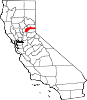
CDPs Alta Sierra | Floriston | Graniteville | Kingvale‡ | Lake of the Pines | Lake Wildwood | North San Juan | Penn Valley | Rough and Ready | Soda Springs | Washington
Unincorporated
communitiesAlta Hill | Bitney Corner | Carpenter Valley | Casey Corner | Cedar Ridge | Chicago Park | Coleman | Crystal Lake | Dew Drop | French Corral | Forest Knolls | Gaston | Gateway | Gold Flat | Higgins Corner | Hills Flat | Hinton | Hirschdale | Junction House | Kres | Lake City | Marsh Mill | Mooney Flat | Mystic | Newtown | Norden | North Bloomfield | North Columbia | Peardale | Pinecrest | Polaris | Relief | Scotts Flat | Sebastopol | Spring Hill | The Oaks | Town Talk | Union Mills | Willow Valley | Wolf | You Bet | Yuba Pass
Ghost towns Alpha | Badger Hill | Balaklava | Bald Eagle | Baltimore Town | Bear River Pines | Bear Valley | Beckmans Flat | Birchville | Blue Tent | Boca | Boston Ravine | Brass Wire Bar | Bridgeport | Brighton House | Bronco | Buena Vista | Burckhalter | Burks Bar | Camp Spaulding | Cascade Diggings | Cedar Kress | Chalk Bluff | Champion | Cherokee | Coyoteville | Crystal Springs | Democrat | Diamond Creek | Diggers Bar | Dillon | Drum | Eagle Bird | Elida | Eureka | Excelsior | Farad | Fernley | Flood | Forest Spring | French Lake | Frenchmans Bar | Gelatt | Glenbrook | Gold Hill | Hacketville | Hobart Mills | Hunt's Hill | Iceland | Indian Springs | Jericho | Jones Bar | La Barr Meadows | Lafayette Hill | Langs | Little York | Louisa | Lowell Hill | Malakoff | Maybert | Meadow Lake | Melburn Hill | Missouri Flat | Moores Flat | Mount Zion | Mountain Well | Mountain View | Negro Flat | Ohm | Omega | Orleans Flat | Pittsburg | Pleasant Flat | Prosser | Prosser Creek | Providence | Randolph House | Rays Flat | Red Diamond | Red Dog | Remington Hill | Rose's Corral | Shands | Shelby Flat | Shellback | Six Mile House | Snow Point | Snow Tent | Spenceville | Spiritsville | Stockings Flat | Sunset View | Sweetland | Tsekankan | Union Hill | Ustoma | Virginia House | Waloupa | White Cloud | Wickes | Wilsonville | Wokodot | Woolsey Flat | Yamako | Zinc House
Footnotes ‡This CDP also has portions in an adjacent county or counties
Categories:- Former settlements in Nevada County, California
- Former populated places in California
- Nevada County, California geography stubs


Wikimedia Foundation. 2010.