- McKee City, New Jersey
-
McKee City, New Jersey — Unincorporated community — 
 McKee City, New Jersey
Coordinates: 39°27′01″N 74°38′27″W / 39.45028°N 74.64083°WCoordinates: 39°27′01″N 74°38′27″W / 39.45028°N 74.64083°W Country United States State New Jersey County Atlantic Township Hamilton Founded 1884 Elevation 69 ft (21 m) Time zone Eastern (EST) (UTC-5) - Summer (DST) EDT (UTC-4) GNIS feature ID 878219[1] McKee City is an unincorporated community within the Mays Landing section of Hamilton Township, Atlantic County, New Jersey. The community was named after Colonel John McKee (1821–1902), a Civil War veteran. Although its name includes the word "city", McKee City is not an actual city — it is currently a crossroads of commerce that has replaced tenant farmers with retail stores and residential neighborhoods. McKee City was founded by Colonel McKee in 1884. It was originally a farming community, along with a sawmill, a schoolhouse, a general store, a community hall, and several farms near the former Pennsylvania-Reading Railroad (currently the site of the Black Horse Pike). Later, McKee City was the home of the Atlantic City Race Course, which still operates today, along with several other commercial businesses, including the Hamilton Mall, which opened in 1987.[2]
References
- ^ U.S. Geological Survey Geographic Names Information System: McKee City, New Jersey
- ^ Jim Waltzer; Tom Wilk (2001). Tales of South Jersey: Profiles and Personalities. Rutgers University Press. ISBN 0813530075. http://books.google.com/books?id=FoGKfZqdLlMC&pg=PA92&dq=mckee+city+new+jersey&hl=en&ei=wqsUTvqOFrODsALL-9XUDw&sa=X&oi=book_result&ct=result&resnum=8&ved=0CE0Q6AEwBw#v=onepage&q=mckee%20city%20new%20jersey&f=false. Retrieved July 6, 2011.
Municipalities and communities of Atlantic County, New Jersey County seat: Mays Landing Cities 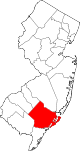
Boroughs Town Townships Buena Vista | Egg Harbor | Galloway | Hamilton | Mullica | Weymouth
CDPs Communities Dorothy | Elwood | Landisville | McKee City | Mizpah | Richland | Smithville | Sweetwater
Categories:- Populated places in Atlantic County, New Jersey
- Unincorporated communities in New Jersey
- New Jersey geography stubs


Wikimedia Foundation. 2010.