- McKownville, New York
-
McKownville Hamlet Formerly: McKownsville Name origin: for John McKown and family, early settlers from the late 18th century Country United States State New York Region Capital District County Albany Municipality Town of Guilderland Elevation 249 ft (76 m) Coordinates 42°40′45″N 73°50′02″W / 42.67917°N 73.83389°W Population 2,756 (1993 (appr.)) Settled late 18th century Timezone EST (UTC-5) - summer (DST) EDT (UTC-4) ZIP Code 12203 Area code 518 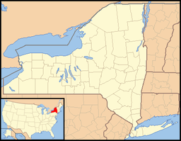
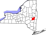
 Location of McKownville
within the US state of New YorkMcKownville is a hamlet in the town of Guilderland, Albany County, New York. It lies along the eastern border of the town with the city of Albany. McKownville is a heavily developed suburb of Albany and is home to many strip malls, shopping centers, and a portion of the University at Albany, SUNY and is bisected by US Route 20 (Western Avenue). McKownville is named for John McKown and family, early settlers from the late 18th century.
Contents
History
In the 18th century the King's Highway, a series of paths through the Pine Bush pine barrens from Albany to Schenectady passed through what would later become McKownville. In the late 1740s John McKown, originally from Scotland, moved his family to the United States of America from County Londonderry, Ireland.[1][n 1] He leased the Five Mile Tavern along the King's Highway, near the present-day Indian Quad of the University at Albany, SUNY. In 1790 his son William built a tavern at the corners of what would later be Fuller Road and Western Avenue. The first post office (1884) was in this tavern, today the site of a Burger King. The family would over time buy the majority of the land in what is now the hamlet named for them. They would donate land for the construction of the Great Western Turnpike built in 1799 (today Western Avenue), land for a local church (McKownville Methodist Church), and the original one room school house. The McKownville School District No. 11 was built around 1877, with a second one room house (McKownville Annex School No. 11-A) built in 1887. Both were closed in 1953 and replaced by the Westmere Elementary School when the district was consolidated into the Guilderland Central School District[1]
Being along Albany's city line McKownville has long been a center of suburban development including residential, commercial/office, retail, and educational. Strip malls, fast food, hotels, and other retail line Western Avenue, including Stuyvesant Plaza which was the first suburban shopping plaza built outside the city border. In 1924 residents formed the McKownville Improvement Association to lobby the town to build sidewalks and a create a water district for the neighborhood. It continued to fight for smart-growth and opposed the building of Crossgates Mall and its subsequent additions.[2] In 2004 the association's push for sidewalks finally came to fruition.[3] One of the additions to Crossgates that the association was worried about was a 1998 proposal by owner Pyramid Companies that would have included a 12 story tall hotel, ice skating rink, miniature golf course, and an additional 2,000,000 square feet (190,000 m2) of retail space to its already 1 million square feet.[4][5] The expansion was dealt a serious blow when the McKownville United Methodist Church, which was an important piece of real estate for the expansion, refused to sell.[4] The expansion would have made Crossgates the largest mall in the nation, but due to opposition from Guilderland the plan was dropped and later retooled for Syracuse's Carousel Center.
In 1896 the Albany Country Club and Golf Course was built straddling the Albany-Guilderland border which demolished remnants of the old King's Highway. The country club would be replaced by the University at Albany, SUNY (SUNYA) Uptown Campus in the 1960s.[1] Though the university is a part of the identity of McKownsville the relationship has at times been strained regarding the growth of the campus which has often grown on land in Albany that impacts McKownville residents but to which they have no say over.[6][7]
In 2002 it was found that in the 2000 Census 1,357 students at the Indian Quad dorms of SUNYA counted as part of Albany were actually in the town of Guilderland. Albany Mayor Jerry Jennings then refused to allow EMS and fire response from the city to cover Indian Quad and the Recreation and Convocation Center (today the SEFCU Arena), both in Guilderland. This caused a dispute between Mayor Jennings, who demanded payment from the town for $37,600 in past calls that the city responded to since 1999, and Ken Runion (Guilderland town supervisor) who claimed that Albany owed $363,000 that the city received from county sales taxes in 2001 that are based on population and included the Indian Quad.[8]
Geography
As a hamlet the boundaries of McKownville are ill-defined though generally considered to be the Governor Thomas E. Dewey Thruway (Interstate 87) and Fuller Road Alternate (unsigned NY Route 910F) to the west, the town of Bethlehem to the south, and the city of Albany to the east and north.[9] Once a part of the Albany Pine Bush it is mostly flat or very gently rolling hills. The Krum Kill marks the eastern border with Albany.[1]
Location

City of Albany
University at Albany, SUNYHamlet of Westmere 
City of Albany  Hamlet of McKownville

Town of Bethlehem
Hamlet of North BethlehemDemographics
As a hamlet McKownville has no definitive boundaries and therefore it is difficult to have statistics on the population. It was estimated by the Albany Times Union in 1993 that there are approximately 2,756 persons with 1,137 housing units in the hamlet.[2]
Education
See also: List of school districts in New York's Capital DistrictMcKownville is a part of the Guilderland Central School District (GCSD) and the children attend Westmere Elementary School for kindergarten through 5th grade; and Farnsworth Middle School for 6th through 9th grade; and Guilderland High School for 9th through 12th.[2]
Notes
- ^ County Londonderry is today in Northern Ireland, a part of the United Kingdom (UK). At the time John McKown lived there it was part of the Kingdom of Ireland, which was in personal union with the UK.
References
- ^ a b c d Alice Begley and Mary Ellen Johnson (1999). Guilderland, New York. Arcadia Publishing. pp. 9–21. ISBN 0-7385-0112-3. http://books.google.com/books?id=I1jO4aXpQY4C&pg=PA9&dq=mckownville&cd=1#v=onepage&q=mckownville&f=false. Retrieved 2010-02-14.
- ^ a b c Ingraham, Frances (1993-01-17). "Residential Life in Mercantile McKownville". Times Union (Albany) (Hearst Newspapers): p. G1. http://albarchive.merlinone.net/mweb/wmsql.wm.request?oneimage&imageid=5675823. Retrieved 2010-02-14.
- ^ Miller, Anne (2004-09-25). "Hamlet Wins Sidewalks After 80 Years". Times Union (Albany) (Hearst Newspapers): p. B1. http://albarchive.merlinone.net/mweb/wmsql.wm.request?oneimage&imageid=6255352. Retrieved 2010-02-14.
- ^ a b Snyder, James G. (November 11, 2000). "Church to Discuss its Role in Mall Plan". Times Union (Albany) (Hearst Newspapers): p. B14. http://albarchive.merlinone.net/mweb/wmsql.wm.request?oneimage&imageid=6048793. Retrieved 2010-02-14.
- ^ Martineau, Kimberly (1998-07-09). "Hotel to Make Crossgates Tourist Spot, Developer Says". Times Union (Albany) (Hearst Newspapers): p. B1. http://albarchive.merlinone.net/mweb/wmsql.wm.request?oneimage&imageid=5933424. Retrieved 2010-02-15.
- ^ Spofford, Tim (1989-08-15). "McKownville Residents Face SUNYA Growth". Times Union (Albany) (Hearst Newspapers): p. B3. http://albarchive.merlinone.net/mweb/wmsql.wm.request?oneimage&imageid=5519370. Retrieved 2010-02-14.
- ^ Anderson, Eric; Chris Churchill; and Larry Rulison (2009-03-22). "Watch Out, McKownville". Times Union (Albany) (Hearst Newspapers): p. E1. http://albarchive.merlinone.net/mweb/wmsql.wm.request?oneimage&imageid=7661444. Retrieved 2010-02-14.
- ^ Duggan, Erin (2002-12-12). "Census Spurs Money Dispute". Times Union (Albany) (Hearst Newspapers): p. A1. http://albarchive.merlinone.net/mweb/wmsql.wm.request?oneimage&imageid=6147954. Retrieved 2010-02-14.
- ^ Dieffenbach, John (1987-09-09). "A Hamlet in Search of its Identity McKownville Longing for Homey Spirit". Knickerbocker News (Albany) (Hearst Newspapers): p. 4A. http://albarchive.merlinone.net/mweb/wmsql.wm.request?oneimage&imageid=5432038. Retrieved 2010-02-14.
Capital District of New York Central communities Albany (History · City Hall · Coat of Arms) · Schenectady (City Hall) · Troy (History) · List of all incorporated places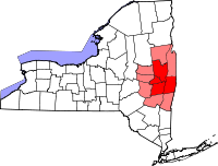
Largest communities
(over 20,000 in 2000)Medium-sized communities
(10,000 to 20,000 in 2000)City of Amsterdam · Brunswick · Cohoes · East Greenbush · Glens Falls · Gloversville · Halfmoon · Malta · North Greenbush · Schodack · Watervliet · WiltonSmall communities
(5,000 to 10,000 in 2000)Town of Amsterdam · Ballston Spa · Cobleskill · Village of Colonie · Duanesburg · City of Johnstown · Town of Johnstown · Kinderhook · Mechanicville · New Scotland · Rensselaer · Sand Lake · Scotia · Town of Stillwater · WaterfordCounties Albany · Columbia · Fulton · Greene · Montgomery · Rensselaer · Saratoga · Schenectady · Schoharie · Warren · WashingtonHistory Mohawks · Mahicans · Fort Orange · Rensselaerswyck · Beverwyck · Albany Plan of Union · Timeline of town creation · Toponymies of places · Tech ValleyGeography Hudson River (Valley) · Mohawk River · Erie Canal · Lake Albany · Lake George · Albany Pine Bush (Rensselaer Lake · Woodlawn Preserve) · Adirondack Mountains · Catskill Mountains · Rensselaer PlateauReligion and culture Culture in New York's Capital District · Sports in New York's Capital District · Episcopal Diocese of Albany · Roman Catholic Diocese of AlbanyEducation Public school districtsList of school districts in New York's Capital DistrictHigher educationNewspapers TV/Radio Broadcast television in the Capital District Local stations WRGB (6.1 CBS, 6.2 This TV) • WTEN (10.1 ABC, 10.2 Weather, 10.3 RTV) • WNYT (13.1 NBC, 13.2 Weather, 13.3 Weather Radar) • WMHT (17.1 PBS, 17.2 ThinkBright, 17.3 HD) • WXXA (23.1 Fox, 23.2 The Cool TV) • WNGN-LP 35 / WNGX-LP 42 (FN) • WCWN (45.1 The CW, 45.2 Uni Sp) • WNYA / WNYA-CD (51.1 MNTV, 51.2 Antenna TV) • W52DF 52 (silent)
Outlying area stations WVBK-CA 2 (RSN' Manchester, VT) • W04AJ 4 (PBS; Glens Falls) • W04BD 4 (PBS; Schoharie) •
WNCE-CA 8 (A1; Glens Falls) • WYBN-CA 14 (RSN; Cobleskill) • WCDC (19.1 ABC; Adams, MA) • WVBG-LP 25 (RSN; Greenwich) • W36AX 36 (PBS / VPT; Manchester, VT) • W47CM 47 (silent; Glens Falls) • WYPX (55.1 Ion, 55.2 qubo, 55.3 Life; Amsterdam) • W53AS 53 (PBS / VPT; Bennington, VT)Adjacent locals Cable-only stations YNN Capital Region • TW3 • YES • SNY • MSG Network
Defunct stations New York State television: Albany/Schenectady • Binghamton • Buffalo • Burlington/Plattsburgh • Elmira • New York City • Rochester • Syracuse • Utica • Watertown
Vermont Broadcast television: Albany/Schenectady • Boston, MA • Burlington/Plattsburgh
Massachusetts television: Albany • Boston • Providence • Springfield
Radio stations in the Albany / Schenectady / Troy market by FM frequency 88.3 · 89.1² · 89.7 · 89.9 · 90.3/93.1² · 90.7/94.9 · 90.7 · 90.7 · 90.9 · 91.1 · 91.5 · 92.3 · 92.9 · 93.5 · 93.7 · 94.5 · 94.7 · 95.5 · 95.9 · 96.3 · 96.7 · 97.3 · 97.5 · 97.7 · 97.9 · 98.3² · 98.5 · 98.5 · 99.1 · 99.5² · 100.3 · 100.9 · 101.3 · 101.7 · 101.9 · 102.3² · 102.7 · 103.1² · 103.5 · 103.9 · 104.5 · 104.9 · 105.7² · 106.1 · 106.5² · 107.1 · 107.7²by AM frequency NOAA Weather Radio frequency 162.550by callsign W226AC · W235AY · W256BU · W291BY · WABY · WAJZ · WAMC (AM) · WAMC-FM² · WBAR · WBPM · WCDB · WCKL · WCKM · WCQL · WCSS · WCTW · WDCD · WDCD-FM · WDDY² · WENT · WEQX · WEXT · WFFG · WFLY · WFNY · WGDJ · WGNA² · WGXC · WGY¹² · WGY-FM² · WHAZ · WHAZ-FM · WHUC · WHVP · WIZR · WJIV · WKBE · WKKF² · WKLI · WLJH · WMHT² · WMYY · WNYQ · WOFX² · WOPG · WPGL · WPYX² · WQAR · WQBJ · WQBK · WQSH² · WRIP · WROW · WRPI · WRUC · WRVE² · WSDE · WTMM · WTRY² · WUAM · WVCR · WVKZ · WVTL · WXL34 · WYAI · WYJB · WYKV · WZCR · WZMRDefunct stations New York Radio Markets: Albany-Schenectady-Troy • Binghamton • Buffalo-Niagara Falls • Elmira-Corning • Hamptons-Riverhead • Ithaca • Nassau-Suffolk (Long Island) • New York City • Newburgh-Middletown (Mid Hudson Valley) • Olean • Plattsburgh • Poughkeepsie • Rochester • Syracuse • Utica-Rome • Watertown
Other New York Radio Regions: Jamestown-Dunkirk • North Country • Saratoga
See also: List of radio stations in New York Capital District Portal
Municipalities and communities of Albany County, New York County seat: Albany Cities Albany | Cohoes | Watervliet
Towns Berne | Bethlehem | Coeymans | Colonie | Green Island | Guilderland | Knox | New Scotland | Rensselaerville | Westerlo
Villages Altamont | Colonie | Green Island | Menands | Ravena | Voorheesville
CDPs Other
hamletsAlcove | Boght Corners | Clarksville | Crescent Station | Dunsbach Ferry | Elsmere | Feura Bush | Fort Hunter | Fullers | Glenmont | Guilderland | Guilderland Center | Karner | Latham | Lisha Kill | Loudonville | Mannsville | McKownville | New Salem | Newtonville | Normansville | Roessleville | Selkirk | Slingerlands | South Bethlehem | Verdoy | West Albany
Categories:- Guilderland, New York
- Hamlets in New York
- Populated places in Albany County, New York


Wikimedia Foundation. 2010.