- McPherson Ridge
-
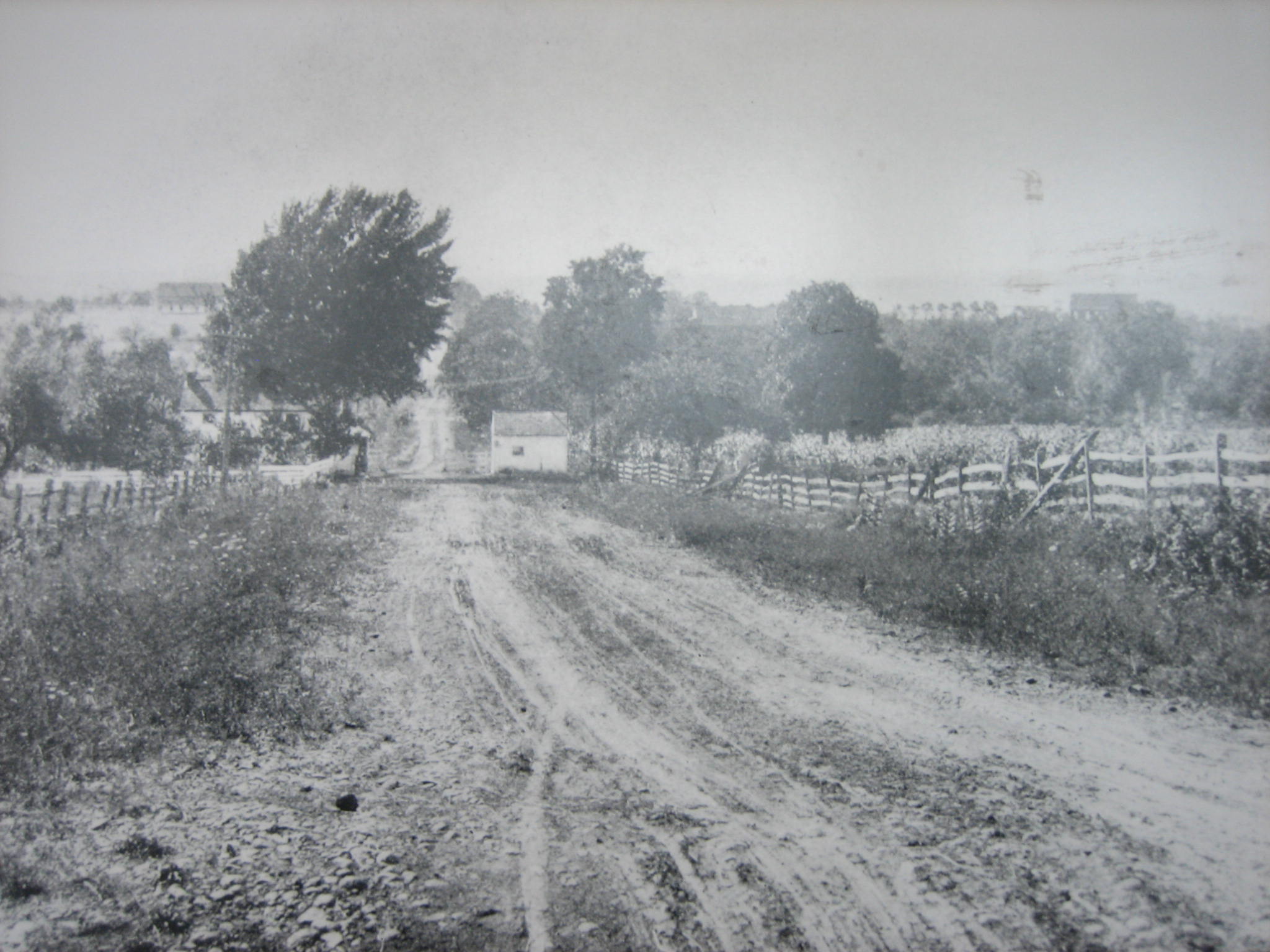
McPherson Ridge Middle Ridge dendritic ridge  Gettysburg Battlefield monuments on McPherson Ridge (north-northeast view) include the
1899 John F. Reynolds equestrian statue.[1]Country United States State Pennsylvania County Adams Township &
NPS unitCumberland,
Gettysburg NMPPart of "outcrop of the Gettysburg sill" [2] Borders on 3Location 1858 Dustman barn [3] - coordinates 39°50′13″N 77°15′05″W / 39.8370°N 77.2514°W [4] Northern-
most pointsaddle point at Oak Ridge near
the intersection of Reynolds- location and Wadsworth Avenues. [4] Southern-
most pointupslope point north of
Willoughby/Pitzer confluence- elevation 532 ft (162.2 m) [5] - coordinates 39°48′46″N 77°15′46″W / 39.812855°N 77.262855°W
(approximate)[4]McPherson Ridge is a landform used for military engagements during the 1863 Battle of Gettysburg, First Day, when the I Corps (Union Army) had a headquarters on the ridge and was defeated by the Confederate division of Major General Henry Heth.[6] The ridge has terrain above ~530 ft (160 m) and is almost entirely a federally-protected area except for township portions at the southern end and along Pennsylvania Route 116, including a PennDOT facility. The northern end is a slight topographic saddle point on the west edge of Oak Ridge, and summit areas above 560 ft (170 m) include 4 on/near the Lincoln Highway, a broader summit south of the Fairfield Road, and the larger plateau at the northern saddle.[4]
History
In 1747, the Nichol's Gap Road[1][2] (later "Hagerstown Road", now Fairfield Road) was built over the ridge,[7] followed by the road on the north that became the 1809 turnpike from Gettysburg to Black's Gap[8] (extended to Chambersburg in 1810).[9] In 1835, Middle Ridge had the middle of three 1835 railway cuts (cf. Herr Ridge & Seminary Ridge) excavated for the Tapeworm Railroad. In the 1850s, the Old Mill Road across the ridge had been established northwest from the Hagerstown Road past the J. Herbst farm along Willoughby Run.[3] During the 1858 Hopkins survey, the "H. Dustman" farm was on the ridge along the turnpike's south side and east of the "Toll Gate", while along Willoughby Run on the ridge's west slope and north of the railway bed were the farms of "Heirs of Wm McPherson" & "J. B. McPherson".[3] After moving back to Gettysburg in 1856, attorney Edward McPherson inherited a farm in 1858[citation needed] which had 66.5 acres (26.9 ha) by 1863.[3] On June 30, 1863, John Buford's Union cavalry camped 400 yd (370 m) east of the ridge prior to the Battle of Gettysburg.[10]
- Battle of Gettysburg
- On July 1, 1863, at ~8 am, Buford's 3,200 dismounted cavalrymen held the ridge until 10:30 am against 7,000 Confederates until the arrival of the 1 Corps infantry.[4] After the Union forces retreated to Seminary Ridge, 2 companies of the 55th Virginia Infantry attacked the "large barn in which many of the Yankees took refuge. … An officer standing in the door of the barn, when ordered to surrender by Major Lauson, refused";[11] and after the barn was captured it was used as a field hospital.[5]
In 1869,[12] a "Horse Railway" was built over the ridge from the borough station,[6][13] and in 1884 the steamtrain railroad was extended westward through the railway cut (a 1902 plan to extend the electric trolley over the ridge was not implemented.)[7] A Pennsylvania bill passed in 1885[14] for the 1886 John F. Reynolds monument in Herbst Woods erected by "Post No. 9, G.A.R."[15] In 1887, Gettysburg Battlefield Memorial Association Director Edward McPherson acted as the agent for Samuel A. Whitney, who sold 17 acres (6.9 ha) on the ridge for a GBMA avenue,[15] and the 1887 "Iron Platt Truss Bridge" over the railway cut was built by the Gilbert and Smith Foundry for the "First Day's Avenue".[15] The ridge's modern name was used as early as 1892--in Minnigh's What They Did Here ("West Reynolds Avenue, McPherson Ridge")[8]:119--and in a newspaper by The Sun for a 1913 Gettysburg reunion report.[9]
Gettysburg National Military Park
After the February 1895 "Sickles Gettysburg Park Bill" (28 Stat. 651) passed,[16] John B. McPherson deeded 58.18 acres (23.54 ha) to the United States in April,[17] and the eminent domain decree of United States v. Five Tracts of Land on October 2, 1900, seized 3 "Reynolds Woods" tracts totalling 40.47 acres (16.38 ha).[18] Stone Avenue was constructed in 1902,[19] and by 1904 Meredith Avenue was on part of the "Springs Hotel Avenue and [former] Horse Railroad".[20] On December 24, 1904, the Gettysburg National Military Park acquired 36.56 acres (14.80 ha) on/near the ridge for $3,626[17] and in 1906, part of Pennsylvania's Camp Henderson was on the ridge.
In 1913, the Chambersburg Turnpike was designated part of the original Lincoln Highway, and in 1927 the Hagerstown Road became Pennsylvania Route 51 (Pennsylvania Route 116 in 1928).[10] The National Park Service replaced the commemorative era guide station on the pike with a Gettysburg Parkitecture entrance station[21] ("Lincolnway station" of Gettysburg Granite) which opened on June 5, 1937;[22] and the 1903 bridge over the railway cut[11] was replaced in 1958 for Mission 66.[23] A Battlefield America Guide about the ridge was published in 2002,[10] and monuments on the ridge were designated historic district contributing structures in 2004.[24]
References
- ^ Davis, William C. (1995--Fifth Printing) [1983]. Gettysburg: The Story Behind the Scenery. ISBN 0-916122-89-1. LCCN 83-80606.
- ^ Brown, Andrew (1962). "GEOLOGY and the Gettysburg Campaign". Pennsylvania: Bureau of Topographic and Geologic Survey. p. 13. http://www.dcnr.state.pa.us/topogeo/education/es5/es5.pdf. Retrieved 2010-02-19.
- ^ a b c M.S. & E. Converse (1858) (Library of Congress mapviewer). G. M. Hopkins survey (Map). http://hdl.loc.gov/loc.gmd/g3823a.la000697. Retrieved 2011-11-04.
- ^ a b c d Google Maps (Map). (The terrain map shows the summits and unprotected areas, and the barn's coordinates are the significant digits from the 4 corners' "ll=" lat/lon values in Google hyperlinks.)
- ^ "X_Value=-77.262855&Y_Value=39.812855". USGS Elevation Web Service Query. United States Geological Survey. http://gisdata.usgs.gov/xmlwebservices2/elevation_service.asmx/getElevation?X_Value=-77.262855&Y_Value=39.812855&Elevation_Units=FEET&Source_Layer=-1&Elevation_Only=FALSE. Retrieved 2011-11-04.
- ^ Stackpole, et al (year tbd) (Google books). The Battle of Gettysburg: A Guided Tour. http://books.google.com/books?id=lP0eIDrcX1gC&pg=PA4&lpg=PA4&dq=%22Meredith+Avenue%22+Gettysburg&source=bl&ots=o6_JxKELUC&sig=zCDhu8czEGS3TXK9B7kMUrznXZo&hl=en&ei=DHmxTvioHKn9iQLojI3xDw&sa=X&oi=book_result&ct=result&resnum=10&ved=0CFgQ6AEwCQ#v=onepage&q=%22Meredith%20Avenue%22%20Gettysburg&f=false. Retrieved 2011-11-06.
- ^ Trostle, Kevin. "The Colonial Period: 1735-1786". A Brief History of Gettysburg. KevinTrostle.com. http://kevintrostle.com/THE_COLONIAL_PERIOD.html. Retrieved 2011-11-04. "In the fall of 1747 a third road through the county was…the Nichol's Gap Road, later known as the Hagerstown Road, [from] New Oxford [(settled 1792) across the Baltimore road (later Gettysburg) through the 1801 location of] Fairfield before winding its way through South Mountain into the Cumberland Valley, eventually accessing Hagerstown Maryland and the shores of the Potomac River leading to Virginia's Shenandoah Valley." NOTE: Initial Nichol's Gap Road buildings east and west of the ridge included the 1761 Samuel Gettys Tavern (Rock Creek) and the 1812 Black Horse Tavern (Marsh Creek).
- ^ Hasse, Adelaide Rosalia. Index of Economic Material in Documents of the States of the United States…. Carnegie Institution of Washington: Dept. of Economics and Sociology. http://books.google.com/books?id=YhpAAAAAMAAJ&pg=PA1502&q=%22Black's%20Gap%22%20Gettysburg. Retrieved 2011-11-04.
- ^ "A Bit of History About Your Own Adams County" (Google News Archive). Gettysburg Times (Times and News Publishing Company). July 16, 1952. http://news.google.com/newspapers?id=O9glAAAAIBAJ&sjid=rPwFAAAAIBAJ&pg=670,2438144&dq=black's-gap+gettysburg&hl=en. Retrieved 2011-11-03.
- ^ a b Newton, Steven H. (2002) (Google books). McPherson's Ridge: the First Battle for the High Ground, July 1, 1863. http://books.google.com/books?id=GLh6bOxGLi4C&pg=PA19&lpg=PA19&dq=%22McPherson's+Ridge%22&source=bl&ots=wLy1xxRH3u&sig=YprL2zgW4CUv7AR6JElaZIQZUkQ&hl=en&ei=05CwTp-eLKaFiALP6LzoDw&sa=X&oi=book_result&ct=result&resnum=4&ved=0CDEQ6AEwAzgU#v=onepage&q&f=false. Retrieved 2011-11-03.
- ^ Matthews, Richard E. (year tbd) (Google books). The 149th Pennsylvania Volunteer Infantry Unit in the Civil War. http://books.google.com/books?id=GbdyqFdbrAsC&pg=PA107&lpg=PA107&dq=clarkson+gettysburg+ridge&source=bl&ots=IrgX0Gj_Zj&sig=wc20jhk0lsOGmOjQQn6qiUWfN5E&hl=en&ei=m6OxTqXcF6qOigL26eQV&sa=X&oi=book_result&ct=result&resnum=4&ved=0CCwQ6AEwAw#v=onepage&q=clarkson%20gettysburg%20ridge&f=false. Retrieved 2011-11-02.
- ^ "Chapter XXX: Cumberland Township". History of Cumberland and Adams Counties, Pennsylvania: Part III, History of Adams County. Chicago: Warner, Beers & Co.. 1886. pp. 236–247. http://files.usgwarchives.net/pa/adams/history/area/chapter-xxx.txt. Retrieved 2011-11-04.
- ^ Bachelder, John B. (1875) (Google books). Popular Resorts, and How to Reach Them. http://books.google.com/books?id=G3x1AAAAMAAJ&vq=gettysburg&pg=PP12. Retrieved 2011-11-02. (The Davis 1875 illustration also appeared without identification in Bachelder's 1878 Gettysburg: What to See and How to See It.)
- ^ [surname tbd], Claude (April 28, 1885). "Harrisburg Letter" (Google News Archive). The Star and Sentinel. http://news.google.com/newspapers?id=nVcmAAAAIBAJ&sjid=af8FAAAAIBAJ&dq=henry-myers%20gettysburg&pg=5585%2C6057527. Retrieved 2011-11-02.
- ^ a b c Krauth, Jno. M. (June 16, 1886). "Board meeting minutes" (1982 transcription). Minute Book, Gettysburg Battlefield Memorial Association, 1872-1895. Gettysburg Battlefield Memorial Association. http://www.gdg.org/Research/Monuments/gbmaminutes.html. Retrieved 2011-11-02.
- ^ "Gettysburg National Military Park Established By Sickles, Bill Passed In February 1895" (Google News Archive). Gettysburg Times. February 10, 1970. http://news.google.com/newspapers?id=HHQlAAAAIBAJ&sjid=uvIFAAAAIBAJ&pg=4065,1632115&dq=sickles+1894&hl=en. Retrieved 2011-03-06.
- ^ a b Property Deed Books, Gettysburg, Pennsylvania: Adams County Courthouse, https://adamscountyparecorder.com/User/Login.aspx?ReturnUrl=%2fIndex.aspx
Deed{Specify|these documents have deed numbers (in addition to pg #s)|date=November 2011}} McPherson, John B. (April 30, 1895). Deed [to War Department?]. Book V V. p. 477. http://books.google.com/books?id=u34AAAAAYAAJ&pg=PA321. Retrieved 2011-11-01. (58 acres & 29 perches)
Indenture Fowler, Henry O. et al., as receivers of the Gettysburg Springs & Hotel Co. (December 24, 1904). Indenture [for 4 tracts of 4.41, 1.56, 24.21, & 6.38 acres to] the United States of America. Book #60. pp. 22-30. http://www.gdg.org/Research/BattlefieldHistories/farmap1.html. Retrieved 2011-11-03. "TRACT NO. 1. …two tracts of land…Herbst Farm and the Herbst Wood. TRACT NO. 2….a part of tract of land…Herbst Farm, and TRACTS NOS. 3 and 4…part of a larger tract of land known as the McPherson Farm … sold … as part of a larger tract of land…of…Samuel A. Whitney [deceased on] July 30th, 1892…Book "T. T." p. 444…to J. Emory Bair" NOTE: the indenture deed book & page numbers are cited in United States military reservations, National cemeteries, and military parks. 1916. http://books.google.com/books?id=u34AAAAAYAAJ&pg=PA315. Retrieved 2011-11-04. "four certain parcels of land aggregating 36.56 acres". - ^ United States military reservations, National cemeteries, and military parks. 1916. http://books.google.com/books?id=u34AAAAAYAAJ&pg=PA315. Retrieved 2011-11-02.
- ^ "Miscellaneous". September 23, 1902. http://news.google.com/newspapers?id=p_0lAAAAIBAJ&sjid=qvIFAAAAIBAJ&pg=1490%2C5376003. Retrieved 2011-10-31. "The contract for a new avenue,…from the Chambersburg pike south through Reynolds Grove to the Springs road,…to M. & T. E. Farrell. …to be 2859 feet long."
- ^ Julius Bien & Co. Lith. (1904). …Battle Field of Gettysburg (Map). Cartography by Gettysburg National Park Commission (Nicholson, John P; Cope, Emmor; Hammond, Schuyler A). New York.
- ^ "Plan $50,000 Battlefield Project Here" (Google News Archive). July 16, 1934. http://news.google.com/newspapers?id=RgkmAAAAIBAJ&sjid=Jf0FAAAAIBAJ&pg=6430,469583&dq=comfort-stations+gettysburg&hl=en. Retrieved 2011-02-02. "The entrance stations…will be combination guides' stations, comfort stations and information bureaus. … The comfort stations will be erected at Devil's Den and Spangler's Spring. "
- ^ "1 of 2 Entrance Stations Opens for Public Use" (Google News Archive). The Star and Sentinel. June 5, 1937. http://news.google.com/newspapers?id=c4klAAAAIBAJ&sjid=ufIFAAAAIBAJ&pg=2725,2946019&dq=comfort-stations+gettysburg&hl=en. Retrieved 2011-11-02.
- ^ "Myers Tells Club of Work on Mission 66" (Google News Archive). Gettysburg Times. November 20, 1960. http://news.google.com/newspapers?id=_UcmAAAAIBAJ&sjid=2v4FAAAAIBAJ&pg=2918,2334330&dq=cyclorama+1958+gettysburg&hl=en. Retrieved 2011-11-04.
- ^ Bush-Browne, Henry Kirke (1896), "Major General John F. Reynolds Equestrian Statue", (structure MN028, LCS ID 009930) List of Classified Structures: GETT p. 19[dead link] (National Park Service), http://webcache.googleusercontent.com/search?q=cache:0y2hOO9XXcUJ:www.hscl.cr.nps.gov/insidenps/report.asp%3FSTATE%3D%26PARK%3DGETT%26STRUCTURE%3Dentrance_station%26SORT%3D5%26RECORDNO%3D346+reynolds+site:hscl.cr.nps.gov&hl=en&gl=us&strip=1, retrieved 2011-11-06, "Bronze equestrian statue, 15' high, mounted on polished granite pedistal, [sic] 21'x13'x20'. Bronze inscription tablets, 8'10"x2'3", mounted on N & S of pedistal. [sic] … Overall height 35 feet."
Categories:- Battle of Gettysburg hospitals
- Places of the Gettysburg Battlefield
- Landforms of Adams County, Pennsylvania
- Protected areas of Adams County, Pennsylvania
- Ridges of Pennsylvania
- U.S. Route 30 in Pennsylvania

Wikimedia Foundation. 2010.