- Darbhanga district
-
This article is about the district. For its eponymous headquarters, see Darbhanga.
Darbhanga district
दरभंगा जिला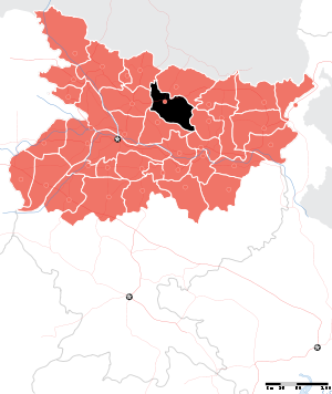
Location of Darbhanga district in BiharState Bihar,  India
IndiaAdministrative division Darbhanga Headquarters Darbhanga Area 2,279 km2 (880 sq mi) Population 3,295,789 (2001) Population density 1,101 /km2 (2,850 /sq mi) Urban population 8.7 per cent Literacy 44.32 per cent[1] Sex ratio 910 Lok Sabha Constituencies Darbhanga Assembly Seats Kusheshwar Asthan, Gaura Bauram, Benipur, Alinagar, Darbhanga Rural, Darbhanga, Hayaghat, Bahadurpur, Keoti, Jale Major highways NH 57, NH 105 Official website  Darbhanga District map
Darbhanga district (Hindi: दरभंगा जिला) is one of the thirty-eight districts of Bihar state in eastern India, and Darbhanga town is the administrative headquarters of this district. Darbhanga district is a part of Darbhanga Division. The district is bounded on the north by Madhubani district, on the south by Samastipur district, on the east by Saharsa district and on the west by Sitamarhi and Muzaffarpur districts. The district covers an area of 2,279 km².
Contents
History
1976 saw the creations of two divisions from Darbhanga's territory: Madhubani and Samastipur.[2]
Geography
Darbhanga district occupies an area of 2,279 square kilometres (880 sq mi),[3] comparatively equivalent to Indonesia's Yapen Island.[4] The district has a vast alluvial plain devoid of any hills. There is a gentle slope from north to south with a depression on the centre. The District can be divided into four natural divisions. The eastern part consists of Ghanshyampur, Biraul and Kusheshwarsthan blocks. This part contains fresh silt deposited by the Kosi River. This region was under the influence of Kosi floods till the construction of Kosi embankment during the Second Five Year Plan. It contains large tracts of sandy land covered with wild marshes. The second part comprises the regions lying south of the Burhi Gandak River and is the most fertile area in the district. It is at a higher level than the other parts of the district and contains very few marshlands. This part is well suited to the rabi crops. The third natural region is the doab between the rivers, Burhi Gandak and Baghmati and consists of low-lying areas dotted over by marshes. This region gets flooded almost every year. The fourth division consists the Sadar sub-division of the district. This region is watered by numerous streams and contains some uplands.
Rivers
Though numerous rivers originating in the Himalayas water this district, it has four major river systems, the Baghmati, the little Baghmati, the Kamla and the Tiljuga. The Bagmati, enters this district from Muzaffarpur district, forms a natural boundary between the district and Samastipur district and pursues a southeasterly course till it joins the Burhi Gandak River near Rosera. The little Bagmati enters the district from Madhubani district near Pali and turns past Darbhanga town down to Hayaghat, where it joins the Baghmati proper. The Kamla River enters the district at Singar Pandaul, and flowing east of Darbhanga town, joins the Tiljuga at the southeastern corner of Rosera block. The Tiljuga skirts the eastern boundary of the district.
Climate
The climate of this district is dry. There are three well-marked seasons in this district, the winter, the summer & the rainy season. The winter season starts in November and continues till February, though March is also pleasant. Westerly winds begin to blow in the second half of March and temperature rises considerably. May is the hottest month when the temperature goes up to 42°C. Rain sets in towards the middle of June. With the advent of the rainy season, temperature drops but humidity rises. The moist heat of the rainy season is very oppressive till August. The rain continues till the middle of October. Average annual rainfall of this district is 1142.3 mm. Around 92% of the total rainfall is received during monsoon months.
Economy
Agriculture is the primary occupation of the majority of the population of this district. There are a huge amount of educated people in Darbhanga. The occupation is mainly doctor, engineer,Govt services,many more IAS IPS can be seen in Darbhanga district.
In 2006 the Ministry of Panchayati Raj named Darbhanga one of the country's 250 most backward districts (out of a total of 640).[5] It is one of the 36 districts in Bihar currently receiving funds from the Backward Regions Grant Fund Programme (BRGF).[5]
Agriculture
The major crop of this district is rice. Other crops produced in this district are wheat, maize, pulses, oil seeds and sugarcane. The district is also famous for mango has many mango orchards.
Industry
The main industries of this district are Paper Mills, Sugar Mills and Handloom.
Divisions
The district comprises three sub-divisions which is further divided into 18 blocks. The sub-divisions are Darbhanga Sadar, Benipur and Biraul. The blocks are Darbhanga, Jale, Singhwara, Keoti, Manigachhi, Tardih (newly formed divided from manigachi block ), Alinagar, Benipur, Bahadurpur, Hanuman Nagar, Hayaghat, Baheri, Biraul, Ghanshyampur, Kiratpur, Gaura Bauram, Kusheswarasthan, and Kusheswarasthan East. This district has 329 Panchayats, 1269 villages & 23 Police Stations. Some of the villages are Pindaruch, Devkuli Dham, Paithan Kabai, Baqui pur, Maheshpatti, Kaligaon, Kansi, Pandaol, Panchobh, Rajarouly-Rampur rouly, Balbhadrapur, Gobindpur, Dharar, Koilakh, Karaj, Nehra, Sahora, Kabilpur, Bahadurpur, Anandpur, Deokuli, Rambhadrapur, Ughara, Patore, Ghanshyampur (famous for Higher cadre services ), Mohanpur, Kamtol, Kothram, Dodhiya, Balha, Dheruk, Mahinam, Pohaddi, Sakhwar(famous for Mandan Mishra ), Tatuar, Antaur,Aundauly (famous for milk production by surender kumar jha) Muraitha, Kathra, lahta, Tumaul, Nawada, Ghonghia (famous for Makhana ), Beloune, Makrampur, Putai, Dadpatti,kasrour, Kurson Nadiyami, Thengha,Basant,better known as Kharka Basant near Jale.
There are one Lok Sabha and 10 Vidhan Sabha constituencies in this district. Manigachhi, Bahera, Darbhanga Rural (SC), Darbhanga, Keoti and Hayaghat Vidhan Sabha constituencies are part of the lone Lok Sabha constituency of this district, Darbhanga. Jale Vidhan Sabha constituency is part of Madhubani Lok Sabha constituency while Ghanshyampur, Baheri and Singhia Vidhan Sabha constituencies are part of Rosera Lok Sabha constituency (only a part of Singhia Vidhan Sabha constituency is within this district).
Political divisions
The major political parties/political organisations active with varying degrees of penetration are as follows • Rashtriya Janta Dal(RJD) • Janta Dal United(JD(U)) • Bharatiya Janta Party (BJP) • Congress • Communist Party of India Marxist(CPI(M)) • Communist Party of India Marxist-Leninist(CPI(ML)) • People's Association(PA) Md.Ali Ashraf Fatmi of RJD has been the longest serving MP from Darbhanga.He was the Minister of State for HRD also.Kirti Jha Azad(the cricketeer)has been elected MP twice.People's Association is a force to reckon with in Darbhanga which has its base in Dalits,Minorities and OBCs and is the most vocal voice against communalism and casteism.It is relevant to give a historical glimpse also.The atmosphere is non-communal by and large and Muslims of Darbhanga were mostly opposed to the Pakistan Movement of Muslim League in the 1940s[citation needed].
Demographics
According to the 2011 census Darbhanga district has a population of 3,921,971,[6] roughly equal to the nation of Liberia[7] or the US state of Oregon.[8] This gives it a ranking of 64th in India (out of a total of 640).[6] The district has a population density of 1,721 inhabitants per square kilometre (4,460 /sq mi) .[6] Its population growth rate over the decade 2001-2011 was 19 %.[6] Darbhanga has a sex ratio of 910 females for every 1000 males,[6] and a literacy rate of 58.26 %.[6]
Population of this district as per 2001 census is 3,285,493 of which rural population is 3,018,639 and urban population is 266,834. According to the Census of India 2001,[1] literacy rate of the district is 44.32% (male 57.18%, female 30.35%). As per 1991 census, the district has 19,55,068 Hindus, 5,55,429 Muslim, 141 Christians, 198 Sikhs, 26 Buddhists and 27 Jains.
The main language spoken in this district is Maithili. Other languages spoken are Hindi and Urdu. The number of residents, able to converse in English is continuously increasing.
Culture
Darbhanga is also known as cultural capital of Bihar,This district is known for its rich tradition of folk art form, Mithila Painting. Traditional folk drama styles of Mithila region are also very popular in this district. Most prominent among them are Nautanki, Natua Nach and Sama Chakeva, Madhushrawani (new Bridegrooms).
The civilian of this district commonly communicate in maithili. The population is strongly trust in their different religion and cast. There are many famous temples among the district, some are Shyama Mandir(Darbhanga Raj), Hanuman Mandir (Laheraisarai),Malechchmardini Mandir(Darbhanga city),KusheshwarSthan mandir(This is a Shivalay),Videshawarsthan(also a shivalaya),SingheshwarSthan(Shivalaya),SidhdhaVidyapeetha Tara Sthan(Navtol village near Ghanshyampur Block),Historical Mahadev Mandir(Hafidwar village near Navtol village),Durga sathan (Nwada village) and many more.
A number of fairs and melas are organised in various parts of the district. The Kartik Purnima mela, Dussehra mela, Janmashtami mela and Divali mela are most popular among them. Mela for bride can be seen in "Sauratha Sabha" where marriages are settled .
Two of the prominent and popular Artistic groups of this district are Mithila Chetna Parishad and Adarsh Kala Manch. Mithila Chetna Parishad is a professionally managed conglomerate of artistic activities of Mithila region. They also conduct stage shows all over India and abroad to spread the ethos of Maithili art and culture. Adarsh Kala Manch, Madanpur (in Bahadurpur Block) is run by a group of amateur artists and activists of the villages in this region. This group is immensely popular due to the depth and style of presentation of local Maithili Natak (based on religious and social themes). However off late, the scarcity of funds has forced this club to reduce its activities and limit it within the village during Festivals like Chhat and Chitragupt Puja.
Education
Universities
The Lalit Narayan Mithila University in Darbhanga was established on 7 August 1972 by dividing the Bihar University (now Baba Saheb Bhim Rao Ambedkar University), Muzaffarpur. It was shifted in the building of Darbhanga Raj in 1975. The Kameshwar Singh Sanskrit University was established in 1961. A great learned Mahamhopadhyay Dr. Umesh Misra was the first Vice Chancellor of this University. Nearly 5500 rare manuscripts on epic, philosophy, Vyakaran, Dharmashastra and a few manuscripts of Vidyapati, Mahesh Thakur in their own handwriting are preserved in the university. The post Graduate Department is corporated with the Veda, the Vyakarna, the Dharma Shastra, the Darshana, the Jyotish & the Sahitya are functioning. Kameshwar Singh Sanskrit University is tha largest university in the world on the basis of intake (approx. 500000 students) in different streams.
There is also an off campus of Maulana Azad National Urdu University (A Central University established by an Act of parliament in 1998), Gachibowli, Hyderabad.See also
References
- ^ a b "District-specific Literates and Literacy Rates, 2001". Registrar General, India, Ministry of Home Affairs. http://www.educationforallinindia.com/page157.html. Retrieved 2010-10-05.
- ^ Law, Gwillim (2011-09-25). "Districts of India". Statoids. http://www.statoids.com/yin.html. Retrieved 2011-10-11.
- ^ Srivastava, Dayawanti et al. (ed.) (2010). "States and Union Territories: Bihar: Government". India 2010: A Reference Annual (54th ed.). New Delhi, India: Additional Director General, Publications Division, Ministry of Information and Broadcasting (India), Government of India. pp. 1118–1119. ISBN 978-81-230-1617-7.
- ^ "Island Directory Tables: Islands by Land Area". United Nations Environment Program. 1998-02-18. http://islands.unep.ch/Tiarea.htm. Retrieved 2011-10-11. "Yapen 2,278km2"
- ^ a b Ministry of Panchayati Raj (September 8, 2009). "A Note on the Backward Regions Grant Fund Programme". National Institute of Rural Development. http://www.nird.org.in/brgf/doc/brgf_BackgroundNote.pdf. Retrieved September 27, 2011.
- ^ a b c d e f "District Census 2011". Census2011.co.in. 2011. http://www.census2011.co.in/district.php. Retrieved 2011-09-30.
- ^ US Directorate of Intelligence. "Country Comparison:Population". https://www.cia.gov/library/publications/the-world-factbook/rankorder/2119rank.html. Retrieved 2011-10-01. "Liberia 3,786,764 July 2011 est."
- ^ "2010 Resident Population Data". U. S. Census Bureau. http://2010.census.gov/2010census/data/apportionment-pop-text.php. Retrieved 2011-09-30. "Oregon 3,831,074"
External links

Sitamarhi district Madhubani district Muzaffarpur district 
Saharsa district  Darbhanga district

Samastipur district Khagaria district Divisions and districts of Bihar, India Bhagalpur: Darbhanga: Kosi: Magadh: Munger: Patna: Purnia: Saran: Tirhut: Minority Concentrated Districts in India Andaman & Nicobar Islands Arunachal Pradesh Assam Barpeta · Bongaigaon · Cachar · Darrang · Dima Hasao · Dhubri · Goalpara · Hailakandi · Kamrup · Karimganj · Kokrajhar · Marigaon · Nagaon
Bihar Delhi Haryana Jammu & Kashmir Jharkhand Karnataka Kerala Madhya Pradesh Maharashtra Manipur Meghalaya Mizoram Orissa Uttar Pradesh Baghpat · Bahraich · Balrampur · Barabanki · Bareilly · Bijnor · Budaun · Bulandshahar · Ghaziabad · Jyotiba Phule Nagar · Kheri · Lucknow · Meerut · Moradabad · Muzaffarnagar · Pilibhit · Rampur · Saharanpur · Shahjahanpur · Shravasti · Siddharth NagarUttarakhand West Bengal Bardhaman · Birbhum · Cooch Behar · Dakshin Dinajpur · Howrah · Kolkata · Malda · Murshidabad · Nadia · North 24 Parganas · South 24 Parganas · Uttar DinajpurCities and towns in Darbhanga Division Darbhanga district Madhubani district Samastipur district See also Darbhanga division topicsCities and towns in other Divisions Darbhanga division topics General Districts Darbhanga • Madhubani • SamastipurRivers Kamala • KoshiTransport Lok Sabha constituencies Vidhan Sabha constituencies Madhubani Harlakhi • Benipatti • Khajauli • Babubarhi • Bisfi • Madhubani • Rajnagar • Jhanjharpur • Phulparas • Laukaha Darbhanga Kusheshwar Asthan • Gaura Bauram • Benipur • Alinagar • Darbhanga Rural • Darbhanga • Hayaghat • Bahadurpur • Keoti • Jale Samastipur Kalyanpur • Warisnagar • Samastipur • Ujiarpur • Morwa • Sarairanjan • Mohiuddinnagar • Bibhutipur • Rosera • HasanpurFormer Vidhan Sabha constituencies See also Cities and towns in Darbhanga Division • Villages in Madhubani district • Villages in Darbhanga district • Villages in Samastipur district • Mithila • Bihar topics • Maharajas of DharbhangaOther Divisions Bhagalpur • Kosi • Magadh • Munger • Patna • Purnia • Saran • TirhutCategories:- Places of Mithila
- Darbhanga Division
- Darbhanga district
- Minority Concentrated Districts in India


Wikimedia Foundation. 2010.