Medicine Hole, North Dakota

Medicine Hole, North Dakota

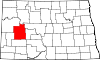
Medicine Hole is a populated place in Dunn County, North Dakota, United States. The name was collected by the United States Geological Survey between 1976 and 1980, and entered into the Geographic Names Information System on February 13, 1980.[1]

References

Coordinates: 47°26′39″N 102°53′28″W / 47.44417°N 102.89111°W / 47.44417; -102.89111


Wikimedia Foundation. 2010.

Игры ⚽ Поможем написать реферат

Look at other dictionaries:

  • University of North Dakota — Motto Lux et Lex (Latin) Motto in English Light and Law Established 1883 …   Wikipedia

  • Grand Forks, North Dakota — Infobox Settlement official name = City of Grand Forks settlement type = City nickname = The Grand Cities The Forks The Sunflake City motto = A Place of Excellence imagesize = image caption = Town Square in downtown Grand Forks image mapsize =… …   Wikipedia

  • Dunn County, North Dakota — Location in the state of North Dakota …   Wikipedia

  • Dunn Center, North Dakota —   City   Location of Dunn Center, North Dakota …   Wikipedia

  • Manning, North Dakota —   Census designated place   …   Wikipedia

  • Marshall, North Dakota — Marshall   Unincorporated community   …   Wikipedia

  • Dodge, North Dakota —   City   Location of Dodge, North Dakota …   Wikipedia

  • Medicine Rocks State Park — IUCN Category V (Protected Landscape/Seascape) Medicine Rocks State Park …   Wikipedia

  • North Shore (Lake Superior) — Split Rock Lighthouse is on North Shore of Lake Superior. This is part of a Minnesota State Park and is open for visitors …   Wikipedia

  • List of North American Numbering Plan area codes — This is a list of North American telephone area codes in effect for the North American Numbering Plan (NANP). The area to which an area code is officially assigned is known as a Numbering Plan Area (NPA). Contents 1 200 2 300 3 400 4 …   Wikipedia

Share the article and excerpts

Direct link
Do a right-click on the link above
and select “Copy Link”