- Mere Beck Meadows
-
Mere Beck Meadows Site of Special Scientific Interest Country England Region North East District Teesdale Location NY951186 - coordinates 54°33′47″N 2°4′35″W / 54.56306°N 2.07639°W Area 6.6 ha (16.3 acres) Notification 1989 Management Natural England Area of Search County Durham Interest Biological 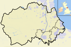
 Location of Mere Beck Meadows SSSI, Co Durham
Website: Map of site Mere Beck Meadows, formerly known as Willoughby Hall Meadows, is a Site of Special Scientific Interest in the Teesdale district of County Durham, England. It consists of three hay meadows, situated on the south side of Hury Reservoir, immediately below the Blackton Reservoir dam.
The site is important as preserving a rich assemblage of plant species, in a habitat that is becoming increasingly scarcer as a result of intensive agricultural practices. A wide variety of flowering plants is found, many in abundance, such as wood cranesbill, Geranium sylvaticum, meadow saxifrage, Saxifraga granulata, melancholy thistle, Cirsium helenioides, and great burnet, Sanguisorba officinalis.[1]
References
- ^ "Mere Beck Meadows". English Nature. 1989. http://www.english-nature.org.uk/citation/citation_photo/1005508.pdf. Retrieved 26 July 2010.
Backstone Bank and Baal Hill Woods • Baldersdale Woodlands • Bishop Middleham Quarry • Bollihope, Pikestone, Eggleston and Woodland Fells • Botany Hill • Bowes Moor • Bowlees and Friar House Meadows • Brasside Pond • Brignall Banks • Burnhope Burn • Butterby Oxbow • Cassop Vale • Castle Eden Dene • Causey Bank Mires • Charity Land • Close House Mine • Cornriggs Meadows • Cotherstone Moor • Crag Gill • Crime Rigg and Sherburn Hill Quarries • Dabble Bank • Derwent Gorge and Horsleyhope Ravine • Durham Coast • Fairy Holes Cave • Far High House Meadows • Fishburn Grassland • Foster's Hush • Frog Wood Bog • God's Bridge • Grains o' th' Beck Meadows • Green Croft and Langley Moor • Greenfoot Quarry • Hannah's Meadows • Hawthorn Dene • Hawthorn Quarry • Hell Kettles • Hesledon Moor East • Hesledon Moor West • Hexhamshire Moors • Hisehope Burn Valley • Hulam Fen • Hunder Beck Juniper • Kilmond Scar • Low Redford Meadows • Lune Forest • Mere Beck Meadows • Middle Crossthwaite • Middle Side and Stonygill Meadows • Middleton Quarry • Middridge Quarry • Moorhouse and Cross Fell • Muggleswick, Stanhope and Edmundbyers Commons and Blanchland Moor • Neasham Fen • Newton Ketton Meadow • Old Moss Lead Vein • Park End Wood • Pig Hill • Pike Whin Bog • Pittington Hill • Pow Hill Bog • Quarrington Hill Grasslands • Railway Stell West • Raisby Hill Grassland • Raisby Hill Quarry • Redcar Field • Rigg Farm and Stake Hill Meadows • Rogerley Quarry • Sherburn Hill • Shipley and Great Woods • Sleightholme Beck Gorge - The Troughs • Slit Woods • Stony Cut, Cold Hesledon • Teesdale Allotments • The Bottoms • The Carrs • Thrislington Plantation • Town Kelloe Bank • Trimdon Limestone Quarry • Tuthill Quarry • Upper Teesdale • Waldridge Fell • West Newlandside Meadows • West Park Meadows • West Rigg Open Cutting • Westernhope Burn Wood • Wingate Quarry • Witton-le-Wear • Yoden Village QuarryCategories:- Sites of Special Scientific Interest in County Durham
- United Kingdom Site of Special Scientific Interest stubs
- County Durham geography stubs

Wikimedia Foundation. 2010.