- Metro East
-
Metro East — Region of Illinois — Belleville Granite City
 Ofallon
Country  United States
State  Illinois
Population - Metro 702,579 Metro East is a region in Illinois that comprises the eastern suburbs of St. Louis, Missouri, United States. It encompasses five Southern Illinois counties (and parts of three others) in the St. Louis Metropolitan Statistical Area.[1] The region's most populated city is Belleville at 45,000 residents. The Metro East is the second largest urban area in Illinois after the Chicago metropolitan area. As of the 2000 census the population of the Metro East statistical area is 599,845. As of 2010, the same area has a noted population above 700,000.
The Metro East is a loose collection of small and mid-sized cities sitting along the American Bottom and the bluffs of the Mississippi River. As of the 2010 census, there has been a major shift in population from the older rust belt industrial cities in the bottom, such as East St. Louis and Alton, to the more suburban satellite cities, such as, Belleville and O'Fallon sitting on the bluffs. This is mainly due to continued white flight.[2] The Metro East is connected with the Missouri by the Metro Link rail service.
The middle class suburban communities of Greater St. Louis' Metro East are getting good reviews for being a family friendly environment, such as when a 2010 issue of Family Circle magazine named Edwardsville third on their "Top 10 Best Towns for Families".[3]
 Downtown Alton
 Downtown East St. Louis
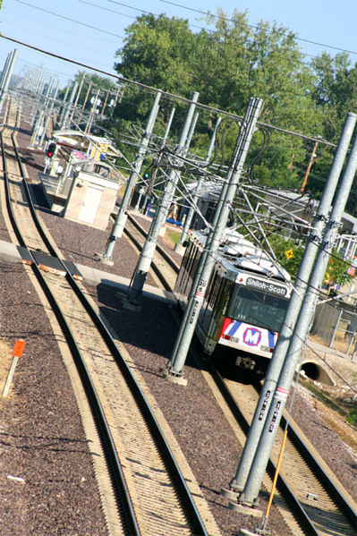
 MetroLink in Belleville Illinois
Geography
According to the U.S. Census Bureau, the five counties of the region have a total area of 6,974 km² (2,692 mi²). 6,787 km² (2,620 mi²) of it is land and 186 km² (71 mi²) of it (2.74%) is water.
As of the 2010 census, the most populated cities in the region include[4]
Principal cities
City populations[5]
- 44,478
- 29,849
- 28,281
- 27,865
- 27,006
- 26,016
- 24,293
Demographics
As of the census[6] of 2000, there were 599,845 people, 229,888 households, and 160,260 families residing in the five Metro-East counties.
The most common language is English, although various other languages are spoken. German speakers exist in southeastern Madison, and Clinton, and southern and eastern St. Clair Counties. Spanish is spoken in the Fairmont City area, and in parts of Clinton County. The largest concentration of African-Americans is in Madison, Venice, western Granite City, East St. Louis, Washington Park, Belleville, and Alton. Secondary languages tend to be cultural or reminiscent of ancestry, and not related to the general business of the area.
 Map of Illinois highlighting Metro-East.
List of counties
- Clinton
- Jersey
- Madison
- Monroe
- St. Clair
- Bond (partial)
- Calhoun (partial)
- Macoupin (partial)
- Washington
List of cities, towns, and villages
Notes:
- ^ means part of city in another county(ies)
- Bold indicates County Seat
Clinton County
- Damiansville
- Germantown
- Huey
- Keyesport ^ (Also in Bond County)
- New Baden ^ (Also in St. Clair County)
- Trenton
- Wamac ^ (Also in Washington and Marion Counties)
Jersey County
- Brighton ^ (Also in Macoupin County)
- Chautauqua
- Delhi
- Dow
- Elsah
Madison County
- Alhambra
- Alton
- Bethalto
- Collinsville ^ (Also in St. Clair County)
- Dorsey
- East Alton
- Edwardsville
- Fairmont City ^ (Also in St. Clair County)
- Glen Carbon
- Godfrey
- Granite City
- Hamel
- Highland
- Livingston
- Madison
- Marine
- Maryville
- New Douglas
- Pierron ^ (Also in Bond County)
- Pontoon Beach
- Roxana
St. Clair County
- Alorton
- Belleville
- Brooklyn
- Cahokia
- Caseyville
- Centreville
- Collinsville ^ (Also in Madison County)
- Dupo
- East St. Louis
- Fairmont City ^ (Also in Madison County)
- Fairview Heights
- Fayetteville
- Freeburg
- Lebanon
- Lenzburg
- Marissa
Colleges and universities
- Greenville College
- Kaskaskia College
- Lewis and Clark Community College
- McKendree University
- The Principia
- Southern Illinois University Edwardsville
- Southwestern Illinois College
Transportation
State routes
U.S. routes
- U.S. Route 40
- U.S. Route 50
- U.S. Route 51
- U.S. Route 66 (Historical Route Designation)
- U.S. Route 67
Interstate freeways
Rapid Transit
The St. Louis Metrolink (a lightrail train) includes 11 stations on the Illinois side of St Louis, from the East St. Louis Riverfront, through Belleville Illinois, and ending at Scott Air Force Base. It links the Metro East to downtown St. Louis, area Universities, downtown Clayton MO, and the major Commercial airport, Lambert St. Louis International.
St. Clair County (East St. Louis, Washington Park, Fairview Heights, Swansea, O'Fallon, Cahokia, Belleville, Shiloh, and Scott AFB) share public transit with the St. Louis metropolitan area, including bus and rail.
Major employers
- Anheuser-Busch
- Boeing
- Charter Communications
- Scott Air Force Base
- Monsanto
- National Steel
- U.S. Steel
- Olin Corporation
- Southern Illinois University Edwardsville
- Norrenberns Trucking
- Illinois Department of Transportation
- Korte Construction
- ConocoPhillips Wood River Refinery
Tourist attractions
- National Shrine of Our Lady of the Snows, Centreville, near Belleville; operated by the Missionary Oblates of Mary Immaculate
- Brooks Catsup Bottle, Collinsville
- Cahokia Mounds, Collinsville, on Madison-St. Clair County line
- GCS Ballpark, Sauget
- Gateway International Raceway , Madison
- Eads Bridge Historic bridge, among East. Louis, on the East St. Louis, Illinois, and St. Louis, Missouri border, over the Mississippi River
- Pere Marquette State Park, Grafton
- Raging Rivers Water Park, Grafton
- The Game, Glen Carbon
- St. Clair Square Mall, Fairview Heights
- Robert Wadlow Statue, Alton
- Horseshoe Lake, Pontoon Beach, Madison, and Granite City
- Alton Square Mall, Alton
- Carlyle Lake, Carlyle
Residents, historic figures, and contributors
- Josephine Baker, East St. Louis, performer and activist
- Jason Boyd, Edwardsville, AAA pitcher
- Jimmy Connors, East St. Louis and Belleville, world-famous tennis player
- Brian Daubach, Belleville, former MLB 1B/DH/Outfielder
- Miles Davis, East St. Louis and Alton, world-famous jazz artist
- Elizabeth Donald, Edwardsville, horror novelist
- Buddy Ebsen, Belleville, Television Actor
- Jay Farrar, Belleville, musician
- Norm Greenberg, Belleville, Metro-East television personality
- Louis Jolliet, explorer of the Mississippi River
- Jackie Joyner-Kersee East St. Louis, World famous Olympic athlete
- Ken Kwapis Belleville, Film/Television director and producer
- Mark Little, Edwardsville, AAA outfielder
- Père Jacques Marquette, French discoverer
- Laurie Metcalf, Edwardsville , Film/Television actress (Rosanne, Uncle Buck, JFK)
- Yadier Molina, Caseyville, Cardinals Baseball Catcher (Resides there only during baseball season, and is originally from Puerto Rico)
- Peter Sarsgaard, Belleville/Scott AFB, Actor (Flightplan, Jarhead, Green Lantern)
- Jeff Tweedy, Belleville, lead singer of the band Wilco
- Uncle Tupelo, Belleville, alternative country band
- Robert Pershing Wadlow, Alton, World's Tallest Man
- William Holden, O'Fallon, Hollywood actor
- Michael Stipe, Collinsville, lead singer of the band REM
- Senator Richard J. Durbin, East St. Louis, U.S. senator
- T. J. Mathews, Columbia, former MLB pitcher
- Neal Cotts, Lebanon, Pitcher currently playing for the Chicago Cubs
- Lea DeLaria, Belleville, Jazz Singer, Actress, and Comedian
- Ray Bradbury, Belleville, Science Fiction Author
- Scott Wolf, Belleville, Actor
Media in the Metro East
St. Louis Area TV stations
- Note: This list is for the entire Metro-East area, however, the low-powered stations may not reach the entire 5-county Metro-East area. WSIU, despite not being based from the St. Louis DMA, is available in Clinton, Washington, and most of St. Clair.
Broadcast television in the Greater St. Louis and Metro East Illinois areas Local stations KTVI (2.1 Fox, 2.2 Antenna TV) • KMOV (4.1 CBS, 4.2 LWN) • KSDK (5.1 NBC, 5.2 AccuWeather) • KPTN-LD (7.1 HSN, 7.2 silent, 7.3 silent, 7.4 silent) • KETC (9.1 PBS, 9.2 PBS Kids, 9.3 PBS World, 9.4 Create) • KPLR (11.1 The CW, 11.2 This TV) • KDTL-LP 16 (RTV) • KNLC (24.1 Ind., 24.2 RES) • KDNL (30.1 ABC, 30.2 TheCoolTV, 30.3 The Country Network) • K33GU 33 • K38HD (38.1 HSN) • WRBU (46.1 MNTV, 46.2 Me-TV) • W50CH 50 (Ind.) • KUMO-LD 51.1 (Daystar)Outlying stations See also: Quincy, Columbia/Jeferson City, Springfield MO, Springfield IL, Evansville, Memphis, and Paducah TV Champaign-Urbana/Decatur/Springfield Area TV stations
- Note: This list is for Jersey County, however, the majority of these stations are not available for most Jersey County residents. These stations are more likely to be available in Greene and Macoupin counties, which border Jersey County.
Broadcast television in South Central Illinois (including Champaign-Urbana, Springfield and Decatur) WCIA (3.1 CBS, 3.2 MNTV) • WILL (12.1 PBS, 12.2 PBS World, 12.3 Create) • WSEC 14 (14.1 PBS, 14.2 PBS World, 14.3 Create) •
WUSI (16.1 PBS, 16.2 SD, 16.3 Create) • WAND (17.1 NBC, 17.2 local weather) • WICS 20.1 / WICD 15.1 (ABC) • WBUI (23.1 The CW, 23.2 This TV) • W29BG 29 / W34DL 34 (silent) • WLCF-LD 45 (CTN / FN) • WBXC-CA 46 (A1) • WCIX (49.1 MNTV, 49.2 CBS) • WEIU (51.1 PBS, 51.2 MHz WorldView) • WRSP 55.1 / WCCU 27.1 (Fox)See also: Peoria-Bloomington, Chicago, Quincy, St. Louis, Quad Cities, Evansville, Terre Haute, Lafayette, and Paducah TV Paducah/Cape Girardeau/Harrisburg Area TV stations
- Note: This list is for St. Clair, and Clinton counties, however, the majority of the stations, with the exception of WSIU and WPXS and possibly KFVS, are not available for a majority of the St. Clair, and/or Clinton County residents. These stations are more likely to be available in Washington County and the Centralia area.
Television stations in the Jackson Purchase and Southern Illinois, including Paducah, KY and Cape Girardeau, MO Local Stations WSIL / KPOB / K10KM-D (3.1/15.1/10.1 ABC) • WPSD (6.1 NBC) • WSIU (8.1 PBS, 8.2 PBS World, 8.3 Create) • WQWQ 9 / WQTV 24 (CW) • KFVS (12.1 CBS, 12.2 CW) • WPXS (13.1 Daystar) • W15BU-D 15 (3ABN) • WKMU / WKPD (21.1/29.1 PBS/KET) • KBSI (23.1 Fox, 23.2 MNTV) • WUWT 26 (A1) • WTCT (27.1 TCT) • K39CP (39) • WDKA (49.1 MNTV)
Adjacent locals Reception may vary by location and some stations may only be viewable with cable television Evansville: WTVW (7.1 Ind./Me-TV) • WNIN (9.1 PBS) • WFIE (14.1 NBC, 14.2 WX, 14.3 This TV) • WEHT (25.1 ABC, 25.2 Wazoo Sports) • WEVV (44.1 CBS, 44.2 Fox/MNTV)
St Louis: KMOV 4 (CBS) • KSDK 5 (NBC) • KETC 9 (PBS) • KDNL 30 (ABC)
Jonesboro: KAIT 8 (ABC) • KTEJ 19 (PBS/AETN)
Memphis: WMC 5 (NBC) • WPTY 24 (ABC)
Jackson TN: WBBJ 7 (ABC) • WLJT 11 (PBS) • WJKT 16 (Fox)
Nashville: WTVF 5 (CBS)Tennessee Broadcast television: Chattanooga • Huntsville, AL • Jackson • Knoxville • Memphis • Nashville • Paducah, KY • Tri-Cities Kentucky Broadcast television: Bowling Green • Charleston/Huntington, WV • Cincinnati, OH • Evansville, IN • Knoxville, TN • Lexington • Louisville • Nashville, TN • Paducah • Tri-Cities, TN and VA
See also: Little Rock TV • Springfield MO TV • Springfield IL TV • Terre Haute TVDaily newspapers
- Note: daily newspaper coverage depends on county.
- Alton Telegraph (Madison, Jersey counties)
- Belleville News-Democrat (region-wide)
- Centralia Sentinel (Clinton and Washington counties)
- Southern Illinoisan (mainly in Washington County, rarely found elsewhere in Metro-East)
- St. Louis Post-Dispatch (region wide)
- Edwardsville Intelligencer (Madison County)
Radio stations
- Note: stations listed are licensed and have offices in Metro-East counties only. Stations that can be heard in the Metro-East but not listed have offices outside the Metro-East counties.
- WSIE 88.7 FM (Edwardsville), jazz/public radio
- WLCA 89.9 FM (Godfrey), alternative/college radio
- WRXX 95.3 FM (Centralia), pop
- WFUN 95.5 FM (Bethalto), hip-hop
- WDLJ 97.5 FM (Carlyle), classic rock
- WSGX 100.3 FM (Alton), urban
- WJAF 103.7 FM (Centralia)
- WNSV 104.7 FM (Nashville), Hot AC
- WAOX 105.3 FM (Staunton), Hot AC
- WSMI 106.1 FM (Litchfield). country
- WILY 1210 AM (Centralia), oldies
- WJBM 1480 AM (Jerseyville), talk
- WESL 1490 AM (East St. Louis), urban
- WQQW 1510 AM (Highland, Belleville)
- WBGZ 1570 AM (Alton), news/talk
See also: Radio stations in Illinois
The Metro East In Film
- Note, the falling is a partial list of films shot, often partially, sometimes with significant production, within the Metro East. All data can be rechecked via the Internet Movie Database[1]
"uncredited" means a Metro East Location was not credited within the database, but was clearly shot on metroeast soil upon watching the film itself.
Categories:


Wikimedia Foundation. 2010.