Coordinates: 51°33′50″N 0°56′13″W / 51.564°N 0.937°W / 51.564; -0.937
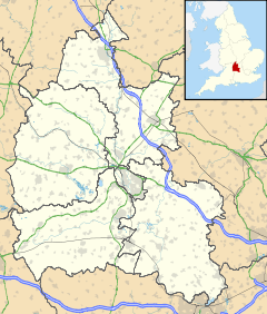
Middle Assendon is a village in the Stonor valley in the Chiltern Hills. It is about 2 miles (3.2 km) northwest of Henley-on-Thames in South Oxfordshire, England.
The village has a public house, the Rainbow Inn.
External links
 Media related to Middle Assendon at Wikimedia Commons
| v · South Oxfordshire |
|
|
|
|
| Towns |
|
 |
|
| Large Villages |
|
|
Other Civil
Parishes
(Component
Villages
and Hamlets) |
Adwell • Aston Rowant • Aston Tirrold • Aston Upthorpe • Beckley and Stowood ( Beckley, Stowood) • Berrick Salome ( Berrick Prior, Roke, Rokemarsh) • Binfield Heath • Bix and Assendon ( Bix, Bix Bottom, Lower Assendon, Middle Assendon) • Brightwell Baldwin • Britwell Salome • Checkendon • Clifton Hampden (Burcot) • Crowell • Cuddesdon and Denton ( Cuddesdon, Denton) • Culham • Cuxham with Easington ( Cuxham, Easington) • Dorchester • Drayton St. Leonard • East Hagbourne ( Coscote) • Elsfield • Eye and Dunsden ( Sonning Eye, Dunsden Green, Playhatch) • Forest Hill with Shotover (Forest Hill, Shotover) • Goring Heath (Whitchurch Hill, Cray's Pond) • Great Haseley (Latchford, Little Haseley, North Weston, Rycote) • Harpsden • Highmoor (Satwell) • Holton • Ipsden • Kidmore End ( Gallowstree Common) • Lewknor ( Postcombe, South Weston) • Little Milton • Little Wittenham • Long Wittenham • Mapledurham ( Trench Green, Chazey Heath) • Marsh Baldon ( Baldon Row) • Moulsford • Nettlebed • Newington ( Great Holcombe) • North Moreton • Nuffield • Nuneham Courtenay • Pishill with Stonor ( Pishill, Stonor, Maidensgrove, Russell's Water) • Pyrton (Clare, Standhill) • Rotherfield Greys • Rotherfield Peppard • Shirburn • South Moreton ( Fulscot) • South Stoke ( Littlestoke) • Stadhampton ( Chiselhampton, Brookhampton, Ascott) • Stanton St. John (Woodperry) • Stoke Row • Stoke Talmage • Swyncombe • Sydenham (Kingston Stert) • Tetsworth • Tiddington-with-Albury (Tiddington, Albury) • Toot Baldon • Towersey • Warborough ( Shillingford) • Waterstock • West Hagbourne • Whitchurch-on-Thames • Woodeaton • Waterperry with Thomley ( Waterperry, Thomley) • Wheatfield • Wilcote
|
|
Former Districts
and Boroughs |
|
|
Former
Constituencies |
|
|
|
|
|
 Middle Assendon