- Milecastle 13
-
Coordinates: 55°00′01″N 1°48′45″W / 55.000327°N 1.812460°W
Milecastle 13 
 Milecastle 13
 Milecastle 13 shown within Northumberland
OS grid reference NZ120673 List of places: UK • England • Northumberland 
This article is part of the series on:
Military of ancient Rome (portal)
753 BC – AD 476Structural history Roman army (unit types and ranks, legions, auxiliaries, generals) Roman navy (fleets, admirals) Campaign history Lists of wars and battles Decorations and punishments Technological history Military engineering (castra, siege engines, arches, roads) Political history Strategy and tactics Infantry tactics Frontiers and fortifications (limes, Hadrian's Wall) Milecastle 13 (Rudchester Burn) was a milecastle of the Roman Hadrian's Wall. Its remains exist as a low platform south of the B6318 Military Road.
Contents
Construction
Milecastle 13 was a short-axis milecastle and the north gateway has been identified as Type I. Such milecastles were thought to have been constructed by the legio II Augusta who were based in Isca Augusta (Caerleon).[1]
The milecastle measured 15.24 metres (50.0 ft) x 17.91 metres (58.8 ft) with narrow side walls having a thickness of 2.34 metres (7.7 ft).[2]
The threshold of the north gate was unworn, and raised 23 centimetres (9.1 in). One stone remained, which could have acted as a third threshold, or part of a later narrowing of the gateway.[2]
Excavations and investigations
- 1776 - A hoard of 516 gold and silver coins (in a pot) were found. The latest dated to AD 168.[2]
- 1930 - Excavation revealed the dimensions and gateway type.[3]
- 1955 - English Heritage Field Investigation. It was noted that the milecastle was visible as a slight rise, but that the slopes not surveyable.[4]
- 1966 - English Heritage Field Investigation. The description and published survey was confirmed.[4]
- 1989 - English Heritage Field Investigation. It was noted that a platform survived, 0.2 metres (0.66 ft) to 0.4 metres (1.3 ft) high, with a further drop of around 4 metres (13 ft) to the east. The platform measured approximately 20 metres (66 ft) east-west and 13 metres (43 ft) north-south overall. 20 metres (66 ft) to the east was another slight mound, measuring 12 metres (39 ft) east-west and 7 metres (23 ft) north-south overall.[4]
Associated turrets
Each milecastle on Hadrian's Wall had two associated turret structures. These turrets were positioned approximately one-third and two-thirds of a Roman mile to the west of the Milecastle, and would probably have been manned by part of the milecastle's garrison. The turrets associated with Milecastle 13 are known as Turret 13A and Turret 13B.
Turret 13A
Th remains of Turret 13A (Rudchester East) are covered by the B6318 Military Road.[5] Investigation in 1930 revealed the turret to have the same plan as Turrets 12A and 12B, having a rectangular platform which occupied the south side of the interior. The mortared walls were recorded as 1.22 metres (4.0 ft) thick, with the doorway lying to the east.[3] At the location of Turret 13B, the curtain wall was recorded as 2.82 metres (9.3 ft) thick (broad wall).
The fort of Vindobala (Rudchester) lies between Turrets 13A and 13B.
Location on Ordnance Survey 1:25 000 map: 55°00′05″N 1°49′12″W / 55.001399°N 1.819958°W
Turret 13B
No remains exist of Turret 13B (Rudchester West). Its measured position is 73 metres (80 yd) beyond the fort's west wall,[2] at the location of an old toll-cottage.[6]
Measured location: 55°00′09″N 1°49′39″W / 55.002596°N 1.827551°W
Monument Records
Monument Monument Number National Monuments Record Number Milecastle 13 22784 NZ 16 NW 6 Turret 13A 22789 NZ 16 NW 7 Turret 13B 22792 NZ 16 NW 8 References
- ^ David J Breeze and Brian Dobson (1976). Hadrian's Wall. Allen Lane. pp. 14–15. ISBN 0140271821.
- ^ a b c d Breeze, David J (1934), Handbook to the Roman Wall (14th Revised edition - Nov 2006), Society of Antiquaries of Newcastle upon Tyne, pp. 167–172, ISBN 0901082651
- ^ a b Simpson, FG (1931). "Excavations on Hadrian's Wall between Heddon-on-the-Wall and North Tyne in 1930". Archaeologia Aeliana : or miscellaneous tracts relating to antiquity. Series 4 (Newcastle-upon-Tyne: Society of Antiquaries of Newcastle upon Tyne) 8: 305–327.
- ^ a b c "Milecastle 12". Pastscape. English Heritage. http://www.pastscape.org/hob.aspx?hob_id=22784. Retrieved 21 June 2010.
- ^ "Turret 13A". Pastscape. English Heritage. http://www.pastscape.org/hob.aspx?hob_id=22789. Retrieved 21 June 2010.
- ^ "Turret 13B". Pastscape. English Heritage. http://www.pastscape.org/hob.aspx?hob_id=22792. Retrieved 21 June 2010.
Bibliography
- Daniels, Charles (1979), "Review: Fact and Theory on Hadrian's Wall", Britannia 10: 357–364, JSTOR 526069
Milecastles of Hadrian's Wall Milecastles 0 • 1 • 2 • 3 • 4 • 5 • 6 • 7 • 8 • 9 • 10 • 11 • 12 • 13 • 14 • 15 • 16 • 17 • 18 • 19 • 20 • 21 • 22 • 23 • 24 • 25 • 26 • 27 • 28 • 29 • 30 • 31 • 32 • 33 • 34 • 35 • 36 • 37 • 38 • 39 • 40 • 41 • 42 • 43 • 44 • 45 • 46 • 47 • 48 • 49 • 50 • 50TW • 51 • 52 • 53 • 54 • 55 • 56 • 57 • 58 • 59 • 60 • 61 • 62 • 63 • 64 • 65 • 66 • 67 • 68 • 69 • 70 • 71 • 72 • 73 • 74 • 75 • 76 • 77 • 78 • 79 • 80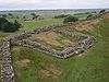
Milefortlets MF 1 • MF 2 • MF 3 • MF 4 • MF 5 • MF 6 • MF 7 • MF 8 • MF 9 • MF 10 • MF 11 • MF 12 • MF 13 • MF 14 • MF 15 • MF 16 • MF 17 • MF 18 • MF 19 • MF 20 • MF 21 • MF 22 • MF 23 • MF 24 • MF 25 • MF 26Other structures on Hadrian's Wall Portgate • Chesters Bridge • Knag Burn Gateway • Peel Gap Tower • Willowford Bridge • Pike Hill Signal TowerCategories:- Milecastles of Hadrian's Wall


Wikimedia Foundation. 2010.