- Milfield
-
See also: Millfield (disambiguation)
Coordinates: 55°35′42″N 2°06′17″W / 55.5950°N 2.1047°W
Milfield 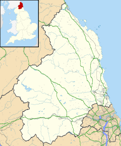
 Milfield
Milfield shown within NorthumberlandPopulation 243 (2001 census)[1] OS grid reference NT935335 District Berwick-upon-Tweed Shire county Northumberland Region North East Country England Sovereign state United Kingdom Post town WOOLER Postcode district NE71 Police Northumbria Fire Northumberland Ambulance North East EU Parliament North East England UK Parliament Berwick-upon-Tweed List of places: UK • England • Northumberland Milfield is a village in Northumberland, England about 3 miles (5 km) northwest of Wooler. The A697 road passes through the village.
Contents
History
Milfield is the likely location of the Northumbrian royal settlement of Maelmin, given "mael" is a Brythonic word meaning "field". Bede tells us that a residence was built at Maelmin to supersede Edwin of Northumbria's residence of Ad-Gefrin at Yeavering.[2] Evidence of a high-status Anglo-Saxon settlement at Milfield strongly suggests that this is the location of Maelmin, because of its proximity to Yeavering.[3]
On Milfield Plain, which is part of the bed of the prehistoric Lake of Glendale, was fought one of the many battles between Scots and English. In the month before the tragedy of Flodden, some Scots, under the Earl of Home, were returning from a raid into England where they had burnt several villages. Laden with booty which they had "lifted", Home's men were surprised by a band of English under Sir William Bulmer of Brancepeth in County Durham. The Durham men were victorious and for long years afterwards the Scot's name for the road through Milfield was "The Ill Road". Many years after the rout of Home's men, General Monk waited at Milfield with his forces before his momentous march south which brought about the Restoration.[4]
Notable people
One of Northumberland's most notable daughters, Josephine Grey, the social reformer, was born at Milfield House, about six miles from Wooler. This woman, who did so much valuable work in the nineteenth century to combat the social evils of the day, is more generally known by her married name of Butler. At the end of her long life she returned to her beloved Northumberland and is buried in Kirknewton churchyard under the shadow of Yeavering Bell.[4]
References
- ^ Office for National Statistics: Neighbourhood Statistics
- ^ Bede (1955/1982). A History of the English Church and People. Trans. Leo Sherley-Price. Harmondsworth, Middlesex, United Kingdom: Penguin Classics.
- ^ Waddington, Clive (2001). Maelmin: An Archaeological Guide. Milfield, Northumberland, United Kingdom: CS Publishing.
- ^ a b Ridley, Nancy (1966 (reprint)). Portrait of Northumberland. London: Robert Hale. OCLC 503957631?referer=br&ht=edition.
External links
- Northumberland Communities (Accessed: 27 November, 2008)
Categories:- Villages in Northumberland
- Northumberland geography stubs

Wikimedia Foundation. 2010.