Mill Neck (LIRR station)

Mill Neck (LIRR station)
Mill Neck
Station statistics
Address 17 Frost Mill Road
Mill Neck, New York
Coordinates 40°52′46.5″N 73°33′45.5″W / 40.879583°N 73.562639°W / 40.879583; -73.562639Coordinates: 40°52′46.5″N 73°33′45.5″W / 40.879583°N 73.562639°W / 40.879583; -73.562639
Lines
Platforms 1 side platform
Tracks 1
Other information
Opened 1892
Closed March 16, 1998
Code None
Owned by LIRR
Fare zone 7
Formerly Bayville(1889-1892)
Services
None
Preceding station   LIRR   Following station
Locust Valley station Oyster Bay Branch
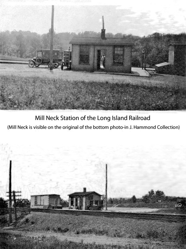
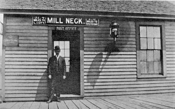
(current and former locations)
Oyster Bay station

Mill Neck is a closed rail station along the Oyster Bay Branch. It was originally opened around November 1892 as a replacement of the former Bayville Station, which was built in 1889 as a boxcar at the Kaintuck Lane railroad crossing on the west side os Shu Swamp. Mill Neck Station was built on the east side of that swamp and was burned on April 3, 1911, only to be rebuilt in 1912, and torched again in 1918, then rebuilt in 1919 slightly to the east of the previous locations. At some point during the 20th Century, a post office was added to the station. Mill Neck Station finally closed on March 16, 1998 along with nine other stations.[1] [2] It is located between Oyster Bay and Locust Valley Stations. As of 2003 the historic station depot is home to a town hall, post office and Old Brookville Police Department substation.

References

External links


Wikimedia Foundation. 2010.

Игры ⚽ Поможем написать реферат

Look at other dictionaries:

  • Richmond Hill (LIRR station) — Richmond Hill The Richmond Hill station as it appears in 2008, photographed from a passing …   Wikipedia

  • Locust Valley (LIRR station) — Infobox Station name=Locust Valley style=LIRR image size= image caption= address=Birch Hill Road and Piping Rock Road Locust Valley, NY line=rail color box|system=LIRR|line=Oyster Bay other=Mid Island Taxi platform=2 tracks=2 parking=Yes; Town of …   Wikipedia

  • Wyandanch, New York — Infobox Settlement official name = Wyandanch, New York settlement type = CDP nickname = motto = imagesize = image caption = image pushpin pushpin label position =none pushpin map caption =Location within the state of New York pushpin mapsize =… …   Wikipedia

  • National Register of Historic Places listings in Oyster Bay (town), New York — Map of all coordinates from Google Map of all coordinates from Bing …   Wikipedia

  • List of county routes in Suffolk County, New York (76–100) — The following is a list of county routes in Suffolk County, New York from Routes 76 to 100. Contents 1 County Route 76 1.1 Major intersections 2 County Route 77 2.1 Route description …   Wikipedia

  • List of county routes in Suffolk County, New York (26–50C) — The following is a list of county routes in Suffolk County, New York from Routes 26 to 50, including former suffixed routes of Suffolk CR 50. Contents 1 County Route 26 1.1 Route description 1.2 Major intersections 2 …   Wikipedia

  • Oyster Bay Branch —      Oyster Bay Branch Train #6506 to Oyster Bay at Mineola Overview …   Wikipedia

  • Oyster Bay (hamlet), New York — This article is about the unincorporated hamlet. For the town encompassing the hamlet, see Town of Oyster Bay, New York. Oyster Bay, New York   Village   Downtown Oyster …   Wikipedia

  • Farmingdale, New York — Farmingdale   Village   Bethpage State Park, located almost entirely in Old Bethpage, just outside the Village of Farmingdale, is served by the Farmingdale Post Office …   Wikipedia

  • Manhasset, New York — Manhasset redirects here. For other uses, see Manhasset (disambiguation). Manhasset, New York   CDP   …   Wikipedia

Share the article and excerpts

Direct link
Do a right-click on the link above
and select “Copy Link”