- Castle Rock Springs, California
-
Castle Rock Springs — Unincorporated community — Location in California
 Castle Rock Springs
Coordinates: 38°46′13″N 122°43′00″W / 38.77028°N 122.7166667°WCoordinates: 38°46′13″N 122°43′00″W / 38.77028°N 122.7166667°W Country United States State California County Lake County Elevation[1] 2,349 ft (716 m) Castle Rock Springs (formerly, Verdant Vales,[1] Camp Houdd Gibson,[1] Castle Springs,[1] Houdd Gibson Camp,[1] Castle Hot Springs,[2] Mills Hot Springs,[2] Mills' Mineral Springs,[2] and Noble's Springs[2]) is an unincorporated community in Lake County, California.[1] It is located 3 miles (4.8 km) south of Whispering Pines,[2] at an elevation of 2349 feet (716 m).[1]
The Castle Springs post office operated here from 1911 to 1917.[2]
References
Municipalities and communities of Lake County, California Cities 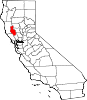
CDPs Clearlake Oaks | Clearlake Riviera | Cobb | Hidden Valley Lake | Kelseyville | Lower Lake | Lucerne | Middletown | Nice | North Lakeport | Soda Bay | Spring Valley | Upper Lake
Unincorporated
communitiesAdams | Bartlett Springs | Bonanza Springs | Buckingham Park | Caldwell Pines | Castle Rock Springs | Clear Lake Keys | Cooper | Crabtree Hot Springs | Crocker Place | Enterprise | Ettawa Springs | Finley | Forest Lake | Four Pines | Glenbrook | Glenhaven | Glenview | Harbin Springs | Harbin Springs Annex | Highland Springs | Hobergs | Hough Springs | Howard Springs | Loch Lomond | Mount Hannah Lodge | Newman Springs | Parramore Springs | Pepperwood Grove | Pine Grove | Pole Garden | Rice Fork Summer Homes | Riviera Estates | Riviera West | Rose Place | Salminas Resort | Saratoga Springs | Seigler Springs | Sunrise Vista | Three Crossing | Twin Lakes | Vann | Whispering Pines | Wild Bill Place
Indian
reservationsBig Valley Rancheria | Elem Indian Colony | Middletown Rancheria | Robinson Rancheria | Upper Lake Rancheria
Former
settlementsArabella | Baker Soda Spring | Barkerville | Bertha | Borax Springs | Bottle Rock | Dahnohabe | Eastlake | Elliott Springs | Ely's | Gifford Springs | Guenoc | Hopitsewah | Hoppins Springs | Howard Mill | Hullville | Kaci-badon | Kayote | Khawina | Knocti | Koi | Laurel Dell | Lolsel | Midlakes | Mirabel | Morgan | Nita | Olposel | Pences | Putah | Quicksilver | Reiff | Sanhedrin | Spiers Springs | Witter Springs
Categories:- Populated places in Lake County, California
- Unincorporated communities in California
- Lake County, California geography stubs


Wikimedia Foundation. 2010.