- Hanover, Maryland
-
Hanover — Unincorporated area — Location within the state of Maryland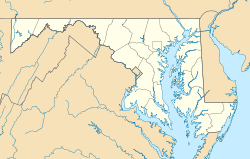
 Hanover
Coordinates: 39°11′34″N 76°43′27″W / 39.19278°N 76.72417°WCoordinates: 39°11′34″N 76°43′27″W / 39.19278°N 76.72417°W Country United States State Maryland County Anne Arundel Time zone Eastern (EST) (UTC-5) – Summer (DST) EDT (UTC-4) Zip Code 21076 Area code(s) 410 FIPS code GNIS feature ID Hanover, Maryland is a locality in unincorporated northwestern Anne Arundel County, Maryland in the United States, located south of Baltimore near the Howard County line.
It is located approximately at the intersection of Maryland State Highway 100 and the Baltimore-Washington Parkway. It is part of the Baltimore-Washington Metropolitan Area and is located just southwest of the Baltimore-Washington International Thurgood Marshall Airport (commonly known as "BWI").
Hanover was largely unknown prior to the opening of the Arundel Mills mall in November 2000. Since then, the area has seen explosive growth; shopping centers and housing developments have popped up along Arundel Mills Boulevard (Route 713), which links the B-W Parkway and Route 100 to Arundel Mills. On November 2nd, 2010 Anne Arundel County voters approved zoning for a gaming and entertainment complex with 4,750 slot machines at Arundel Mills Mall. The Maryland Department of Transportation is headquartered at 7201 Corporate Center Drive, which has a Hanover address.[1]
Real estate developments
- Arundel Mills
- Stoney Run Garden Condominiums, being developed by Ryan Homes, featuring both luxury elevator condominiums and townhome condominiums.
- Villages of Dorchester (a residential development)
- Arundel Preserve (a mixed-use development) being developed by Somerset Construction Co. of Bethesda, Corporate Office Properties Trust of Columbia, Bozzuto Development Co. of Greenbelt, and Toll Brothers Inc. of Horsham, Pa. They are teaming up to build about two million square feet of office space, 500 apartments, 440 homes, 300,000 square feet (30,000 m2) of retail space, and two hotels near Arundel Mills mall.[2]
- Ridgefield I and II constructed by Rice Homes and Washington Homes in the late 70's and early 80's.
- Ridgewood constructed by Washington Homes in the early 80's featuring homes with 1-acre (4,000 m2) lots.
References
- ^ "MDOT Departments." Maryland Department of Transportation. Retrieved on March 23, 2009.
- ^ Massive project set for Arundel
Municipalities and communities of Anne Arundel County, Maryland City 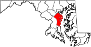
Town CDPs Arden-on-the-Severn | Arnold | Brooklyn Park | Cape St. Claire | Crofton | Crownsville | Deale | Ferndale | Fort Meade | Glen Burnie | Green Haven | Herald Harbor | Hillsmere Shores | Jessup‡ | Lake Shore | Linthicum | Londontowne | Maryland City | Mayo | Naval Academy | Odenton | Parole | Pasadena | Pumphrey | Riva | Riviera Beach | Selby-on-the-Bay | Severn | Severna Park | Shady Side | South Gate
Other
communitiesArundel on the Bay | Beverly Beach | Bristol | Churchton | Davidsonville | Fairhaven | Fairview | Franklin Manor-on-the-Bay | Friendship | Gambrills | Galesville | Germantown | Gibson Island | Hanover | Harmans | Harundale | Harwood | Iglehart | Jacobsville | Jennings | Lothian | Millersville | Orchard Beach | Owensville | Piney Orchard | Riverdale | Rose Haven | Russett | Saunders Point | Seven Oaks | Sherwood Forest | Skidmore | South River | Sudley | Tall Timbers | Tracys Landing | West River | Winchester-on-the-Severn | Woodland Beach | Woodwardville
Footnotes ‡This populated place also has portions in an adjacent county or counties
Categories:- Populated places in Anne Arundel County, Maryland
- Unincorporated communities in Maryland
- Maryland geography stubs


Wikimedia Foundation. 2010.