- Mono Basin National Scenic Area
-
 Mono Lake viewed from the summit of Mount Dana.
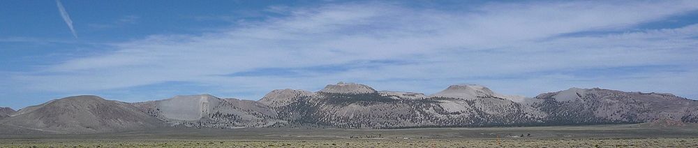
 The Mono Lake Basin from near Conway Summit.
The Mono Basin National Scenic Area is a protected area in Eastern California that surrounds Mono Lake and the northern half of the Mono Craters volcanic field. It is administered by the Inyo National Forest as a unit of the National Forest Scenic Area program, under the U.S. Forest Service.
Contents
History
Mono Basin became the first National Scenic Area in the United States in 1984.[1]
Access
 Mono Basin National Scenic Area Visitor Center
Visitor Center
The Mono Basin Scenic Area Visitor Center is located 1/2 mile north of the town of Lee Vining, California just east of Tioga Pass (the eastern entrance to Yosemite National Park), on U.S. Route 395.
A variety of activities and exhibits introduce the natural and human history of the Mono Basin. A twenty-minute film, an interactive exhibit hall, two art galleries and a Book Store are available inside.[2]
Features
- Features in the Mono Basin Scenic Area include
- Features nearby include
- Ansel Adams Wilderness
- Bodie, California - a ghost town and California State Park
- Devils Postpile National Monument
- Hot Creek - hot springs
- Mammoth Mountain Ski Area
- Yosemite National Park - eastern Sierra section
See also
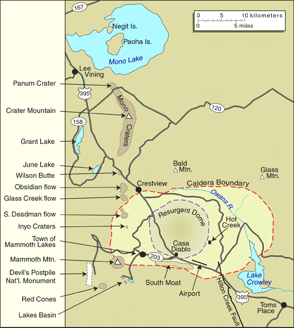
 USGS map of the Mono Basin area, showing geological features (click on to see detail).
- Mono Lake Committee
- Arsenic-based life - new science discovery at Mono Lake
References
 This article incorporates public domain material from websites or documents of the United States Department of Agriculture.
- ^ USFS contributors (2009). "Inyo National Forest: About Us". United States Forest Service. http://www.fs.fed.us/r5/inyo/about/index.shtml. Retrieved 2010-02-07.
- ^ Mono Lake Scenic Area Visitor Center
External links
- official Mono Basin National Forest Scenic Area website
- Mono Lake Scenic Area Visitor Center website
- Mono Lake Tufa State Reserve website
- CA.Parks: Mono Lake tufa tower images
Coordinates: 37°57′01″N 119°03′34″W / 37.95028°N 119.05944°W
Categories:- Protected areas of Mono County, California
- Inyo National Forest
- National Scenic Areas
- Protected areas of California
- Protected areas of the Sierra Nevada (U.S.)
- Protected areas established in 1984
- Geography of Mono County, California
- Museums in Mono County, California
- Natural history museums in California


Wikimedia Foundation. 2010.