- Mont-Bellevue Park
-
Mount Bellevue 
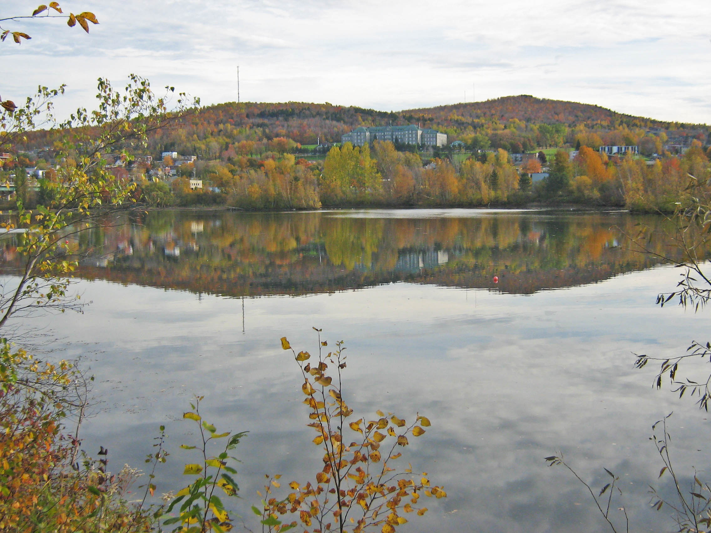
View of Mounts Bellevue and John-S.-Bourque from across the Magog RiverElevation 333 m (1,093 ft) Parent peak John-S.-Bourque Location Sherbrooke, Quebec, Canada
 Mount Bellevue
Range Green Mountains Coordinates 45°22′49″N 71°54′51″W / 45.38028°N 71.91417°WCoordinates: 45°22′49″N 71°54′51″W / 45.38028°N 71.91417°W Topo map NTS: 021E05 Climbing Easiest route hiking or cycling Mont Bellevue Park is a public park located in the borough of Mont-Bellevue in Sherbrooke, Quebec. It contains two mountain peaks (Mont Bellevue and Mont John-S.-Bourque) 200 hectares of land, 30 kilometers of trails, several different types of ecosystems, and remarkable biodiversity. Claiming 20% of the total park land, it is the largest park in Sherbrooke. In winter, it is available for alpine skiing, cross-country skiing, snow shoeing, walking, and inner tubing. In summer, visitors may participate in hiking, mountain biking, archery, tennis, and jogging.[1]
History
The University of Sherbrooke, built in 1954, originally used the land for sports, recreation, education, and research. In 1959, the City of Sherbrooke constructed the first ski lift on the mountain, signaling the beginning of the development of Mont Bellevue for public recreational purposes. Between 1959 and 1975, the city reserved 45 hectares of land for alpine skiing, tennis, archery, and various trails. In 1976, the City of Sherbrooke undertook park management and maintenance. To this day, the City of Sherbrooke continues to improve the park with consideration for the environment.[2]
References
- ^ City of Sherbrooke (8 December 2010). "Parc du Mont-Bellevue" (in French). http://www.ville.sherbrooke.qc.ca/webconcepteur/web/VilledeSherbrooke/fr/ext/nav/Basesdepleinairurbaines/ParcduMontBellevue.html?iddoc=97398. Retrieved 1 June 2011.
- ^ City of Sherbrooke (24 March 2010). "Un peu d'histoire" (in French). http://www.ville.sherbrooke.qc.ca/webconcepteur/web/VilledeSherbrooke/fr/ext/nav/Basesdepleinairurbaines/ParcduMontBellevue/Unpeudhistoire.html?iddoc=124450&page=details.jsp. Retrieved 1 June 2011.
External Links
- Official website(French)
Categories:- Sherbrooke
- Mountains of Quebec
- Ski areas and resorts in Quebec
- Estrie geography stubs

Wikimedia Foundation. 2010.